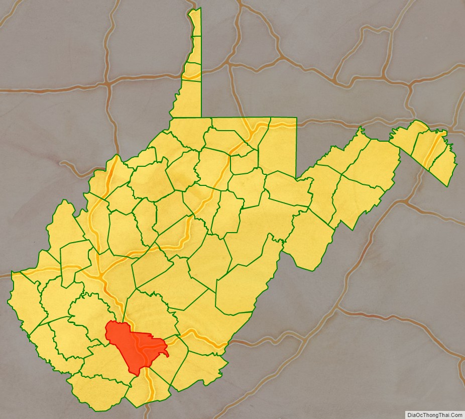
Raleigh County is a county in the U.S. state of West Virginia. As of the 2020 census, the population was 74,591. Its county seat is Beckley. The county was founded in 1850 and is named for Sir Walter Raleigh. Raleigh County is included in the Beckley, West Virginia Metropolitan Statistical Area.
| Name: | Raleigh County |
|---|---|
| FIPS code: | 54-081 |
| State: | West Virginia |
| Founded: | January 23, 1850 |
| Named for: | Sir Walter Raleigh |
| Seat: | Beckley |
| Largest city: | Beckley |
| Total Area: | 609 sq mi (1,580 km²) |
| Land Area: | 605 sq mi (1,570 km²) |
| Total Population: | 74,591 |
| Population Density: | 120/sq mi (47/km²) |
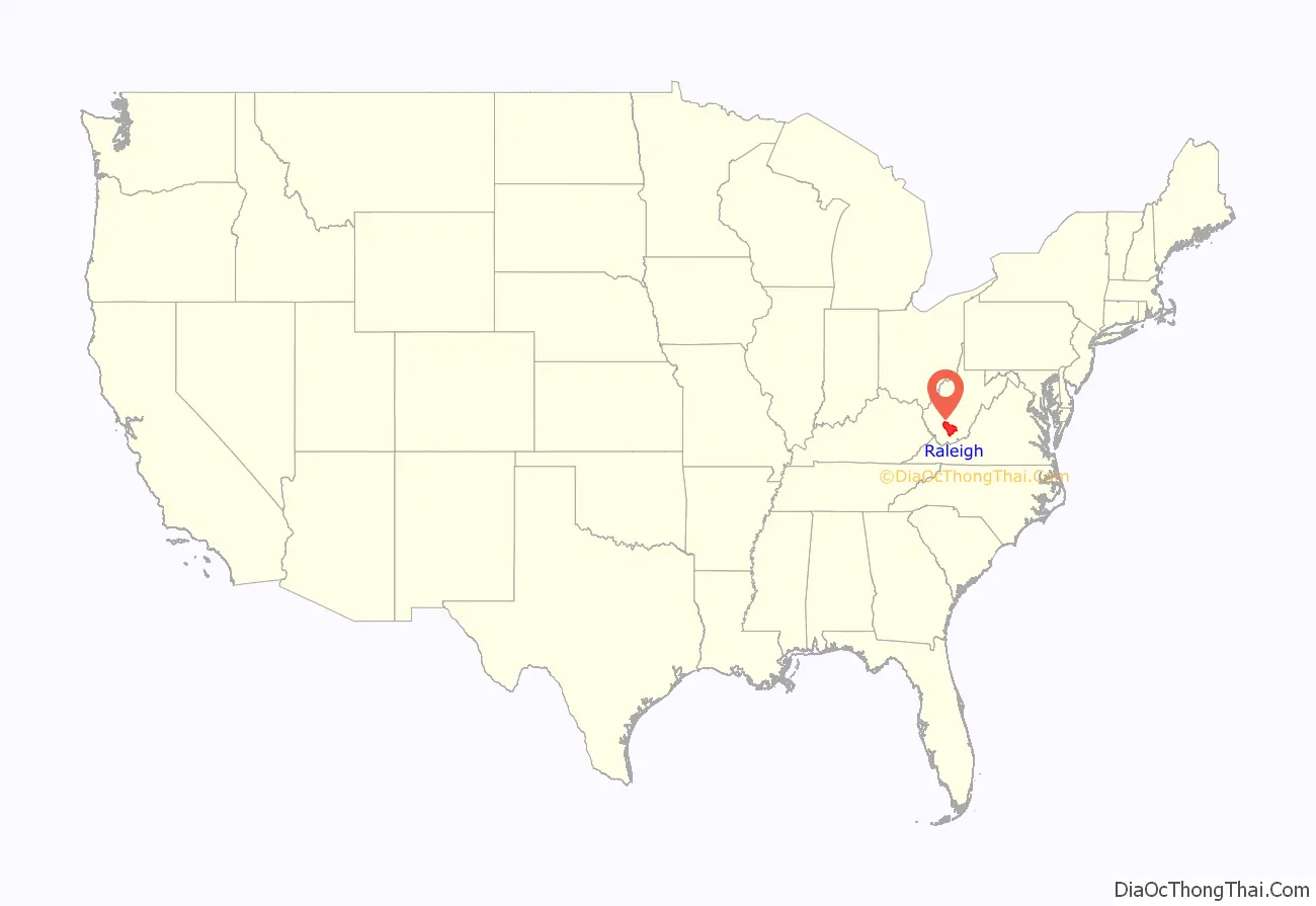
Raleigh County location map. Where is Raleigh County?
History
Raleigh County and the surrounding area have long been home to many indigenous peoples. Early encounters describe the land as being the ancestral home of the Catawba-speaking Moneton people, who referred to the surrounding area as “okahok amai”, and were allies of the Monacan people . The Moneton’s Catawba speaking neighbors to the south, the Tutelo, (a tribe since absorbed into the Cayuga Nation) may have absorbed surviving Moneton communities, and claim the area as ancestral lands. Cherokee and Shawnee and Yuchi peoples also claim the area as part of their traditional lands. Waves of conflict and displacement connected to European settler-colonial conquest also resulted in varied communities finding home and refuge in southern West Virginia, becoming identified as Mingo—remote affiliates of the Iroquois Confederacy.
Raleigh County was formed on January 23, 1850, from portions of Fayette County, then a part of Virginia. Alfred Beckley (1802–88) said that he named the county for Sir Walter Raleigh (1552–1618), the “enterprising and far-seeing patron of the earliest attempts to colonize our old Mother State of Virginia”.
Raleigh was one of fifty Virginia Counties that were admitted to the Union as the state of West Virginia on June 20, 1863. Later that year, the counties were divided into civil townships, with the intention of encouraging local government. This proved impractical in the heavily rural state, and in 1872 the townships were converted into magisterial districts. Raleigh County was initially divided into six townships: Clear Fork, Marsh Fork, Richman, Shady Spring, Town, and Trap Hill. These became magisterial districts in 1872, and the same year a seventh district, Slab Fork, was created from land that had previously belonged to Wyoming County. These remained largely unchanged over the next century, but in the 1970s the seven historic magisterial districts were consolidated into three new districts: District 1, District 2, and District 3.
Heavily involved in the coal mining industry, Raleigh County has been the scene of numerous deadly incidents, of which the most severe was the Eccles Mine Disaster in 1914. At least one hundred and eighty miners died in what was the second-worst coal mining disaster in state history. More recently, the 2010 Upper Big Branch Mine disaster, which killed twenty-nine miners, occurred in Raleigh County. Raleigh County miners were also killed by violent suppression of labor organizing, such as in the so-called Battle of Stanaford during the 1902-1903 New River coal strike in which an armed posse led by a US Marshall who shot up miners’ houses while they and their families slept, killing at least six. The perpetrators were later acquitted. The lead-up and aftermath were witnessed and widely recounted by Mother Jones, and the massacre is considered a prelude to the West Virginia coal wars.
The town of Sophia in Raleigh County was the home of Senator Robert C. Byrd.
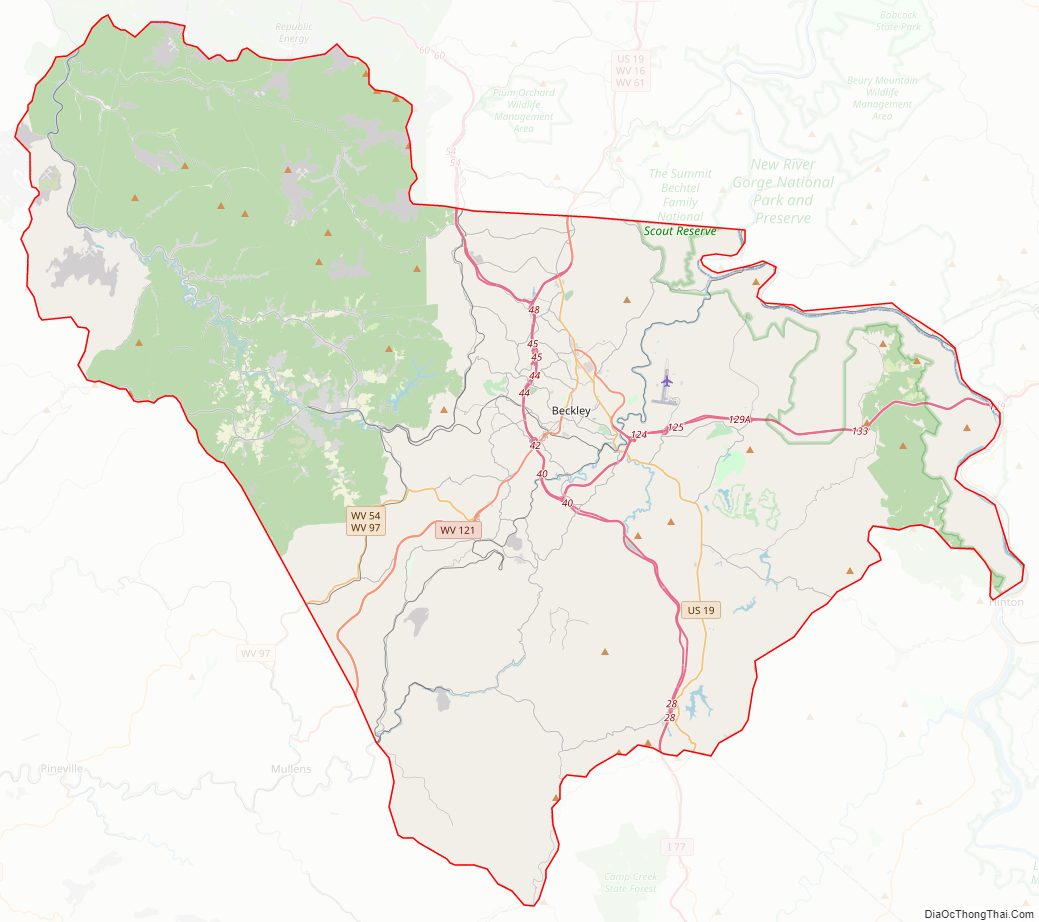
Raleigh County Road Map
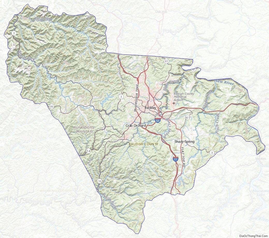
Geography
The New River flows northwestward along the county’s east border. The county terrain consists of wooded hills, carved with drainages. The terrain slopes to the north and west; its highest point is near its southmost corner, at 3,524′ (1074m) ASL. The county has a total area of 609 square miles (1,580 km), of which 605 square miles (1,570 km) is land and 4.0 square miles (10 km) (0.7%) is water.
Major highways
- Interstate 64
- Interstate 77
- U.S. Highway 19
- West Virginia Route 3
- West Virginia Route 16
- West Virginia Route 41
- West Virginia Route 54
- West Virginia Route 61
- West Virginia Route 97
- West Virginia Route 99
- West Virginia Route 210
- West Virginia Route 307
- West Virginia Route 121
- West Virginia Route 20
Adjacent counties
- Kanawha County (north)
- Fayette County (northeast)
- Summers County (east)
- Mercer County (southeast)
- Wyoming County (southwest)
- Boone County (northwest)
Protected areas
- Little Beaver State Park
- New River Gorge National Park and Preserve (part)
Lakes
- Flat Top Lake
- Glade Creek Reservoir
- Little Beaver Lake
- Stephens Lake
Raleigh County Topographic Map
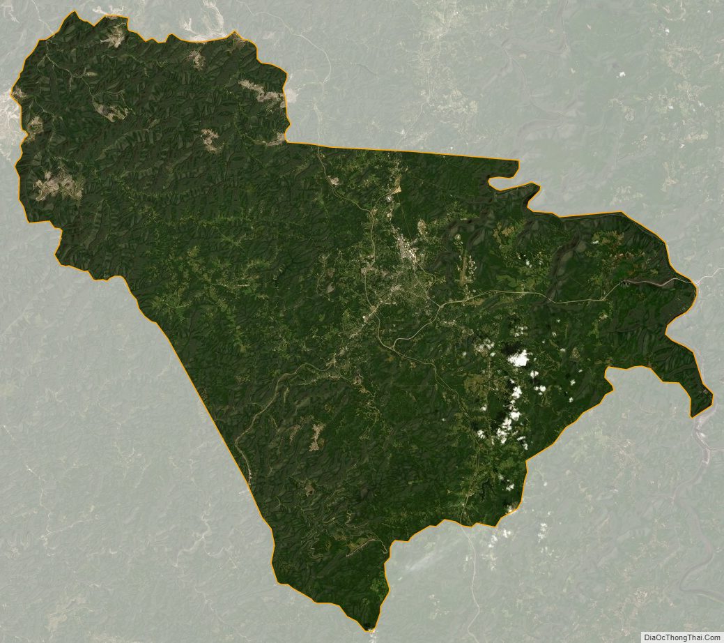
Raleigh County Satellite Map
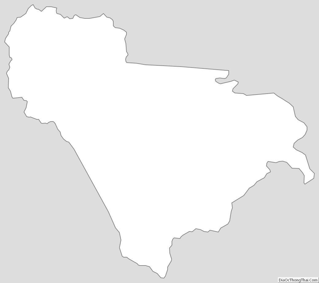
Raleigh County Outline Map
See also
Map of West Virginia State and its subdivision:- Barbour
- Berkeley
- Boone
- Braxton
- Brooke
- Cabell
- Calhoun
- Clay
- Doddridge
- Fayette
- Gilmer
- Grant
- Greenbrier
- Hampshire
- Hancock
- Hardy
- Harrison
- Jackson
- Jefferson
- Kanawha
- Lewis
- Lincoln
- Logan
- Marion
- Marshall
- Mason
- McDowell
- Mercer
- Mineral
- Mingo
- Monongalia
- Monroe
- Morgan
- Nicholas
- Ohio
- Pendleton
- Pleasants
- Pocahontas
- Preston
- Putnam
- Raleigh
- Randolph
- Ritchie
- Roane
- Summers
- Taylor
- Tucker
- Tyler
- Upshur
- Wayne
- Webster
- Wetzel
- Wirt
- Wood
- Wyoming
- Alabama
- Alaska
- Arizona
- Arkansas
- California
- Colorado
- Connecticut
- Delaware
- District of Columbia
- Florida
- Georgia
- Hawaii
- Idaho
- Illinois
- Indiana
- Iowa
- Kansas
- Kentucky
- Louisiana
- Maine
- Maryland
- Massachusetts
- Michigan
- Minnesota
- Mississippi
- Missouri
- Montana
- Nebraska
- Nevada
- New Hampshire
- New Jersey
- New Mexico
- New York
- North Carolina
- North Dakota
- Ohio
- Oklahoma
- Oregon
- Pennsylvania
- Rhode Island
- South Carolina
- South Dakota
- Tennessee
- Texas
- Utah
- Vermont
- Virginia
- Washington
- West Virginia
- Wisconsin
- Wyoming