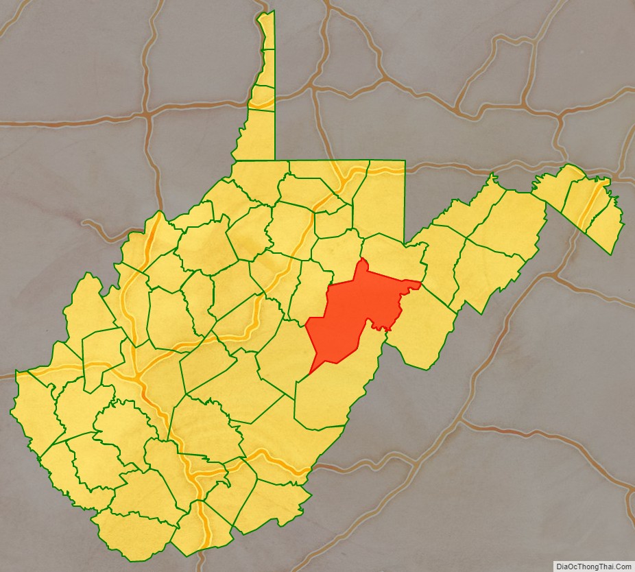
Randolph County is a county located in the U.S. state of West Virginia. As of the 2020 census, the population was 27,932. Its county seat is Elkins. The county was founded in 1787 and is named for Edmund Jennings Randolph.
Randolph County comprises the Elkins, West Virginia, Micropolitan Statistical Area.
| Name: | Randolph County |
|---|---|
| FIPS code: | 54-083 |
| State: | West Virginia |
| Founded: | October 16, 1787 |
| Named for: | Edmund Jennings Randolph |
| Seat: | Elkins |
| Largest city: | Elkins |
| Total Area: | 1,040 sq mi (2,700 km²) |
| Land Area: | 1,040 sq mi (2,700 km²) |
| Total Population: | 27,932 |
| Population Density: | 27/sq mi (10/km²) |
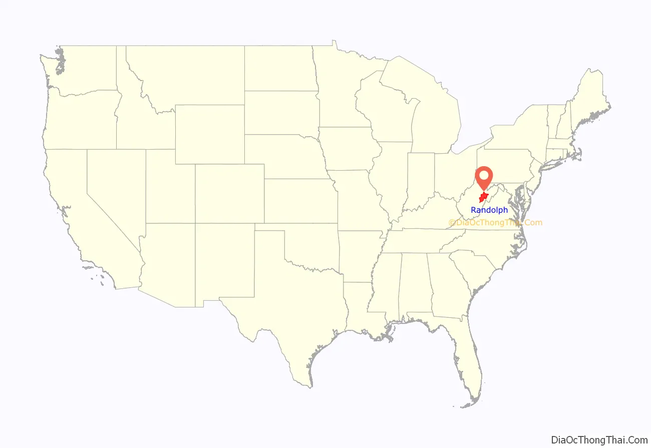
Randolph County location map. Where is Randolph County?
History
The first attempt by whites at settlement in present-day Randolph County came in 1752 or ’53 when David Tygart — for whom the Tygart Valley River was named — and Robert Foyle (later called Files) located (separately) with their families in the vicinity of present-day Beverly. Although there had been no recent history of conflicts between whites and Indians in that immediate area, that summer a party of Indians traveling the Shawnee Trail discovered the Foyle cabin and killed seven members of the family. One son escaped and alerted the Tygart family, allowing all to escape. (The Tygart-Foyle settlements were the first white settlements attempted anywhere within the Monongahela River watershed in present-day West Virginia.) No other white settlement was attempted in present Randolph until 1772.
Thomas Skidmore (ca. 1733–1807), born in Maryland, obtained a title to 400 acres of land (“by virtue of a settlement”) in the future Elkins area before 1778. This land, on the east side of the Tygart Valley River, was surveyed by John Poage in 1780 and included the land that is now most of downtown Elkins. Thus, Skidmore was probably the first white settler in what became Elkins.
When Randolph County, Virginia (now West Virginia) was created out of the vast Harrison County on October 16, 1787, it included not only present-day Randolph County, but parts of what are now eight other counties. It took its name from the surname of the then Governor of Virginia. The name of the new county seat, originally Randolph Court House, or Edmundton (the latter from the Governor’s given name), was changed to Beverly by 1790. Beverly remained the county seat until 1890 when county government was moved to Elkins.
Minor actions of the American Civil War which took place in Randolph County include the Battle of Rich Mountain and a part of the Battle of Cheat Mountain, both in 1861. These operations came in the course of the Western Virginia Campaign.
Randolph was one of fifty Virginia counties that were admitted to the Union as the state of West Virginia on June 20, 1863. Later that year, the new state’s counties were divided into civil townships, with the intention of encouraging local government. This proved impractical in the heavily rural state, and in 1872 the townships were converted into magisterial districts. Randolph County was divided into nine districts: Beverly, Clarke, Clay, Dry Fork, Green, Mingo Flats, Reynolds, Scott, and Union. Several of these were renamed during the 1870s: Clark became Valley Bend, Clay became New Interest, Green became Leadsville, Mingo Flats was abbreviated to Mingo, Reynolds became Huttonsville, Scott became Roaring Creek, and Union became Middle Fork.
Randolph County Road Map
Geography
According to the United States Census Bureau, the county has a total area of 1,040 square miles (2,700 km), of which 1,040 square miles (2,700 km) is land and 0.3 square miles (0.78 km) (0.03%) is water. It is the largest county in West Virginia by area.
Rivers
- Tygart Valley River
- Shavers Fork
- Laurel Fork
Mountains
- Point Mountain
- Cheat Mountain
- White Top, a knob of Cheat Mountain
- Laurel Mountain
- Rich Mountain
- Shavers Mountain
- Gaudineer Knob, a knob of Shavers Mountain
Caves and caverns
- Bowden Cave
- Sinks of Gandy
National Natural Landmarks
- Blister Run Swamp
- Gaudineer Scenic Area
- Shavers Mountain Spruce-Hemlock Stand
Major highways
Adjacent counties
- Tucker County (northeast)
- Pendleton County (east)
- Pocahontas County (south)
- Webster County (southwest)
- Upshur County (west)
- Barbour County (northwest)
National protected area
- Monongahela National Forest (part)
- United States National Radio Quiet Zone (part)
Randolph County Topographic Map
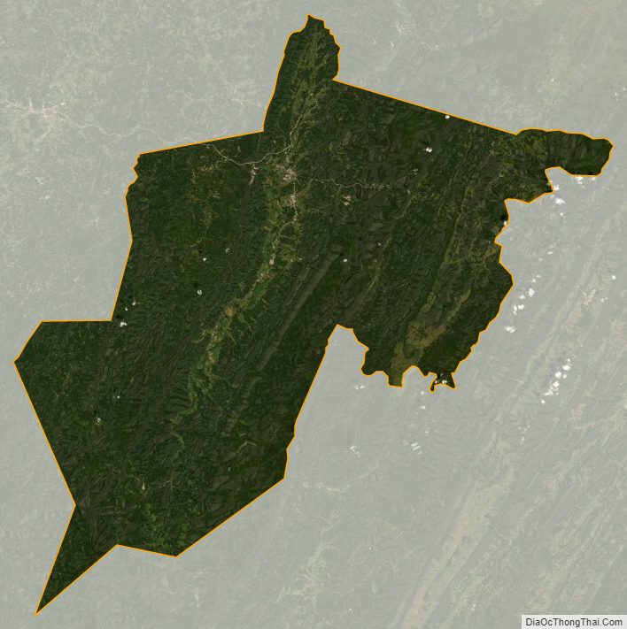
Randolph County Satellite Map
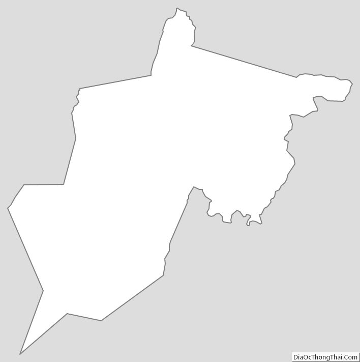
Randolph County Outline Map
See also
Map of West Virginia State and its subdivision:- Barbour
- Berkeley
- Boone
- Braxton
- Brooke
- Cabell
- Calhoun
- Clay
- Doddridge
- Fayette
- Gilmer
- Grant
- Greenbrier
- Hampshire
- Hancock
- Hardy
- Harrison
- Jackson
- Jefferson
- Kanawha
- Lewis
- Lincoln
- Logan
- Marion
- Marshall
- Mason
- McDowell
- Mercer
- Mineral
- Mingo
- Monongalia
- Monroe
- Morgan
- Nicholas
- Ohio
- Pendleton
- Pleasants
- Pocahontas
- Preston
- Putnam
- Raleigh
- Randolph
- Ritchie
- Roane
- Summers
- Taylor
- Tucker
- Tyler
- Upshur
- Wayne
- Webster
- Wetzel
- Wirt
- Wood
- Wyoming
- Alabama
- Alaska
- Arizona
- Arkansas
- California
- Colorado
- Connecticut
- Delaware
- District of Columbia
- Florida
- Georgia
- Hawaii
- Idaho
- Illinois
- Indiana
- Iowa
- Kansas
- Kentucky
- Louisiana
- Maine
- Maryland
- Massachusetts
- Michigan
- Minnesota
- Mississippi
- Missouri
- Montana
- Nebraska
- Nevada
- New Hampshire
- New Jersey
- New Mexico
- New York
- North Carolina
- North Dakota
- Ohio
- Oklahoma
- Oregon
- Pennsylvania
- Rhode Island
- South Carolina
- South Dakota
- Tennessee
- Texas
- Utah
- Vermont
- Virginia
- Washington
- West Virginia
- Wisconsin
- Wyoming