Ray County is a county located in the northwestern portion of the U.S. state of Missouri and is part of the Kansas City metropolitan area. As of the 2020 census, the population was 23,158. Its county seat is Richmond. The county was organized November 16, 1820 and named for John Ray, a Missouri state legislator and member of the first state Constitutional Convention.
| Name: | Ray County |
|---|---|
| FIPS code: | 29-177 |
| State: | Missouri |
| Founded: | November 16, 1820 |
| Named for: | John Ray, Missouri state legislator |
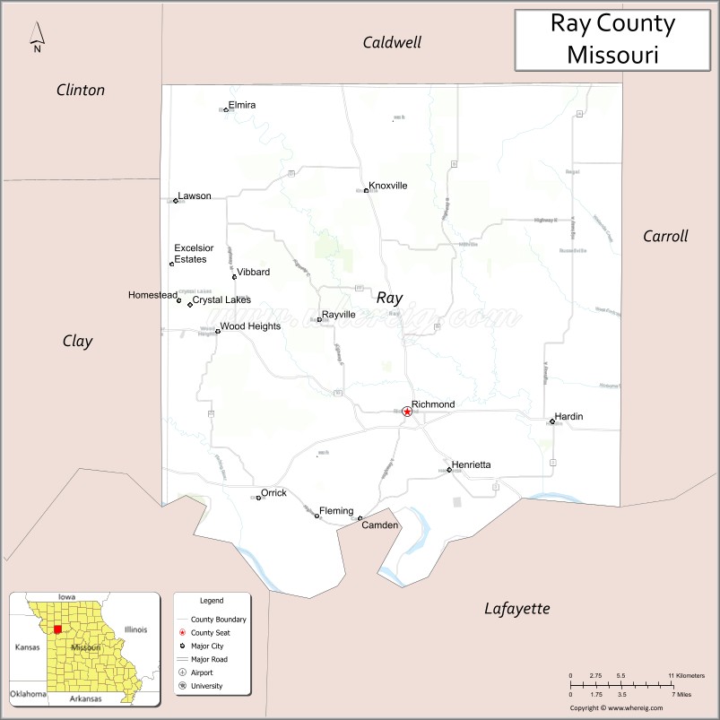
| Seat: | Richmond |
| Largest city: | Richmond |
| Total Area: | 574 sq mi (1,490 km²) |
| Land Area: | 569 sq mi (1,470 km²) |
| Total Population: | 23,158 |
| Population Density: | 40/sq mi (16/km²) |
| Time zone: | UTC−6 (Central) |
| Summer Time Zone (DST): | UTC−5 (CDT) |
| Website: | www.raycountymo.com |
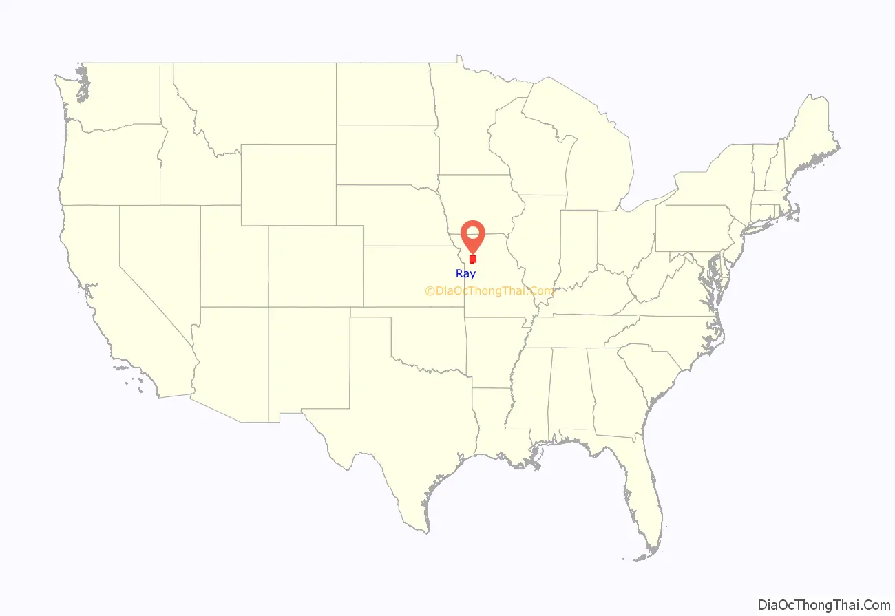
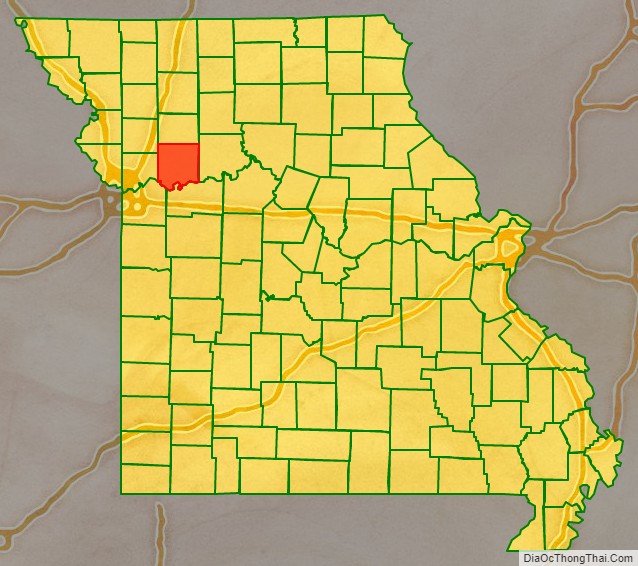
Ray County location map. Where is Ray County?
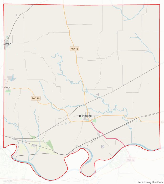
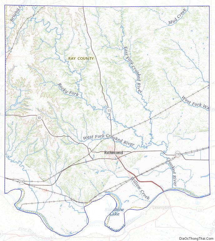
Ray County Road Map
Geography
According to the U.S. Census Bureau, the county has a total area of 574 square miles (1,490 km), of which 569 square miles (1,470 km) is land and 5.4 square miles (14 km) (0.9%) is water.
Adjacent counties
- Caldwell County (north)
- Carroll County (east)
- Lafayette County (south)
- Jackson County (southwest)
- Clay County (west)
- Clinton County (northwest)
Major highways
- Route 10
- Route 13
- Route 210
National protected area
- Big Muddy National Fish and Wildlife Refuge (part)
Ray County Topographic Map
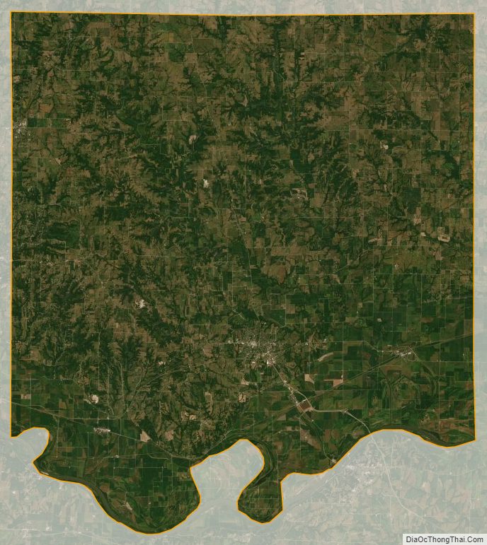
Ray County Satellite Map
Ray County Outline Map

See also
Map of Missouri State and its subdivision:- Adair
- Andrew
- Atchison
- Audrain
- Barry
- Barton
- Bates
- Benton
- Bollinger
- Boone
- Buchanan
- Butler
- Caldwell
- Callaway
- Camden
- Cape Girardeau
- Carroll
- Carter
- Cass
- Cedar
- Chariton
- Christian
- Clark
- Clay
- Clinton
- Cole
- Cooper
- Crawford
- Dade
- Dallas
- Daviess
- De Kalb
- Dent
- Douglas
- Dunklin
- Franklin
- Gasconade
- Gentry
- Greene
- Grundy
- Harrison
- Henry
- Hickory
- Holt
- Howard
- Howell
- Iron
- Jackson
- Jasper
- Jefferson
- Johnson
- Knox
- Laclede
- Lafayette
- Lawrence
- Lewis
- Lincoln
- Linn
- Livingston
- Macon
- Madison
- Maries
- Marion
- McDonald
- Mercer
- Miller
- Mississippi
- Moniteau
- Monroe
- Montgomery
- Morgan
- New Madrid
- Newton
- Nodaway
- Oregon
- Osage
- Ozark
- Pemiscot
- Perry
- Pettis
- Phelps
- Pike
- Platte
- Polk
- Pulaski
- Putnam
- Ralls
- Randolph
- Ray
- Reynolds
- Ripley
- Saint Charles
- Saint Clair
- Saint Francois
- Saint Louis
- Sainte Genevieve
- Saline
- Schuyler
- Scotland
- Scott
- Shannon
- Shelby
- Stoddard
- Stone
- Sullivan
- Taney
- Texas
- Vernon
- Warren
- Washington
- Wayne
- Webster
- Worth
- Wright
- Alabama
- Alaska
- Arizona
- Arkansas
- California
- Colorado
- Connecticut
- Delaware
- District of Columbia
- Florida
- Georgia
- Hawaii
- Idaho
- Illinois
- Indiana
- Iowa
- Kansas
- Kentucky
- Louisiana
- Maine
- Maryland
- Massachusetts
- Michigan
- Minnesota
- Mississippi
- Missouri
- Montana
- Nebraska
- Nevada
- New Hampshire
- New Jersey
- New Mexico
- New York
- North Carolina
- North Dakota
- Ohio
- Oklahoma
- Oregon
- Pennsylvania
- Rhode Island
- South Carolina
- South Dakota
- Tennessee
- Texas
- Utah
- Vermont
- Virginia
- Washington
- West Virginia
- Wisconsin
- Wyoming