| Name: | Rice County |
|---|---|
| FIPS code: | 27-131 |
| State: | Minnesota |
| Founded: | March 5, 1853 |
| Named for: | Henry Mower Rice |
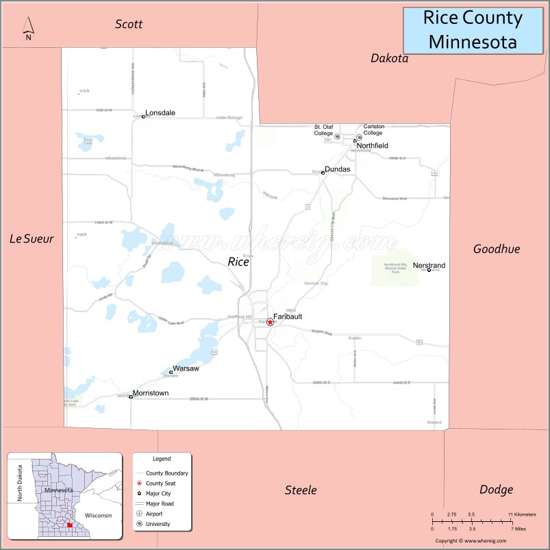
| Seat: | Faribault |
| Largest city: | Faribault |
| Total Area: | 516 sq mi (1,340 km²) |
| Land Area: | 496 sq mi (1,280 km²) |
| Total Population: | 67,097 |
| Population Density: | 135.3/sq mi (52.2/km²) |
| Time zone: | UTC−6 (Central) |
| Summer Time Zone (DST): | UTC−5 (CDT) |
| Website: | www.co.rice.mn.us |
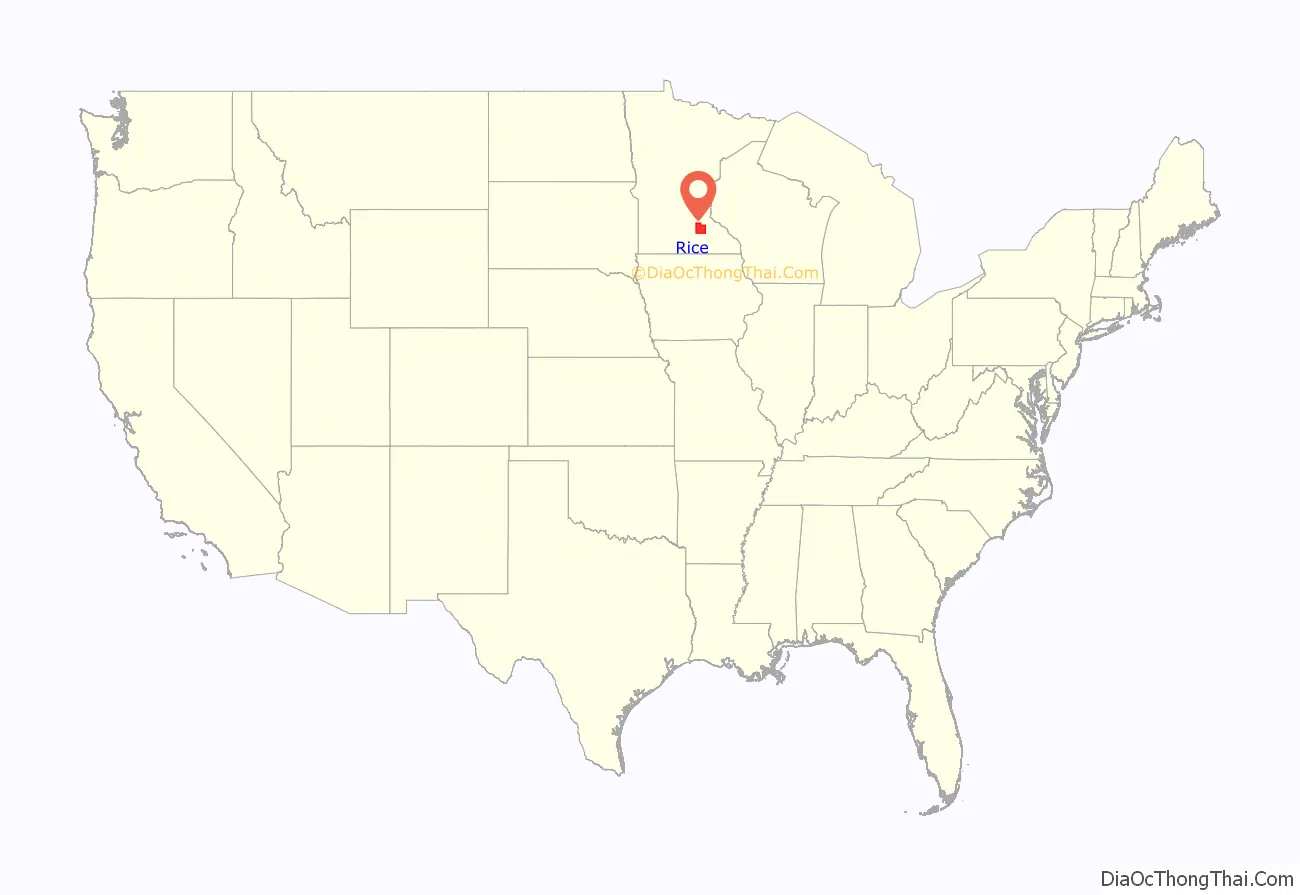
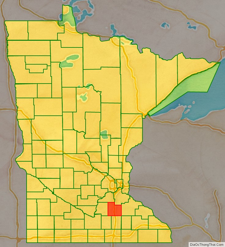
Rice County location map. Where is Rice County?
History
Rice County was founded on March 5, 1853. It was named for Henry Mower Rice, a fur trader who became instrumental in creation of the Minnesota Territory and its subsequent growth and development.
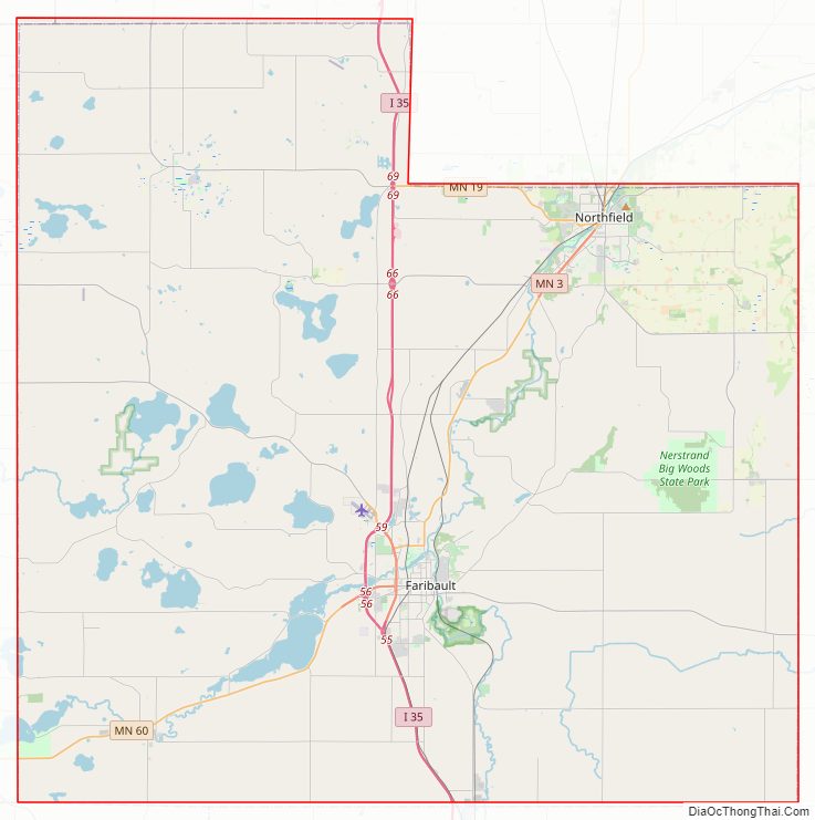
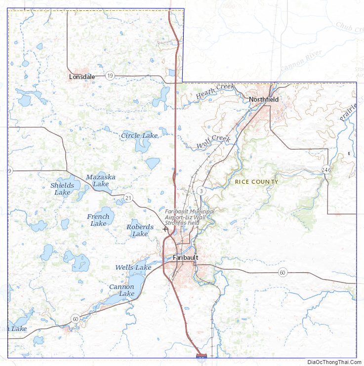
Rice County Road Map
Geography
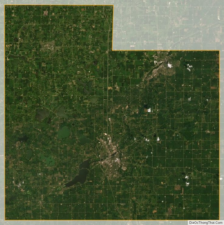
The Cannon River flows northeasterly through the center of the county, on its way to discharge into the Mississippi River at Red Wing. The Straight River flows northerly into the county from Steele County to its discharge point into the Cannon River at Faribault. The North Fork of the Zumbro River rises in south-central Rice County, and flows eastward into Goodhue County on its way to discharge into the Mississippi east of Kellogg.
The county terrain consists of low, rolling hills, entirely devoted to agriculture, and dotted with lakes. The county slopes to the east and north; its highest point is near its SE corner, at 1,263′ (385m) ASL. The county has an area of 516 square miles (1,340 km), of which 496 square miles (1,280 km) is land and 20 square miles (52 km) (3.9%) is water. The Cannon River flows northeastwardly through the county, collecting the Straight River in Faribault. The North Fork of the Zumbro River has its headwaters in the county’s southeastern part. Rice is one of 17 Minnesota savanna counties with more savanna soils than either prairie or forest soils.
Major highways
- Interstate 35
- I-35 BL
- Minnesota State Highway 3
- Minnesota State Highway 13
- Minnesota State Highway 19
- Minnesota State Highway 21
- Minnesota State Highway 60
- Minnesota State Highway 99
- Minnesota State Highway 246
- Minnesota State Highway 298
- Minnesota State Highway 299
Adjacent counties
- Dakota County – northeast
- Goodhue County – east
- Dodge County – southeast
- Steele County – south
- Waseca County – southwest
- Le Sueur County – west
- Scott County – northwest
Protected areas
- Cannon Lake Wilderness Area
- Cannon River Trout Lily Scientific and Natural Area
- Faribault State Wildlife Management Area
- Nerstrand Big Woods State Park
- River Bend Nature Area
- Sakatah Lake State Park (part)
- Shager Park
- Townsend Woods Scientific and Natural Area
- Whitney Island Scientific and Natural Area
Lakes
- Cannon Lake
- Caron Lake
- Cedar Lake
- Circle Lake
- Crystal Lake
- Duban Lake
- Dudley Lake
- Fox Lake
- French Lake
- Hatch Lake
- Horseshoe Lake (part)
- Hunt Lake
- Kelly Lake
- Mazaska Lake
- Metogga Lake
- Mud Lake
- Phelps Lake
- Rice Lake
- Roberds Lake
- Sakatah Lake (part)
- Shields Lake
- Sprague Lake
- Union Lake
- Weinberger Lake
- Wells Lake
- Willing Lake
Rice County Topographic Map
Rice County Satellite Map
Rice County Outline Map

See also
Map of Minnesota State and its subdivision:- Aitkin
- Anoka
- Becker
- Beltrami
- Benton
- Big Stone
- Blue Earth
- Brown
- Carlton
- Carver
- Cass
- Chippewa
- Chisago
- Clay
- Clearwater
- Cook
- Cottonwood
- Crow Wing
- Dakota
- Dodge
- Douglas
- Faribault
- Fillmore
- Freeborn
- Goodhue
- Grant
- Hennepin
- Houston
- Hubbard
- Isanti
- Itasca
- Jackson
- Kanabec
- Kandiyohi
- Kittson
- Koochiching
- Lac qui Parle
- Lake
- Lake of the Woods
- Lake Superior
- Le Sueur
- Lincoln
- Lyon
- Mahnomen
- Marshall
- Martin
- McLeod
- Meeker
- Mille Lacs
- Morrison
- Mower
- Murray
- Nicollet
- Nobles
- Norman
- Olmsted
- Otter Tail
- Pennington
- Pine
- Pipestone
- Polk
- Pope
- Ramsey
- Red Lake
- Redwood
- Renville
- Rice
- Rock
- Roseau
- Saint Louis
- Scott
- Sherburne
- Sibley
- Stearns
- Steele
- Stevens
- Swift
- Todd
- Traverse
- Wabasha
- Wadena
- Waseca
- Washington
- Watonwan
- Wilkin
- Winona
- Wright
- Yellow Medicine
- Alabama
- Alaska
- Arizona
- Arkansas
- California
- Colorado
- Connecticut
- Delaware
- District of Columbia
- Florida
- Georgia
- Hawaii
- Idaho
- Illinois
- Indiana
- Iowa
- Kansas
- Kentucky
- Louisiana
- Maine
- Maryland
- Massachusetts
- Michigan
- Minnesota
- Mississippi
- Missouri
- Montana
- Nebraska
- Nevada
- New Hampshire
- New Jersey
- New Mexico
- New York
- North Carolina
- North Dakota
- Ohio
- Oklahoma
- Oregon
- Pennsylvania
- Rhode Island
- South Carolina
- South Dakota
- Tennessee
- Texas
- Utah
- Vermont
- Virginia
- Washington
- West Virginia
- Wisconsin
- Wyoming