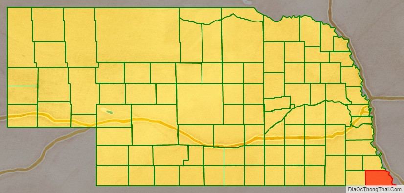
Richardson County is the easternmost county in the U.S. state of Nebraska. As of the 2010 census, the population was 8,363. Its county seat is Falls City.
In the Nebraska license plate system, Richardson County is represented by the prefix 19 (it had the nineteenth-largest number of vehicles registered in the county when the license plate system was established in 1922).
Parts of the Ioway Reservation and the Sac and Fox Reservation are located in the southeast corner of the county between Falls City, Rulo (Nebraska), and Hiawatha (Kansas). The incorporated village of Preston, Nebraska is located inside the latter reservation.
| Name: | Richardson County |
|---|---|
| FIPS code: | 31-147 |
| State: | Nebraska |
| Founded: | 1854 |
| Named for: | William Alexander Richardson |
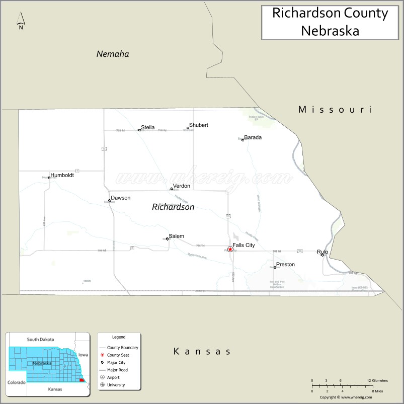
| Seat: | Falls City |
| Largest city: | Falls City |
| Total Area: | 555 sq mi (1,440 km²) |
| Land Area: | 552 sq mi (1,430 km²) |
| Total Population: | 7,759 |
| Population Density: | 14.4/sq mi (5.6/km²) |
| Time zone: | UTC−6 (Central) |
| Summer Time Zone (DST): | UTC−5 (CDT) |
| Website: | www.co.richardson.ne.us |
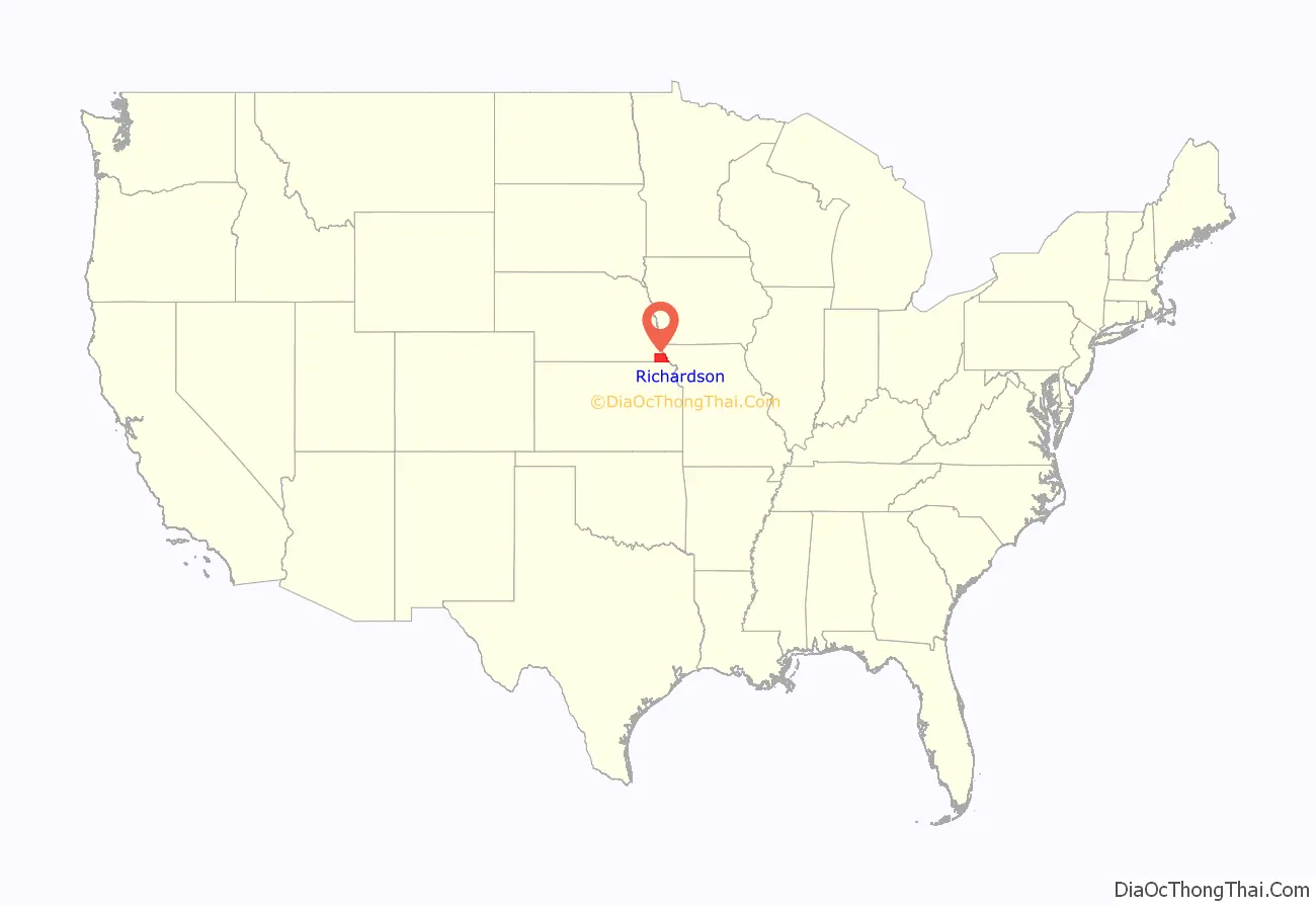
Richardson County location map. Where is Richardson County?
History
The Nebraska Territory, including this county, was opened for settlement through the Kansas–Nebraska Act on May 30, 1854. Richardson County was created that same year and reorganized in 1855 by the first territorial legislature. It was named after William A. Richardson, a US Representative from the state of Illinois who had sponsored the Kansas-Nebraska Act; subsequently, in 1858, Richardson was appointed governor of the Nebraska Territory.
The first courthouse was built in 1863. The second courthouse was built in 1873 and burned on May 7, 1919.
On May 30, 1879, the “Irving, Kansas Tornado” passed through Richardson County. This tornado measured F4 on the Fujita scale, and had a damage path 800 yards (730 m) wide and 100 miles (160 km) long. Eighteen people were killed and sixty were injured in this tornado.
In the summer of 1966, Braniff Airlines Flight 250 crashed near Falls City due to bad weather, killing all 42 on board. The BAC One-Eleven aircraft was on the Kansas City to Omaha leg of a multi-stop flight from New Orleans to Minneapolis on Saturday night, August 6.
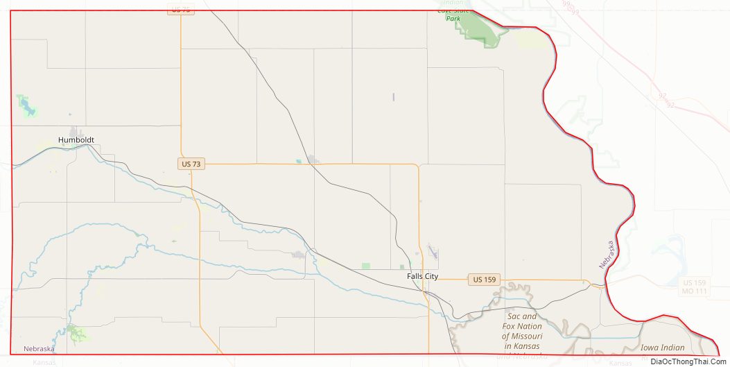
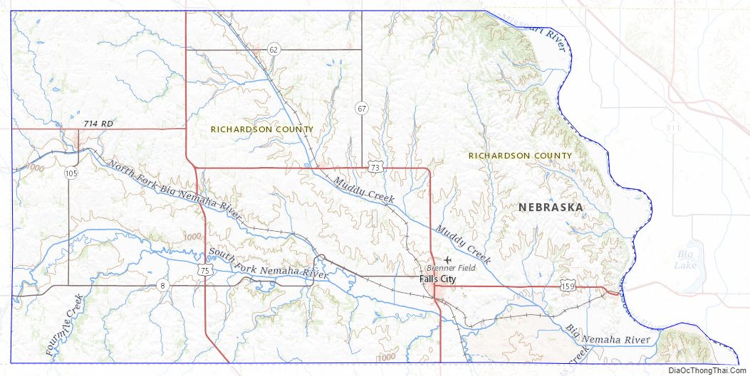
Richardson County Road Map
Geography
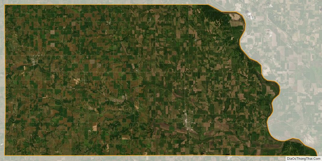
Richardson County lies at the SE tip of Nebraska. Its east boundary line abuts the west boundary line of the state of Missouri (across the Missouri River). Its south boundary line abuts the north boundary line of the state of Kansas. Several branches and tributaries of the Big Nemaha River flow southeast through the county, depositing their waters into the Missouri River at the county’s SE corner. The county’s terrain consists of rolling hills, sloped to the southeast, cut by numerous drainages. The county area is largely devoted to agriculture. The lowest point in the state of Nebraska is located on the Missouri River in Richardson County, where it flows out of Nebraska and into Kansas and Missouri.
The county has a total area of 555 square miles (1,440 km), of which 552 square miles (1,430 km) is land and 2.7 square miles (7.0 km) (0.5%) is water.
Major highways
The major highways through the area are U.S. Highway 73 () and U.S. Highway 75 () running north and south through the county, U.S. Highway 159 () running east toward the Rulo bridge (and connecting to the state of Missouri), and Nebraska Highway 8 () running west along the southern border of Nebraska. Other state highways provide connections between smaller towns.
- U.S. Highway 73
- U.S. Highway 75
- U.S. Highway 159
- Nebraska Highway 8
- Nebraska Highway 62
- Nebraska Highway 67
- Nebraska Highway 105
Protected area
- Four Mile Creek State Wildlife Management Area
- Indian Cave State Park (part)
- Kirkmans Cove Recreation Area
- Verdon Lake State Recreation Area
Adjacent counties
- Nemaha County – north
- Holt County, Missouri – east
- Doniphan County, Kansas – southeast
- Brown County, Kansas – south
- Nemaha County, Kansas – southwest
- Pawnee County – west
Richardson County Topographic Map
Richardson County Satellite Map
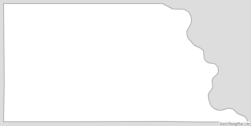
Richardson County Outline Map
See also
Map of Nebraska State and its subdivision:- Adams
- Antelope
- Arthur
- Banner
- Blaine
- Boone
- Box Butte
- Boyd
- Brown
- Buffalo
- Burt
- Butler
- Cass
- Cedar
- Chase
- Cherry
- Cheyenne
- Clay
- Colfax
- Cuming
- Custer
- Dakota
- Dawes
- Dawson
- Deuel
- Dixon
- Dodge
- Douglas
- Dundy
- Fillmore
- Franklin
- Frontier
- Furnas
- Gage
- Garden
- Garfield
- Gosper
- Grant
- Greeley
- Hall
- Hamilton
- Harlan
- Hayes
- Hitchcock
- Holt
- Hooker
- Howard
- Jefferson
- Johnson
- Kearney
- Keith
- Keya Paha
- Kimball
- Knox
- Lancaster
- Lincoln
- Logan
- Loup
- Madison
- McPherson
- Merrick
- Morrill
- Nance
- Nemaha
- Nuckolls
- Otoe
- Pawnee
- Perkins
- Phelps
- Pierce
- Platte
- Polk
- Red Willow
- Richardson
- Rock
- Saline
- Sarpy
- Saunders
- Scotts Bluff
- Seward
- Sheridan
- Sherman
- Sioux
- Stanton
- Thayer
- Thomas
- Thurston
- Valley
- Washington
- Wayne
- Webster
- Wheeler
- York
- Alabama
- Alaska
- Arizona
- Arkansas
- California
- Colorado
- Connecticut
- Delaware
- District of Columbia
- Florida
- Georgia
- Hawaii
- Idaho
- Illinois
- Indiana
- Iowa
- Kansas
- Kentucky
- Louisiana
- Maine
- Maryland
- Massachusetts
- Michigan
- Minnesota
- Mississippi
- Missouri
- Montana
- Nebraska
- Nevada
- New Hampshire
- New Jersey
- New Mexico
- New York
- North Carolina
- North Dakota
- Ohio
- Oklahoma
- Oregon
- Pennsylvania
- Rhode Island
- South Carolina
- South Dakota
- Tennessee
- Texas
- Utah
- Vermont
- Virginia
- Washington
- West Virginia
- Wisconsin
- Wyoming