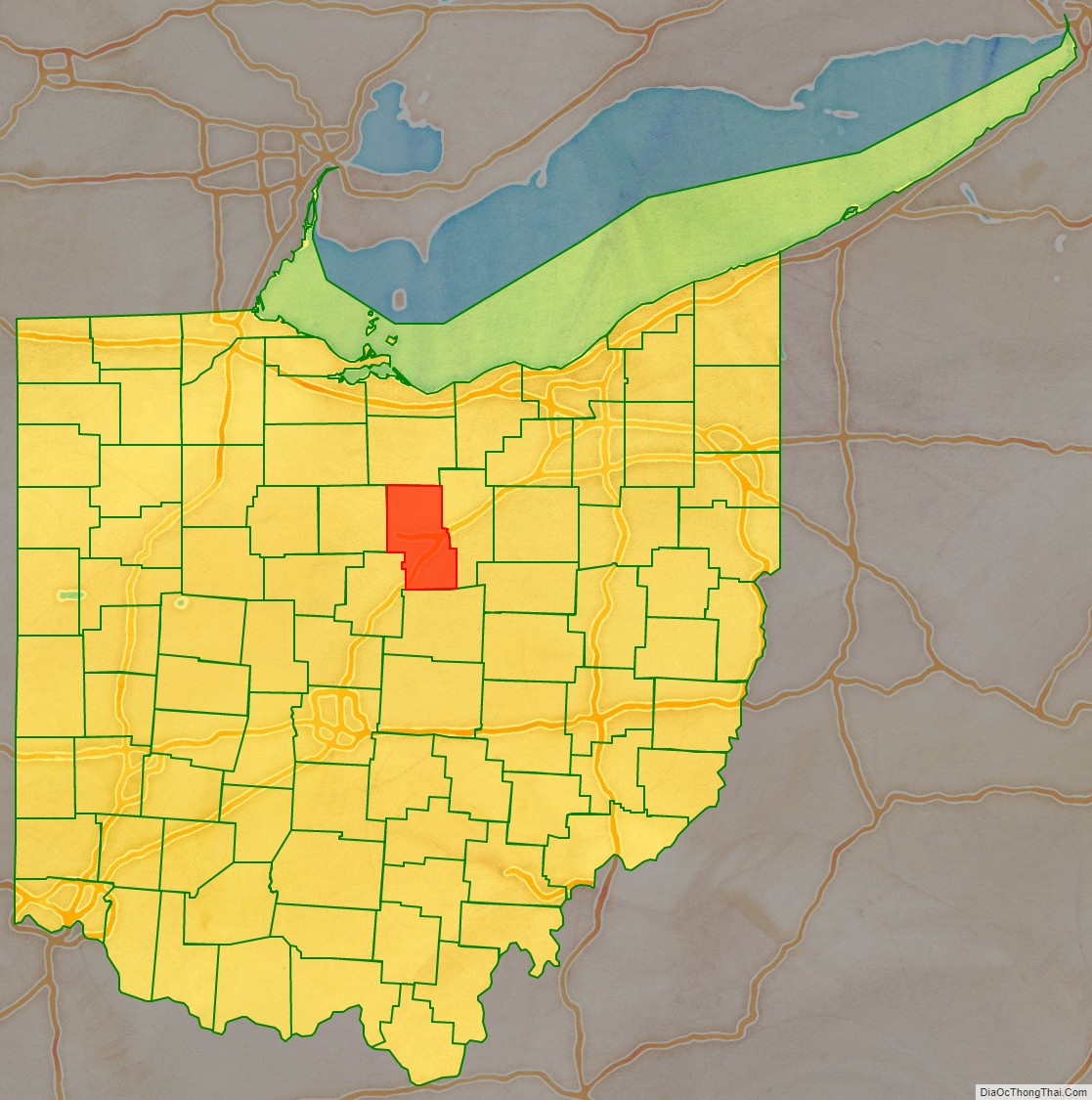
Richland County is a county located in the U.S. state of Ohio. As of the 2020 census, the population was 124,936. Its county seat is Mansfield. The county was created in 1808 and later organized in 1813. It is named for the fertile soil found there.
Richland County is included in the Mansfield, OH Metropolitan Statistical Area as well as the Mansfield-Ashland–Bucyrus, OH Combined Statistical Area. The county is one of the six Metropolitan Statistical Areas that make up Northeast Ohio.
| Name: | Richland County |
|---|---|
| FIPS code: | 39-139 |
| State: | Ohio |
| Founded: | March 1, 1813 |
| Named for: | their fertile soil |
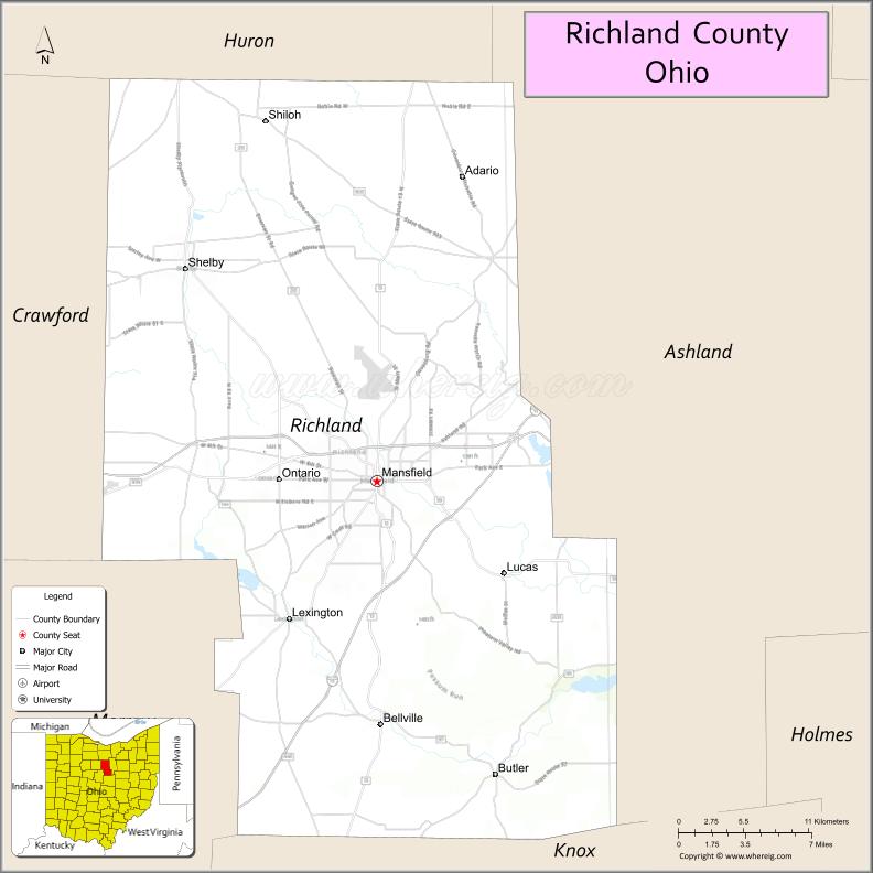
| Seat: | Mansfield |
| Largest city: | Mansfield |
| Total Area: | 500 sq mi (1,000 km²) |
| Land Area: | 495 sq mi (1,280 km²) |
| Total Population: | 124,936 |
| Population Density: | 250/sq mi (96/km²) |
| Time zone: | UTC−5 (Eastern) |
| Summer Time Zone (DST): | UTC−4 (EDT) |
| Website: | www.richlandcountyoh.us |
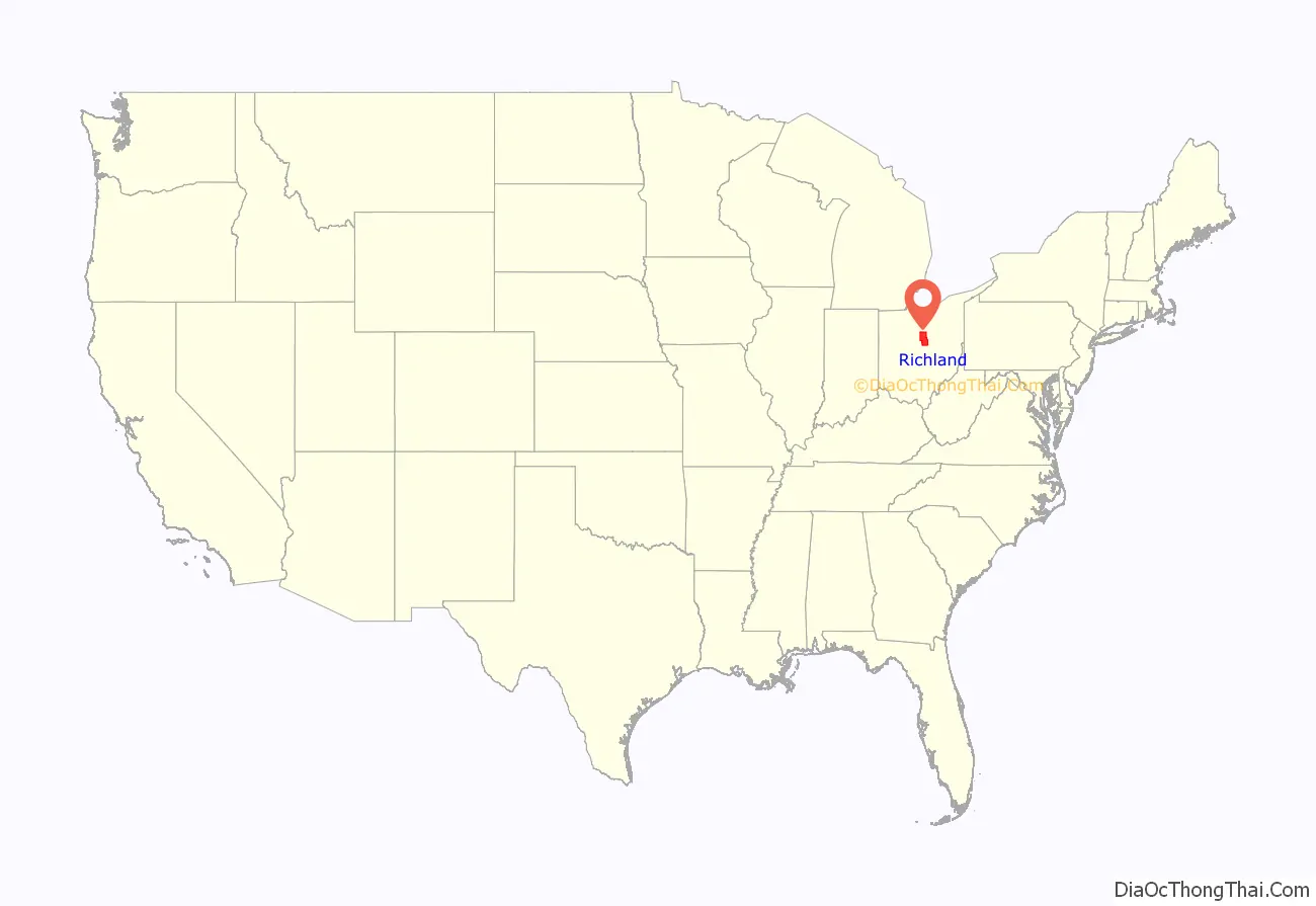
Richland County location map. Where is Richland County?
History
At its formation in 1806 Richland County encompassed a larger area. The land was mainly forest. Settlers cleared the land for farming and the population increased. When Ashland County was formed on 24 February 1846, most of its area was provided by townships annexed in whole (such as Green Township) or in part (Clear Creek, Milton and Mifflin townships) from eastern Richland County.
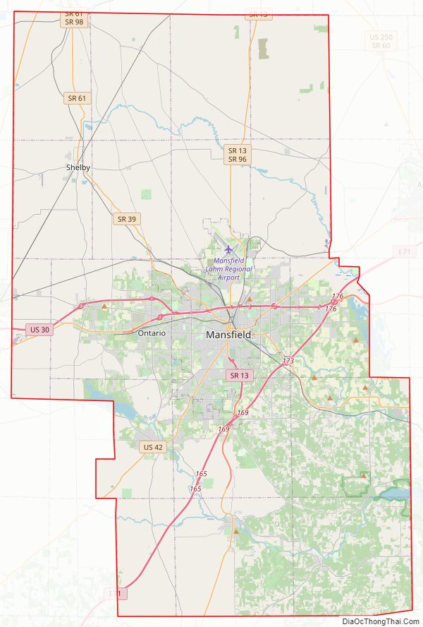
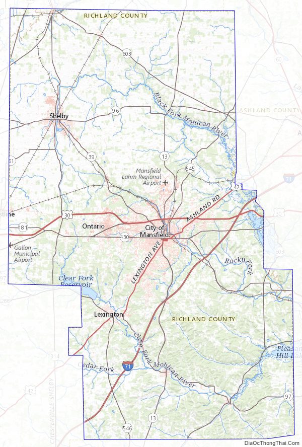
Richland County Road Map
Geography
According to the U.S. Census Bureau, the county has a total area of 500 square miles (1,300 km), of which 495 square miles (1,280 km) is land and 4.8 square miles (12 km) (1.0%) is water.
Adjacent counties
- Huron County (north)
- Ashland County (east)
- Knox County (south)
- Morrow County (southwest)
- Crawford County (west)
Richland County Topographic Map
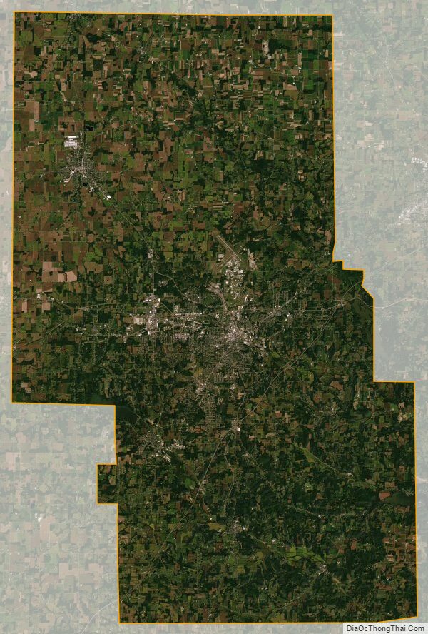
Richland County Satellite Map
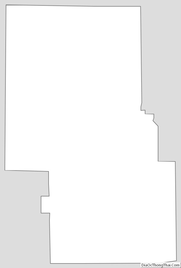
Richland County Outline Map
See also
Map of Ohio State and its subdivision:- Adams
- Allen
- Ashland
- Ashtabula
- Athens
- Auglaize
- Belmont
- Brown
- Butler
- Carroll
- Champaign
- Clark
- Clermont
- Clinton
- Columbiana
- Coshocton
- Crawford
- Cuyahoga
- Darke
- Defiance
- Delaware
- Erie
- Fairfield
- Fayette
- Franklin
- Fulton
- Gallia
- Geauga
- Greene
- Guernsey
- Hamilton
- Hancock
- Hardin
- Harrison
- Henry
- Highland
- Hocking
- Holmes
- Huron
- Jackson
- Jefferson
- Knox
- Lake
- Lake Erie
- Lawrence
- Licking
- Logan
- Lorain
- Lucas
- Madison
- Mahoning
- Marion
- Medina
- Meigs
- Mercer
- Miami
- Monroe
- Montgomery
- Morgan
- Morrow
- Muskingum
- Noble
- Ottawa
- Paulding
- Perry
- Pickaway
- Pike
- Portage
- Preble
- Putnam
- Richland
- Ross
- Sandusky
- Scioto
- Seneca
- Shelby
- Stark
- Summit
- Trumbull
- Tuscarawas
- Union
- Van Wert
- Vinton
- Warren
- Washington
- Wayne
- Williams
- Wood
- Wyandot
- Alabama
- Alaska
- Arizona
- Arkansas
- California
- Colorado
- Connecticut
- Delaware
- District of Columbia
- Florida
- Georgia
- Hawaii
- Idaho
- Illinois
- Indiana
- Iowa
- Kansas
- Kentucky
- Louisiana
- Maine
- Maryland
- Massachusetts
- Michigan
- Minnesota
- Mississippi
- Missouri
- Montana
- Nebraska
- Nevada
- New Hampshire
- New Jersey
- New Mexico
- New York
- North Carolina
- North Dakota
- Ohio
- Oklahoma
- Oregon
- Pennsylvania
- Rhode Island
- South Carolina
- South Dakota
- Tennessee
- Texas
- Utah
- Vermont
- Virginia
- Washington
- West Virginia
- Wisconsin
- Wyoming