Roberts County is a county located in the U.S. state of Texas. As of the 2020 census, its population was 827, making it the eighth-least populous county in Texas. Its county seat is Miami, which is also the county’s only incorporated community. The county was created in 1876 and organized in 1889. It is named for Oran Milo Roberts, a governor of Texas. Roberts County is one of five prohibition (entirely dry) counties in the state of Texas.
| Name: | Roberts County |
|---|---|
| FIPS code: | 48-393 |
| State: | Texas |
| Founded: | 1889 |
| Named for: | Oran Milo Roberts |
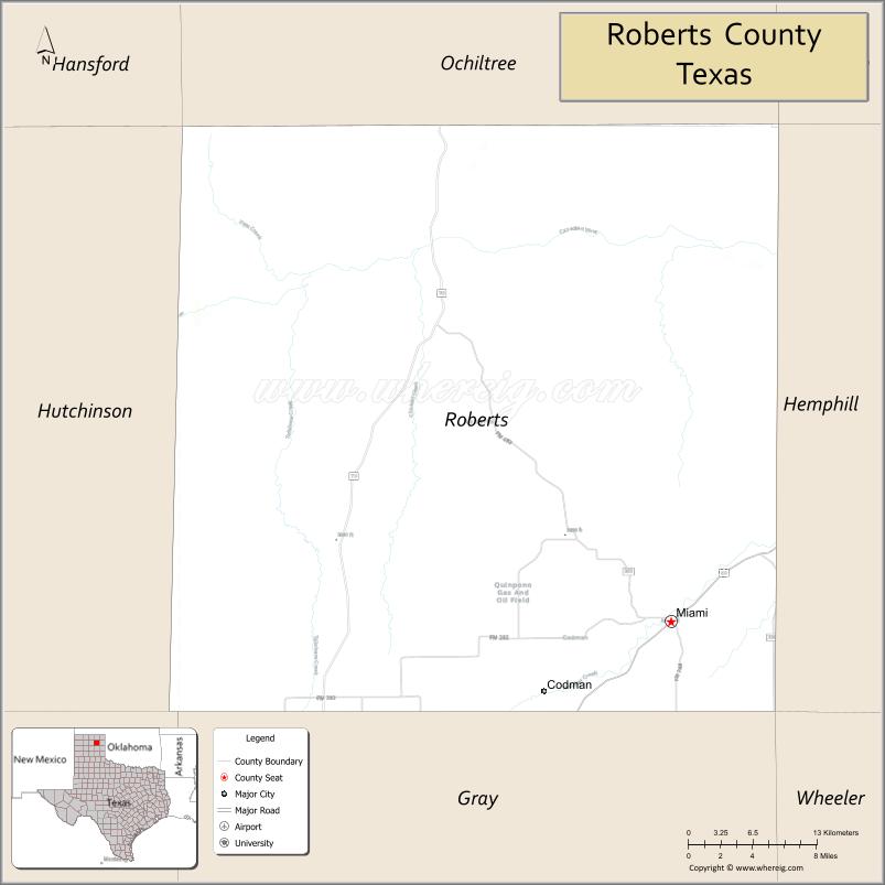
| Seat: | Miami |
| Largest city: | Miami |
| Total Area: | 924 sq mi (2,390 km²) |
| Land Area: | 924 sq mi (2,390 km²) |
| Total Population: | 797 |
| Population Density: | 1/sq mi (0.4/km²) |
| Time zone: | UTC−6 (Central) |
| Summer Time Zone (DST): | UTC−5 (CDT) |
| Website: | www.co.roberts.tx.us |
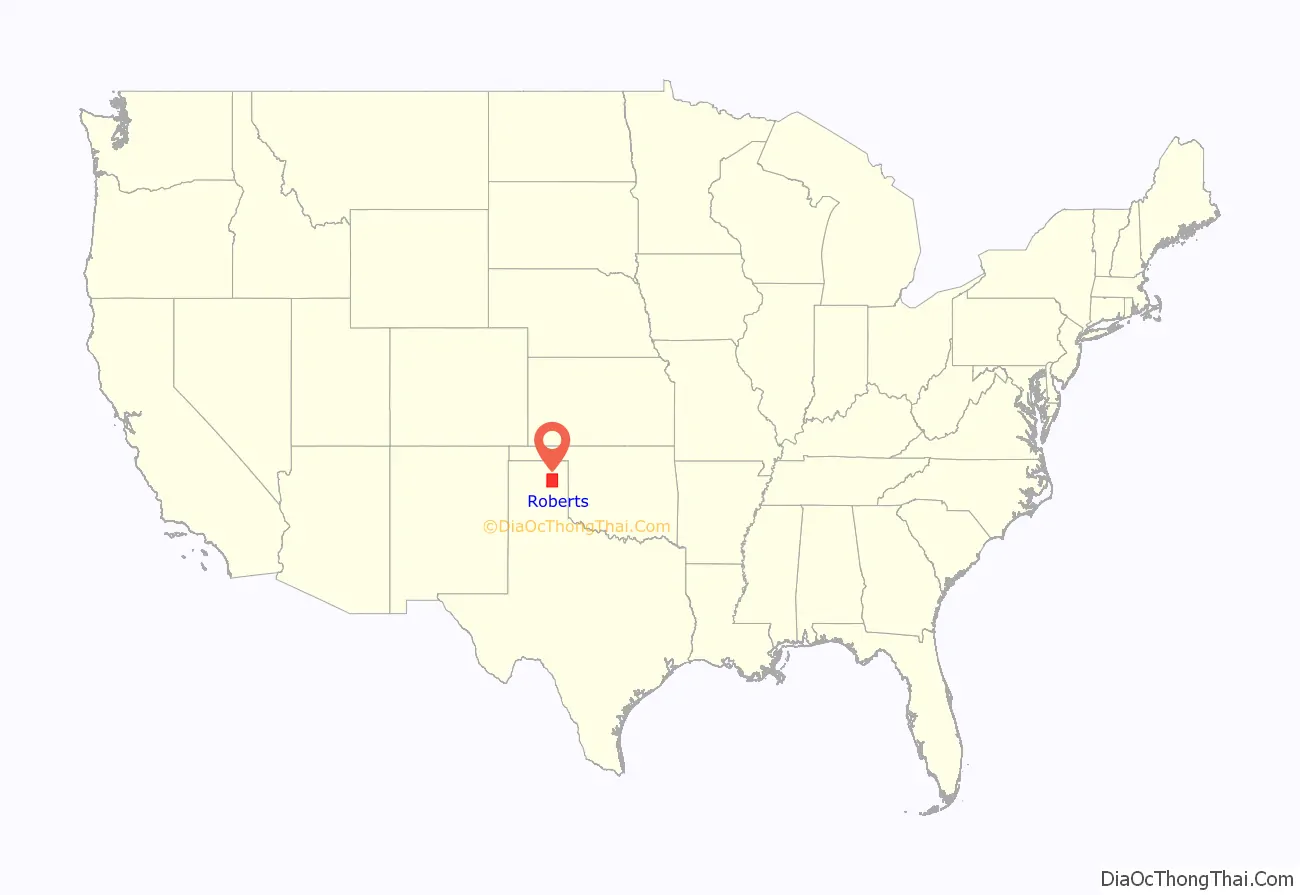
Roberts County location map. Where is Roberts County?
History
The Plains Apache inhabited the Texas Panhandle until they were displaced by the Comanche who dominated the area until the 1870s. The Comanche hunted the large herds of buffalo, which grazed on the prairie. In the Red River War of 1874–75, United States Army troops led by Ranald S. Mackenzie drove out the Comanches. Simultaneously, buffalo hunters killed the large herds in the area, destroying the food supply and livelihood of the Plains tribes, making way for permanent settlement by Anglo-Americans.
In 1876, Roberts County was carved from Bexar County and the Clay Land District. In 1887, the Southern Kansas Railway was built through Roberts County, and settlers followed.
Roberts County is the scene of a recent battle for water rights, where the City of Amarillo, Texas, the Canadian River Municipal Water Authority, and T. Boone Pickens have sought to purchase the water rights within the county. Between the three, they own 80% of the water rights.
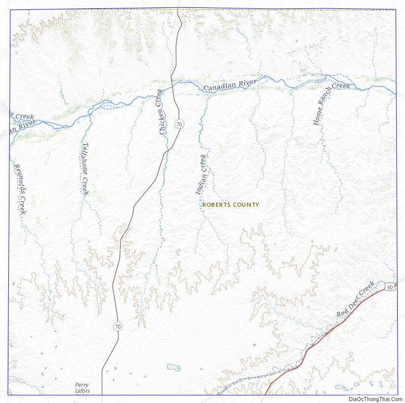
Roberts County Road Map
Geography
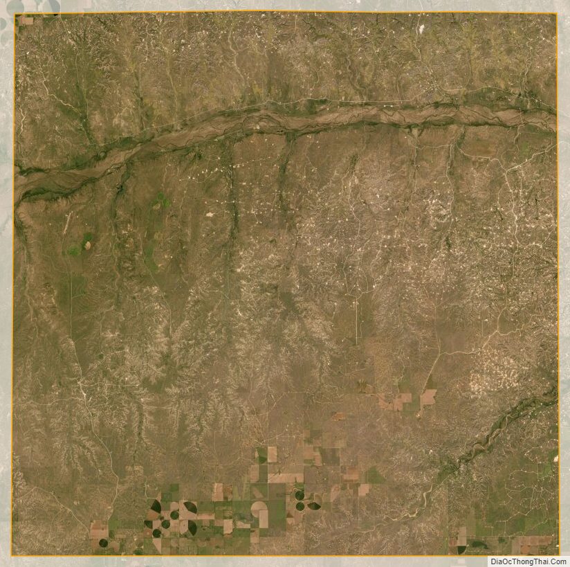
According to the U.S. Census Bureau, the county has a total area of 924 sq mi (2,390 km), of which 0.1 sq mi (0.26 km) (0.01%) is covered by water.
The county is relatively flat except for the Canadian River valley. Most of the land is used for cattle ranching. The county contains the 68,000-acre (280 km) Mesa Vista Ranch, which seeks to protect quail, dove, and pheasant habitat along the creek beds south of the Canadian River.
Major highways
- U.S. Highway 60
- State Highway 70
Adjacent counties
- Ochiltree County (north)
- Lipscomb County northeast)
- Hemphill County (east)
- Gray County (south)
- Carson County (southwest)
- Hutchinson County (west)
- Hansford County (northwest)
- Wheeler County (southeast)
Roberts County Topographic Map
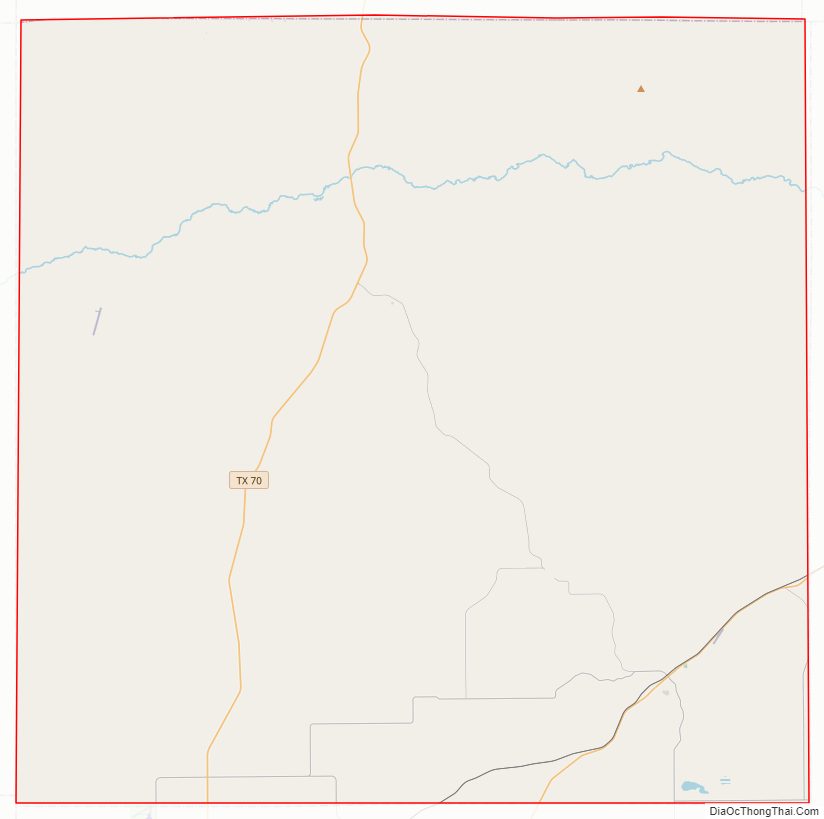
Roberts County Satellite Map
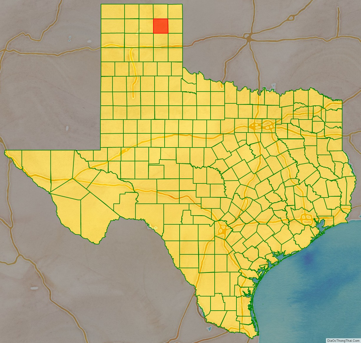
Roberts County Outline Map

See also
Map of Texas State and its subdivision:- Anderson
- Andrews
- Angelina
- Aransas
- Archer
- Armstrong
- Atascosa
- Austin
- Bailey
- Bandera
- Bastrop
- Baylor
- Bee
- Bell
- Bexar
- Blanco
- Borden
- Bosque
- Bowie
- Brazoria
- Brazos
- Brewster
- Briscoe
- Brooks
- Brown
- Burleson
- Burnet
- Caldwell
- Calhoun
- Callahan
- Cameron
- Camp
- Carson
- Cass
- Castro
- Chambers
- Cherokee
- Childress
- Clay
- Cochran
- Coke
- Coleman
- Collin
- Collingsworth
- Colorado
- Comal
- Comanche
- Concho
- Cooke
- Coryell
- Cottle
- Crane
- Crockett
- Crosby
- Culberson
- Dallam
- Dallas
- Dawson
- Deaf Smith
- Delta
- Denton
- Dewitt
- Dickens
- Dimmit
- Donley
- Duval
- Eastland
- Ector
- Edwards
- El Paso
- Ellis
- Erath
- Falls
- Fannin
- Fayette
- Fisher
- Floyd
- Foard
- Fort Bend
- Franklin
- Freestone
- Frio
- Gaines
- Galveston
- Garza
- Gillespie
- Glasscock
- Goliad
- Gonzales
- Gray
- Grayson
- Gregg
- Grimes
- Guadalupe
- Hale
- Hall
- Hamilton
- Hansford
- Hardeman
- Hardin
- Harris
- Harrison
- Hartley
- Haskell
- Hays
- Hemphill
- Henderson
- Hidalgo
- Hill
- Hockley
- Hood
- Hopkins
- Houston
- Howard
- Hudspeth
- Hunt
- Hutchinson
- Irion
- Jack
- Jackson
- Jasper
- Jeff Davis
- Jefferson
- Jim Hogg
- Jim Wells
- Johnson
- Jones
- Karnes
- Kaufman
- Kendall
- Kenedy
- Kent
- Kerr
- Kimble
- King
- Kinney
- Kleberg
- Knox
- La Salle
- Lamar
- Lamb
- Lampasas
- Lavaca
- Lee
- Leon
- Liberty
- Limestone
- Lipscomb
- Live Oak
- Llano
- Loving
- Lubbock
- Lynn
- Madison
- Marion
- Martin
- Mason
- Matagorda
- Maverick
- McCulloch
- McLennan
- McMullen
- Medina
- Menard
- Midland
- Milam
- Mills
- Mitchell
- Montague
- Montgomery
- Moore
- Morris
- Motley
- Nacogdoches
- Navarro
- Newton
- Nolan
- Nueces
- Ochiltree
- Oldham
- Orange
- Palo Pinto
- Panola
- Parker
- Parmer
- Pecos
- Polk
- Potter
- Presidio
- Rains
- Randall
- Reagan
- Real
- Red River
- Reeves
- Refugio
- Roberts
- Robertson
- Rockwall
- Runnels
- Rusk
- Sabine
- San Augustine
- San Jacinto
- San Patricio
- San Saba
- Schleicher
- Scurry
- Shackelford
- Shelby
- Sherman
- Smith
- Somervell
- Starr
- Stephens
- Sterling
- Stonewall
- Sutton
- Swisher
- Tarrant
- Taylor
- Terrell
- Terry
- Throckmorton
- Titus
- Tom Green
- Travis
- Trinity
- Tyler
- Upshur
- Upton
- Uvalde
- Val Verde
- Van Zandt
- Victoria
- Walker
- Waller
- Ward
- Washington
- Webb
- Wharton
- Wheeler
- Wichita
- Wilbarger
- Willacy
- Williamson
- Wilson
- Winkler
- Wise
- Wood
- Yoakum
- Young
- Zapata
- Zavala
- Alabama
- Alaska
- Arizona
- Arkansas
- California
- Colorado
- Connecticut
- Delaware
- District of Columbia
- Florida
- Georgia
- Hawaii
- Idaho
- Illinois
- Indiana
- Iowa
- Kansas
- Kentucky
- Louisiana
- Maine
- Maryland
- Massachusetts
- Michigan
- Minnesota
- Mississippi
- Missouri
- Montana
- Nebraska
- Nevada
- New Hampshire
- New Jersey
- New Mexico
- New York
- North Carolina
- North Dakota
- Ohio
- Oklahoma
- Oregon
- Pennsylvania
- Rhode Island
- South Carolina
- South Dakota
- Tennessee
- Texas
- Utah
- Vermont
- Virginia
- Washington
- West Virginia
- Wisconsin
- Wyoming