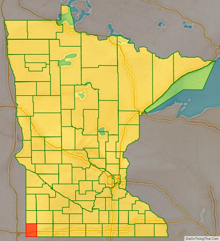
Rock County is a county at the southwestern corner of the U.S. state of Minnesota. As of the 2020 census, the population was 9,704. Its county seat is Luverne.
| Name: | Rock County |
|---|---|
| FIPS code: | 27-133 |
| State: | Minnesota |
| Founded: | 1857 |
| Named for: | Rock outcrop on Rock River |
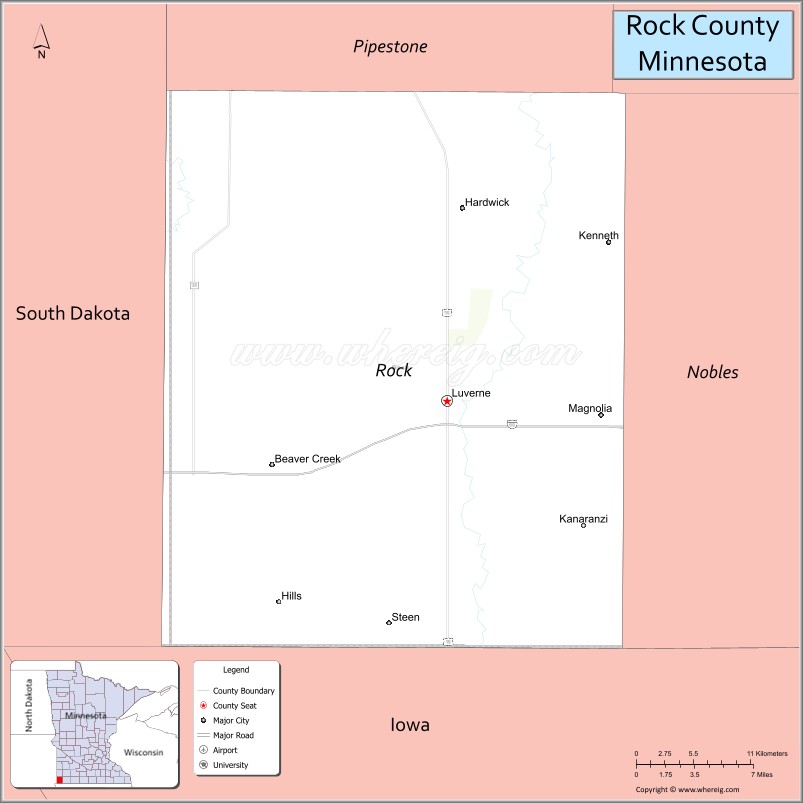
| Seat: | Luverne |
| Largest city: | Luverne |
| Total Area: | 483 sq mi (1,250 km²) |
| Land Area: | 482 sq mi (1,250 km²) |
| Total Population: | 9,704 |
| Population Density: | 20.1/sq mi (7.8/km²) |
| Time zone: | UTC−6 (Central) |
| Summer Time Zone (DST): | UTC−5 (CDT) |
| Website: | www.co.rock.mn.us |
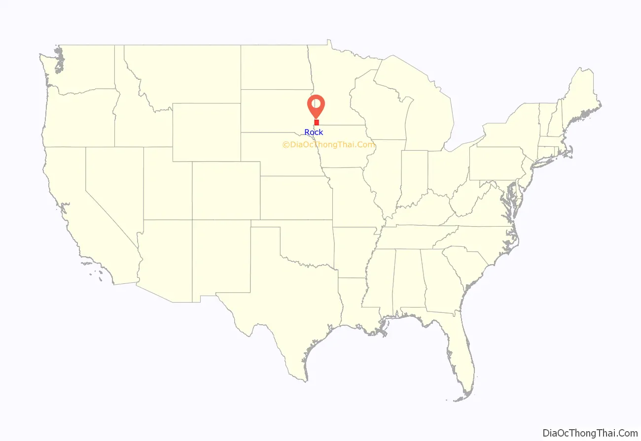
Rock County location map. Where is Rock County?
History
The county was formed on May 23, 1857, by act of the territorial legislature, but was not organized at that time. The area was designated Pipestone County, and the name Rock County was attached to the present Pipestone. In 1862 the Minnesota state legislature changed the designations, attaching the present names to the present counties. On March 5, 1870, the state legislature approved an act that finalized the county’s organization and designated Luverne as the county seat. The county’s name came from the Rock River, which in turn is named for a prominent rocky outcrop (designated “The Rock” on an 1843 map of the area) of reddish-gray quartzite, about 3 miles (5 km) north of Luverne. The mound dramatically contrasts with the low surrounding prairie. Another source attributes the county name to its rocky soil.
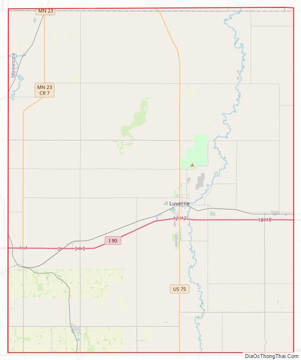
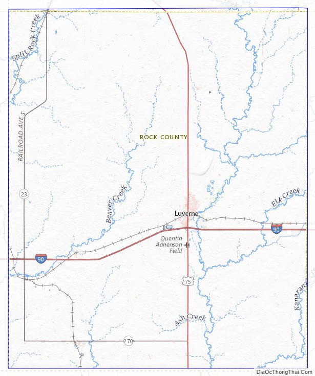
Rock County Road Map
Geography
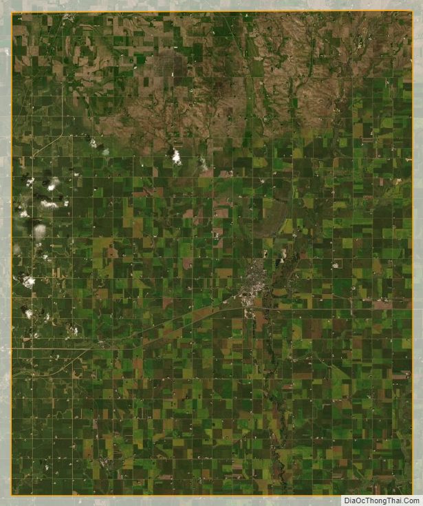
Rock County lies at Minnesota’s southwest corner. Its western border abuts South Dakota‘s eastern border; its southern border abuts Iowa‘s northern border. The Rock River flows southward through the east central part of the county, and Beaver Creek flows southward through the west central part of the county. The county consists of low rolling hills carved with drainages. The area is devoted to agriculture. The terrain slopes to the south, with its highest point near the midpoint of its north boundary, at 1,759’ (536m) ASL. The county has an area of 483 square miles (1,250 km), of which 482 square miles (1,250 km) is land and 0.3 square miles (0.78 km) (0.06%) is water. The entire county falls in the hot summer humid continental climate zone (Dfa).
Lakes
One of Minnesota’s nicknames is “Land of 10,000 Lakes”, and it is speckled with bodies of water large and small. But four of the state’s counties do not contain a natural lake; Rock County is one of them. Rock County did host a manmade lake from 1938 until 2014: a WPA work project constructed a small dam (the “Lower Dam”) on Blue Mounds Creek in 1938, creating a small lake in Blue Mounds State Park. This continued until June 2014, when the dam was damaged by rain and floodwaters, allowing the pond to drain. In June 2016 the Minnesota Department of Natural Resources announced its decision not to rebuild the dam.
Major highways
- Interstate 90
- U.S. Highway 75
- Minnesota State Highway 23
- Minnesota State Highway 269
- Minnesota State Highway 270
Adjacent counties
- Pipestone County – north
- Murray County – northeast
- Nobles County – east
- Lyon County, Iowa – south
- Minnehaha County, South Dakota – west
- Moody County, South Dakota – northwest
Protected areas
- Blue Mounds State Park
- Northern Tallgrass Prairie National Wildlife Refuge (part)
Rock County Topographic Map
Rock County Satellite Map
Rock County Outline Map

See also
Map of Minnesota State and its subdivision:- Aitkin
- Anoka
- Becker
- Beltrami
- Benton
- Big Stone
- Blue Earth
- Brown
- Carlton
- Carver
- Cass
- Chippewa
- Chisago
- Clay
- Clearwater
- Cook
- Cottonwood
- Crow Wing
- Dakota
- Dodge
- Douglas
- Faribault
- Fillmore
- Freeborn
- Goodhue
- Grant
- Hennepin
- Houston
- Hubbard
- Isanti
- Itasca
- Jackson
- Kanabec
- Kandiyohi
- Kittson
- Koochiching
- Lac qui Parle
- Lake
- Lake of the Woods
- Lake Superior
- Le Sueur
- Lincoln
- Lyon
- Mahnomen
- Marshall
- Martin
- McLeod
- Meeker
- Mille Lacs
- Morrison
- Mower
- Murray
- Nicollet
- Nobles
- Norman
- Olmsted
- Otter Tail
- Pennington
- Pine
- Pipestone
- Polk
- Pope
- Ramsey
- Red Lake
- Redwood
- Renville
- Rice
- Rock
- Roseau
- Saint Louis
- Scott
- Sherburne
- Sibley
- Stearns
- Steele
- Stevens
- Swift
- Todd
- Traverse
- Wabasha
- Wadena
- Waseca
- Washington
- Watonwan
- Wilkin
- Winona
- Wright
- Yellow Medicine
- Alabama
- Alaska
- Arizona
- Arkansas
- California
- Colorado
- Connecticut
- Delaware
- District of Columbia
- Florida
- Georgia
- Hawaii
- Idaho
- Illinois
- Indiana
- Iowa
- Kansas
- Kentucky
- Louisiana
- Maine
- Maryland
- Massachusetts
- Michigan
- Minnesota
- Mississippi
- Missouri
- Montana
- Nebraska
- Nevada
- New Hampshire
- New Jersey
- New Mexico
- New York
- North Carolina
- North Dakota
- Ohio
- Oklahoma
- Oregon
- Pennsylvania
- Rhode Island
- South Carolina
- South Dakota
- Tennessee
- Texas
- Utah
- Vermont
- Virginia
- Washington
- West Virginia
- Wisconsin
- Wyoming