Rockingham County is a county in the U.S. state of New Hampshire. At the 2020 census, the population was 314,176, making it New Hampshire’s second-most populous county. The county seat is Brentwood. Rockingham County is part of the Boston–Cambridge–Newton, MA-NH Metropolitan Statistical Area and the greater Boston-Worcester-Providence, MA-RI-NH–CT Combined Statistical Area. Per the 2020 census, it was New Hampshire’s fastest growing county from 2010 to 2020.[1]
As of 2014-2018 estimates from the American Community Survey, Rockingham County was the 4th wealthiest county in New England, with a median household income of $90,429.
| Name: | Rockingham County |
|---|---|
| FIPS code: | 33-015 |
| State: | New Hampshire |
| Founded: | 1769 |
| Named for: | Charles Watson-Wentworth, 2nd Marquess of Rockingham |
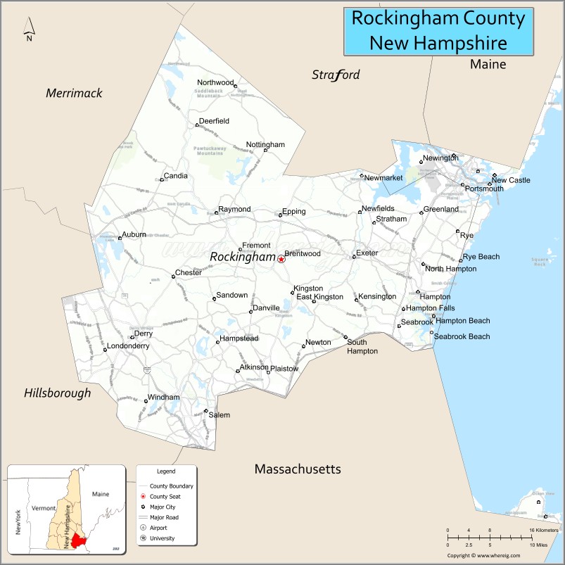
| Seat: | Brentwood |
| Largest town: | Derry |
| Total Area: | 795.2 sq mi (2,060 km²) |
| Land Area: | 695.4 sq mi (1,801 km²) |
| Total Population: | 314,176 |
| Population Density: | 400/sq mi (150/km²) |
| Time zone: | UTC−5 (Eastern) |
| Summer Time Zone (DST): | UTC−4 (EDT) |
| Website: | www.rockinghamcountynh.org |
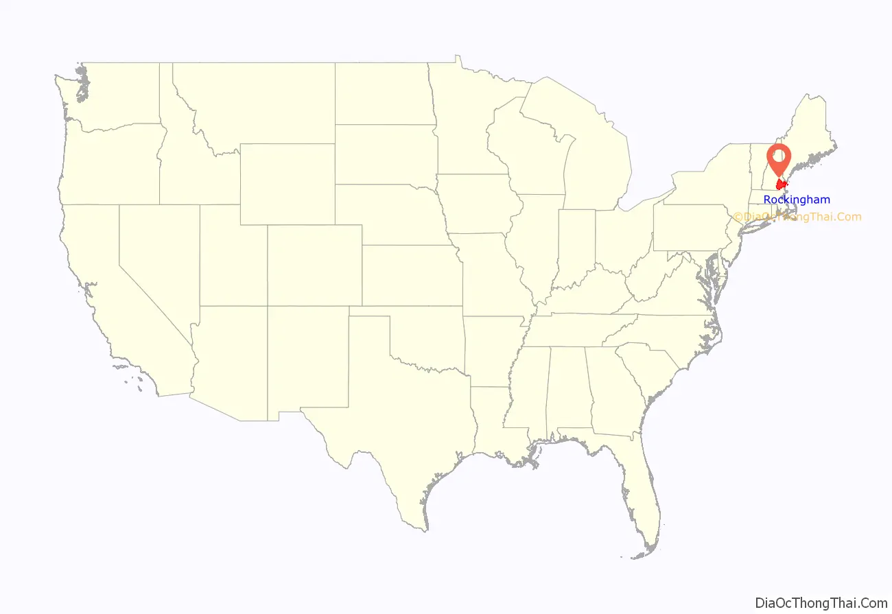
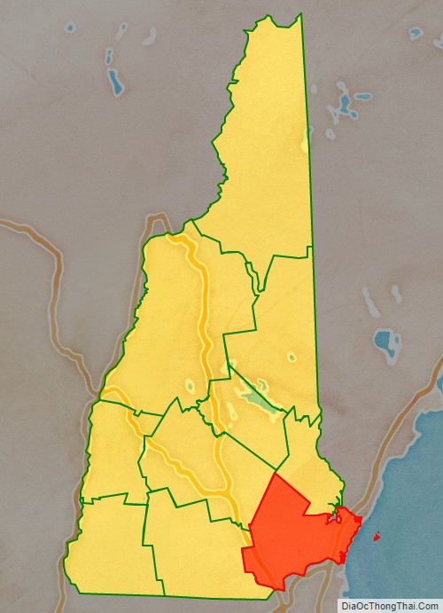
Rockingham County location map. Where is Rockingham County?
History
The area that today is Rockingham County was first settled by Europeans moving north from the Plymouth Colony in Massachusetts as early as 1623. The government was linked tightly with Massachusetts until New Hampshire became a separate colony in 1679, but counties were not introduced until 1769.
Rockingham was identified in 1769 as one of five original counties for the colony. It is named for Charles Watson-Wentworth, 2nd Marquess of Rockingham, who had been Prime Minister from 1765 to 1766. The county was organized in 1771, with its county seat at Exeter. In 1823, a portion of Hillsborough Country became part of the formation of Merrimack County. In 1844, its area was further reduced by the formation of Belknap County to the northwest. In 1997, the county court facilities were moved to Brentwood, a rural town adjacent to Exeter.
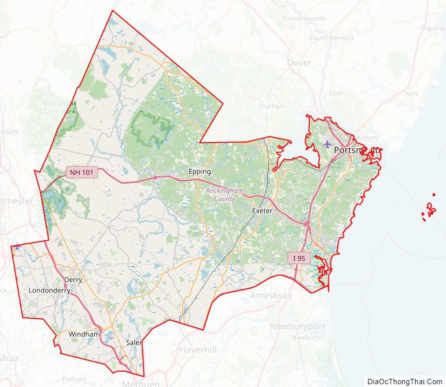
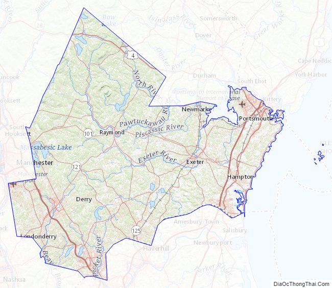
Rockingham County Road Map
Geography
The county occupies the southeastern corner of the state of New Hampshire, and it contains the state’s easternmost point. The county contains all of New Hampshire’s Atlantic coast, which, at approximately 18 miles (29 km), is the shortest ocean coastline of any state in the U.S. According to the U.S. Census Bureau, the county has an area of 795 square miles (2,060 km), of which 695 square miles (1,800 km) are land and 100 square miles (260 km) (13%) are water. Its highest point is Nottingham Mountain, at 1,340 feet (410 m), in Deerfield.
Adjacent counties
- Strafford County (north)
- York County, Maine (northeast)
- Essex County, Massachusetts (south)
- Hillsborough County (west)
- Merrimack County (northwest)
National protected area
- Great Bay National Wildlife Refuge
Rockingham County Topographic Map
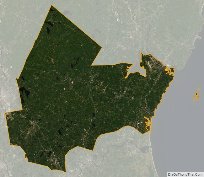
Rockingham County Satellite Map
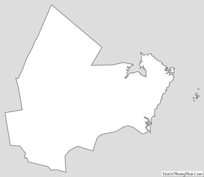
Rockingham County Outline Map
See also
Map of New Hampshire State and its subdivision: Map of other states:- Alabama
- Alaska
- Arizona
- Arkansas
- California
- Colorado
- Connecticut
- Delaware
- District of Columbia
- Florida
- Georgia
- Hawaii
- Idaho
- Illinois
- Indiana
- Iowa
- Kansas
- Kentucky
- Louisiana
- Maine
- Maryland
- Massachusetts
- Michigan
- Minnesota
- Mississippi
- Missouri
- Montana
- Nebraska
- Nevada
- New Hampshire
- New Jersey
- New Mexico
- New York
- North Carolina
- North Dakota
- Ohio
- Oklahoma
- Oregon
- Pennsylvania
- Rhode Island
- South Carolina
- South Dakota
- Tennessee
- Texas
- Utah
- Vermont
- Virginia
- Washington
- West Virginia
- Wisconsin
- Wyoming