Roseau County (/roʊˈzoʊ/) (pronounced row – so) is a county in the northwestern part of the U.S. state of Minnesota, along the Canada–US border. As of the 2020 census, the population was 15,331. Its county seat is Roseau. Roseau County borders the Canadian province of Manitoba.
Part of the Red Lake Indian Reservation is in Roseau County.
| Name: | Roseau County |
|---|---|
| FIPS code: | 27-135 |
| State: | Minnesota |
| Founded: | December 31, 1894 |
| Named for: | Roseau River |
| Seat: | Roseau |
| Largest city: | Roseau |
| Total Area: | 1,678 sq mi (4,350 km²) |
| Land Area: | 1,672 sq mi (4,330 km²) |
| Total Population: | 15,331 |
| Population Density: | 9.2/sq mi (3.6/km²) |
| Time zone: | UTC−6 (Central) |
| Summer Time Zone (DST): | UTC−5 (CDT) |
| Website: | www.co.roseau.mn.us |
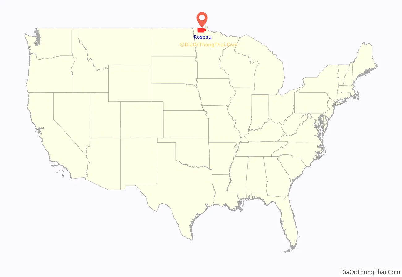
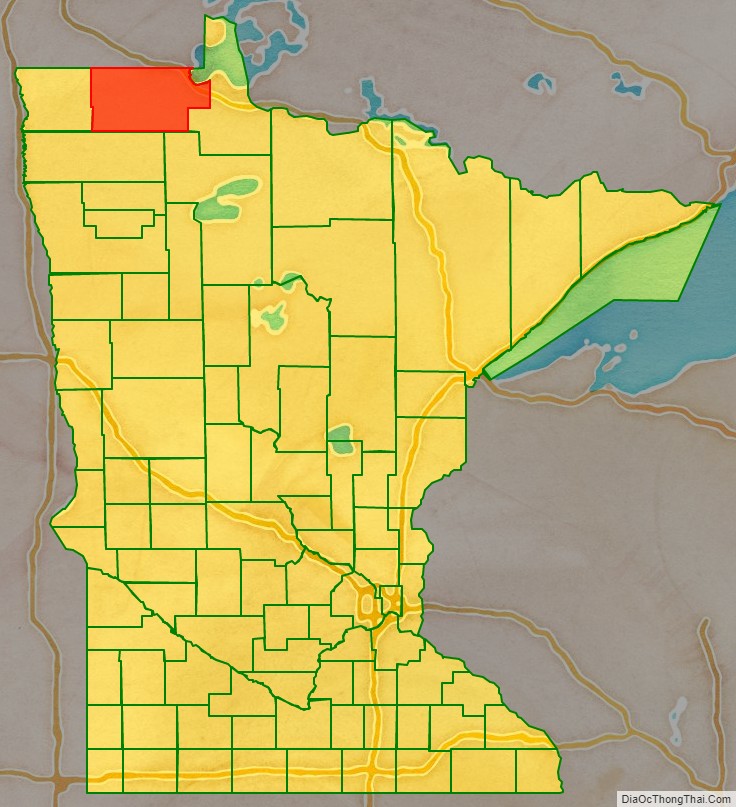
Roseau County location map. Where is Roseau County?
History
Roseau County was once the home of many Ojibwe, Sioux, and Mandan tribes. Archeologists have found artifacts within the county belonging to these tribes that date back 7,200 years. More recent history includes fur trappers and European-based explorers. By 1822, a fur-trading post was established in the area. In 1885, the future Roseau City hosted four settlers; by 1895 there were 600, and the area was incorporated as Roseau City.
By the mid-1880s the early settlers of eastern Kittson County were feeling the disadvantage of their location, far from the county seat, and petitioned the government for a separate county. On December 31, 1894, Governor Knute Nelson proclaimed the eastern portion of Kittson a new county, to be named Roseau. On February 11, 1896, the next governor, David Marston Clough, added part of Beltrami County to Roseau County. Roseau City was named the county seat.
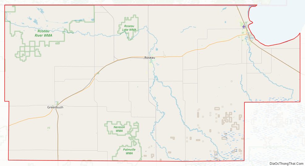
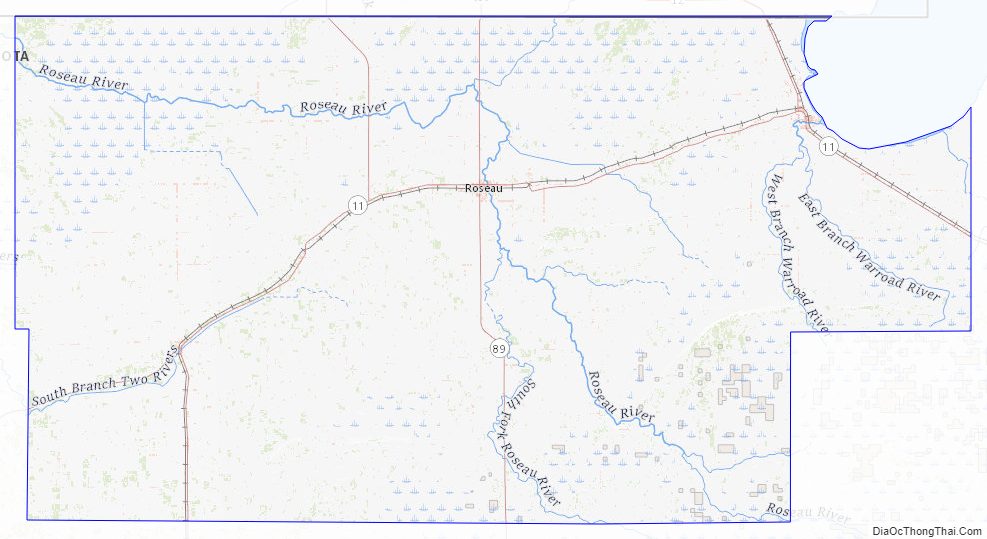
Roseau County Road Map
Geography
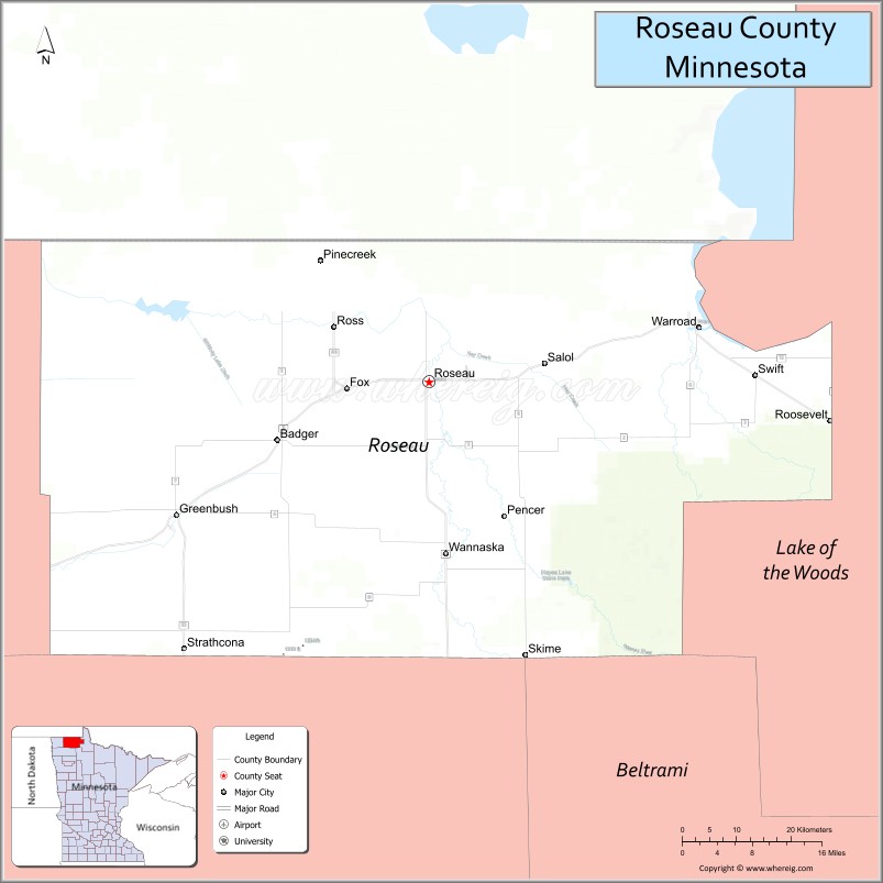
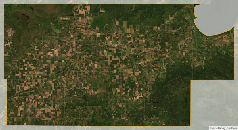
Roseau County is in far northern Minnesota. Its northern boundary abuts Canada. The Roseau River drains the upper part of the county, flowing west into Kittson County on its way to the Hudson Bay. The county terrain consists of low rolling hills, devoted to agriculture, and dotted with lakes and drainages. There is considerable wooded area, especially in the southeast portion. The county has an area of 1,678 square miles (4,350 km), of which 1,672 square miles (4,330 km) is land and 6.5 square miles (17 km) (0.4%) is water. Roseau is one of 17 Minnesota savanna counties with more savanna soils than prairie or forest soils.
Roseau County Topographic Map
Roseau County Satellite Map
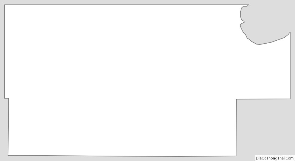
Roseau County Outline Map
See also
Map of Minnesota State and its subdivision:- Aitkin
- Anoka
- Becker
- Beltrami
- Benton
- Big Stone
- Blue Earth
- Brown
- Carlton
- Carver
- Cass
- Chippewa
- Chisago
- Clay
- Clearwater
- Cook
- Cottonwood
- Crow Wing
- Dakota
- Dodge
- Douglas
- Faribault
- Fillmore
- Freeborn
- Goodhue
- Grant
- Hennepin
- Houston
- Hubbard
- Isanti
- Itasca
- Jackson
- Kanabec
- Kandiyohi
- Kittson
- Koochiching
- Lac qui Parle
- Lake
- Lake of the Woods
- Lake Superior
- Le Sueur
- Lincoln
- Lyon
- Mahnomen
- Marshall
- Martin
- McLeod
- Meeker
- Mille Lacs
- Morrison
- Mower
- Murray
- Nicollet
- Nobles
- Norman
- Olmsted
- Otter Tail
- Pennington
- Pine
- Pipestone
- Polk
- Pope
- Ramsey
- Red Lake
- Redwood
- Renville
- Rice
- Rock
- Roseau
- Saint Louis
- Scott
- Sherburne
- Sibley
- Stearns
- Steele
- Stevens
- Swift
- Todd
- Traverse
- Wabasha
- Wadena
- Waseca
- Washington
- Watonwan
- Wilkin
- Winona
- Wright
- Yellow Medicine
- Alabama
- Alaska
- Arizona
- Arkansas
- California
- Colorado
- Connecticut
- Delaware
- District of Columbia
- Florida
- Georgia
- Hawaii
- Idaho
- Illinois
- Indiana
- Iowa
- Kansas
- Kentucky
- Louisiana
- Maine
- Maryland
- Massachusetts
- Michigan
- Minnesota
- Mississippi
- Missouri
- Montana
- Nebraska
- Nevada
- New Hampshire
- New Jersey
- New Mexico
- New York
- North Carolina
- North Dakota
- Ohio
- Oklahoma
- Oregon
- Pennsylvania
- Rhode Island
- South Carolina
- South Dakota
- Tennessee
- Texas
- Utah
- Vermont
- Virginia
- Washington
- West Virginia
- Wisconsin
- Wyoming