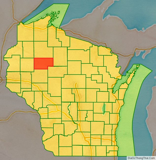
Rusk County is a county in the U.S. state of Wisconsin. As of the 2020 census, the population was 14,188. Its county seat is Ladysmith.
| Name: | Rusk County |
|---|---|
| FIPS code: | 55-107 |
| State: | Wisconsin |
| Founded: | 1901 |
| Named for: | Jeremiah McLain Rusk |
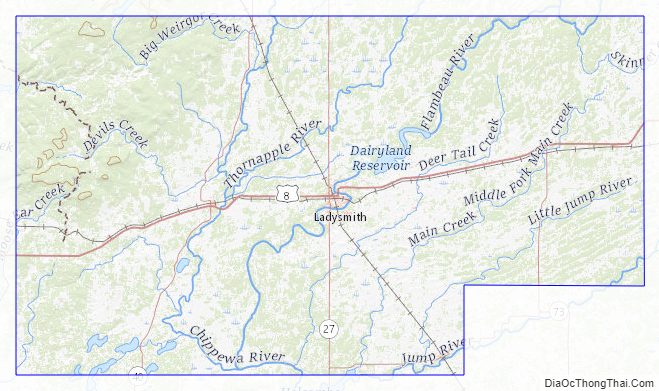
| Seat: | Ladysmith |
| Largest city: | Ladysmith |
| Total Area: | 931 sq mi (2,410 km²) |
| Land Area: | 914 sq mi (2,370 km²) |
| Total Population: | 14,188 |
| Population Density: | 15.5/sq mi (6.0/km²) |
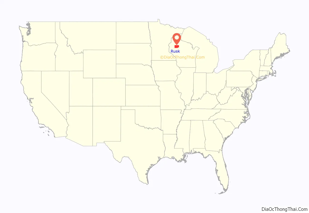
Rusk County location map. Where is Rusk County?
History
Founded in 1901, Rusk County was originally named Gates County after Milwaukee land speculator James L. Gates. It was renamed Rusk County in 1905 after Jeremiah M. Rusk, governor of Wisconsin and the first U.S. Secretary of Agriculture. It was formed out of the northern portion of Chippewa County.
Rusk County Road Map
Geography
According to the U.S. Census Bureau, the county has an area of 931 square miles (2,410 km), of which 914 square miles (2,370 km) is land and 17 square miles (44 km) (1.9%) is water.
Adjacent counties
- Washburn County – northwest
- Sawyer County – north
- Price County – east
- Taylor County – southeast
- Chippewa County – south
- Barron County – west
Major highways
- U.S. Highway 8
- Highway 27 (Wisconsin)
- Highway 40 (Wisconsin)
- Highway 73 (Wisconsin)
Railroads
- Canadian National
- Watco
Buses
- List of intercity bus stops in Wisconsin
Airport
- KRCX – Rusk County Airport serves the county and surrounding communities.
Rusk County Topographic Map
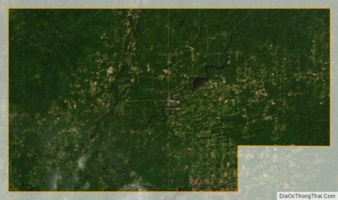
Rusk County Satellite Map
Rusk County Outline Map

See also
Map of Wisconsin State and its subdivision:- Adams
- Ashland
- Barron
- Bayfield
- Brown
- Buffalo
- Burnett
- Calumet
- Chippewa
- Clark
- Columbia
- Crawford
- Dane
- Dodge
- Door
- Douglas
- Dunn
- Eau Claire
- Florence
- Fond du Lac
- Forest
- Grant
- Green
- Green Lake
- Iowa
- Iron
- Jackson
- Jefferson
- Juneau
- Kenosha
- Kewaunee
- La Crosse
- Lafayette
- Lake Michigan
- Lake Superior
- Langlade
- Lincoln
- Manitowoc
- Marathon
- Marinette
- Marquette
- Menominee
- Milwaukee
- Monroe
- Oconto
- Oneida
- Outagamie
- Ozaukee
- Pepin
- Pierce
- Polk
- Portage
- Price
- Racine
- Richland
- Rock
- Rusk
- Saint Croix
- Sauk
- Sawyer
- Shawano
- Sheboygan
- Taylor
- Trempealeau
- Vernon
- Vilas
- Walworth
- Washburn
- Washington
- Waukesha
- Waupaca
- Waushara
- Winnebago
- Wood
- Alabama
- Alaska
- Arizona
- Arkansas
- California
- Colorado
- Connecticut
- Delaware
- District of Columbia
- Florida
- Georgia
- Hawaii
- Idaho
- Illinois
- Indiana
- Iowa
- Kansas
- Kentucky
- Louisiana
- Maine
- Maryland
- Massachusetts
- Michigan
- Minnesota
- Mississippi
- Missouri
- Montana
- Nebraska
- Nevada
- New Hampshire
- New Jersey
- New Mexico
- New York
- North Carolina
- North Dakota
- Ohio
- Oklahoma
- Oregon
- Pennsylvania
- Rhode Island
- South Carolina
- South Dakota
- Tennessee
- Texas
- Utah
- Vermont
- Virginia
- Washington
- West Virginia
- Wisconsin
- Wyoming