Sacramento County (/ˌsækrəˈmɛntoʊ/ (listen)) is a county located in the U.S. state of California. As of the 2020 census, the population was 1,585,055. Its county seat is Sacramento, which has been the state capital of California since 1854.
Sacramento County is the central county of the Greater Sacramento metropolitan area. The county covers about 994 square miles (2,570 km) in the northern portion of the Central Valley, on into Gold Country. Sacramento County extends from the low delta lands between the Sacramento River and San Joaquin River, including Suisun Bay, north to about ten miles (16 km) beyond the State Capitol and east into the foothills of the Sierra Nevada Mountains. The southernmost portion of Sacramento County has direct access to San Francisco Bay. Since 2010, statewide droughts in California have further strained Sacramento County’s water security.
| Name: | Sacramento County |
|---|---|
| FIPS code: | 06-067 |
| State: | California |
| Founded: | 1850 |
| Named for: | The capital city of Sacramento, which is named for the Sacrament of the Holy Eucharist |
| Seat: | Sacramento |
| Total Area: | 994 sq mi (2,570 km²) |
| Land Area: | 965 sq mi (2,500 km²) |
| Total Population: | 1,585,055 |
| Population Density: | 1,600/sq mi (620/km²) |
| Time zone: | UTC−8 (Pacific Standard Time) |
| Summer Time Zone (DST): | UTC−7 (Pacific Daylight Time) |
| Website: | www.saccounty.net |
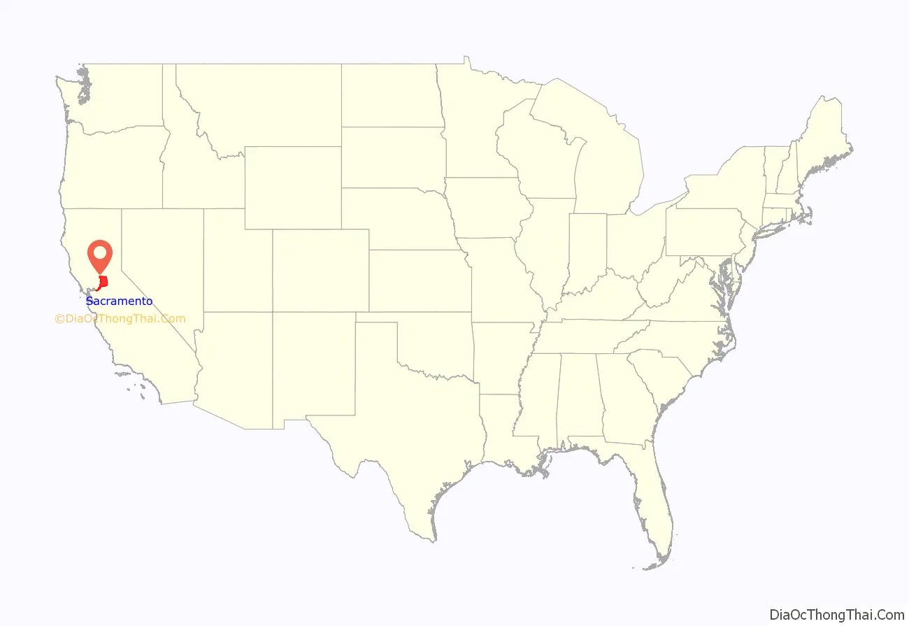
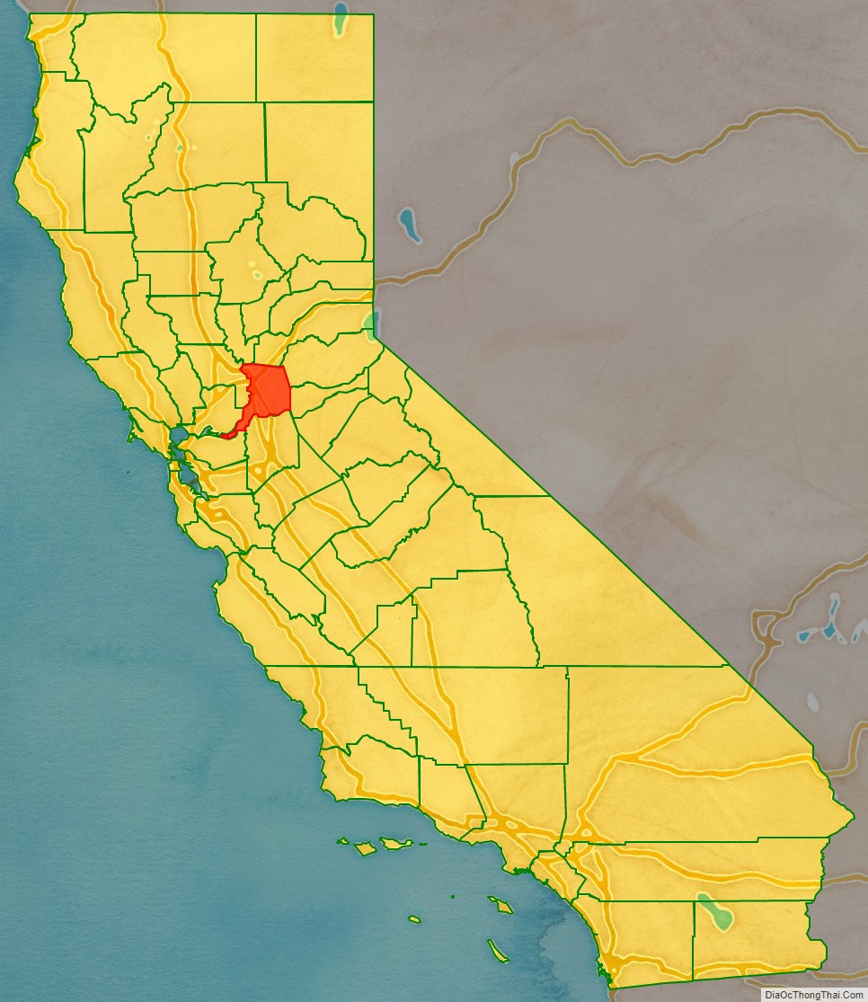
Sacramento County location map. Where is Sacramento County?
History
Sacramento County was one of the original counties of California, which were created in 1850 at the time of statehood. The county was named after the Sacramento River, which forms its western border. The river was named by Spanish cavalry officer Gabriel Moraga for the Santisimo Sacramento (Most Holy Sacrament), referring to the Catholic Eucharist.
Alexander Hamilton Willard, a member of the Lewis and Clark Expedition, is buried in the old Franklin Cemetery.
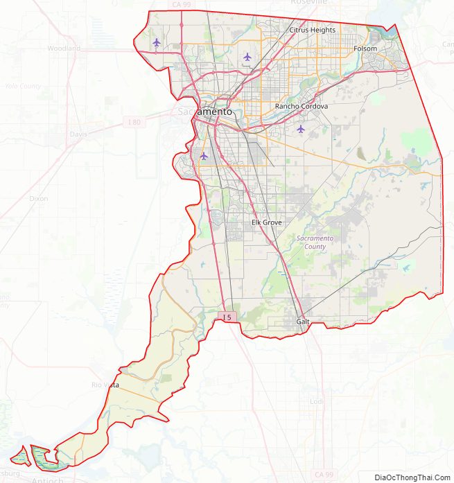
Sacramento County Road Map

Geography
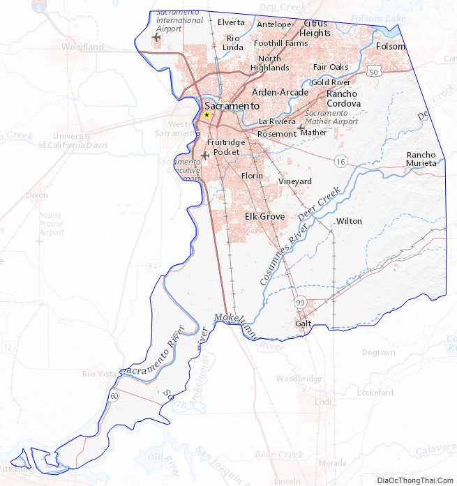
According to the U.S. Census Bureau, the county has a total area of 994 square miles (2,570 km), of which 965 square miles (2,500 km) is land and 29 square miles (75 km) (3.0%) is water. Most of the county is at an elevation close to sea level, with some areas below sea level. The highest point in the county is Carpenter Hill at 828 feet (252 m), in the southeast part of Folsom. Major watercourses in the county include the American River, Sacramento River, Cosumnes River, a tributary of the Mokelumne River, and Dry Creek, a tributary of the Sacramento River.
Adjacent counties
- Sutter County – northwest
- Placer County – north
- El Dorado County – northeast
- Amador County – east
- San Joaquin County – south
- Contra Costa County – southwest
- Solano County – west
- Yolo County – west
National protected areas
- Stone Lakes National Wildlife Refuge
- California National Historic Trail
- Pony Express National Historic Trail
Sacramento County Topographic Map
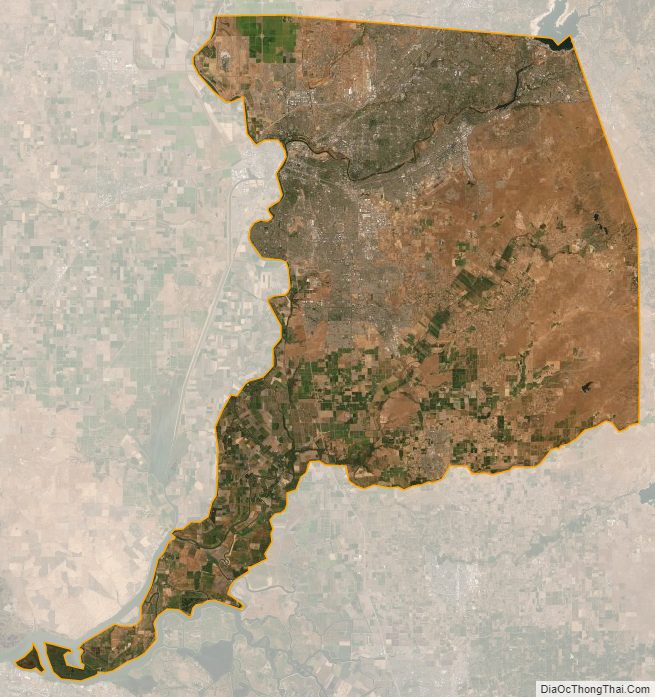
Sacramento County Satellite Map
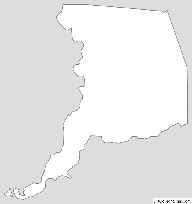
Sacramento County Outline Map
See also
Map of California State and its subdivision:- Alameda
- Alpine
- Amador
- Butte
- Calaveras
- Colusa
- Contra Costa
- Del Norte
- El Dorado
- Fresno
- Glenn
- Humboldt
- Imperial
- Inyo
- Kern
- Kings
- Lake
- Lassen
- Los Angeles
- Madera
- Marin
- Mariposa
- Mendocino
- Merced
- Modoc
- Mono
- Monterey
- Napa
- Nevada
- Orange
- Placer
- Plumas
- Riverside
- Sacramento
- San Benito
- San Bernardino
- San Diego
- San Francisco
- San Joaquin
- San Luis Obispo
- San Mateo
- Santa Barbara
- Santa Clara
- Santa Cruz
- Shasta
- Sierra
- Siskiyou
- Solano
- Sonoma
- Stanislaus
- Sutter
- Tehama
- Trinity
- Tulare
- Tuolumne
- Ventura
- Yolo
- Yuba
- Alabama
- Alaska
- Arizona
- Arkansas
- California
- Colorado
- Connecticut
- Delaware
- District of Columbia
- Florida
- Georgia
- Hawaii
- Idaho
- Illinois
- Indiana
- Iowa
- Kansas
- Kentucky
- Louisiana
- Maine
- Maryland
- Massachusetts
- Michigan
- Minnesota
- Mississippi
- Missouri
- Montana
- Nebraska
- Nevada
- New Hampshire
- New Jersey
- New Mexico
- New York
- North Carolina
- North Dakota
- Ohio
- Oklahoma
- Oregon
- Pennsylvania
- Rhode Island
- South Carolina
- South Dakota
- Tennessee
- Texas
- Utah
- Vermont
- Virginia
- Washington
- West Virginia
- Wisconsin
- Wyoming