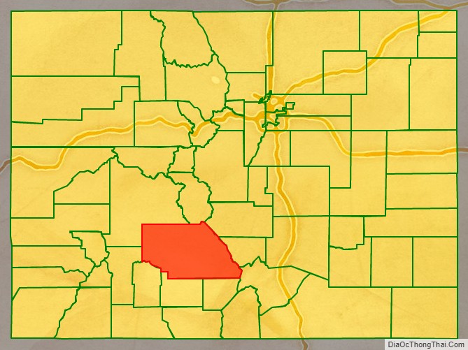
Saguache County (suh-WATCH /səˈwɑːtʃ/ (listen)) is a county located in the U.S. state of Colorado. As of the 2020 census, the population was 6,368. The county seat is Saguache.
| Name: | Saguache County |
|---|---|
| FIPS code: | 08-109 |
| State: | Colorado |
| Founded: | December 29, 1866 |
| Seat: | Saguache |
| Largest town: | Center |
| Total Area: | 3,170 sq mi (8,200 km²) |
| Land Area: | 3,169 sq mi (8,210 km²) |
| Total Population: | 6,471 |
| Population Density: | 2.0/sq mi (0.8/km²) |
| Time zone: | UTC−7 (Mountain) |
| Summer Time Zone (DST): | UTC−6 (MDT) |
| Website: | saguachecounty.colorado.gov |
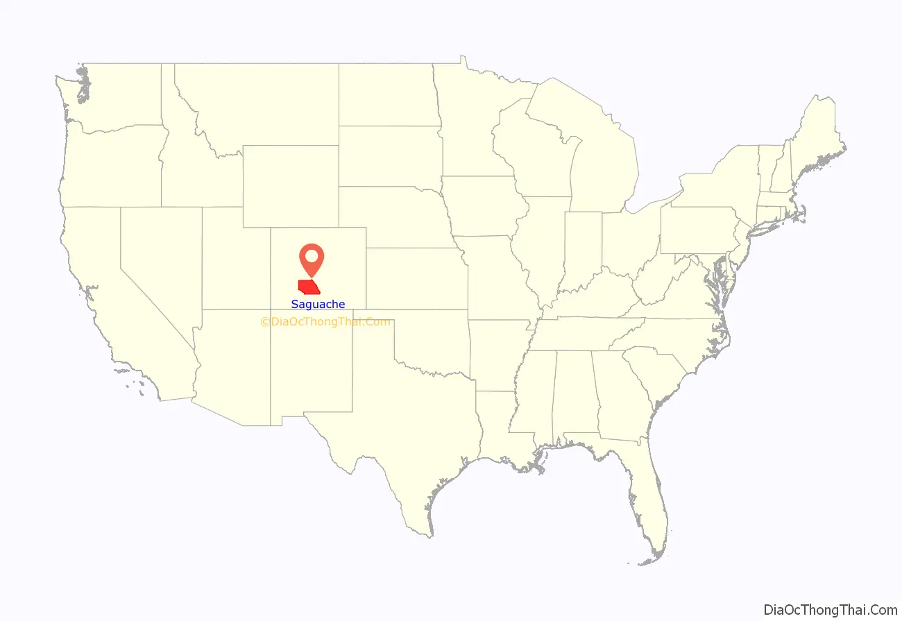
Saguache County location map. Where is Saguache County?
History
Saguache County was formed December 29, 1866 in the Territory of Colorado when it was extracted from the northern half of Costilla County. A partition from Lake County on February 9, 1872, added the northwest section of the present-day county.
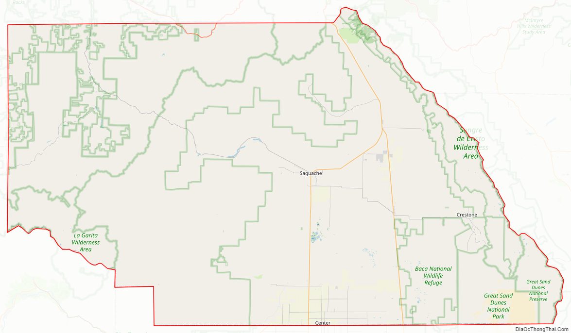
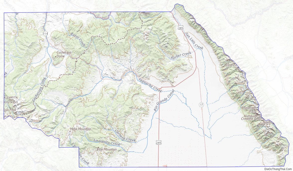
Saguache County Road Map
Geography
According to the U.S. Census Bureau, the county has a total area of 3,170 square miles (8,200 km), of which 3,169 square miles (8,210 km) is land and 1.7 square miles (4.4 km) (0.05%) is water. It is the 7th largest of Colorado’s 64 counties.
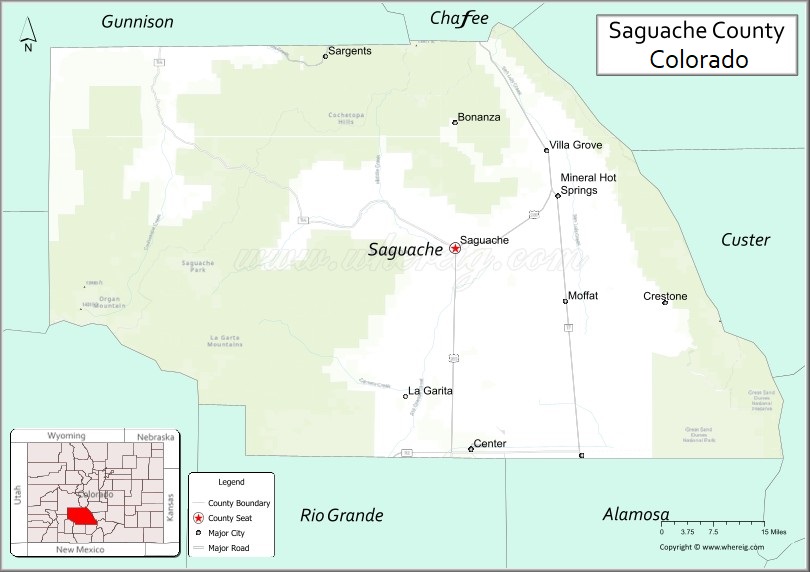
Adjacent counties
- Chaffee County – north
- Fremont County – northeast
- Custer County – east
- Huerfano County – southeast
- Rio Grande County – south
- Alamosa County – south
- Mineral County – southwest
- Hinsdale County – southwest
- Gunnison County – northwest
Major Highways
- U.S. Highway 285
- State Highway 17
- State Highway 112
- State Highway 114
National protected areas
- Great Sand Dunes National Park and Preserve
- Great Sand Dunes Wilderness
- Gunnison National Forest
- La Garita Wilderness
- Rio Grande National Forest
- Sangre de Cristo Wilderness
Trails and byways
- Colorado Trail
- Continental Divide National Scenic Trail
- Great Parks Bicycle Route
- Liberty Road historic mail route open to foot, horse, and bicycle travel between Crestone and the ghost towns of Duncan and Liberty crossing the Baca Mountain Tract Rio Grande National Forest.
- Medano Pass Primitive Road
- Montville Nature Trail
- Mosca Pass Trail
- Old Spanish National Historic Trail
- Sand Ramp Trail, a hiking trail within the Great Sand Dunes National Park and Preserve which skirts the east and north of the dune field.
- Western Express Bicycle Route
Saguache County Topographic Map
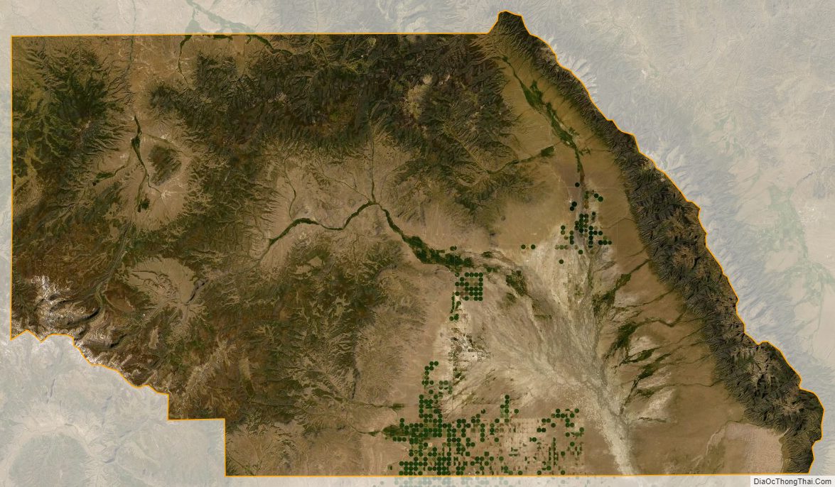
Saguache County Satellite Map
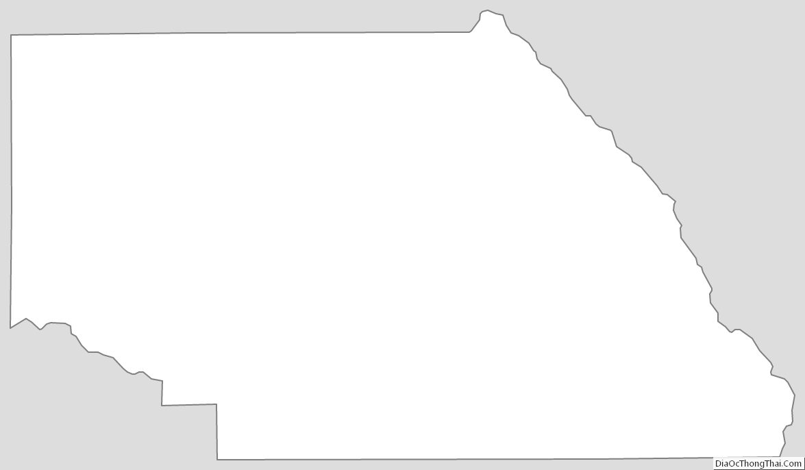
Saguache County Outline Map
See also
Map of Colorado State and its subdivision:- Adams
- Alamosa
- Arapahoe
- Archuleta
- Baca
- Bent
- Boulder
- Broomfield
- Chaffee
- Cheyenne
- Clear Creek
- Conejos
- Costilla
- Crowley
- Custer
- Delta
- Denver
- Dolores
- Douglas
- Eagle
- El Paso
- Elbert
- Fremont
- Garfield
- Gilpin
- Grand
- Gunnison
- Hinsdale
- Huerfano
- Jackson
- Jefferson
- Kiowa
- Kit Carson
- La Plata
- Lake
- Larimer
- Las Animas
- Lincoln
- Logan
- Mesa
- Mineral
- Moffat
- Montezuma
- Montrose
- Morgan
- Otero
- Ouray
- Park
- Phillips
- Pitkin
- Prowers
- Pueblo
- Rio Blanco
- Rio Grande
- Routt
- Saguache
- San Juan
- San Miguel
- Sedgwick
- Summit
- Teller
- Washington
- Weld
- Yuma
- Alabama
- Alaska
- Arizona
- Arkansas
- California
- Colorado
- Connecticut
- Delaware
- District of Columbia
- Florida
- Georgia
- Hawaii
- Idaho
- Illinois
- Indiana
- Iowa
- Kansas
- Kentucky
- Louisiana
- Maine
- Maryland
- Massachusetts
- Michigan
- Minnesota
- Mississippi
- Missouri
- Montana
- Nebraska
- Nevada
- New Hampshire
- New Jersey
- New Mexico
- New York
- North Carolina
- North Dakota
- Ohio
- Oklahoma
- Oregon
- Pennsylvania
- Rhode Island
- South Carolina
- South Dakota
- Tennessee
- Texas
- Utah
- Vermont
- Virginia
- Washington
- West Virginia
- Wisconsin
- Wyoming