St. Croix County is a county in the U.S. state of Wisconsin. As of the 2020 census, the population was 93,536. Its county seat is Hudson. The county was created in 1840 (then in the Wisconsin Territory) and organized in 1849. St. Croix County is part of the Minneapolis-St. Paul-Bloomington, MN-WI Metropolitan Statistical Area. Between 2000 and 2010, it was the fastest-growing county in Wisconsin.
| Name: | St. Croix County |
|---|---|
| FIPS code: | 55-109 |
| State: | Wisconsin |
| Founded: | 1849 |
| Named for: | St. Croix River |
| Seat: | Hudson |
| Largest city: | Hudson |
| Total Area: | 736 sq mi (1,910 km²) |
| Land Area: | 722 sq mi (1,870 km²) |
| Total Population: | 93,536 |
| Population Density: | 129.5/sq mi (50.0/km²) |
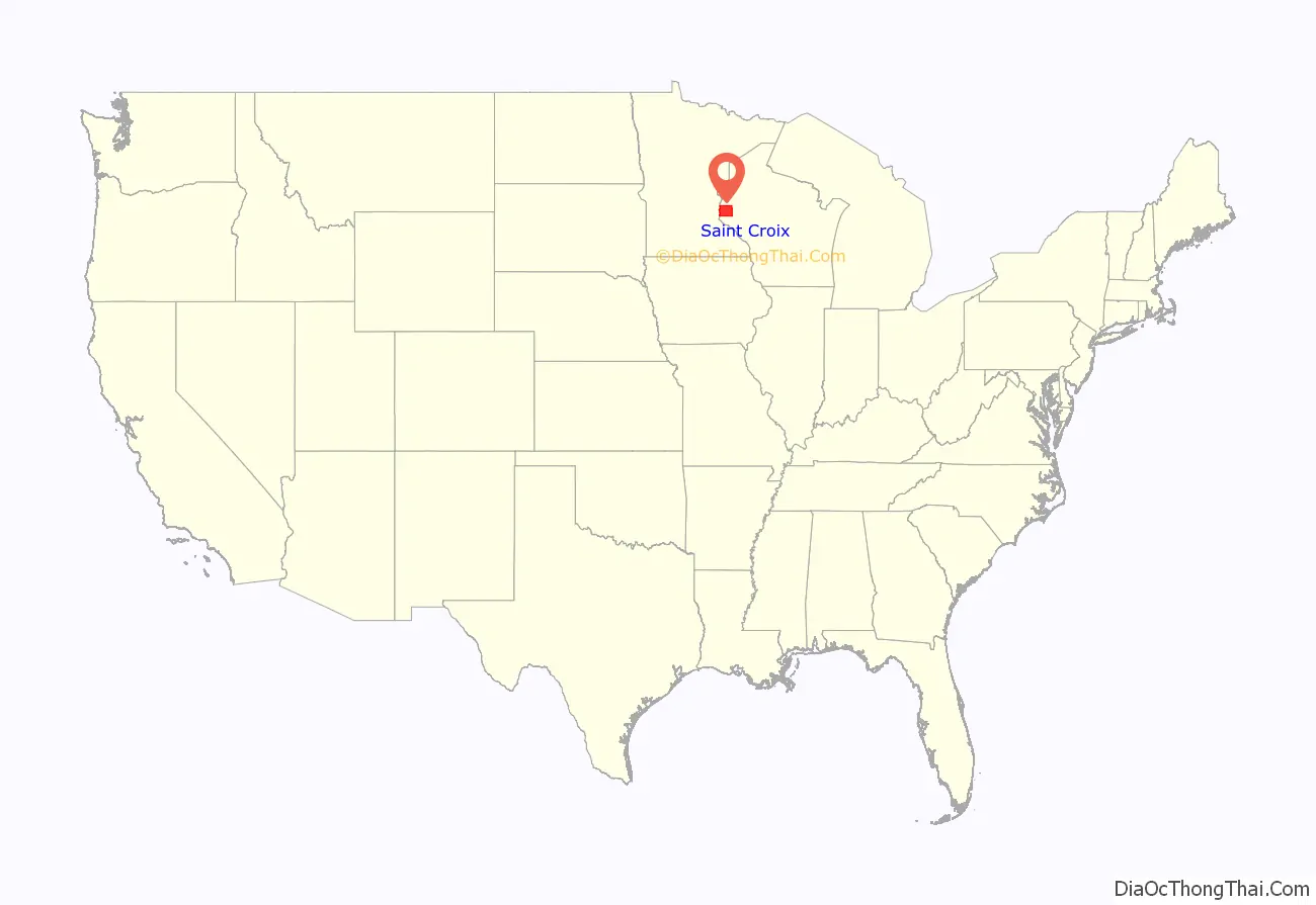
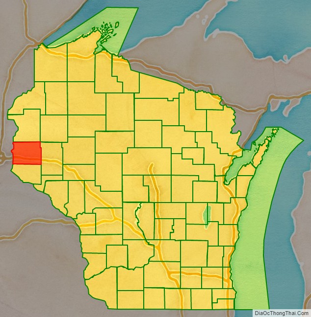
St. Croix County location map. Where is St. Croix County?
History
St. Croix County was created on August 3, 1840 by the legislature of the Wisconsin Territory. It was named after the river on its western border. Sources vary on the origin of the name; the St. Croix River may have been named after Monsieur St. Croix, an explorer who drowned at the mouth of the river late in the seventeenth century. Another account credits Father Hennepin with giving this region the French name St Croix (Holy Cross) because of the burial markers located at the mouth of the river.
La Pointe County (now extinct, see Bayfield County) was created from the northern portions of Wisconsin Territory’s St. Croix County on February 19, 1845. When Wisconsin was admitted into the union as a state on May 29, 1848, the territorial St. Croix County was further divided, with the territory from the Mississippi River to the current border of Minnesota continuing as de facto Wisconsin Territory until on March 3, 1849, it and unorganized federal territory lying north of Iowa were used in the creation of the Minnesota Territory. Itasca, Washington, Ramsey and Benton Counties were created by the Minnesota Territory on October 27, 1849 from the de facto Wisconsin Territory that had been separated from the Wisconsin Territory’s La Pointe County.
The part of St. Croix County allocated to Wisconsin became the parental county to Pierce and Polk Counties, and formed significant portions of Dunn, Barron, Washburn and Burnett Counties.
On June 12, 1899, a deadly F5 tornado struck New Richmond. The tornado’s damage path was 400 yards (370 m) wide and 46 miles (74 km) long. The tornado formed on the banks of the St. Croix River, south of Hudson. Moving to the northeast across St. Croix County, the tornado passed through the villages of Burkhardt and Boardman before striking New Richmond head on leveling the entire business district and half the town’s residences. The storm continued on towards the northeast, narrowly missing the town of Deer Park before crossing into Polk County, where it again narrowly missed the towns of Clear Lake, Richardson and Clayton. Once the tornado passed into Barron County, it struck the village of Arland (No reported fatalities or serious injuries) before breaking up southwest of Barron. The tornado killed 117 people (Four at Boardman, two in Polk County and the rest at New Richmond), including at least 20 people who died from their injuries in the days after the storm. Largely in thanks to state aid and donations, most of the town was rebuilt by the following winter. Today, the tornado stands as the deadliest ever recorded in Wisconsin and the 9th deadliest tornado in U.S. history.
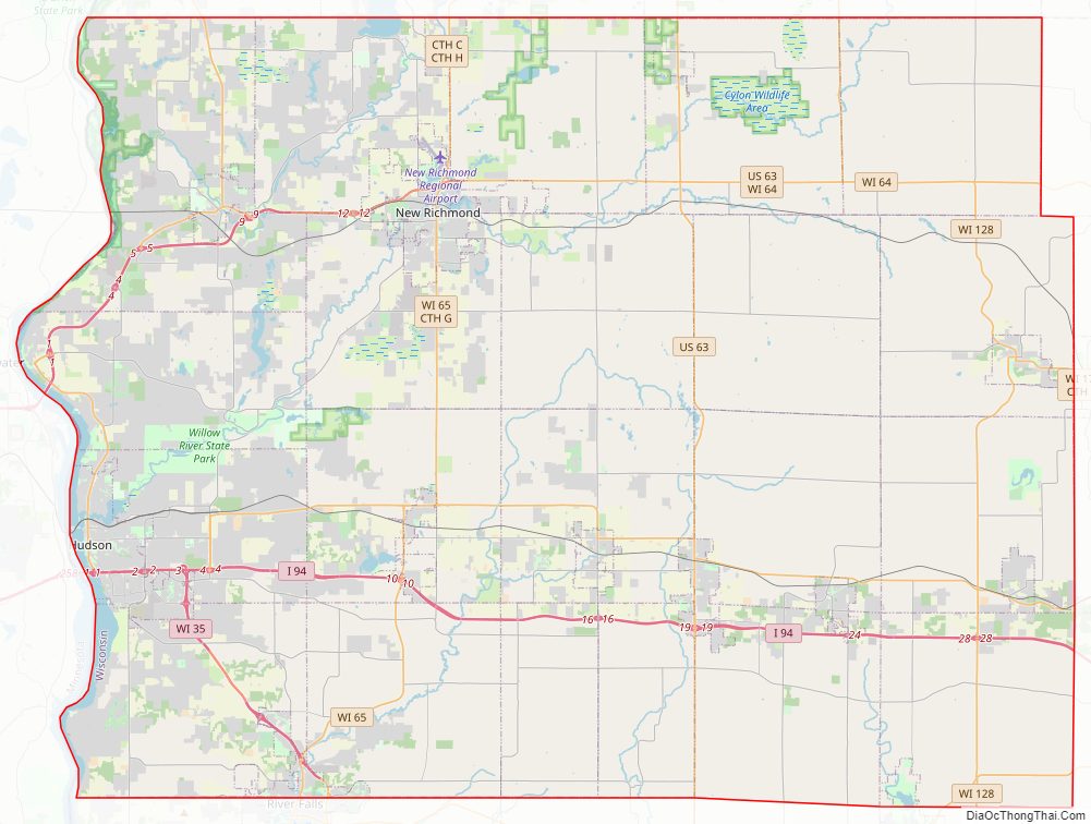
St. Croix County Road Map
Geography
According to the U.S. Census Bureau, the county has a total area of 736 square miles (1,910 km), of which 722 square miles (1,870 km) is land and 13 square miles (34 km) (1.8%) is water.
Major highways
Railroads
- Canadian National
- Union Pacific
Buses
- List of intercity bus stops in Wisconsin
Airport
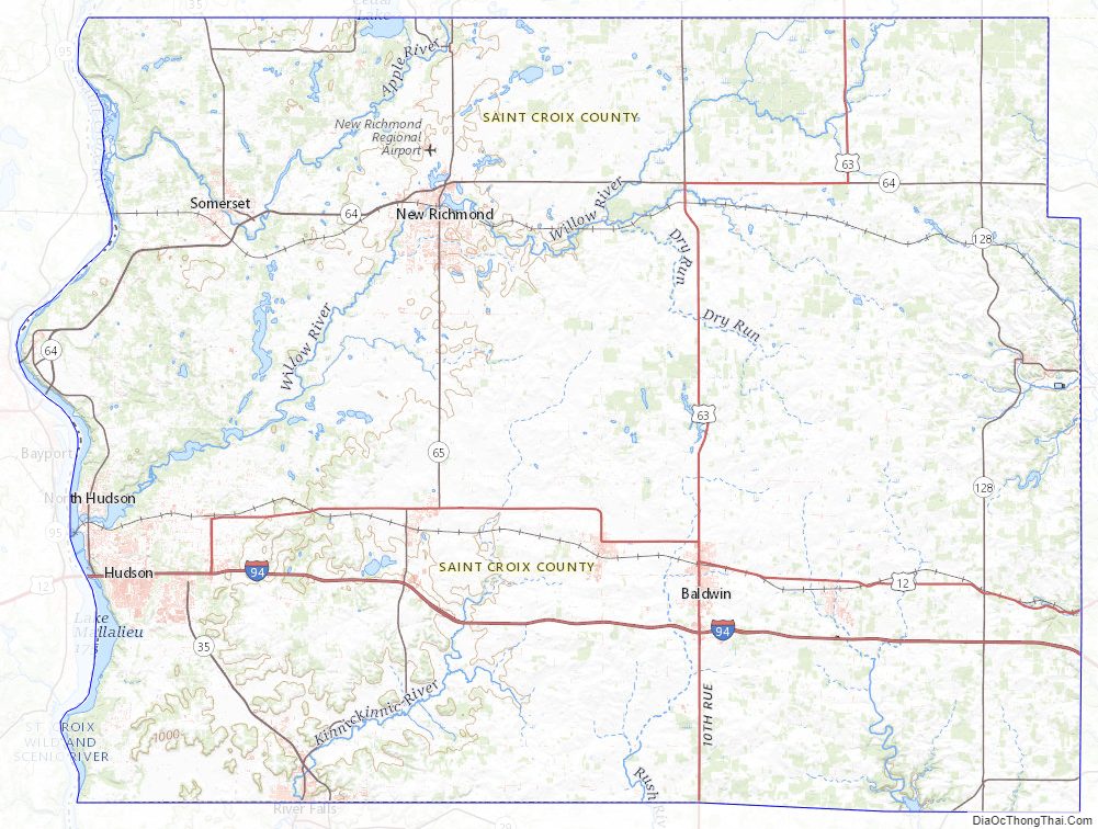
New Richmond Regional Airport (KRNH) serves the county and surrounding communities.
National protected area
- Saint Croix National Scenic Riverway (part)
Adjacent counties
- Polk County – north
- Barron County – northeast
- Dunn County – east
- Pierce County – south
- Washington County, Minnesota – west
St. Croix County Topographic Map
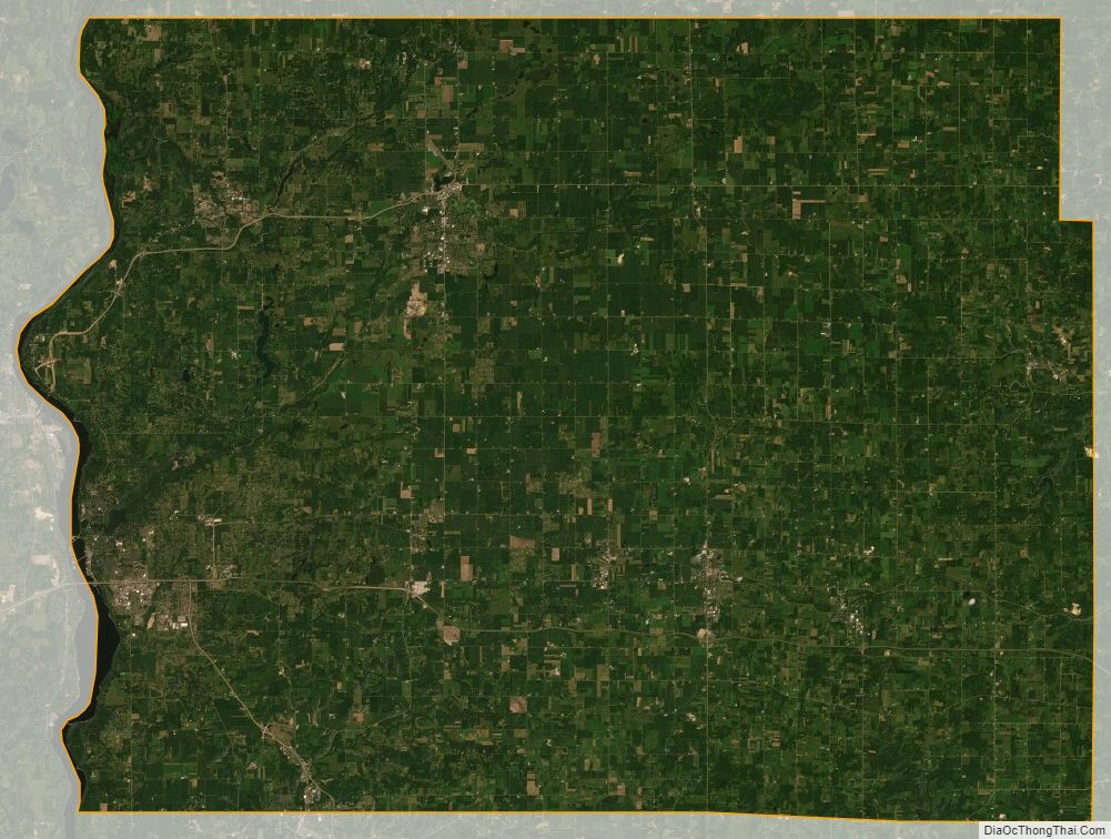
St. Croix County Satellite Map
St. Croix County Outline Map

See also
Map of Wisconsin State and its subdivision:- Adams
- Ashland
- Barron
- Bayfield
- Brown
- Buffalo
- Burnett
- Calumet
- Chippewa
- Clark
- Columbia
- Crawford
- Dane
- Dodge
- Door
- Douglas
- Dunn
- Eau Claire
- Florence
- Fond du Lac
- Forest
- Grant
- Green
- Green Lake
- Iowa
- Iron
- Jackson
- Jefferson
- Juneau
- Kenosha
- Kewaunee
- La Crosse
- Lafayette
- Lake Michigan
- Lake Superior
- Langlade
- Lincoln
- Manitowoc
- Marathon
- Marinette
- Marquette
- Menominee
- Milwaukee
- Monroe
- Oconto
- Oneida
- Outagamie
- Ozaukee
- Pepin
- Pierce
- Polk
- Portage
- Price
- Racine
- Richland
- Rock
- Rusk
- Saint Croix
- Sauk
- Sawyer
- Shawano
- Sheboygan
- Taylor
- Trempealeau
- Vernon
- Vilas
- Walworth
- Washburn
- Washington
- Waukesha
- Waupaca
- Waushara
- Winnebago
- Wood
- Alabama
- Alaska
- Arizona
- Arkansas
- California
- Colorado
- Connecticut
- Delaware
- District of Columbia
- Florida
- Georgia
- Hawaii
- Idaho
- Illinois
- Indiana
- Iowa
- Kansas
- Kentucky
- Louisiana
- Maine
- Maryland
- Massachusetts
- Michigan
- Minnesota
- Mississippi
- Missouri
- Montana
- Nebraska
- Nevada
- New Hampshire
- New Jersey
- New Mexico
- New York
- North Carolina
- North Dakota
- Ohio
- Oklahoma
- Oregon
- Pennsylvania
- Rhode Island
- South Carolina
- South Dakota
- Tennessee
- Texas
- Utah
- Vermont
- Virginia
- Washington
- West Virginia
- Wisconsin
- Wyoming