St. Louis County is a county located in the Arrowhead Region of the U.S. state of Minnesota. As of the 2020 census, the population was 200,231. Its county seat is Duluth. It is the largest county in Minnesota by land area, and the largest in the United States by total area east of the Mississippi River, ahead of Aroostook County, Maine.
St. Louis County is included in the Duluth, MN-Superior WI Metropolitan Statistical Area.
Major industries include pulpwood production and tourism. Open pit mining of taconite and processing it into high grade iron ore remains an important part of the economy of the Iron Range and is directly tied to shipping in the Twin Ports of Duluth-Superior. Parts of the federally recognized Bois Forte and Fond du Lac Indian reservations are in the county.
| Name: | St. Louis County |
|---|---|
| FIPS code: | 27-137 |
| State: | Minnesota |
| Founded: | February 20, 1855 |
| Named for: | St. Louis River |
| Seat: | Duluth |
| Largest city: | Duluth |
| Total Area: | 6,860 sq mi (17,800 km²) |
| Land Area: | 6,247 sq mi (16,180 km²) |
| Total Population: | 200,231 |
| Population Density: | 29/sq mi (11/km²) |
| Time zone: | UTC−6 (Central) |
| Summer Time Zone (DST): | UTC−5 (CDT) |
| Website: | www.stlouiscountymn.gov |
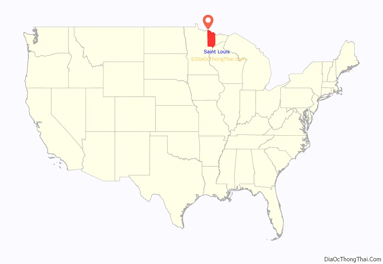
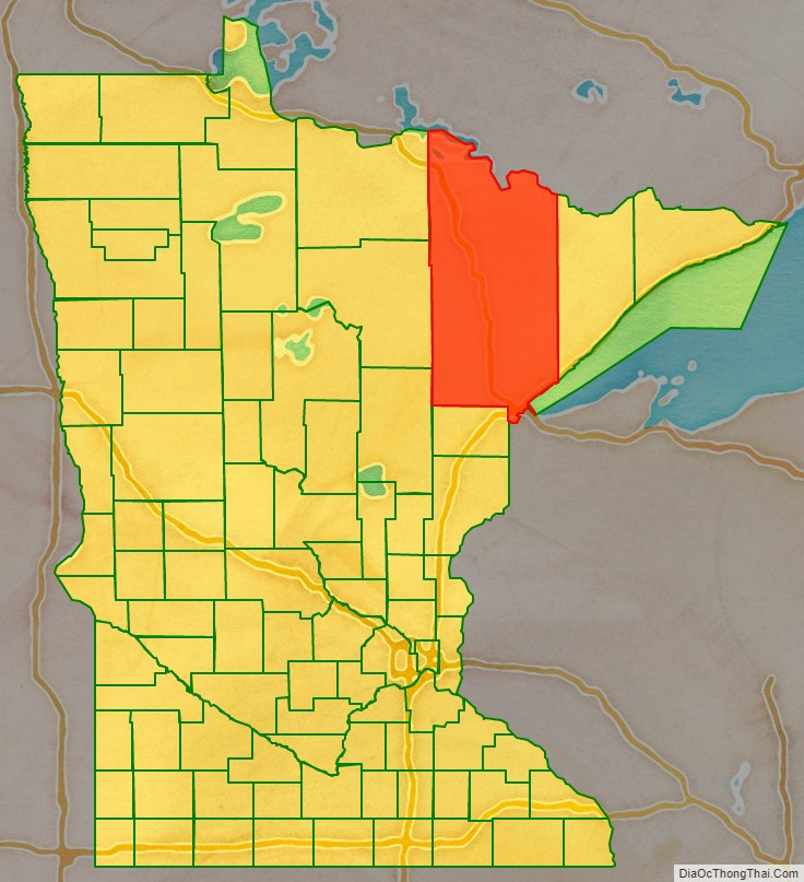
St. Louis County location map. Where is St. Louis County?
History
This area was long inhabited by Algonquian-speaking tribes: the Ojibwe (Chippewa), Ottawa and Potawatomi peoples were loosely affiliated in the Council of Three Fires. As American settlers entered the territory, the Native Americans were pushed to outer areas.
The Minnesota Legislature established St. Louis County on February 20, 1855, as Doty County, and changed its name to Newton County on March 3, 1855. It originally consisted of the area east and south of the St. Louis River, while the area east of the Vermilion River and north of the St. Louis River was part of Superior County. Superior County was renamed St. Louis County.
On March 1, 1856, that St. Louis County was renamed as Lake County. Newton County was renamed as St. Louis County and had that eastern area added to it; it was also expanded westward by incorporating parts of Itasca County, which then also included most of Carlton County. On May 23, 1857, St. Louis County took its current shape when Carlton County was formed from parts of St. Louis and Pine counties.
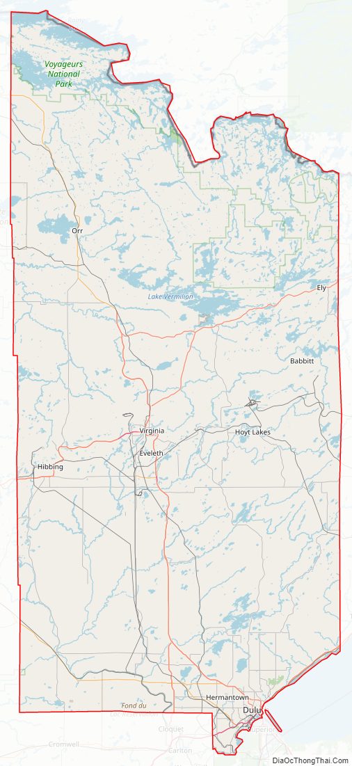
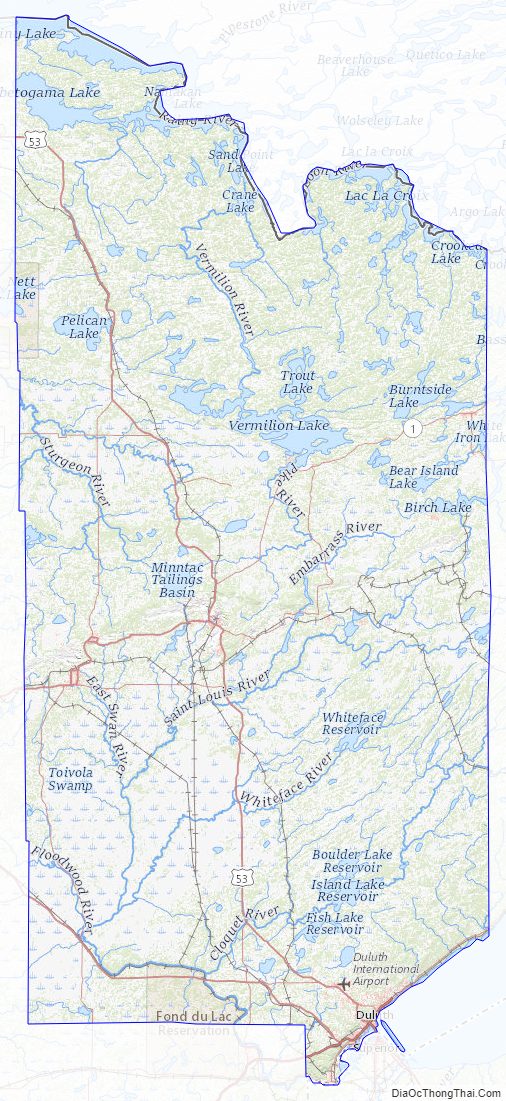
St. Louis County Road Map
Geography
According to the United States Census Bureau, the county has a total area of 6,860 square miles (17,800 km), of which 6,247 square miles (16,180 km) is land and 612 square miles (1,590 km) (8.9%) is water. It is the largest county in Minnesota and the largest (by total area) in the United States east of the Mississippi River.
Voyageurs National Park, established in 1975, is located in its northwestern corner, on the south shore of Rainy Lake on the Canada–US border; it is popular with water enthusiasts and fishers. The county includes parts of Superior National Forest, established in 1909, and the Boundary Waters Canoe Area Wilderness on the border, established in 1978. The BWCAW is a 1,090,000-acre (4,400 km) wilderness area designated for fishing, camping, hiking, and canoeing, and is one of the most visited wilderness areas in the United States. St. Louis County has more than 500 lakes. The largest lakes are Pelican and Vermilion.
The “Hill of Three Waters” on the Laurentian Divide lies northeast of Hibbing. Rainfall on this hill runs to three watersheds: Hudson Bay to the north, the Gulf of Saint Lawrence to the east (via Lake Superior), or the Gulf of Mexico to the south and west (via the Mississippi River). The county is drained by the St. Louis, Vermilion, and other rivers.
Duluth on Lake Superior is one of the most important fresh-water ports in the United States.
The county encompasses part of the Iron Range. It has had a significant taconite mining industry, with active mines located in Hibbing, Mountain Iron, Eveleth, Virginia, and Babbitt, in addition to Keewatin in Itasca County.
Major highways
- Interstate Highway 35
- Interstate Highway 535 – John Blatnik Bridge
- U.S. Highway 2
- U.S. Highway 53
- U.S. Highway 169
- Minnesota State Highway 1
- Minnesota State Highway 23
- Minnesota State Highway 33
- Minnesota State Highway 37
- Minnesota State Highway 39 – McCuen Street
- Minnesota State Highway 61 – North Shore
- Minnesota State Highway 73
- Minnesota State Highway 135
- Minnesota State Highway 169
- Minnesota State Highway 194
- Minnesota State Highway 210
- St. Louis County Road 4 – Rice Lake Road
- St. Louis County Road 13 – Midway Road
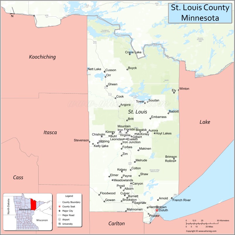
Adjacent counties
- Rainy River District, Ontario, Canada (north)
- Lake County (east)
- Douglas County, Wisconsin (southeast)
- Carlton County (south)
- Aitkin County (southwest)
- Itasca County (west)
- Koochiching County (northwest)
National protected areas
- Superior National Forest (part)
- Boundary Waters Canoe Area Wilderness (part)
- Voyageurs National Park (part)
St. Louis County Topographic Map
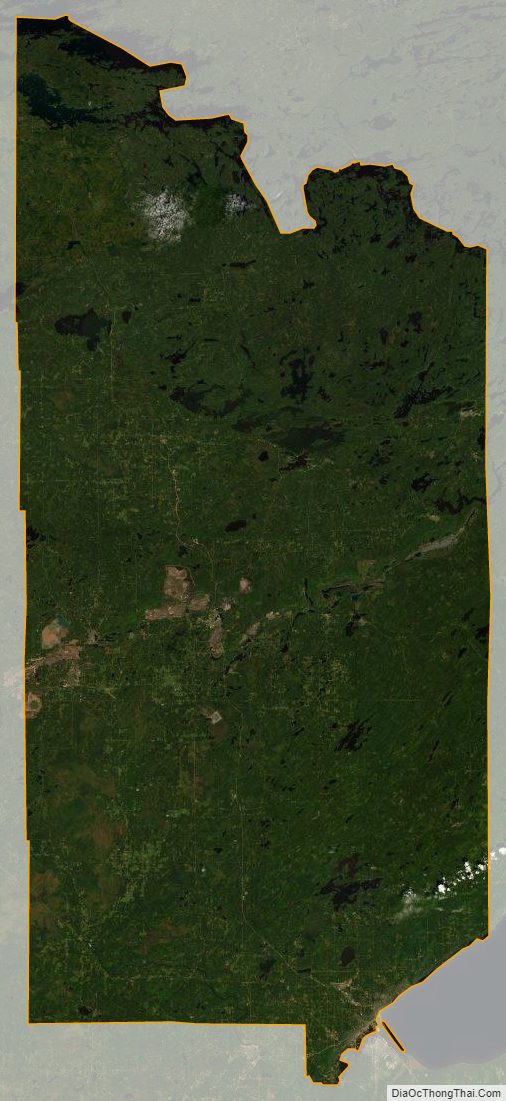
St. Louis County Satellite Map
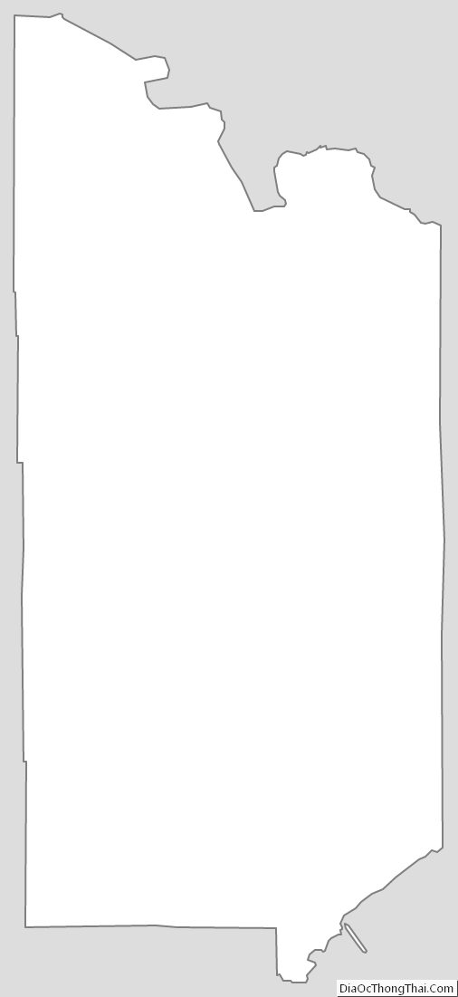
St. Louis County Outline Map
See also
Map of Minnesota State and its subdivision:- Aitkin
- Anoka
- Becker
- Beltrami
- Benton
- Big Stone
- Blue Earth
- Brown
- Carlton
- Carver
- Cass
- Chippewa
- Chisago
- Clay
- Clearwater
- Cook
- Cottonwood
- Crow Wing
- Dakota
- Dodge
- Douglas
- Faribault
- Fillmore
- Freeborn
- Goodhue
- Grant
- Hennepin
- Houston
- Hubbard
- Isanti
- Itasca
- Jackson
- Kanabec
- Kandiyohi
- Kittson
- Koochiching
- Lac qui Parle
- Lake
- Lake of the Woods
- Lake Superior
- Le Sueur
- Lincoln
- Lyon
- Mahnomen
- Marshall
- Martin
- McLeod
- Meeker
- Mille Lacs
- Morrison
- Mower
- Murray
- Nicollet
- Nobles
- Norman
- Olmsted
- Otter Tail
- Pennington
- Pine
- Pipestone
- Polk
- Pope
- Ramsey
- Red Lake
- Redwood
- Renville
- Rice
- Rock
- Roseau
- Saint Louis
- Scott
- Sherburne
- Sibley
- Stearns
- Steele
- Stevens
- Swift
- Todd
- Traverse
- Wabasha
- Wadena
- Waseca
- Washington
- Watonwan
- Wilkin
- Winona
- Wright
- Yellow Medicine
- Alabama
- Alaska
- Arizona
- Arkansas
- California
- Colorado
- Connecticut
- Delaware
- District of Columbia
- Florida
- Georgia
- Hawaii
- Idaho
- Illinois
- Indiana
- Iowa
- Kansas
- Kentucky
- Louisiana
- Maine
- Maryland
- Massachusetts
- Michigan
- Minnesota
- Mississippi
- Missouri
- Montana
- Nebraska
- Nevada
- New Hampshire
- New Jersey
- New Mexico
- New York
- North Carolina
- North Dakota
- Ohio
- Oklahoma
- Oregon
- Pennsylvania
- Rhode Island
- South Carolina
- South Dakota
- Tennessee
- Texas
- Utah
- Vermont
- Virginia
- Washington
- West Virginia
- Wisconsin
- Wyoming