San Juan County (Spanish: Condado de San Juan) is a county located in the Salish Sea in the far northwestern corner of the U.S. state of Washington. As of the 2020 census, its population was 17,788. The county seat and only incorporated city is Friday Harbor, located on San Juan Island. The county was formed on October 31, 1873, from Whatcom County and is named for the San Juan Islands, which are in turn named for Juan Vicente de Güemes, 2nd Count of Revillagigedo, the Viceroy of New Spain.
Although the islands themselves have no state highways, the ferry routes serving the islands are designated as part of the state highway system.
| Name: | San Juan County |
|---|---|
| FIPS code: | 53-055 |
| State: | Washington |
| Founded: | October 31, 1873 |
| Named for: | San Juan Islands |
| Seat: | Friday Harbor |
| Largest town: | Friday Harbor |
| Total Area: | 621 sq mi (1,610 km²) |
| Land Area: | 174 sq mi (450 km²) |
| Total Population: | 17,788 |
| Population Density: | 96/sq mi (37/km²) |
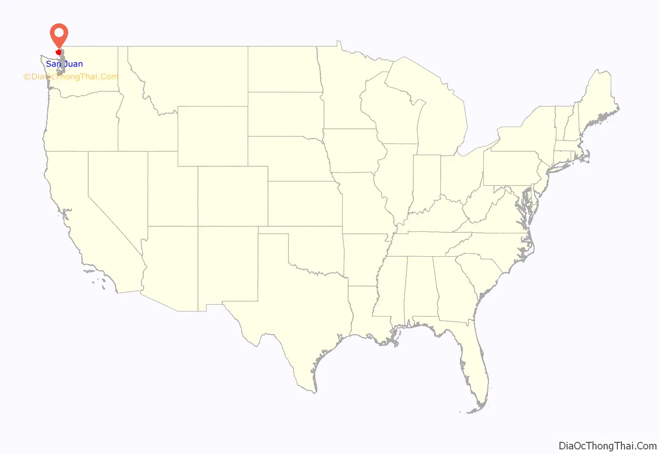
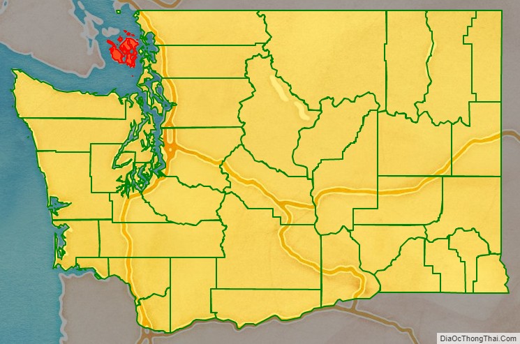
San Juan County location map. Where is San Juan County?
History
The San Juan Islands were the subject of a territorial dispute between Great Britain and the United States from 1846 to 1872, leading to the Pig War in 1859. The bloodless conflict ended through arbitration led by Kaiser Wilhelm I, which awarded the islands to the United States. San Juan County was home to Henry Cayou, one of the first elected officials of Native descent in Washington.
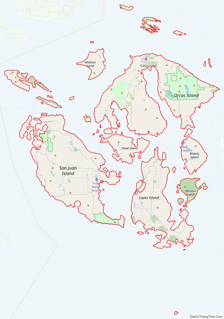
San Juan County Road Map
Geography
According to the United States Census Bureau, the county has a total area of 621 square miles (1,610 km), of which 174 square miles (450 km) is land and 447 square miles (1,160 km) (72%) is water. It is the smallest county in Washington by land area and fourth-smallest by total area.
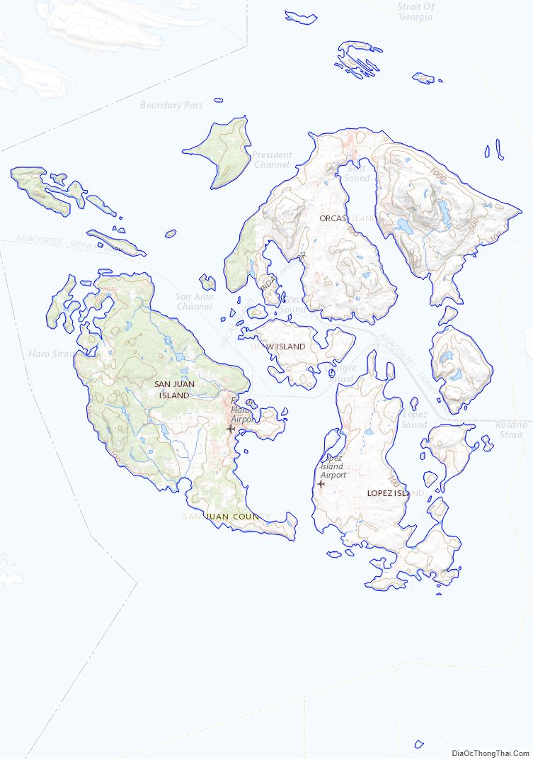
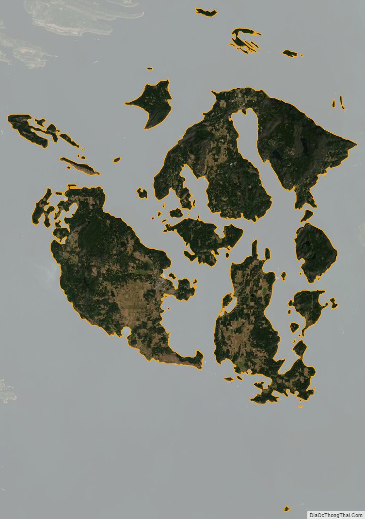
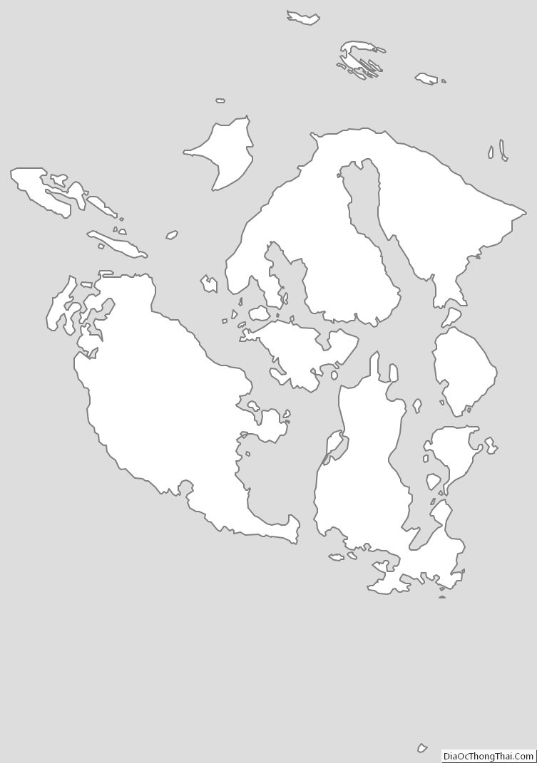
San Juan County is a cluster of more than 400 islands and rocks with elevations above mean high tide. 134 of these islands and rocks are named. The county has a rugged, rocky shoreline and several mountains. The highest point in the county is Mount Constitution on Orcas Island at 2,407 feet (734 m) above sea level.
Geographic features
- Boundary Pass
- Haro Strait
- Rosario Strait
- San Juan Islands
- Strait of Georgia
- Strait of Juan de Fuca
Major islands
There are approximately 743 islands and rocks in the San Juan Island chain. Most of the county’s population lives on the largest four islands, which are the only county islands served by the Washington State Ferries. The four largest islands are:
- Orcas Island (149.43 km/57.7 sq mi)
- San Juan Island (143.62 km/55.5 sq mi)
- Lopez Island (76.57 km/29.6 sq mi)
- Shaw Island (19.64 km/7.6 sq mi)
Adjacent counties
- Whatcom County – northeast
- Skagit County – east
- Island County – southeast
- Jefferson County – south
- Clallam County – south/southwest
- Capital Regional District, British Columbia – west
National protected areas
- San Juan Island National Historical Park
- San Juan Islands National Wildlife Refuge
- San Juan Islands National Monument
- San Juan Wilderness
San Juan County Topographic Map
San Juan County Satellite Map
San Juan County Outline Map
See also
Map of Washington State and its subdivision:- Adams
- Asotin
- Benton
- Chelan
- Clallam
- Clark
- Columbia
- Cowlitz
- Douglas
- Ferry
- Franklin
- Garfield
- Grant
- Grays Harbor
- Island
- Jefferson
- King
- Kitsap
- Kittitas
- Klickitat
- Lewis
- Lincoln
- Mason
- Okanogan
- Pacific
- Pend Oreille
- Pierce
- San Juan
- Skagit
- Skamania
- Snohomish
- Spokane
- Stevens
- Thurston
- Wahkiakum
- Walla Walla
- Whatcom
- Whitman
- Yakima
- Alabama
- Alaska
- Arizona
- Arkansas
- California
- Colorado
- Connecticut
- Delaware
- District of Columbia
- Florida
- Georgia
- Hawaii
- Idaho
- Illinois
- Indiana
- Iowa
- Kansas
- Kentucky
- Louisiana
- Maine
- Maryland
- Massachusetts
- Michigan
- Minnesota
- Mississippi
- Missouri
- Montana
- Nebraska
- Nevada
- New Hampshire
- New Jersey
- New Mexico
- New York
- North Carolina
- North Dakota
- Ohio
- Oklahoma
- Oregon
- Pennsylvania
- Rhode Island
- South Carolina
- South Dakota
- Tennessee
- Texas
- Utah
- Vermont
- Virginia
- Washington
- West Virginia
- Wisconsin
- Wyoming