Sanilac County (/sænəlæk/ SAN-ə-lack) is a county located in the Thumb region of the U.S. state of Michigan. As of the 2020 Census, the population was 40,611. The county seat is Sandusky. The county was created on September 10, 1822, and was fully organized on December 31, 1849. Sanilac County is considered to be part of the Thumb of Michigan, a subregion of the Flint/Tri-Cities. Sanilac County enjoys seasonal tourism in towns such as Lexington, Port Sanilac, and Carsonville. Sanilac County is economically attached to St. Clair County and Huron County and is largely composed of nearly flat areas of rich soil.
| Name: | Sanilac County |
|---|---|
| FIPS code: | 26-151 |
| State: | Michigan |
| Founded: | 1822 |
| Seat: | Sandusky |
| Largest city: | Sandusky |
| Total Area: | 1,590 sq mi (4,100 km²) |
| Land Area: | 963 sq mi (2,490 km²) |
| Total Population: | 40,611 |
| Population Density: | 45/sq mi (17/km²) |
| Time zone: | UTC−5 (Eastern) |
| Summer Time Zone (DST): | UTC−4 (EDT) |
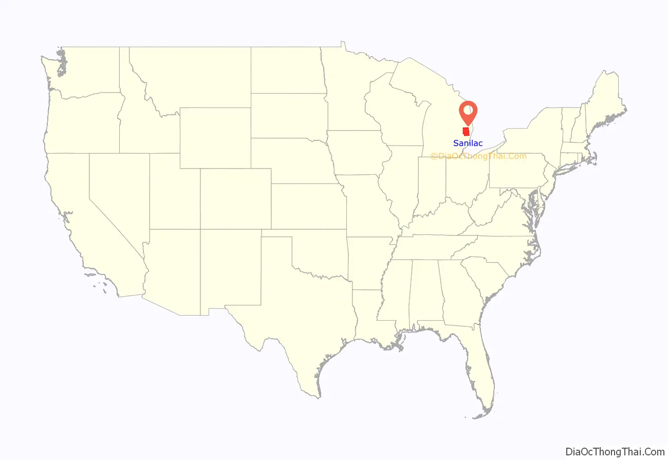
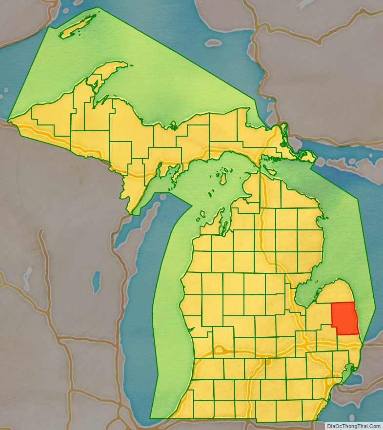
Sanilac County location map. Where is Sanilac County?
History
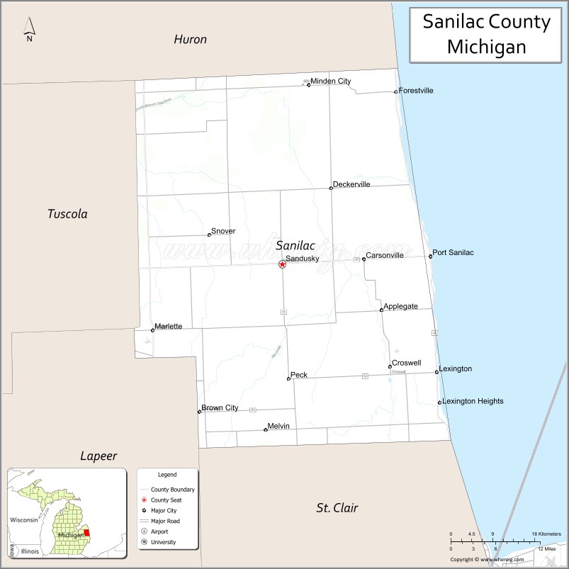
Sanilac County was probably named for a Wyandot (Huron) chief named Sanilac. (See List of Michigan county name etymologies). The county was formed on September 10, 1822, by the Michigan Territorial Legislature, partitioning parts of St. Clair County and unorganized territory administered by Oakland County. The original boundary of the county was reduced in 1840, when parts were partitioned off to create Huron and Tuscola counties. The county government was fully organized on December 31, 1849. In the middle of the 19th century, the area now called Port Sanilac was called Bark Shanty. It was named for a lone shanty made of bark, which was used to make shingles from pine. The county seat of Sanilac is the city of Sandusky.
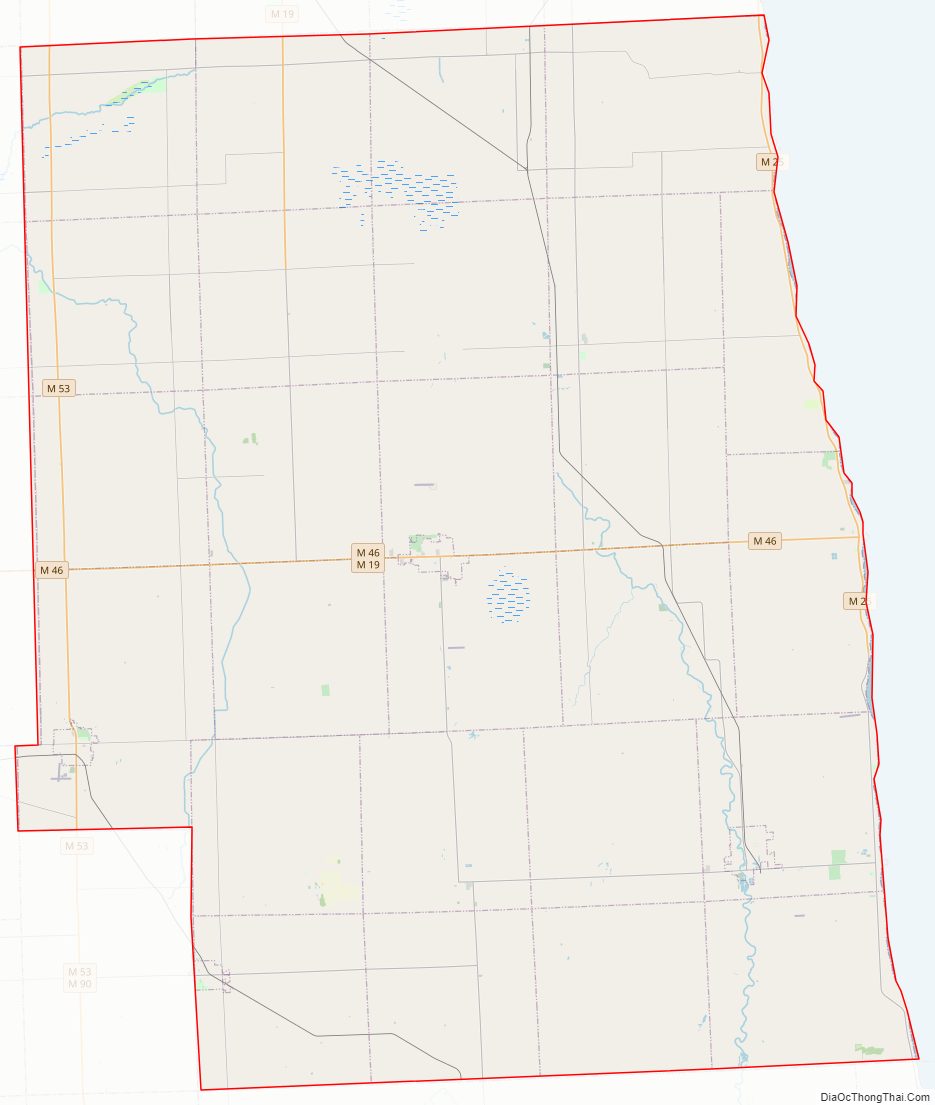
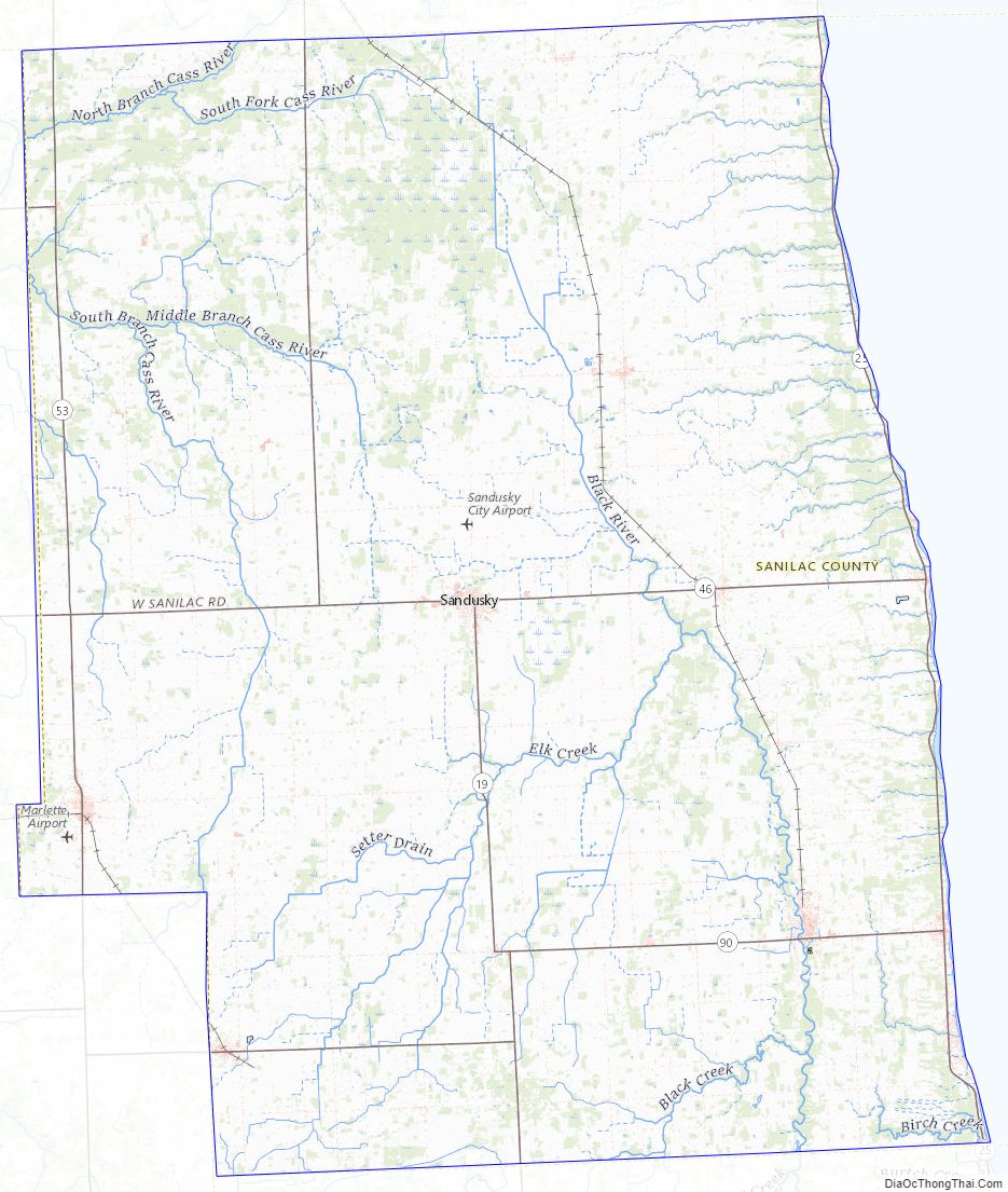
Sanilac County Road Map
Geography
According to the U.S. Census Bureau, the county has a total area of 1,590 square miles (4,100 km), of which 963 square miles (2,490 km) is land and 627 square miles (1,620 km) (39%) is water.
Adjacent counties
- Huron County (north)
- Tuscola County (west)
- St. Clair County (south)
- Lapeer County (southwest)
- Huron County, Ontario, Canada (east)
Major highways
- M-19
- M-25
- M-46
- M-53
- M-81
- M-90
Sanilac County Topographic Map
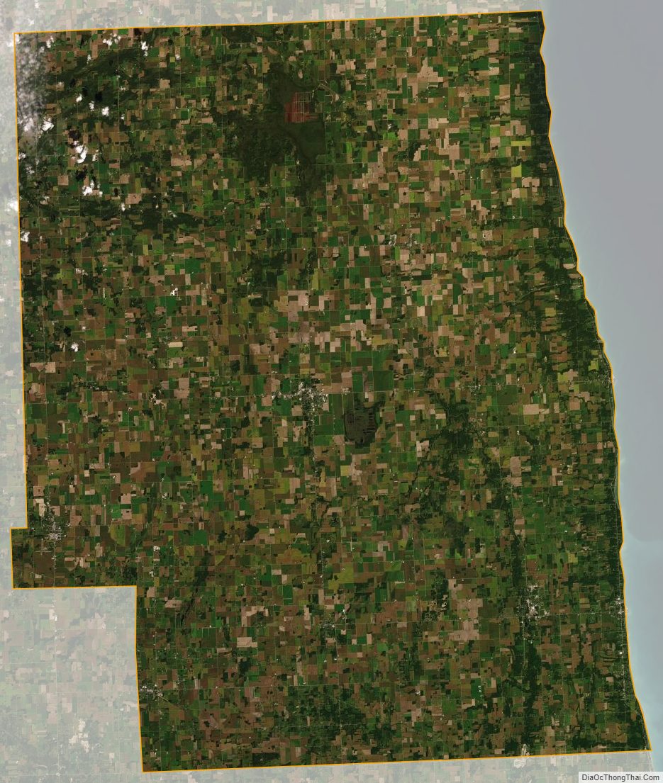
Sanilac County Satellite Map
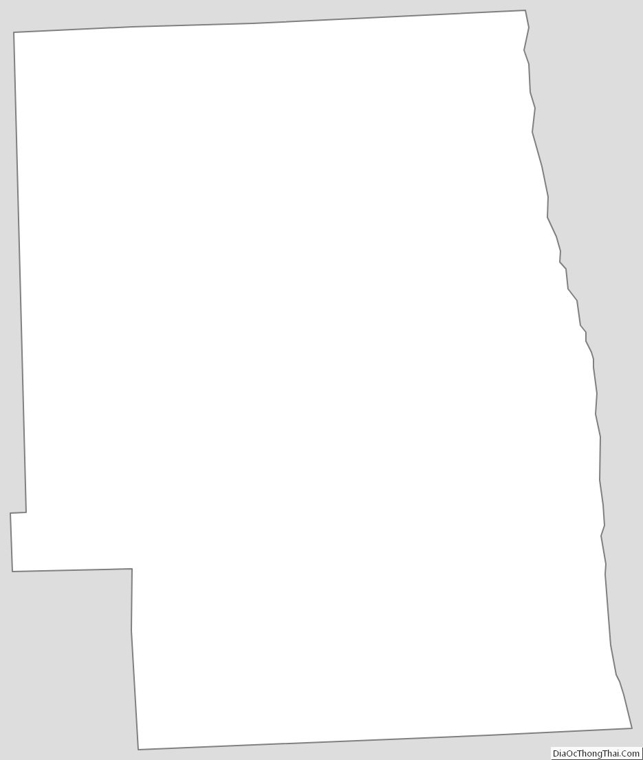
Sanilac County Outline Map
See also
Map of Michigan State and its subdivision:- Alcona
- Alger
- Allegan
- Alpena
- Antrim
- Arenac
- Baraga
- Barry
- Bay
- Benzie
- Berrien
- Branch
- Calhoun
- Cass
- Charlevoix
- Cheboygan
- Chippewa
- Clare
- Clinton
- Crawford
- Delta
- Dickinson
- Eaton
- Emmet
- Genesee
- Gladwin
- Gogebic
- Grand Traverse
- Gratiot
- Hillsdale
- Houghton
- Huron
- Ingham
- Ionia
- Iosco
- Iron
- Isabella
- Jackson
- Kalamazoo
- Kalkaska
- Kent
- Keweenaw
- Lake
- Lake Hurron
- Lake Michigan
- Lake St. Clair
- Lake Superior
- Lapeer
- Leelanau
- Lenawee
- Livingston
- Luce
- Mackinac
- Macomb
- Manistee
- Marquette
- Mason
- Mecosta
- Menominee
- Midland
- Missaukee
- Monroe
- Montcalm
- Montmorency
- Muskegon
- Newaygo
- Oakland
- Oceana
- Ogemaw
- Ontonagon
- Osceola
- Oscoda
- Otsego
- Ottawa
- Presque Isle
- Roscommon
- Saginaw
- Saint Clair
- Saint Joseph
- Sanilac
- Schoolcraft
- Shiawassee
- Tuscola
- Van Buren
- Washtenaw
- Wayne
- Wexford
- Alabama
- Alaska
- Arizona
- Arkansas
- California
- Colorado
- Connecticut
- Delaware
- District of Columbia
- Florida
- Georgia
- Hawaii
- Idaho
- Illinois
- Indiana
- Iowa
- Kansas
- Kentucky
- Louisiana
- Maine
- Maryland
- Massachusetts
- Michigan
- Minnesota
- Mississippi
- Missouri
- Montana
- Nebraska
- Nevada
- New Hampshire
- New Jersey
- New Mexico
- New York
- North Carolina
- North Dakota
- Ohio
- Oklahoma
- Oregon
- Pennsylvania
- Rhode Island
- South Carolina
- South Dakota
- Tennessee
- Texas
- Utah
- Vermont
- Virginia
- Washington
- West Virginia
- Wisconsin
- Wyoming