Santa Cruz County (/ˌsæntə ˈkruːz/ (listen)), officially the County of Santa Cruz, is a county on the Pacific coast of the U.S. state of California. As of the 2020 census, the population was 270,861. The county seat is Santa Cruz. Santa Cruz County comprises the Santa Cruz–Watsonville, CA Metropolitan Statistical Area, which is also included in the San Jose–San Francisco–Oakland, CA Combined Statistical Area. The county is on the California Central Coast, south of the San Francisco Bay Area region. The county forms the northern coast of the Monterey Bay, with Monterey County forming the southern coast.
| Name: | Santa Cruz County |
|---|---|
| FIPS code: | 06-087 |
| State: | California |
| Founded: | 1850 |
| Named for: | Mission Santa Cruz and the city of Santa Cruz, both named after the Exaltation of the Cross |
| Seat: | Santa Cruz |
| Largest city: | Santa Cruz |
| Total Area: | 607 sq mi (1,570 km²) |
| Land Area: | 445 sq mi (1,150 km²) |
| Total Population: | 270,861 |
| Population Density: | 609/sq mi (235/km²) |
| Time zone: | UTC−8 (Pacific Time Zone) |
| Summer Time Zone (DST): | UTC−7 (Pacific Daylight Time) |
| Website: | www.co.santa-cruz.ca.us |
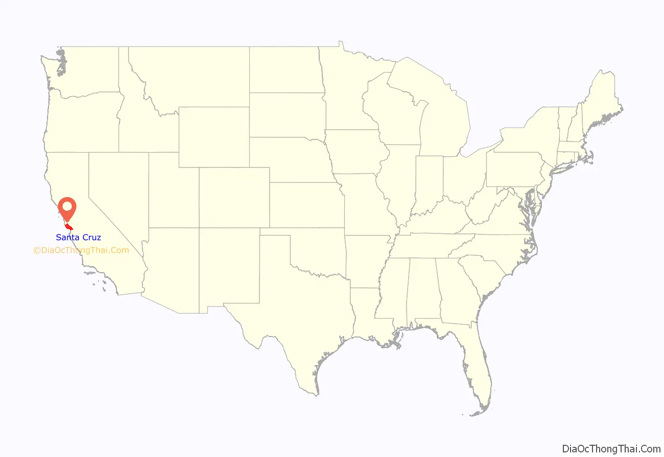
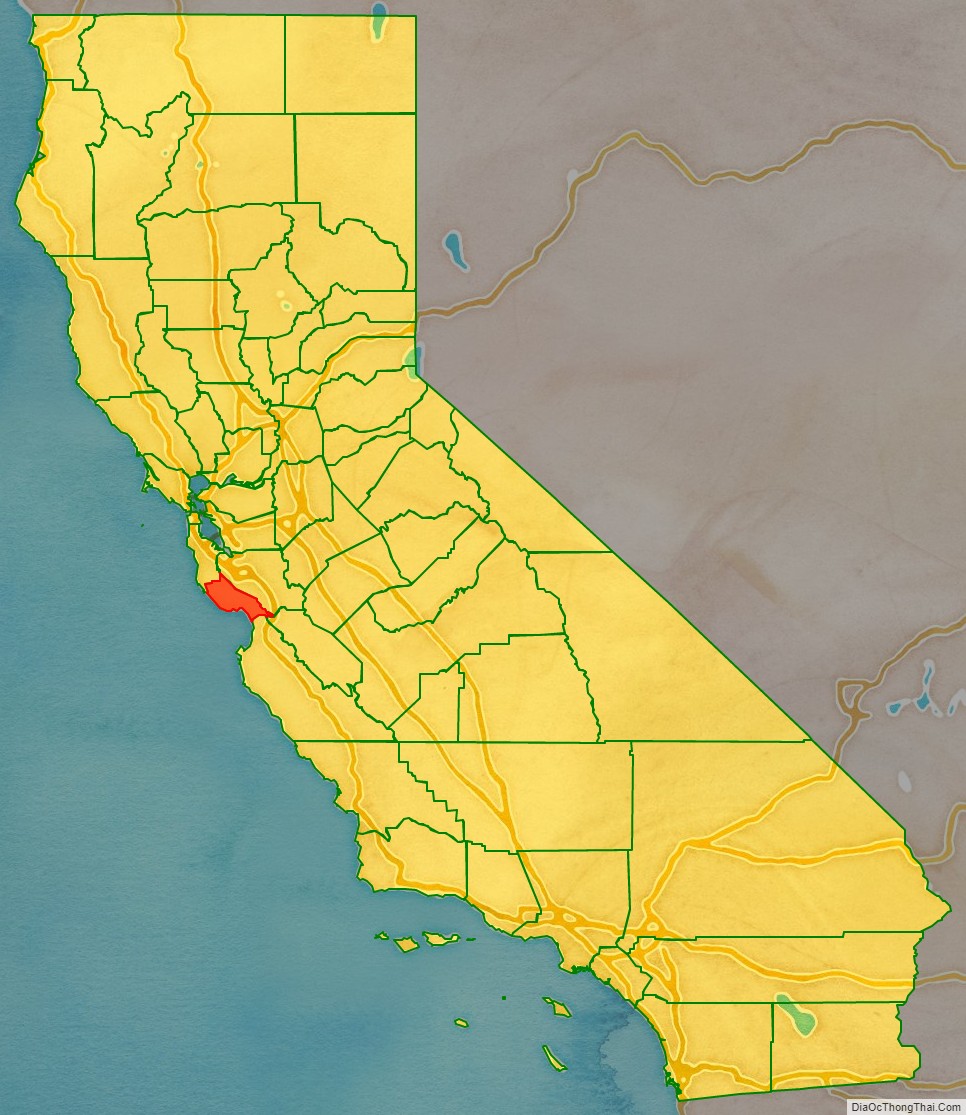
Santa Cruz County location map. Where is Santa Cruz County?
History
Santa Cruz County was one of the original counties of California, created in 1850 at the time of statehood. In the original act, the county was given the name of “Branciforte” after the Spanish pueblo founded there in 1797. A major watercourse in the county, Branciforte Creek, still bears this name. Less than two months later, on April 5, 1850, the name was changed to “Santa Cruz” (“Holy Cross”).
Mission Santa Cruz, established in 1791 and completed in 1794, was destroyed by the 1857 Fort Tejon earthquake, but a smaller-scale replica was erected in 1931.
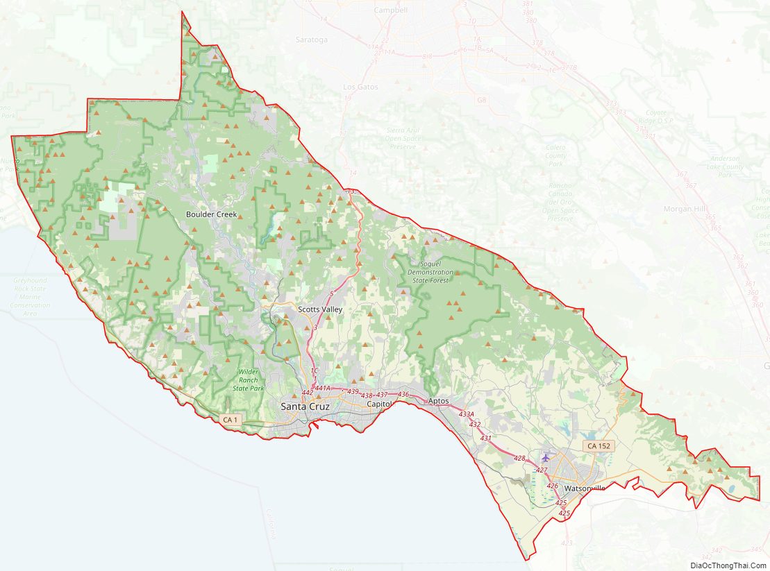
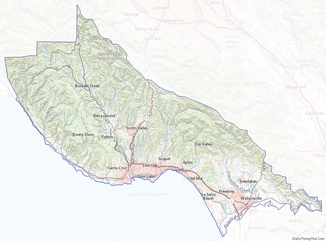
Santa Cruz County Road Map
Geography
According to the U.S. Census Bureau, the county has a total area of 607 square miles (1,570 km), of which 445 square miles (1,150 km) is land and 162 square miles (420 km) (27%) is water. It is the second-smallest county in California by land area and third-smallest by total area. Of California’s counties, only San Francisco is smaller by land area.
The county is situated on a wide coastline with over 29 miles (47 km) of beaches. It is a strip about 10 miles (16 km) wide between the coast and the crest of the Santa Cruz Mountains at the northern end of the Monterey Bay. It can be divided roughly into four regions: the rugged “north coast”; the urban City of Santa Cruz, Soquel, Capitola, and Aptos; mountainous Bonny Doon, San Lorenzo River Valley; and the fertile “south county”, including Watsonville and Corralitos. Agriculture is concentrated in the coastal lowlands of the county’s northern and southern ends. Most of the north coastal land comprises relatively flat terraces that end at steep cliffs like those shown in the photo below.
Flora and fauna
Santa Cruz County is home to the following threatened or endangered species:
- California clapper rail – endangered (1970)
- California red-legged frog – threatened (1996)
- California tiger salamander – Central California DPS, threatened (2004)
- Coho salmon – Central California Coast ESU is endangered (2005)
- Marbled murrelet – threatened (1992)
- Mount Hermon June beetle – endangered (1997)
- Ohlone tiger beetle – endangered (2001)
- San Francisco garter snake – endangered (1967)
- Santa Cruz long-toed salamander – endangered (1967)
- Santa Cruz tarweed – threatened (2000)
- Smith’s blue butterfly – endangered (1976)
- Southern sea otter – threatened (1977)
- Steelhead – Central California Coast DPS is threatened (2011)
- Tidewater goby – endangered (1994)
- Western snowy plover – threatened (1993)
- Yellow-billed cuckoo – threatened (2014)
- Zayante band-winged grasshopper – endangered (1997)
Historically, tule elk (Cervus canadensis nannodes) were native to the coastal grasslands of Santa Cruz County. Elk, sometimes confused with bison, were initially described by Miguel Costansó in his diary of the 1769 Portola Expedition near the mouth of the Pajaro River both on the way north on October 6, and on the way south on November 25. Later, elk were also described by nineteenth century American hunters. They were also described in Santa Cruz County by Jlli tribelet Awaswas Ohlone people, who utilized elk along with pronghorn (Antilocapra americana) and lived on the Jarro Coast (El Jarro Point is north of Davenport, California). Additionally, there is a “Cañada del Ciervo” (ciervo is Spanish for elk) close to the boundary between Rancho de los Corralitos and Rancho San Andrés, near the present-day Larkin Valley Road. This “Elk Valley” place name was given by José Antonio Robles who rode down, roped, and killed elk there in 1831. Lastly, elk remains dating from the Middle and Late Periods in Northern California were found in at least four late Holocene archeological sites in Santa Cruz County, all coastal: SCR-9 (Bonny Doon site) and SCR-20 (Brown site) on the western slope of Ben Lomond Mountain, SCR-93 (Sunflower site) a coastal terrace on the north shore of the San Lorenzo River in Santa Cruz, and SCR-132 (Scott Creek site) 4 miles inland.
Pronghorn antelope (Antilocapra americana) remains were found at the SCR-20 (Brown site) on the western slope of Ben Lomond Mountain dating to about 1500 A.D.
Año Nuevo State Marine Conservation Area, Greyhound Rock State Marine Conservation Area and Natural Bridges State Marine Reserve are marine protected areas off the coast of Santa Cruz County. Like underwater parks, these marine protected areas help conserve ocean wildlife and marine ecosystems.
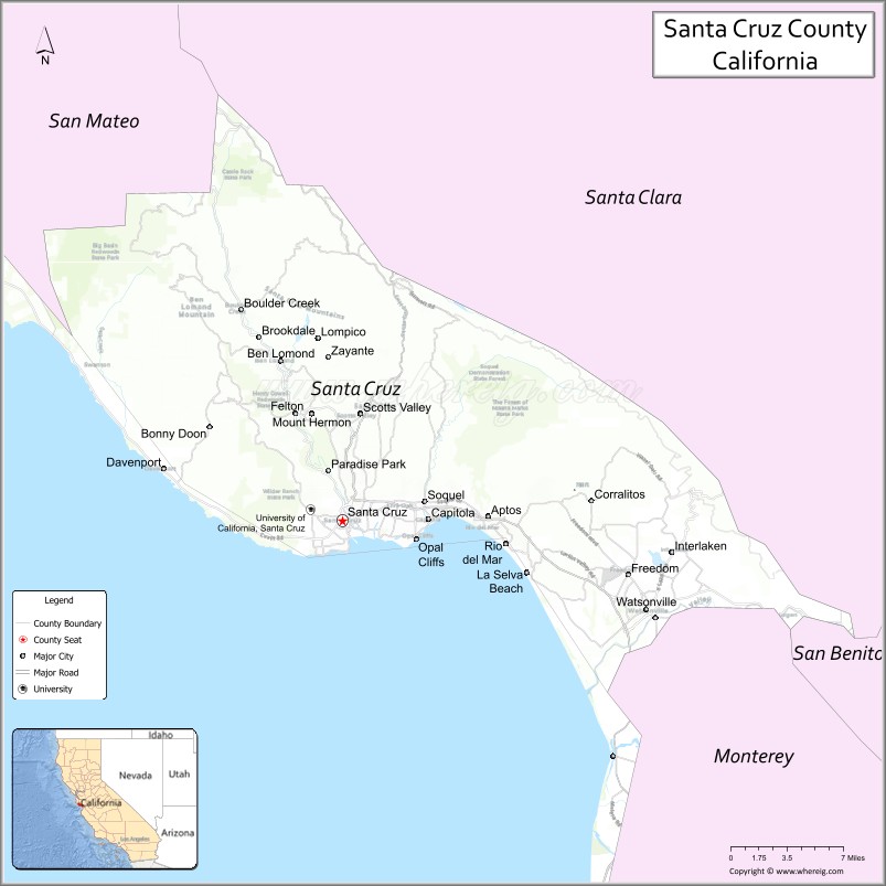
Adjacent counties
Santa Cruz County borders four other counties: San Mateo to the northwest, Santa Clara to the north and east, Monterey to the south, and San Benito with a small border to the south.
Santa Cruz County Topographic Map
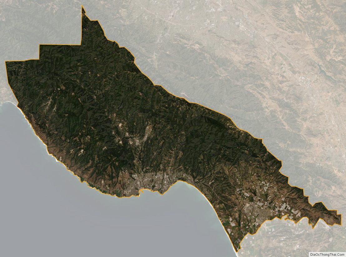
Santa Cruz County Satellite Map
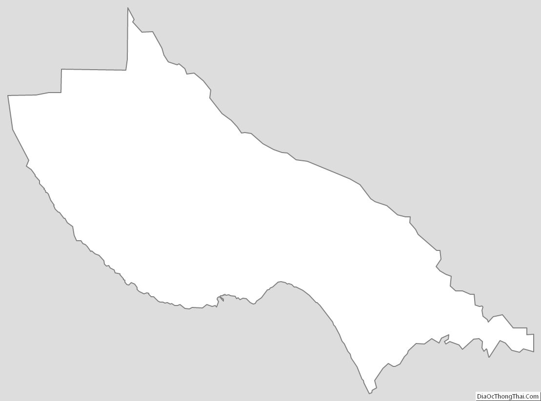
Santa Cruz County Outline Map
See also
Map of California State and its subdivision:- Alameda
- Alpine
- Amador
- Butte
- Calaveras
- Colusa
- Contra Costa
- Del Norte
- El Dorado
- Fresno
- Glenn
- Humboldt
- Imperial
- Inyo
- Kern
- Kings
- Lake
- Lassen
- Los Angeles
- Madera
- Marin
- Mariposa
- Mendocino
- Merced
- Modoc
- Mono
- Monterey
- Napa
- Nevada
- Orange
- Placer
- Plumas
- Riverside
- Sacramento
- San Benito
- San Bernardino
- San Diego
- San Francisco
- San Joaquin
- San Luis Obispo
- San Mateo
- Santa Barbara
- Santa Clara
- Santa Cruz
- Shasta
- Sierra
- Siskiyou
- Solano
- Sonoma
- Stanislaus
- Sutter
- Tehama
- Trinity
- Tulare
- Tuolumne
- Ventura
- Yolo
- Yuba
- Alabama
- Alaska
- Arizona
- Arkansas
- California
- Colorado
- Connecticut
- Delaware
- District of Columbia
- Florida
- Georgia
- Hawaii
- Idaho
- Illinois
- Indiana
- Iowa
- Kansas
- Kentucky
- Louisiana
- Maine
- Maryland
- Massachusetts
- Michigan
- Minnesota
- Mississippi
- Missouri
- Montana
- Nebraska
- Nevada
- New Hampshire
- New Jersey
- New Mexico
- New York
- North Carolina
- North Dakota
- Ohio
- Oklahoma
- Oregon
- Pennsylvania
- Rhode Island
- South Carolina
- South Dakota
- Tennessee
- Texas
- Utah
- Vermont
- Virginia
- Washington
- West Virginia
- Wisconsin
- Wyoming