Sargent County is a county in the U.S. state of North Dakota. Its county seat is Forman, and its most populous city is Gwinner. The county is named in honor of Homer E. Sargent, a 19th-century general manager of the Northern Pacific Railroad Company. The county spans an agricultural region between the James River and Red River valleys in southeastern North Dakota dotted with various sloughs, lakes, and hills.
As of the 2020 census, the population was 3,862. It is the 29th-most populous county in North Dakota, and was the original home of the Bobcat Company, a manufacturer of farm and construction equipment that still produces a large number of skid-steer loaders at its facility in Gwinner.
| Name: | Sargent County |
|---|---|
| FIPS code: | 38-081 |
| State: | North Dakota |
| Founded: | 1883 |
| Named for: | H. E. Sargent |
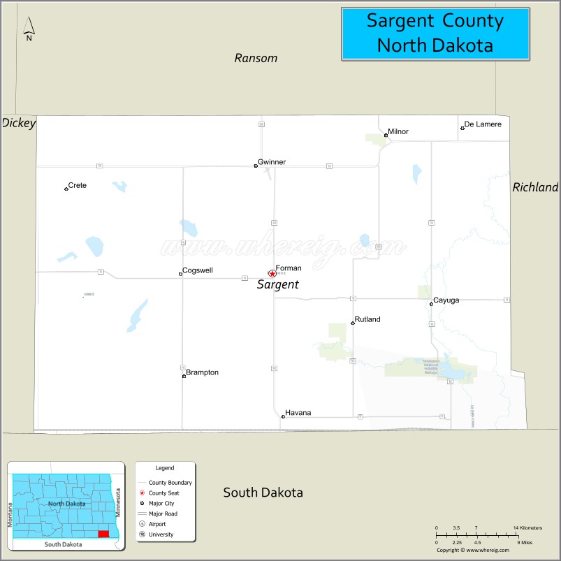
| Seat: | Forman |
| Largest city: | Gwinner |
| Total Area: | 867 sq mi (2,250 km²) |
| Land Area: | 859 sq mi (2,220 km²) |
| Total Population: | 3,862 |
| Population Density: | 4.5/sq mi (1.7/km²) |
| Time zone: | UTC−6 (Central) |
| Summer Time Zone (DST): | UTC−5 (CDT) |
| Website: | www.sargentnd.com |
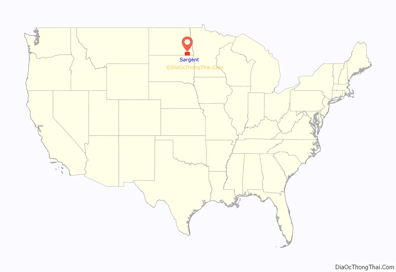
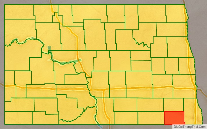
Sargent County location map. Where is Sargent County?
History
The Dakota Territory created the county on April 9, 1883, with areas partitioned from Ransom County, from previously unorganized areas and from non-county areas in the Wahpeton and Sisseton Indian Reserve. It was named for H. E. Sargent, a railroad executive. Its governing structure was not completed at that time, so it was attached to Richland for judicial purposes and to Ransom for administrative purposes. This arrangement only lasted until October 8, when the county government was effected, with Milnor as the county seat. However, in 1884, in the county’s first election, Forman was chosen as the county seat.
The Northern Pacific Railway laid a line into the county in 1883, reaching Milnor. By 1900 it had been extended across the county. The county’s population rapidly increased, reaching a peak in the 1920 United States census (9,655).
In 1997 the Brampton Lutheran Church (originally built in 1908) was moved to Sletta near Radøy in Norway and reconstructed there. It is now called Emigrantkirka (Emigrant Church).
The Sargent County Courthouse, a Beaux Arts-style building built in 1910, is listed on the U.S. National Register of Historic Places.
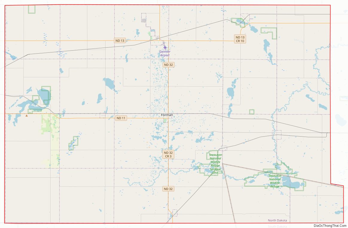
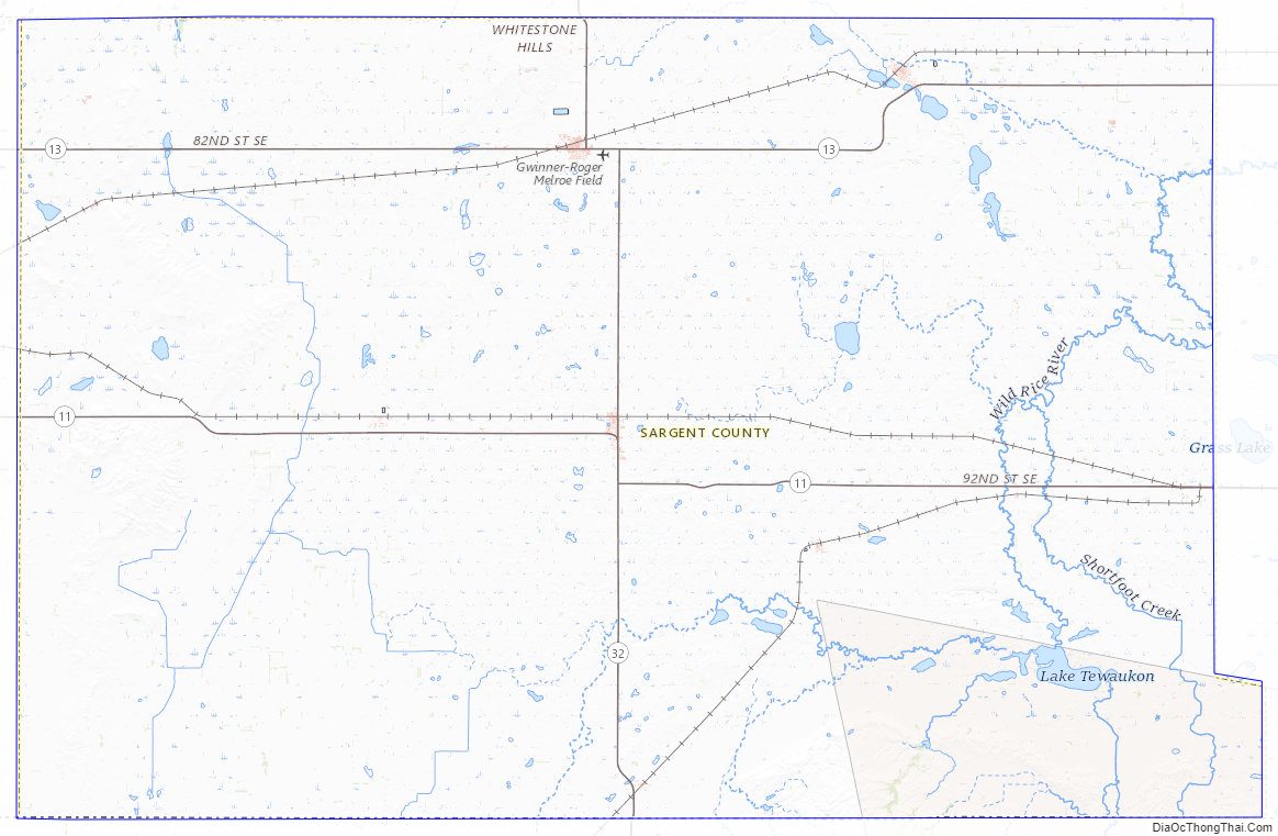
Sargent County Road Map
Geography
Sargent County lies near the southeastern corner of North Dakota, abutting the state’s southern border with South Dakota. The county is almost exactly rectangular in shape (consisting of 24 sections of land), with a small protrusion in the county’s southeastern corner for alignment with the boundaries of the Lake Traverse Indian Reservation. The county has a total area of 867 square miles (2,250 km), of which 859 square miles (2,220 km) is land and 8.4 square miles (22 km) (1.0%) is water.
Other than small portions of the western and northern sides of the county that lie in the James River and Sheyenne River watersheds, respectively, the vast majority of the county lies within the watershed of the Wild Rice River, whose source is the termination of a drainage ditch about two miles northeast of Brampton in southwestern Sargent County. It flows generally easterly through the southern part of the county, passing through Silver Lake and Lake Tewaukon before flowing further east into Richland County about five miles southeast of De Lamere.
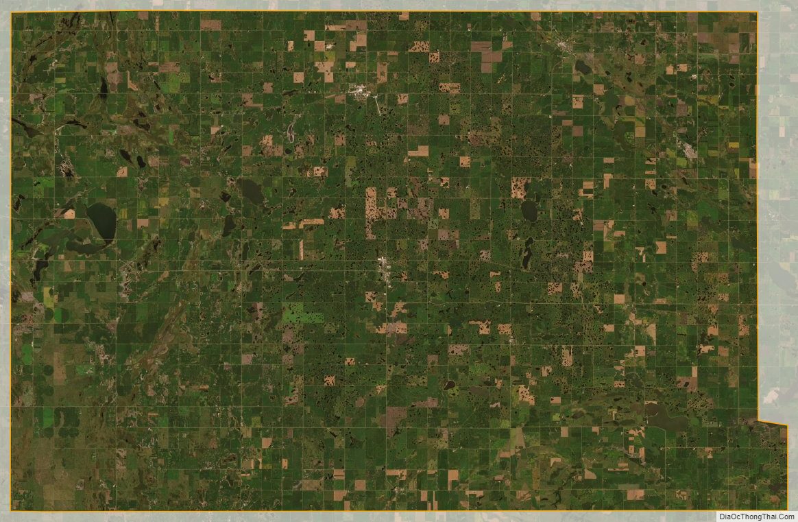
The county’s topography is varied, with the southern and western portions of the county being dominated by glacial hills, including the northern tip of the Coteau des Prairies standing prominently along the county’s southern border, gradually transitioning into the much flatter landscape of the Red River Valley in the eastern portion of the county. The flatter areas of the county are largely devoted to the production of corn, soybean, and wheat, with much of the more hilly terrain being used as pastures for grazing livestock. The terrain generally slopes to the south and east, with its highest point on its western boundary line at 1,365′ (416m) ASL, although a northwest–southeast rise on the eastern portion of its south boundary line rises to 1,729′ (527m) ASL.
Sargent County is located within the Prairie Pothole Region of the northern Great Plains, and as such has a landscape that is covered in numerous wetlands. The majority of these wetlands are shallow sloughs that vary in size in wetter and drier years, but there are also a number of larger and deeper lakes. Lake Tewaukon, located within Tewaukon National Wildlife Refuge in the southeastern portion of the county, is one of the county’s largest lakes. Meanwhile, the western end of the county contains a chain of lakes, the largest of which is Kraft Lake. Many of the county’s lakes are populated with fish such as yellow perch and walleye, making fishing (including ice fishing in the winter months) a popular recreation for both locals and visitors to the county.
Adjacent counties
- Ransom County to the north
- Richland County to the east
- Roberts County, South Dakota to the southeast
- Marshall County, South Dakota to the south
- Brown County, South Dakota to the southwest
- Dickey County to the west
National protected areas
- Storm Lake National Wildlife Refuge
- Tewaukon National Wildlife Refuge
- Wild Rice Lake National Wildlife Refuge
Lakes
- Alkali Lake
- Borg Lake
- Buffalo Lake
- Clouds Lake
- Golden Hill Lake
- Kraft Lake
- Lake Dell
- Lake Fedge
- Lake Tewaukon
- Pickell Lake
- Silver Lake
- Sprague Lake
- Storm Lake
- White Lake
Sargent County Topographic Map
Sargent County Satellite Map
Sargent County Outline Map

See also
Map of North Dakota State and its subdivision:- Adams
- Barnes
- Benson
- Billings
- Bottineau
- Bowman
- Burke
- Burleigh
- Cass
- Cavalier
- Dickey
- Divide
- Dunn
- Eddy
- Emmons
- Foster
- Golden Valley
- Grand Forks
- Grant
- Griggs
- Hettinger
- Kidder
- Lamoure
- Logan
- McHenry
- McIntosh
- McKenzie
- McLean
- Mercer
- Morton
- Mountrail
- Nelson
- Oliver
- Pembina
- Pierce
- Ramsey
- Ransom
- Renville
- Richland
- Rolette
- Sargent
- Sheridan
- Sioux
- Slope
- Stark
- Steele
- Stutsman
- Towner
- Traill
- Walsh
- Ward
- Wells
- Williams
- Alabama
- Alaska
- Arizona
- Arkansas
- California
- Colorado
- Connecticut
- Delaware
- District of Columbia
- Florida
- Georgia
- Hawaii
- Idaho
- Illinois
- Indiana
- Iowa
- Kansas
- Kentucky
- Louisiana
- Maine
- Maryland
- Massachusetts
- Michigan
- Minnesota
- Mississippi
- Missouri
- Montana
- Nebraska
- Nevada
- New Hampshire
- New Jersey
- New Mexico
- New York
- North Carolina
- North Dakota
- Ohio
- Oklahoma
- Oregon
- Pennsylvania
- Rhode Island
- South Carolina
- South Dakota
- Tennessee
- Texas
- Utah
- Vermont
- Virginia
- Washington
- West Virginia
- Wisconsin
- Wyoming