Scioto County is a county located along the Ohio River in the south central region of the U.S. state of Ohio. As of the 2020 census, the population was 74,008. Its county seat is Portsmouth. The county was founded March 24, 1804, from Adams County and is named for a Native American word referring to deer or deer-hunting. Scioto County comprises the Portsmouth, OH Micropolitan Statistical Area. It is located at the confluence of the Scioto and Ohio rivers.
| Name: | Scioto County |
|---|---|
| FIPS code: | 39-145 |
| State: | Ohio |
| Founded: | March 24, 1803 |
| Named for: | Scioto River |
| Seat: | Portsmouth |
| Largest city: | Portsmouth |
| Total Area: | 616 sq mi (1,600 km²) |
| Land Area: | 610 sq mi (1,600 km²) |
| Total Population: | 74,008 |
| Population Density: | 120/sq mi (50/km²) |
| Time zone: | UTC−5 (Eastern) |
| Summer Time Zone (DST): | UTC−4 (EDT) |
| Website: | www.sciotocountyohio.com |
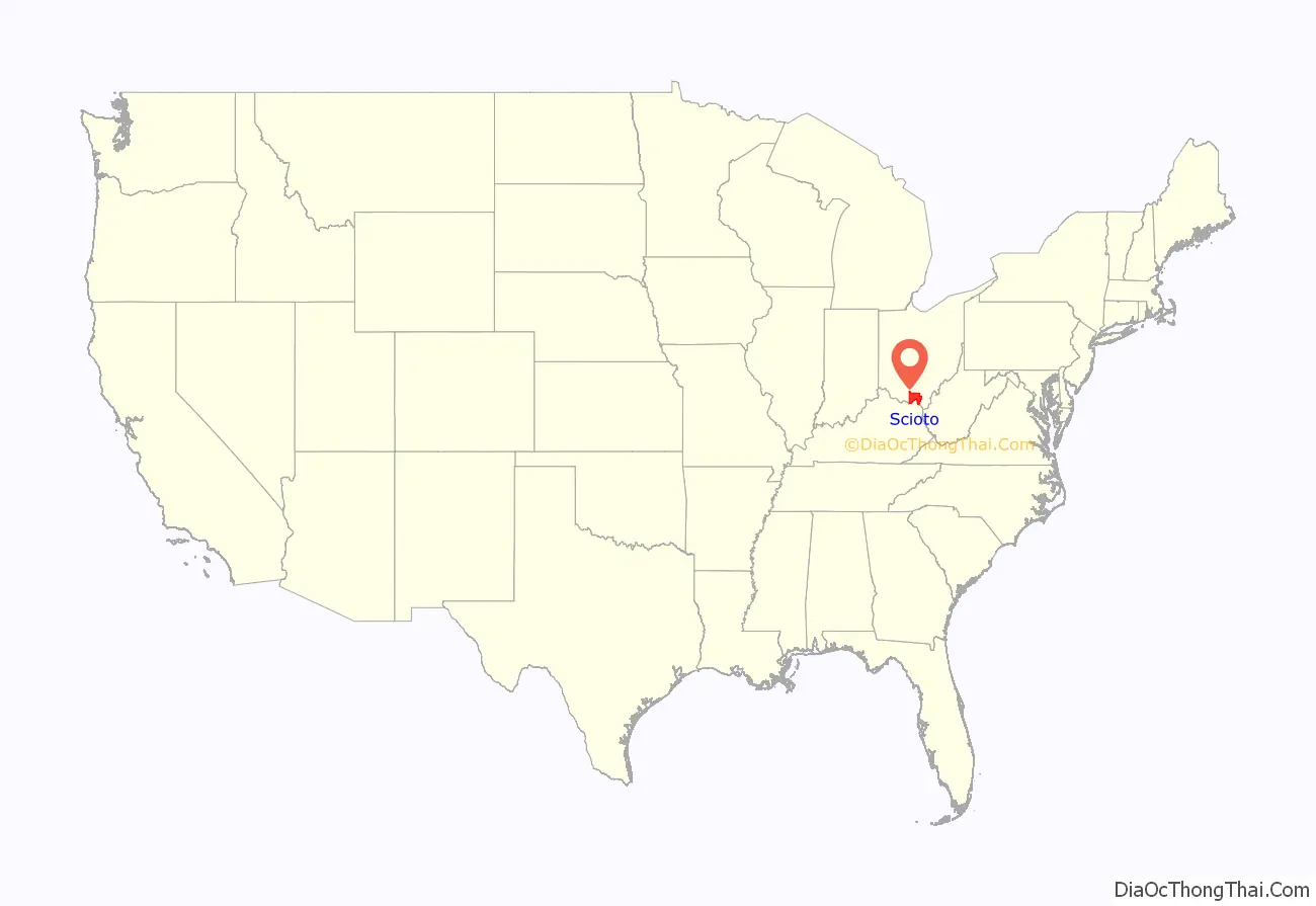
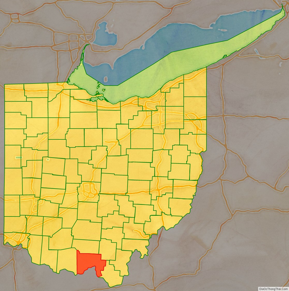
Scioto County location map. Where is Scioto County?
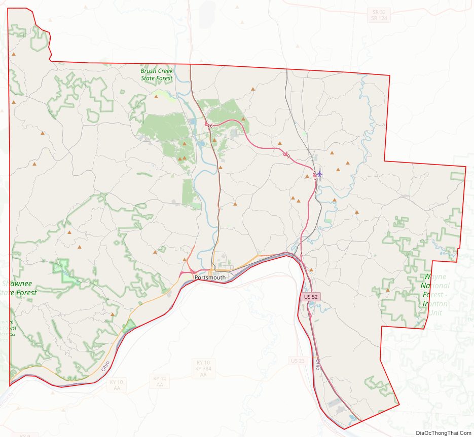
Scioto County Road Map
Geography
According to the U.S. Census Bureau, the county has a total area of 616 square miles (1,600 km), of which 610 square miles (1,600 km) is land and 5.9 square miles (15 km) (1.0%) is water. Many parts of Scioto County are heavily forested, especially in the western half of the county with Shawnee State Park.
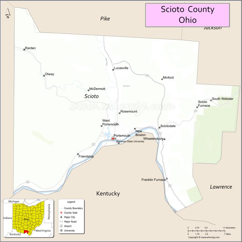
Adjacent counties
- Pike County (north)
- Jackson County (northeast)
- Lawrence County (southeast)
- Greenup County, Kentucky (south)
- Lewis County, Kentucky (southwest)
- Adams County (west)
National protected area
- Wayne National Forest (part)
Other parks
Shawnee State Forest and Park, the state’s largest with over 88,000 acres (360 km), covers most of western Scioto County, and Brush Creek State Park touches part of northwestern Scioto County. The county also has numerous parks and recreational areas in each of its townships, including Earl Thomas Conley Park on U.S. 52 west of Portsmouth. Public lands in the county also include the Wayne National Forest on the Ironton Ranger District. The 241,000-acre (980 km) forest encompasses almost 12,000 acres (49 km) in three townships in Scioto County (Vernon 6,793.50 acres (27.4923 km), Green township 81,695 acres (330.61 km), and Bloom 4,008.29 acres).
Within the city limits of Portsmouth, there are fourteen parks for the residents and for community use. These parks include Alexandria Park (Ohio and Scioto River confluence), Allard Park (Bonser Avenue in Sciotoville), Bannon Park (near Farley Square), Branch Rickey Park (on Williams Street near levee), Buckeye Park (near Branch Rickey Park), Cyndee Secrest Park (Sciotoville), Dr. Hartlage Park (Rose Street in Sciotoville), Labold Park (near Spartan Stadium), Larry Hisle Park (23rd Street and Thomas Avenue), Mound Park (17th and Hutchins Streets), York Park (riverfront), Spartan Stadium, Tracy Park (Chillicothe and Gay Streets), and Weghorst Park (Fourth and Jefferson Streets).
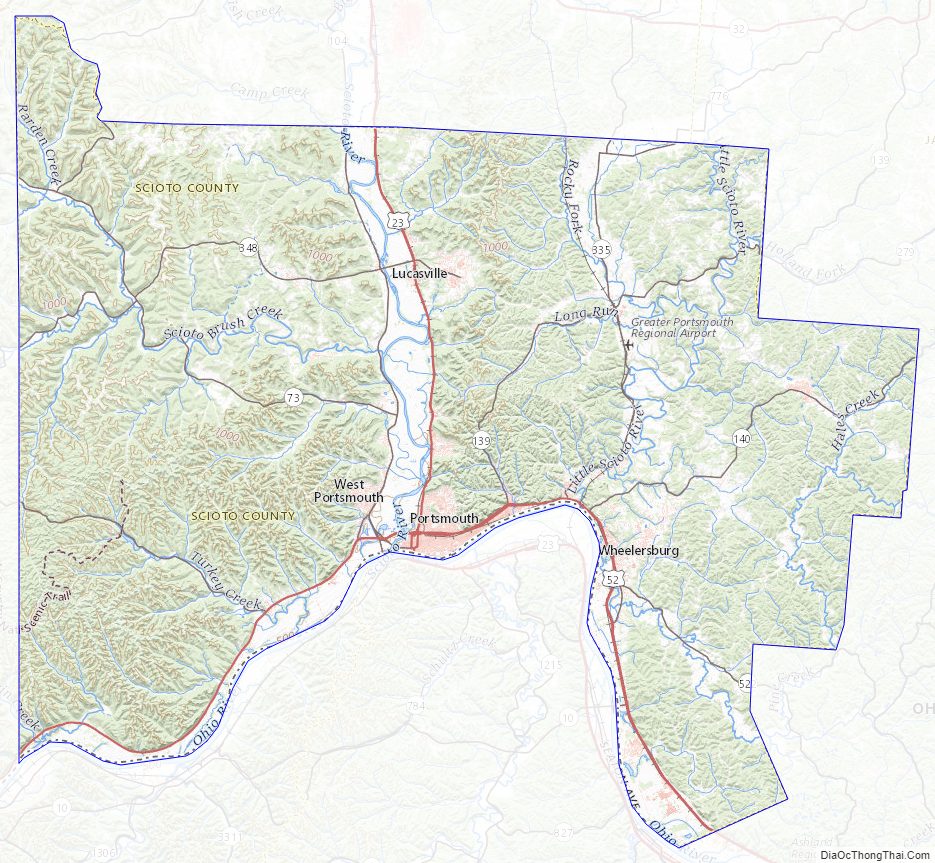
Scioto County Topographic Map
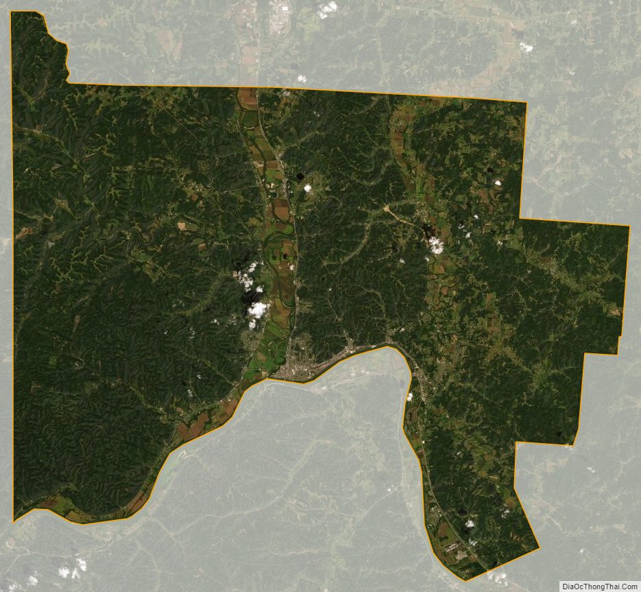
Scioto County Satellite Map
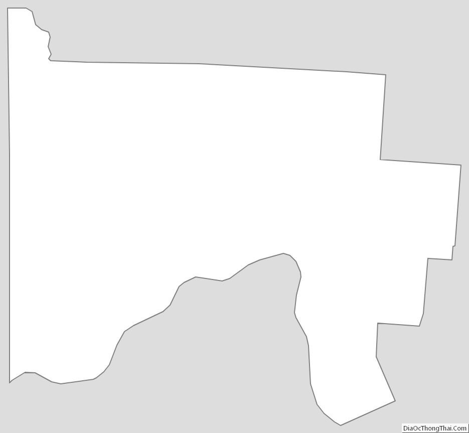
Scioto County Outline Map
See also
Map of Ohio State and its subdivision:- Adams
- Allen
- Ashland
- Ashtabula
- Athens
- Auglaize
- Belmont
- Brown
- Butler
- Carroll
- Champaign
- Clark
- Clermont
- Clinton
- Columbiana
- Coshocton
- Crawford
- Cuyahoga
- Darke
- Defiance
- Delaware
- Erie
- Fairfield
- Fayette
- Franklin
- Fulton
- Gallia
- Geauga
- Greene
- Guernsey
- Hamilton
- Hancock
- Hardin
- Harrison
- Henry
- Highland
- Hocking
- Holmes
- Huron
- Jackson
- Jefferson
- Knox
- Lake
- Lake Erie
- Lawrence
- Licking
- Logan
- Lorain
- Lucas
- Madison
- Mahoning
- Marion
- Medina
- Meigs
- Mercer
- Miami
- Monroe
- Montgomery
- Morgan
- Morrow
- Muskingum
- Noble
- Ottawa
- Paulding
- Perry
- Pickaway
- Pike
- Portage
- Preble
- Putnam
- Richland
- Ross
- Sandusky
- Scioto
- Seneca
- Shelby
- Stark
- Summit
- Trumbull
- Tuscarawas
- Union
- Van Wert
- Vinton
- Warren
- Washington
- Wayne
- Williams
- Wood
- Wyandot
- Alabama
- Alaska
- Arizona
- Arkansas
- California
- Colorado
- Connecticut
- Delaware
- District of Columbia
- Florida
- Georgia
- Hawaii
- Idaho
- Illinois
- Indiana
- Iowa
- Kansas
- Kentucky
- Louisiana
- Maine
- Maryland
- Massachusetts
- Michigan
- Minnesota
- Mississippi
- Missouri
- Montana
- Nebraska
- Nevada
- New Hampshire
- New Jersey
- New Mexico
- New York
- North Carolina
- North Dakota
- Ohio
- Oklahoma
- Oregon
- Pennsylvania
- Rhode Island
- South Carolina
- South Dakota
- Tennessee
- Texas
- Utah
- Vermont
- Virginia
- Washington
- West Virginia
- Wisconsin
- Wyoming