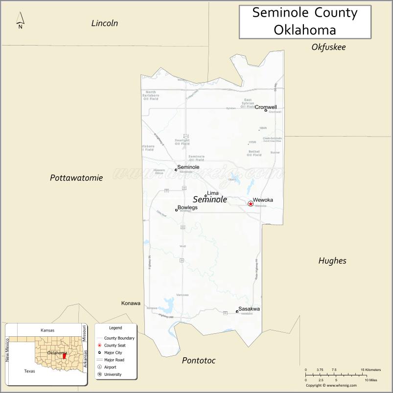
Seminole County is a county located in the U.S. state of Oklahoma. As of the 2010 census, the population was 25,482. Its county seat is Wewoka. Most of the county was a reservation for the Seminole Nation of Oklahoma which still retains jurisdiction over some land in the county. A small portion of land at the eastern end of the county belonged to the Muscogee (Creek) Nation.
Seminole County is notable for the Greater Seminole Field, one of the most important oil fields ever found, which is still producing. It extends into nearby counties. In the early years of the oil boom, workers and adventurers flooded into the county, rapidly tripling the population. As oil production later declined, jobs and residents left.
| Name: | Seminole County |
|---|---|
| FIPS code: | 40-133 |
| State: | Oklahoma |
| Founded: | 1907 |
| Seat: | Wewoka |
| Largest city: | Seminole |
| Total Area: | 640 sq mi (1,700 km²) |
| Land Area: | 633 sq mi (1,640 km²) |
| Total Population: | 25,482 |
| Population Density: | 40/sq mi (20/km²) |
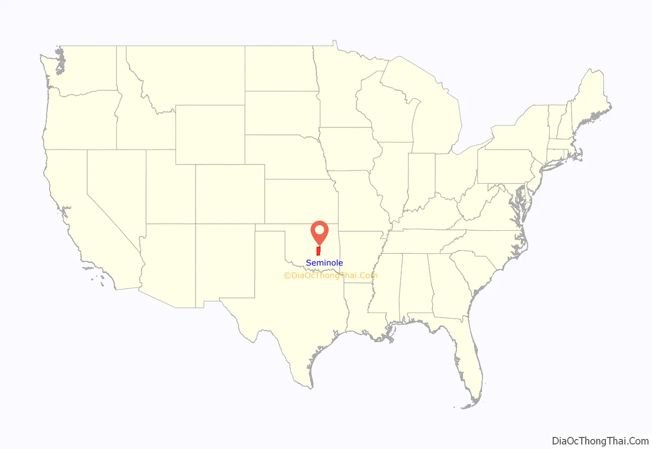
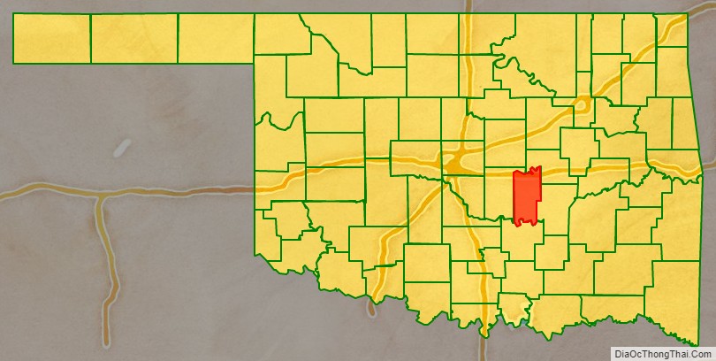
Seminole County location map. Where is Seminole County?
History
Seminole County has been an important part of the Oklahoma and United States petroleum industry for over 80 years. The Greater Seminole Field was one of the most important oil fields ever found and is still producing. Discovered one field after another in 1926, it contained an estimated 822,000,000 barrels (130,700,000 m) of oil. To group the fields together, the oil companies decided to come up with a name, and this was suggested by Paul Hedrick, oil editor of the Tulsa World. Early oil discoveries in the area were the Wewoka oil field and Cromwell oil field, both discovered in 1923. Then, on 16 July 1926, the Fixico No. 1 well reached the Wilcox sand at 4073 feet, bringing in the Seminole City Field. Located within the Greater Seminole area are 6 of Oklahoma’s 22 giant oil fields, including Earlsboro, St. Louis, Seminole, Bowlegs, Little River, and Allen. Total production from the Greater Seminole area from 1926 to 1936 was 702,157,800 barrels, or 18% of all production in Oklahoma.
The Maud field, discovered in 1927 by Amerada Petroleum, was the first discovery using reflection seismology. This marked the beginning of the use of modern geophysical methods in the petroleum industry.
The Seminole County Courthouse was built in 1927.
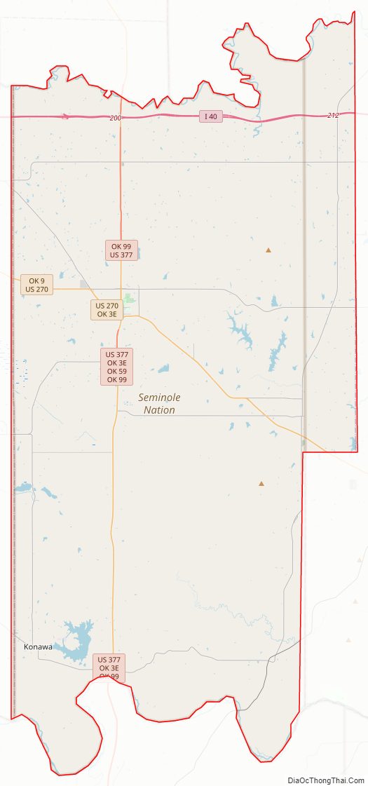
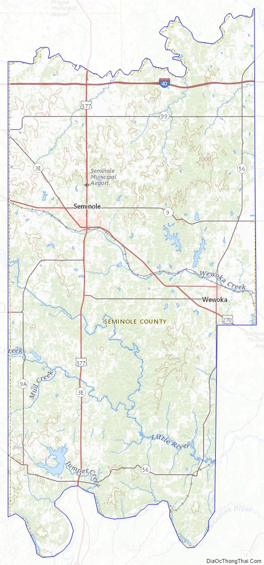
Seminole County Road Map
Geography
According to the U.S. Census Bureau, the county has a total area of 640 square miles (1,700 km), of which 633 square miles (1,640 km) is land and 7.6 square miles (20 km) (1.2%) is water. The county is bounded on the north by the North Canadian River and on the south by the Canadian River.
Adjacent counties
- Okfuskee County (northeast)
- Hughes County (east)
- Pontotoc County (south)
- Pottawatomie County (west)
Seminole County Topographic Map
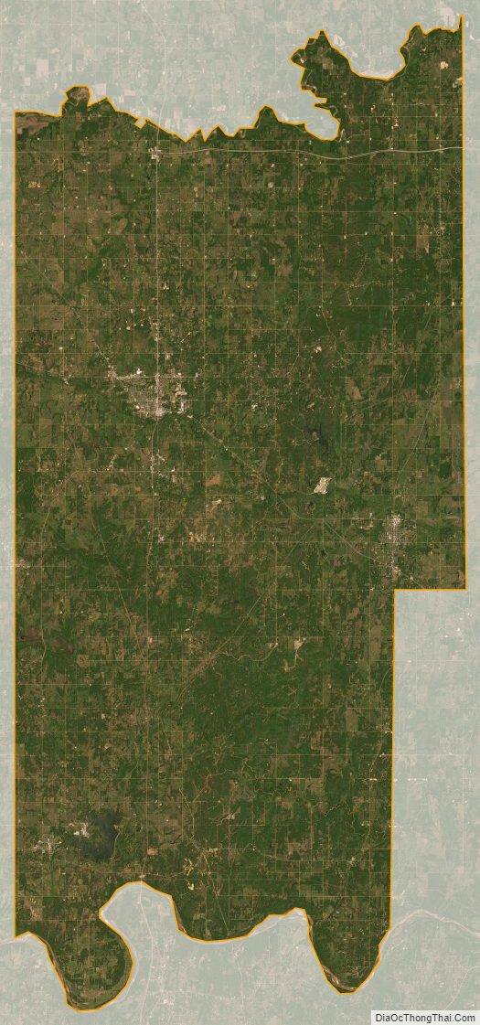
Seminole County Satellite Map
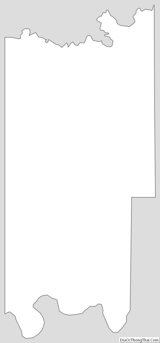
Seminole County Outline Map
See also
Map of Oklahoma State and its subdivision:- Adair
- Alfalfa
- Atoka
- Beaver
- Beckham
- Blaine
- Bryan
- Caddo
- Canadian
- Carter
- Cherokee
- Choctaw
- Cimarron
- Cleveland
- Coal
- Comanche
- Cotton
- Craig
- Creek
- Custer
- Delaware
- Dewey
- Ellis
- Garfield
- Garvin
- Grady
- Grant
- Greer
- Harmon
- Harper
- Haskell
- Hughes
- Jackson
- Jefferson
- Johnston
- Kay
- Kingfisher
- Kiowa
- Latimer
- Le Flore
- Lincoln
- Logan
- Love
- Major
- Marshall
- Mayes
- McClain
- McCurtain
- McIntosh
- Murray
- Muskogee
- Noble
- Nowata
- Okfuskee
- Oklahoma
- Okmulgee
- Osage
- Ottawa
- Pawnee
- Payne
- Pittsburg
- Pontotoc
- Pottawatomie
- Pushmataha
- Roger Mills
- Rogers
- Seminole
- Sequoyah
- Stephens
- Texas
- Tillman
- Tulsa
- Wagoner
- Washington
- Washita
- Woods
- Woodward
- Alabama
- Alaska
- Arizona
- Arkansas
- California
- Colorado
- Connecticut
- Delaware
- District of Columbia
- Florida
- Georgia
- Hawaii
- Idaho
- Illinois
- Indiana
- Iowa
- Kansas
- Kentucky
- Louisiana
- Maine
- Maryland
- Massachusetts
- Michigan
- Minnesota
- Mississippi
- Missouri
- Montana
- Nebraska
- Nevada
- New Hampshire
- New Jersey
- New Mexico
- New York
- North Carolina
- North Dakota
- Ohio
- Oklahoma
- Oregon
- Pennsylvania
- Rhode Island
- South Carolina
- South Dakota
- Tennessee
- Texas
- Utah
- Vermont
- Virginia
- Washington
- West Virginia
- Wisconsin
- Wyoming