Sevier County (/səˈvɪər/ sə-VEER) is a county of the U.S. state of Tennessee. As of the 2020 census, the population was 98,380. Its county seat and largest city is Sevierville. Sevier County comprises the Sevierville, TN Micropolitan Statistical Area, which is included in the Knoxville–Morristown-Sevierville, TN Combined Statistical Area.
| Name: | Sevier County |
|---|---|
| FIPS code: | 47-155 |
| State: | Tennessee |
| Founded: | September 28, 1794 |
| Named for: | John Sevier |
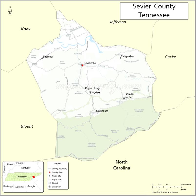
| Seat: | Sevierville |
| Largest city: | Sevierville |
| Total Area: | 598 sq mi (1,550 km²) |
| Land Area: | 593 sq mi (1,540 km²) |
| Total Population: | 98,380 |
| Population Density: | 152/sq mi (59/km²) |
| Time zone: | UTC−5 (Eastern) |
| Summer Time Zone (DST): | UTC−4 (EDT) |
| Website: | www.seviercountytn.gov |
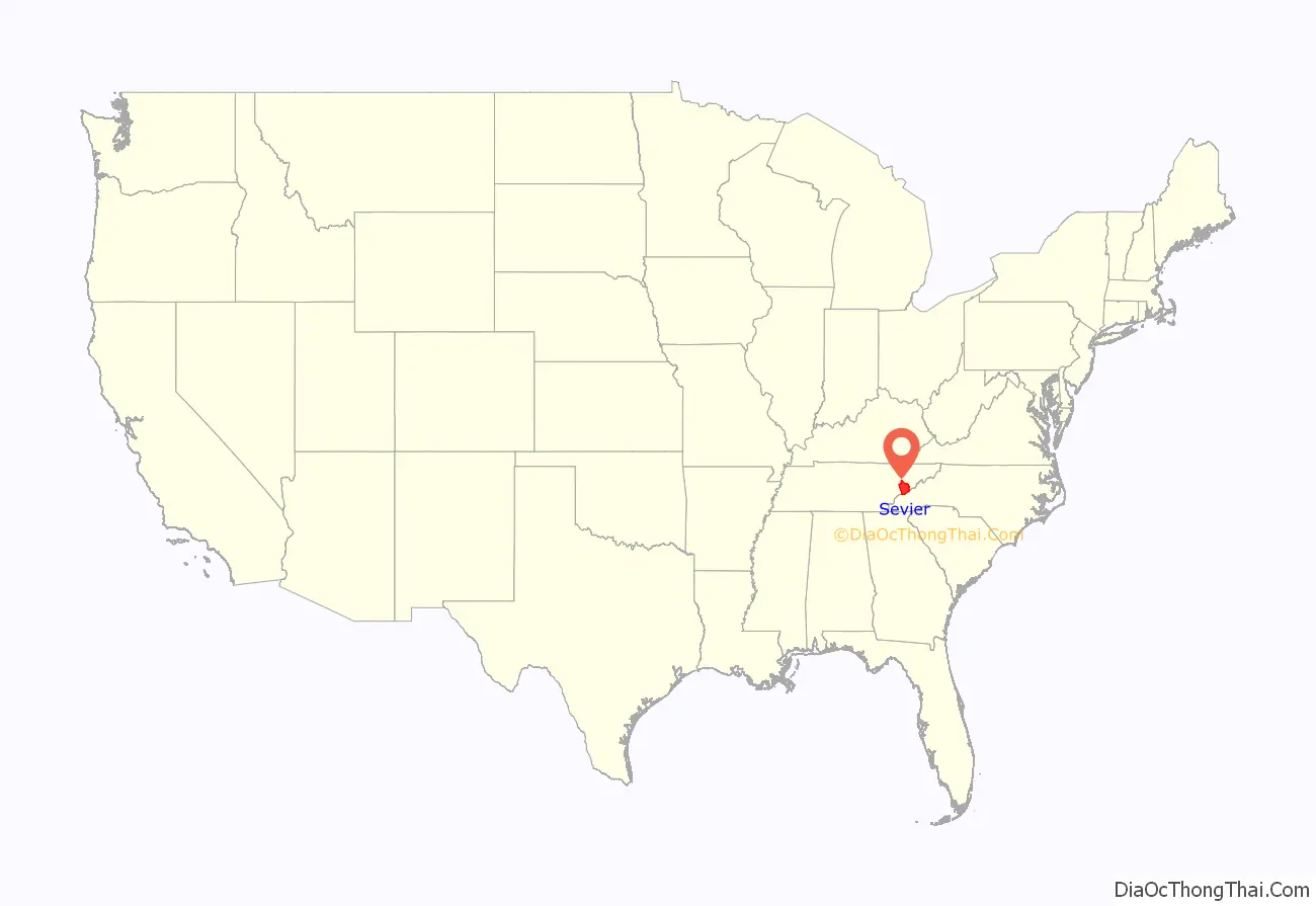
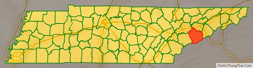
Sevier County location map. Where is Sevier County?
History
Prior to the arrival of white settlers in present-day Sevier County in the mid-18th century, the area had been inhabited for as many as 20,000 years by nomadic and semi-nomadic Native Americans. In the mid-16th century, Spanish expeditions led by Hernando de Soto (1540) and Juan Pardo (1567) passed through what is now Sevier County, reporting that the region was part of the domain of Chiaha, a minor Muskogean chiefdom centered around a village located on a now-submerged island just upstream from modern Douglas Dam. By the late 17th-century, however, the Cherokee, whose ancestors were living in the mountains at the time of the Spaniards’ visit, had become the dominant tribe in the region. Although they used the region primarily as hunting grounds, the Chicakamauga faction of the Cherokee vehemently fought white settlement in their territory, frequently leading raids on households, even through the signing of various peace treaties, alternating short periods of peace with violent hostility, until forcibly marched from their territory by the U.S. government on the “Trail of Tears”.
Sevier County was formed on September 18, 1794, from part of neighboring Jefferson County, and has retained its original boundaries ever since. The county takes its name from John Sevier, governor of the failed State of Franklin and first governor of Tennessee, who played a prominent role during the early years of settlement in the region. Since its establishment in 1795, the county seat has been situated at Sevierville (also named for Sevier), the eighth-oldest city in Tennessee.
Sevier County was strongly pro-Union during the Civil War. When Tennessee held a vote on the state’s Ordinance of Secession on June 8, 1861, Sevier Countians voted 1,528 to 60 in favor of remaining in the Union. In November 1861, William C. Pickens, Sheriff of Sevier County, led a failed attempt to destroy the railroad bridge at Strawberry Plains as part of the East Tennessee bridge-burning conspiracy.
Prior to the late 1930s, Sevier County’s population, economy, and society, which relied primarily on subsistence agriculture, held little significance vis-à-vis any other county in the rural South. However, with the creation of the Great Smoky Mountains National Park in the early 1930s, the future of Sevier County (within which lies thirty percent of the total area of the national park) changed drastically. Today, tourism supports the county’s economy.
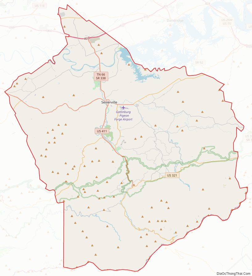
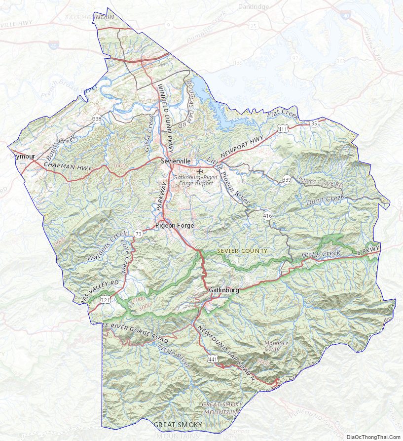
Sevier County Road Map
Geography
According to the U.S. Census Bureau, the county has a total area of 598 square miles (1,550 km), of which 593 square miles (1,540 km) is land and 5.2 square miles (13 km) (0.9%) is water. The southern part of Sevier County is located within the Great Smoky Mountains, and is protected by the Great Smoky Mountains National Park. The northern parts of the county are located within the Ridge-and-Valley Appalachians. Sevier contains the highest point in Tennessee, Clingmans Dome, which rises to 6,643 feet (2,025 m) along the county’s border with North Carolina. Mount Guyot, located in the Eastern Smokies in the extreme eastern part of the county, is the state’s second-highest mountain at 6,621 feet (2,018 m). The 6,593-foot (2,010 m) Mount Le Conte, a very prominent mountain visible from much of the central part of the county, is the state’s third-highest.
Sevier County is drained primarily by the French Broad River, which passes through the northern part of the county. A portion of the French Broad is part of Douglas Lake, an artificial reservoir created by Douglas Dam in the northeastern part of the county. The three forks of the Little Pigeon River (East, Middle, and West) flow northward from the Smokies, converge near Sevierville, and empty into the French Broad north of Sevierville. The West Fork is the best known, as it flows through the popular tourist areas of Gatlinburg and Pigeon Forge.
The maximum elevation differential in Sevier County is the greatest in Tennessee, ranging from a high of 6,643 feet (2,025 m) at Clingmans Dome to a low of 850 feet (260 m) at the French Broad River.
Adjacent counties
- Jefferson County, Tennessee – north
- Cocke County, Tennessee – east
- Haywood County, North Carolina – southeast
- Swain County, North Carolina – south
- Blount County, Tennessee – west
- Knox County, Tennessee – northwest
National protected areas
- Appalachian Trail (part)
- Foothills Parkway (part)
- Great Smoky Mountains National Park (part)
State protected area
- Roundtop Mountain State Natural Area
Sevier County Topographic Map
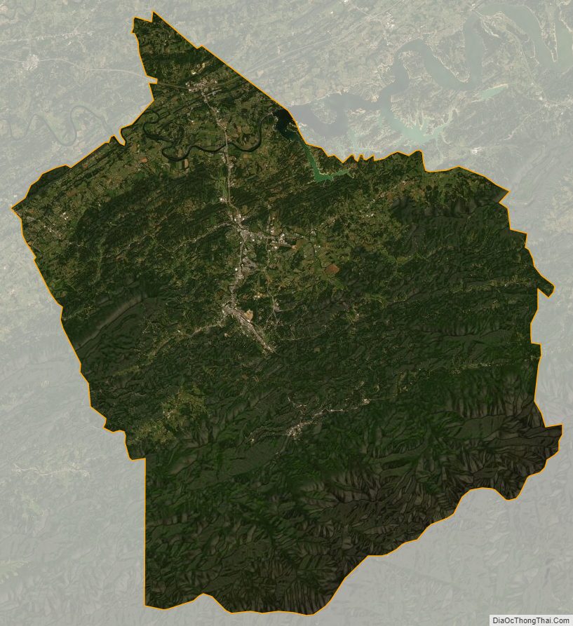
Sevier County Satellite Map
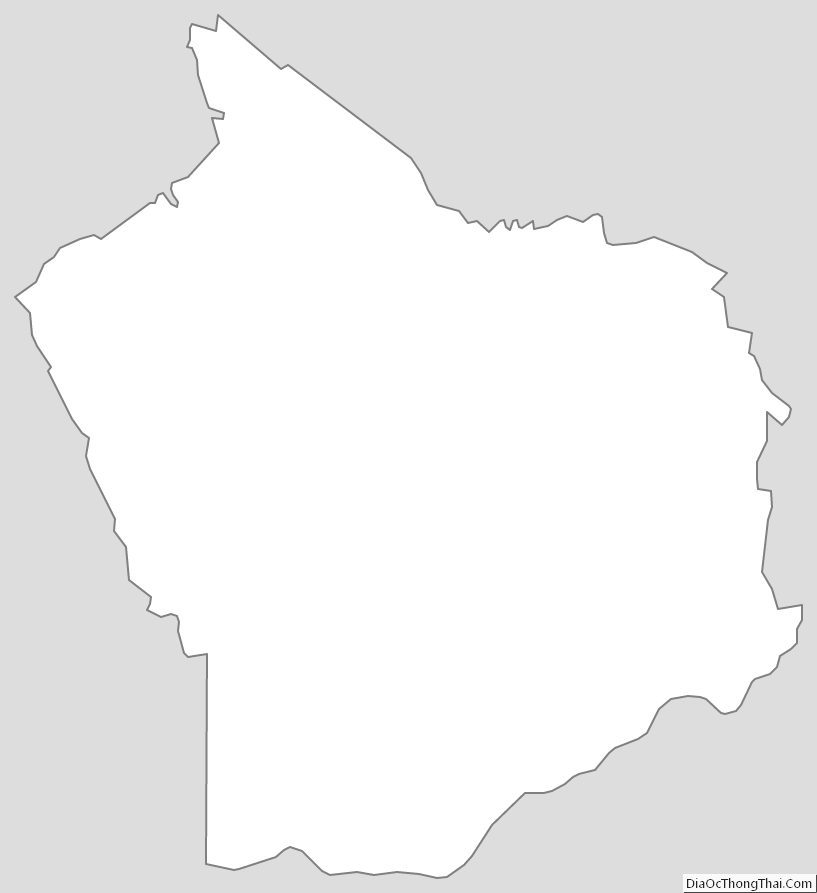
Sevier County Outline Map
See also
Map of Tennessee State and its subdivision:- Anderson
- Bedford
- Benton
- Bledsoe
- Blount
- Bradley
- Campbell
- Cannon
- Carroll
- Carter
- Cheatham
- Chester
- Claiborne
- Clay
- Cocke
- Coffee
- Crockett
- Cumberland
- Davidson
- Decatur
- DeKalb
- Dickson
- Dyer
- Fayette
- Fentress
- Franklin
- Gibson
- Giles
- Grainger
- Greene
- Grundy
- Hamblen
- Hamilton
- Hancock
- Hardeman
- Hardin
- Hawkins
- Haywood
- Henderson
- Henry
- Hickman
- Houston
- Humphreys
- Jackson
- Jefferson
- Johnson
- Knox
- Lake
- Lauderdale
- Lawrence
- Lewis
- Lincoln
- Loudon
- Macon
- Madison
- Marion
- Marshall
- Maury
- McMinn
- McNairy
- Meigs
- Monroe
- Montgomery
- Moore
- Morgan
- Obion
- Overton
- Perry
- Pickett
- Polk
- Putnam
- Rhea
- Roane
- Robertson
- Rutherford
- Scott
- Sequatchie
- Sevier
- Shelby
- Smith
- Stewart
- Sullivan
- Sumner
- Tipton
- Trousdale
- Unicoi
- Union
- Van Buren
- Warren
- Washington
- Wayne
- Weakley
- White
- Williamson
- Wilson
- Alabama
- Alaska
- Arizona
- Arkansas
- California
- Colorado
- Connecticut
- Delaware
- District of Columbia
- Florida
- Georgia
- Hawaii
- Idaho
- Illinois
- Indiana
- Iowa
- Kansas
- Kentucky
- Louisiana
- Maine
- Maryland
- Massachusetts
- Michigan
- Minnesota
- Mississippi
- Missouri
- Montana
- Nebraska
- Nevada
- New Hampshire
- New Jersey
- New Mexico
- New York
- North Carolina
- North Dakota
- Ohio
- Oklahoma
- Oregon
- Pennsylvania
- Rhode Island
- South Carolina
- South Dakota
- Tennessee
- Texas
- Utah
- Vermont
- Virginia
- Washington
- West Virginia
- Wisconsin
- Wyoming