Shawano County (pronounced SHAW-no) (originally Shawanaw County) is a county located in the U.S. state of Wisconsin. As of the 2020 census, the population was 40,881. Its county seat is Shawano.
Shawano County is included in the Shawano, WI Micropolitan Statistical Area, which is also included in the Green Bay-Shawano, WI Combined Statistical Area.
| Name: | Shawano County |
|---|---|
| FIPS code: | 55-115 |
| State: | Wisconsin |
| Founded: | February 16, 1853 |
| Seat: | Shawano |
| Largest city: | Shawano |
| Total Area: | 909 sq mi (2,350 km²) |
| Land Area: | 893 sq mi (2,310 km²) |
| Total Population: | 40,881 |
| Population Density: | 45.8/sq mi (17.7/km²) |
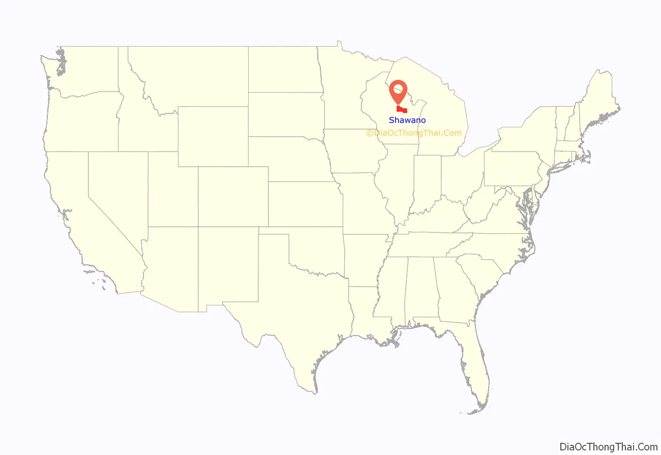
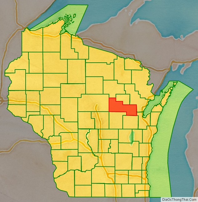
Shawano County location map. Where is Shawano County?
History
Its name is from a modified Ojibwa term meaning “southern”; it was the southern boundary of the Ojibwa nation. A Menominee chief named Sawanoh led a band that lived in the area. Many citizens of Shawano believe the lake, county, and city (Town of Shawanaw founded 1853 and changed to Shawano in 1856), were named after Chief Sawanoh. A historical marker placed in 1958 near the lake along Highway 22 states the lake was named as the southern boundary of Chippewa (Ojibwe) territory.
Various historical recordings of the spelling of Shawano include Sawanoh, Shawanaw, Sharuno, Shabin, Savannah, and Savanah. This shows the influence of French, German, and English translation (v’s, w’s, and b’s sounding very similar and thus being recorded incorrectly at times). Similar differences in spelling have been seen in the Mahican/Mahikan/Maikens tribe or Mohecan/Morhican/Mohican tribe, all referring to the same Algonquian-speaking people.
The federally recognized Stockbridge-Munsee Community (made up of Algonquian-speaking Mahican and Lenape), whose ancestors traditionally lived in the East along the Hudson River Valley, is located in Shawano County. Their reservation encompasses the towns of Bartelme and Red Springs.
The county was created as a separate county in 1853 under the name Shawanaw County. The county, unlike the city, retained the old spelling until 1864.
From the mid-nineteenth century on, the county was settled by European Americans, including many German, and later, Polish immigrants. They developed the county for agriculture. Before that, French-Canadian and British fur traders traveled widely through the area, trading with the Chippewa and other Native American peoples of the region.
The first non-Indian credited with exploring the region where Shawano is now located is Samuel Farnsworth. He paddled up the Wolf River in 1843 with a few men to scout the area for logging the vast forests. A small Menominee village was located along the Shawano lake Channel when their party arrived, and the Indians were friendly and cooperative. Charles Wescott and the Farnsworth group then set up a sawmill where the Channel meets the Wolf River.
Captain William Powell, an officer of the Black Hawk War, established a trading post on the Wolf River about two miles from the village in 1844. He had been an interpreter for the government when the treaties were signed allowing white people to settle this area of Wisconsin.
E. F. Sawyer platted a village near Powell’s trading post in 1854 but public favor clung to the region adjacent to the old mill property and it was decided by popular vote to locate the county seat at Shawanaw, which was the name of the newly formed county.
The county, which was organized in 1853, was formed from areas of Oconto and Outagamie Counties. Forty-seven votes were cast and Elias Murray, Charles D Wescott and Elisha Alexander were elected supervisors. At that time there were 254 registered inhabitants, but only the men were allowed to vote.
When the county was first organized the name was spelled Shawanaw, taken from the Indian Sha-wa-Nah-Pay-Sa which meant “lake to the south” in Menominee and Chippewa. The spelling was changed in 1864 to its present Shawano, with three townships: Richmond, Waukechon and Shawano. Later others were added, making twenty-five townships.
In 1860 the first school house was erected in the county and Orlin Andrews was employed as its teacher. In 1898 there were 108 public schools in the county with 124 teachers.
A courthouse was erected on Main Street in 1857 and was replaced in 1879–80 at a cost of $17,000.00. The County Board authorized a new courthouse and jail in June 1953.
The earliest settlers who came to Shawano County consisted mostly of people from the New England States, Canada, and a few from British Columbia. A large influx of Bohemians settled in the Leopolis area and near Powell’s Trading Post in the area about two miles from the city on Highway K. Norwegians settled in the area around Wittenberg, Lessor, Lunds and Navarino. Germans have been very predominate in the entire county, with 4,524 of the 27,475 inhabitants in 1900 born in Germany.
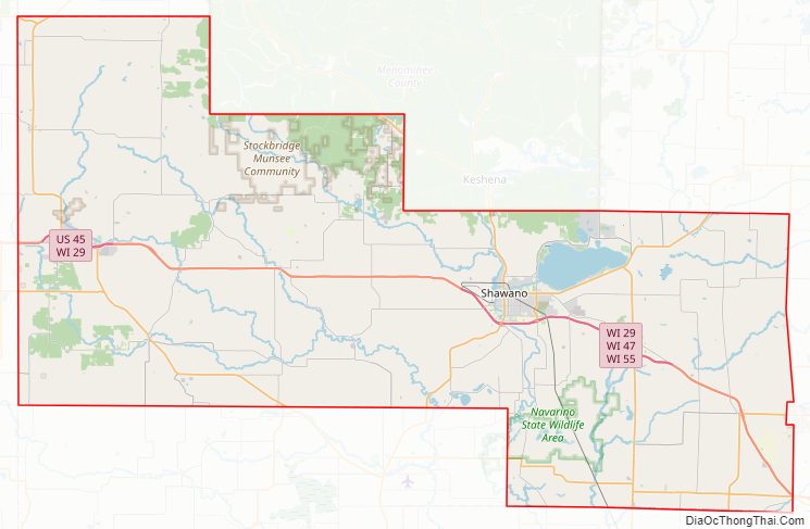
Shawano County Road Map
Geography
According to the U.S. Census Bureau, the county has a total area of 909 square miles (2,350 km), of which 893 square miles (2,310 km) is land and 16 square miles (41 km) (1.8%) is water.
Adjacent counties
- Menominee County – north
- Oconto County – east
- Brown County – southeast
- Outagamie County – south
- Waupaca County – south
- Portage County – southwest
- Marathon County – west
- Langlade County – northwest
Major highways
- U.S. Highway 45
- Highway 22 (Wisconsin)
- Highway 29 (Wisconsin)
- Highway 32 (Wisconsin)
- Highway 47 (Wisconsin)
- Highway 52 (Wisconsin)
- Highway 55 (Wisconsin)
- Highway 110 (Wisconsin)
- Highway 117 (Wisconsin)
- Highway 153 (Wisconsin)
- Highway 156 (Wisconsin)
- Highway 160 (Wisconsin)
- Highway 187 (Wisconsin)
Railroads
- Watco
Buses
- List of intercity bus stops in Wisconsin
Airport
The city and county jointly operate the Shawano Municipal Airport (KEZS) which is located on Shawano Lake.
Shawano County Topographic Map
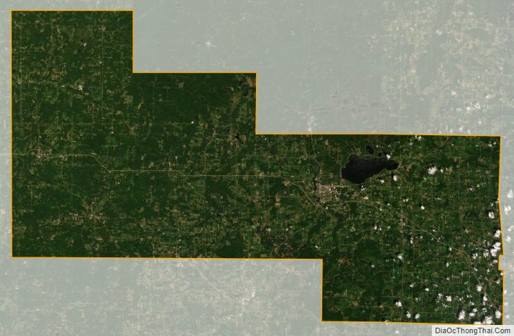
Shawano County Satellite Map
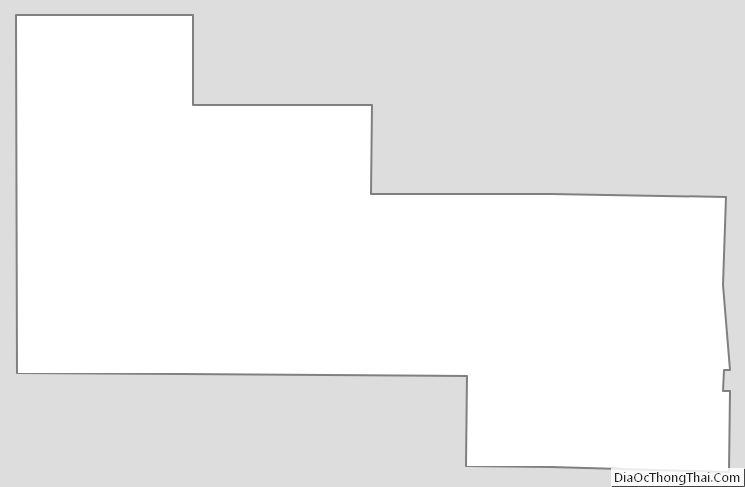
Shawano County Outline Map
See also
Map of Wisconsin State and its subdivision:- Adams
- Ashland
- Barron
- Bayfield
- Brown
- Buffalo
- Burnett
- Calumet
- Chippewa
- Clark
- Columbia
- Crawford
- Dane
- Dodge
- Door
- Douglas
- Dunn
- Eau Claire
- Florence
- Fond du Lac
- Forest
- Grant
- Green
- Green Lake
- Iowa
- Iron
- Jackson
- Jefferson
- Juneau
- Kenosha
- Kewaunee
- La Crosse
- Lafayette
- Lake Michigan
- Lake Superior
- Langlade
- Lincoln
- Manitowoc
- Marathon
- Marinette
- Marquette
- Menominee
- Milwaukee
- Monroe
- Oconto
- Oneida
- Outagamie
- Ozaukee
- Pepin
- Pierce
- Polk
- Portage
- Price
- Racine
- Richland
- Rock
- Rusk
- Saint Croix
- Sauk
- Sawyer
- Shawano
- Sheboygan
- Taylor
- Trempealeau
- Vernon
- Vilas
- Walworth
- Washburn
- Washington
- Waukesha
- Waupaca
- Waushara
- Winnebago
- Wood
- Alabama
- Alaska
- Arizona
- Arkansas
- California
- Colorado
- Connecticut
- Delaware
- District of Columbia
- Florida
- Georgia
- Hawaii
- Idaho
- Illinois
- Indiana
- Iowa
- Kansas
- Kentucky
- Louisiana
- Maine
- Maryland
- Massachusetts
- Michigan
- Minnesota
- Mississippi
- Missouri
- Montana
- Nebraska
- Nevada
- New Hampshire
- New Jersey
- New Mexico
- New York
- North Carolina
- North Dakota
- Ohio
- Oklahoma
- Oregon
- Pennsylvania
- Rhode Island
- South Carolina
- South Dakota
- Tennessee
- Texas
- Utah
- Vermont
- Virginia
- Washington
- West Virginia
- Wisconsin
- Wyoming