Sheboygan County is a county in the U.S. state of Wisconsin. It is named after the Sheboygan River. As of the 2020 census, the population was 118,034. Its county seat is Sheboygan. The county was created in 1836 and organized in 1846. At the time, it was located in the Wisconsin Territory. Sheboygan County comprises the Sheboygan, WI Metropolitan Statistical Area. Part of the Holyland region is located in northwestern Sheboygan County.
| Name: | Sheboygan County |
|---|---|
| FIPS code: | 55-117 |
| State: | Wisconsin |
| Named for: | Sheboygan River |
| Largest city: | Sheboygan |
| Total Area: | 1,271 sq mi (3,290 km²) |
| Land Area: | 511 sq mi (1,320 km²) |
| Total Population: | 118,034 |
| Population Density: | 93/sq mi (36/km²) |
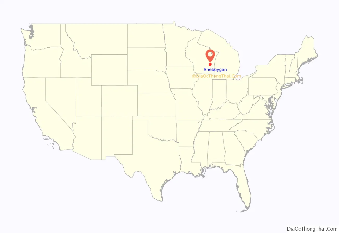
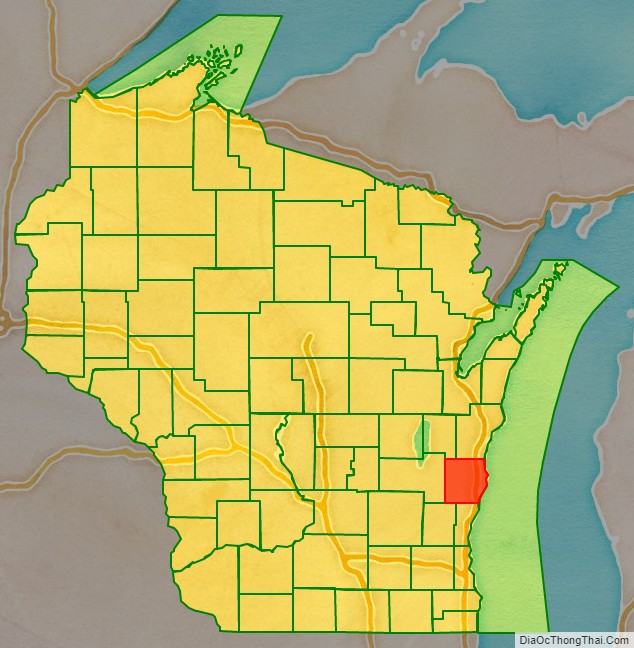
Sheboygan County location map. Where is Sheboygan County?
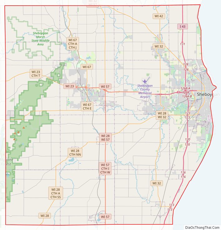
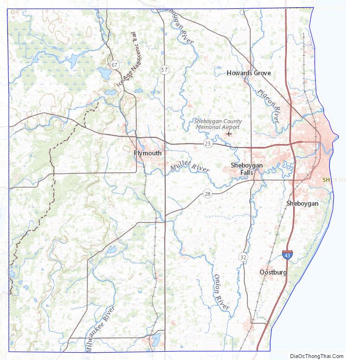
Sheboygan County Road Map
Geography
According to the U.S. Census Bureau, the county has a total area of 1,271 square miles (3,290 km), of which 511 square miles (1,320 km) is land and 760 square miles (2,000 km) (60%) is water.
Major highways
- Interstate 43
- Highway 23 (Wisconsin)
- Highway 28 (Wisconsin)
- Highway 32 (Wisconsin)
- Highway 42 (Wisconsin)
- Highway 57 (Wisconsin)
- Highway 67 (Wisconsin)
- Highway 144 (Wisconsin)
Railroads
- Union Pacific
- Wisconsin and Southern Railroad
Buses
- Shoreline Metro
- List of intercity bus stops in Wisconsin
Airport
Sheboygan County Memorial Airport (KSBM), serves the county and surrounding communities.
Adjacent counties
- Manitowoc County – north
- Ozaukee County – south
- Washington County – southwest
- Fond du Lac County – west
- Calumet County – northwest
Sheboygan County Topographic Map
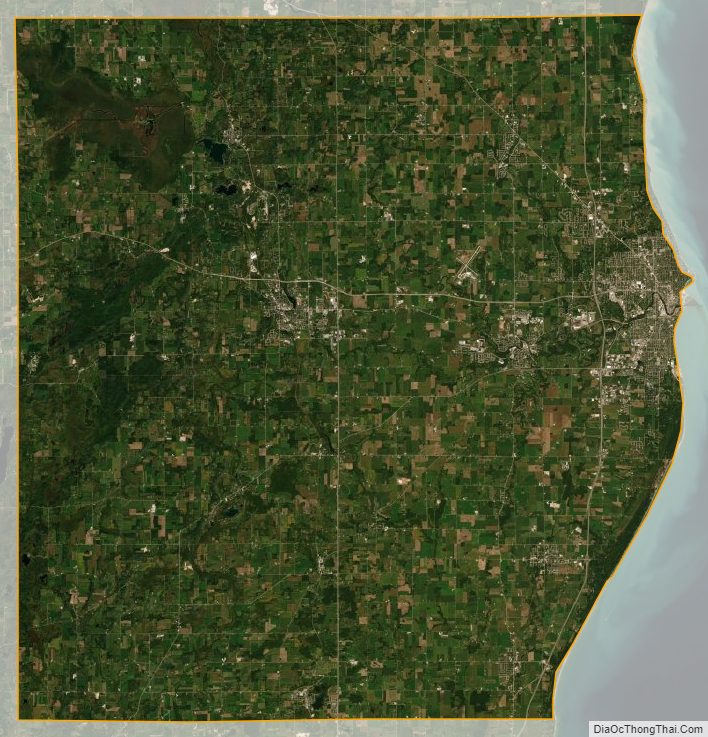
Sheboygan County Satellite Map
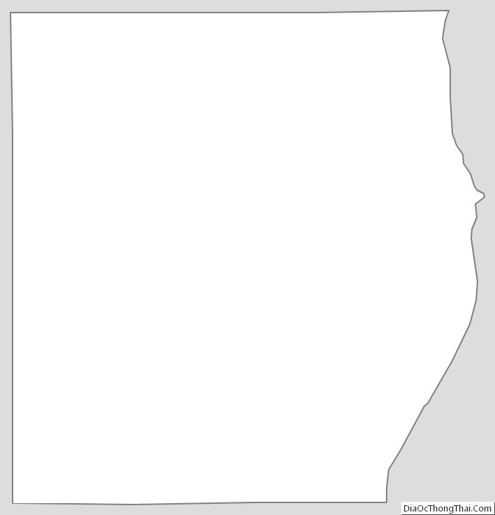
Sheboygan County Outline Map
See also
Map of Wisconsin State and its subdivision:- Adams
- Ashland
- Barron
- Bayfield
- Brown
- Buffalo
- Burnett
- Calumet
- Chippewa
- Clark
- Columbia
- Crawford
- Dane
- Dodge
- Door
- Douglas
- Dunn
- Eau Claire
- Florence
- Fond du Lac
- Forest
- Grant
- Green
- Green Lake
- Iowa
- Iron
- Jackson
- Jefferson
- Juneau
- Kenosha
- Kewaunee
- La Crosse
- Lafayette
- Lake Michigan
- Lake Superior
- Langlade
- Lincoln
- Manitowoc
- Marathon
- Marinette
- Marquette
- Menominee
- Milwaukee
- Monroe
- Oconto
- Oneida
- Outagamie
- Ozaukee
- Pepin
- Pierce
- Polk
- Portage
- Price
- Racine
- Richland
- Rock
- Rusk
- Saint Croix
- Sauk
- Sawyer
- Shawano
- Sheboygan
- Taylor
- Trempealeau
- Vernon
- Vilas
- Walworth
- Washburn
- Washington
- Waukesha
- Waupaca
- Waushara
- Winnebago
- Wood
- Alabama
- Alaska
- Arizona
- Arkansas
- California
- Colorado
- Connecticut
- Delaware
- District of Columbia
- Florida
- Georgia
- Hawaii
- Idaho
- Illinois
- Indiana
- Iowa
- Kansas
- Kentucky
- Louisiana
- Maine
- Maryland
- Massachusetts
- Michigan
- Minnesota
- Mississippi
- Missouri
- Montana
- Nebraska
- Nevada
- New Hampshire
- New Jersey
- New Mexico
- New York
- North Carolina
- North Dakota
- Ohio
- Oklahoma
- Oregon
- Pennsylvania
- Rhode Island
- South Carolina
- South Dakota
- Tennessee
- Texas
- Utah
- Vermont
- Virginia
- Washington
- West Virginia
- Wisconsin
- Wyoming