Shelby County is a county located in the U.S. state of Kentucky. As of the 2020 census, the population was 48,065. Its county seat is Shelbyville. The county was established in 1792 and named for Isaac Shelby, the first Governor of Kentucky. Shelby County is part of the Louisville/Jefferson County, KY–IN Metropolitan Statistical Area. Shelby County’s motto is “Good Land, Good Living, Good People”.
| Name: | Shelby County |
|---|---|
| FIPS code: | 21-211 |
| State: | Kentucky |
| Founded: | 1792 |
| Named for: | Isaac Shelby |
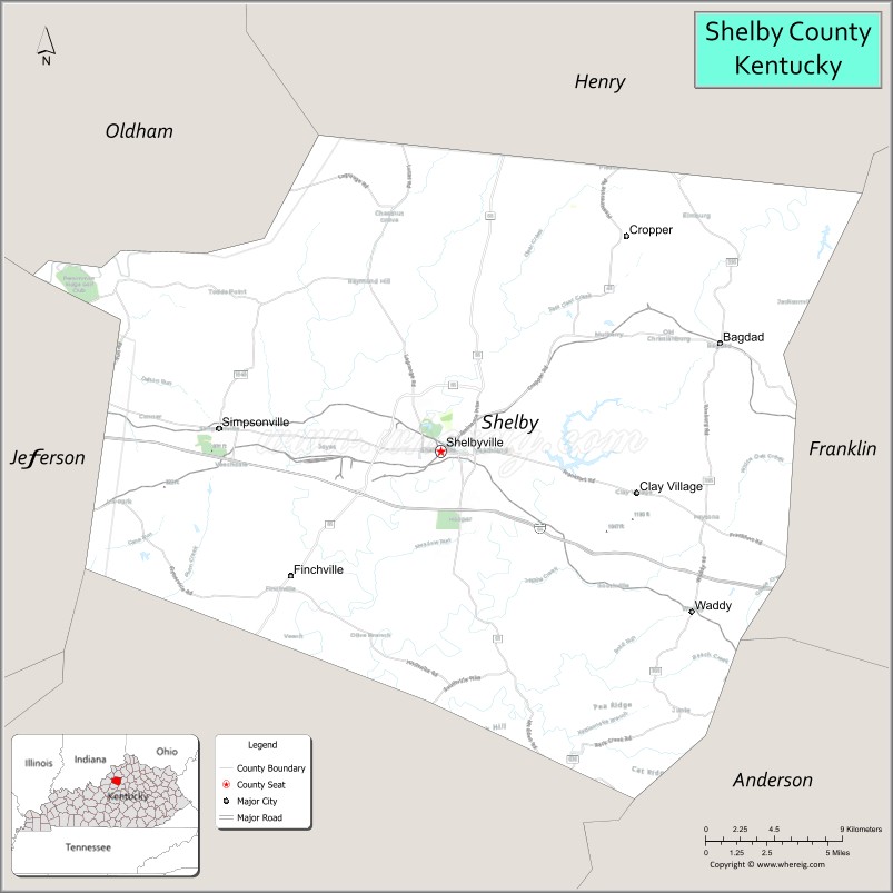
| Seat: | Shelbyville |
| Largest city: | Shelbyville |
| Total Area: | 386 sq mi (1,000 km²) |
| Land Area: | 380 sq mi (1,000 km²) |
| Total Population: | 48,065 |
| Population Density: | 120/sq mi (48/km²) |
| Time zone: | UTC−5 (Eastern) |
| Summer Time Zone (DST): | UTC−4 (EDT) |
| Website: | www.shelbycountykentucky.com |
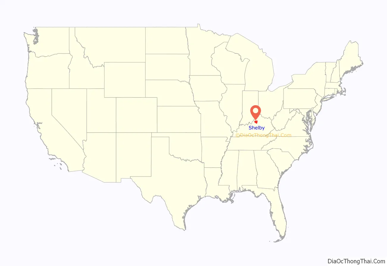
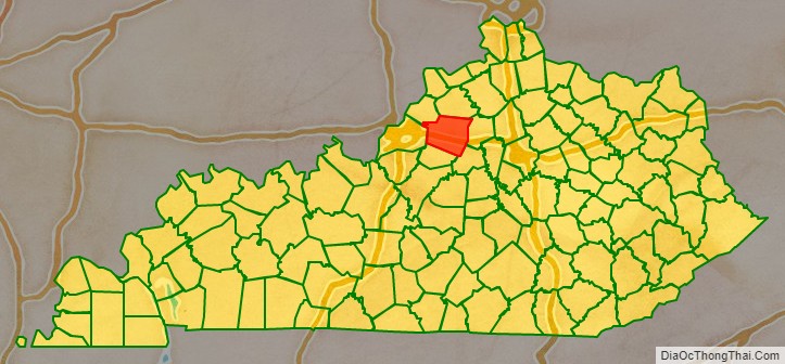
Shelby County location map. Where is Shelby County?
History
Shelby County was founded in 1792 from land given by Jefferson County.
Founding families
One of the earliest families to settle in Shelby County was that of Daniel Ketcham of Washington County, Maryland. Ketcham, who arrived in 1784, had been a soldier in the American Revolution. He had 9 children. His oldest, John Ketcham, moved to Indiana, become involved in politics, and laid the groundwork for the creation of Indiana University.
Another early settler was Thomas Mitchell, who also moved to Shelby County in 1784. Mitchell was born on December 16, 1777, in Augusta County, Virginia. He married Rebecca Ketcham, daughter of Daniel Ketcham, and settled near the headwaters of South Fork Clear Creek (or Mulberry Creek). Mitchell was commissioned an ensign in the 18th Regiment of Militia and on January 4, 1801, Governor James Garrard became a captain in the 18th Regiment. Mitchell was a minister of the Methodist Church and served in the War of 1812.
Sale of alcohol
Shelby County was historically a prohibition or completely dry county, but the city of Shelbyville is now wet (i.e., allows retail alcohol sales), and the county has voted wet and now allows package sales (7 days a week) and restaurants outside Shelbyville to sell alcoholic beverages by the drink if they seat at least 100 patrons and derive at least 70% of their total sales from food. Today, Shelby County is officially classified by the Kentucky Office of Alcoholic Beverage Control as a wet county.
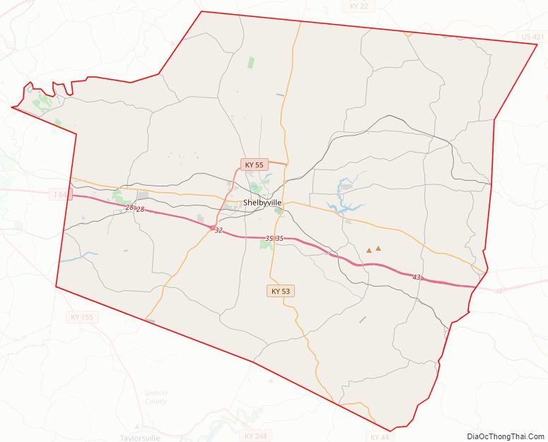
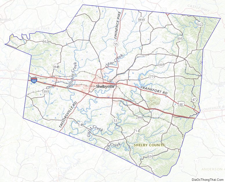
Shelby County Road Map
Geography
According to the United States Census Bureau, the county has a total area of 386 square miles (1,000 km), of which 380 square miles (980 km) is land and 6.0 square miles (16 km) (1.6%) is water. Jeptha Knob at 1,188 feet (362 m) is the highest point in the Louisville area. Guist Creek Lake and Marina offers 325 acres of fishing.
Adjacent counties
- Henry County (north)
- Franklin County (east)
- Anderson County (southeast)
- Spencer County (southwest)
- Jefferson County (west)
- Oldham County (northwest)
Major highways
- I-64
- US 60
- US 421
- KY 53
- KY 55
Shelby County Topographic Map
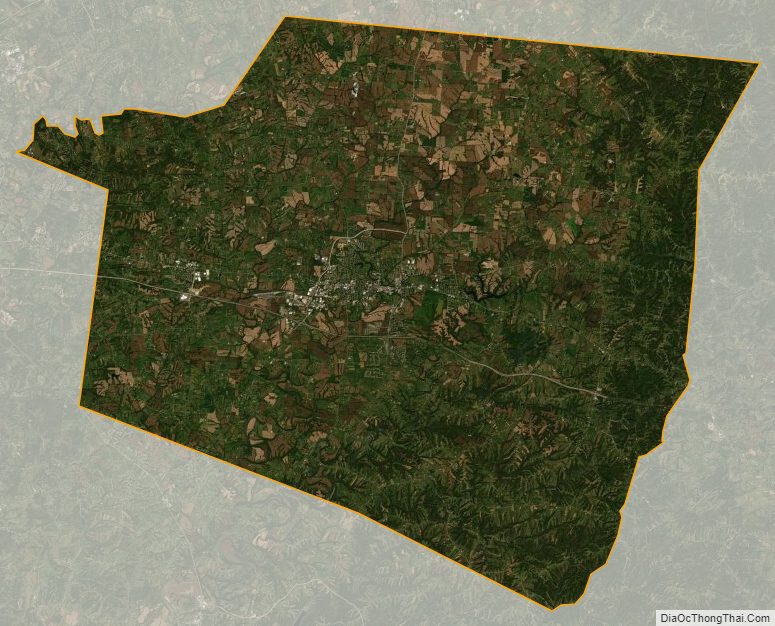
Shelby County Satellite Map
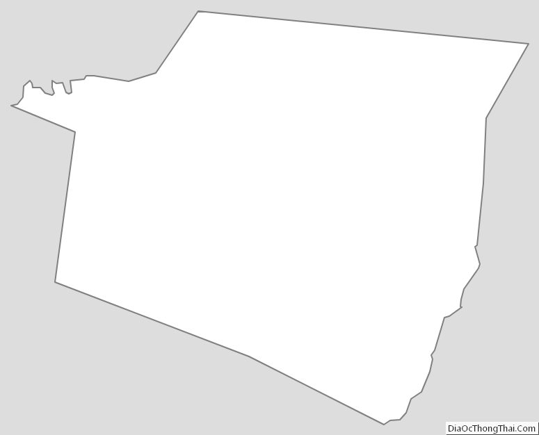
Shelby County Outline Map
See also
Map of Kentucky State and its subdivision:- Adair
- Allen
- Anderson
- Ballard
- Barren
- Bath
- Bell
- Boone
- Bourbon
- Boyd
- Boyle
- Bracken
- Breathitt
- Breckinridge
- Bullitt
- Butler
- Caldwell
- Calloway
- Campbell
- Carlisle
- Carroll
- Carter
- Casey
- Christian
- Clark
- Clay
- Clinton
- Crittenden
- Cumberland
- Daviess
- Edmonson
- Elliott
- Estill
- Fayette
- Fleming
- Floyd
- Franklin
- Fulton
- Gallatin
- Garrard
- Grant
- Graves
- Grayson
- Green
- Greenup
- Hancock
- Hardin
- Harlan
- Harrison
- Hart
- Henderson
- Henry
- Hickman
- Hopkins
- Jackson
- Jefferson
- Jessamine
- Johnson
- Kenton
- Knott
- Knox
- Larue
- Laurel
- Lawrence
- Lee
- Leslie
- Letcher
- Lewis
- Lincoln
- Livingston
- Logan
- Lyon
- Madison
- Magoffin
- Marion
- Marshall
- Martin
- Mason
- McCracken
- McCreary
- McLean
- Meade
- Menifee
- Mercer
- Metcalfe
- Monroe
- Montgomery
- Morgan
- Muhlenberg
- Nelson
- Nicholas
- Ohio
- Oldham
- Owen
- Owsley
- Pendleton
- Perry
- Pike
- Powell
- Pulaski
- Robertson
- Rockcastle
- Rowan
- Russell
- Scott
- Shelby
- Simpson
- Spencer
- Taylor
- Todd
- Trigg
- Trimble
- Union
- Warren
- Washington
- Wayne
- Webster
- Whitley
- Wolfe
- Woodford
- Alabama
- Alaska
- Arizona
- Arkansas
- California
- Colorado
- Connecticut
- Delaware
- District of Columbia
- Florida
- Georgia
- Hawaii
- Idaho
- Illinois
- Indiana
- Iowa
- Kansas
- Kentucky
- Louisiana
- Maine
- Maryland
- Massachusetts
- Michigan
- Minnesota
- Mississippi
- Missouri
- Montana
- Nebraska
- Nevada
- New Hampshire
- New Jersey
- New Mexico
- New York
- North Carolina
- North Dakota
- Ohio
- Oklahoma
- Oregon
- Pennsylvania
- Rhode Island
- South Carolina
- South Dakota
- Tennessee
- Texas
- Utah
- Vermont
- Virginia
- Washington
- West Virginia
- Wisconsin
- Wyoming