Sherburne County is a county in Central Minnesota. At the 2020 census, the population was 97,183. The county seat is Elk River.
Sherburne County is included in the Minneapolis–St. Paul–Bloomington, MN-WI Metropolitan Statistical Area.
| Name: | Sherburne County |
|---|---|
| FIPS code: | 27-141 |
| State: | Minnesota |
| Founded: | February 25, 1856 |
| Named for: | Moses Sherburne |
| Seat: | Elk River |
| Largest city: | Elk River |
| Total Area: | 451 sq mi (1,170 km²) |
| Land Area: | 433 sq mi (1,120 km²) |
| Total Population: | 97,183 |
| Population Density: | 225/sq mi (87/km²) |
| Time zone: | UTC−6 (Central) |
| Summer Time Zone (DST): | UTC−5 (CDT) |
| Website: | www.co.sherburne.mn.us |
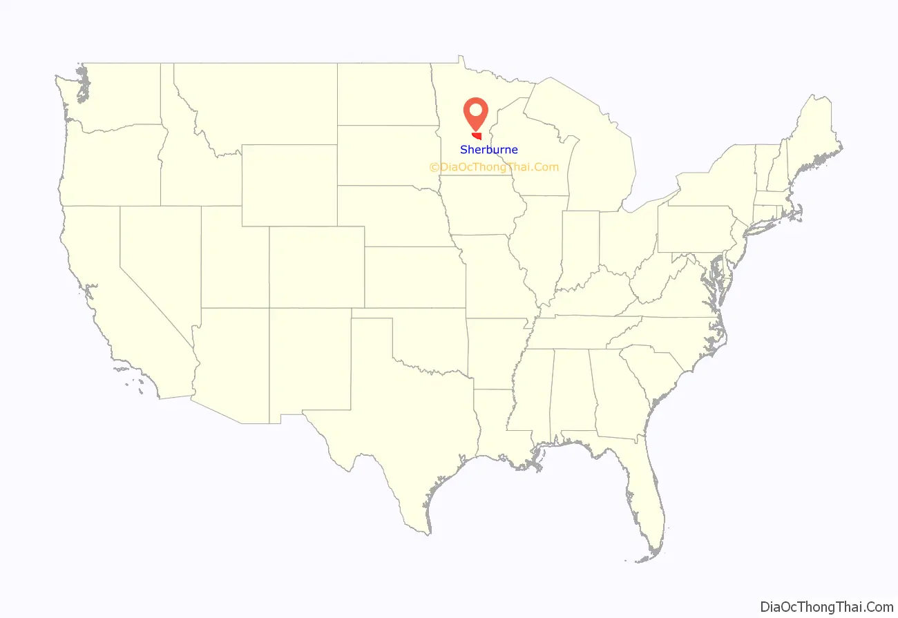
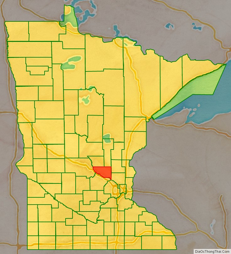
Sherburne County location map. Where is Sherburne County?
History
The Wisconsin Territory was established by the federal government effective 3 July 1836, and existed until its eastern portion was granted statehood (as Wisconsin) in 1848. Therefore, the federal government set up the Minnesota Territory effective March 3, 1849. The newly organized territorial legislature created nine counties across the territory in October of that year. One of those original counties, Benton, had its southern section partitioned off on 25 February 1856 to form a new county. It was named Sherburne, to recognize Moses Sherburne (1808-1868), a prominent area attorney, associate justice of the Supreme Court of the Minnesota Territory (1853-1857), who retired to the county and spent his final year of life there (in Orono).
The area now delineated by Big Lake Township was first settled in 1848; the small village was named Humboldt. When the county creation was announced in 1856, Humboldt was named the county seat. The area now covered by Elk River was also first settled in 1848. Two villages grew up, fairly close together: Orono (platted 1855); and Elk River Village (platted 1865). Their growth was such that by 1867 a county vote moved the county seat from Humboldt to Elk River (designated as “The Lower Town” in the vote, to distinguish it from nearby Orono. The two villages merged under the name ‘Elk River’ in 1881). Also in 1867, the village of Humboldt changed its name to Big Lake.
The boundaries of Sherburne County have remained as created since 1856.
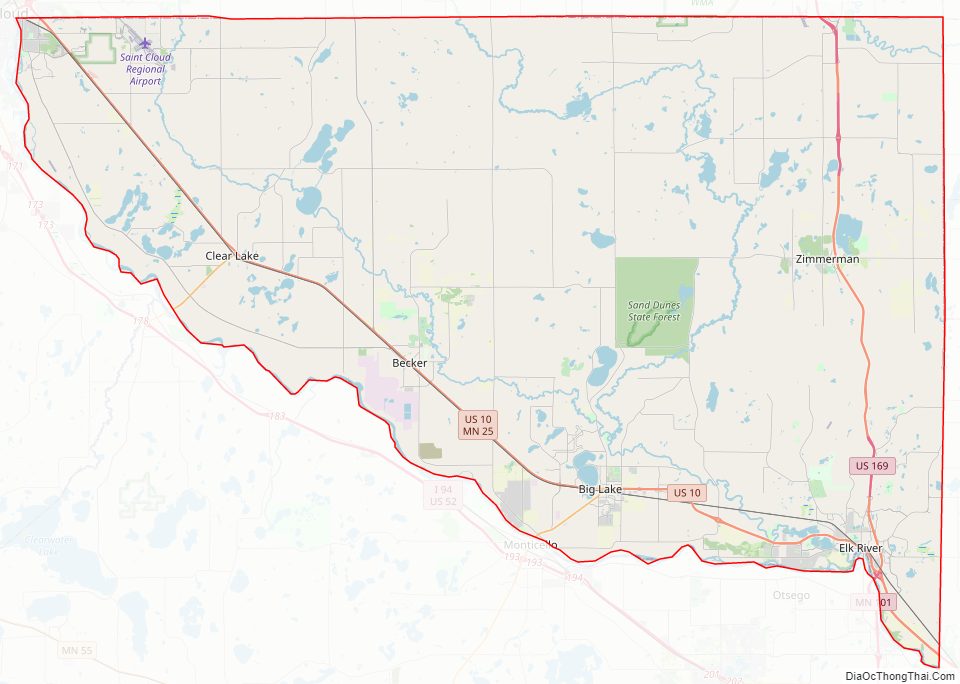
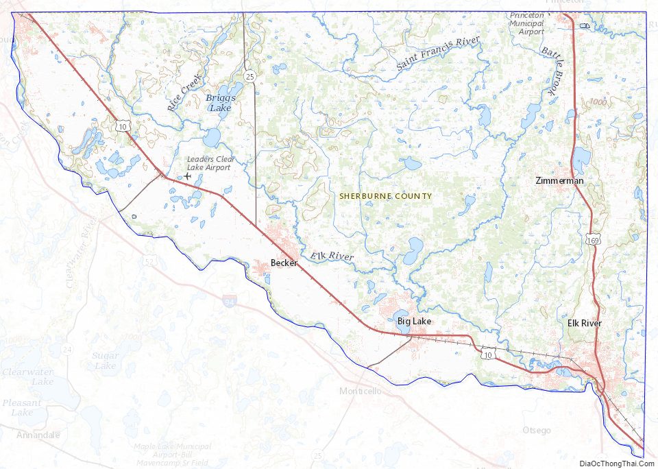
Sherburne County Road Map
Geography
The Mississippi River flows southeast along the county’s south border. The Rum River flows southeast through the county’s upper east portion. The Elk River rises in nearby Benton County, and flows south-southeast through the western and southern part of Sherburne County, discharging into the Mississippi at Elk River. The Saint Francis River also rises in Benton and flows southward through the central part of Sherburne County, discharging into the Elk just north of Big Lake.
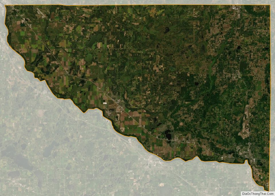
The terrain of Sherburne County consists of low rolling hills, partially wooded, heavily sprinkled with lakes, ponds and depressions. The soil of Sherburne County contains considerable sand and gravel due to glacial activity in past epochs, and thus is less suitable for agriculture than much of Minnesota. The county terrain slopes to the south and east. The county’s highest point lies 3 miles (5 km) east-southeast of Saint Cloud, at 1,110′ (338m) ASL. The county has a total area of 451 square miles (1,170 km), of which 433 square miles (1,120 km) is land and 18 square miles (47 km) (4.0%) is water.
Major highways
- U.S. Highway 10
- U.S. Highway 169
- Minnesota State Highway 24
- Minnesota State Highway 25
- Minnesota State Highway 101
- Minnesota State Highway 301
Airports
- Leaders Clear Lake Airport (8Y6) – one mile (1.6 km) east of Clear Lake
- Princeton Municipal Airport (PNM) – at SW edge of Princeton (on border between Mille Lacs and Sherburne counties)
- St. Cloud Regional Airport (STC) – two miles (3 km) east of Saint Cloud
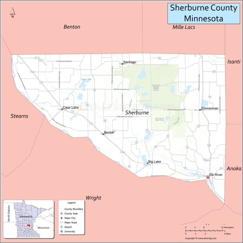
Adjacent counties
- Mille Lacs County – north
- Isanti County – northeast
- Anoka County – east
- Hennepin County – southeast
- Wright County – southwest
- Stearns County – west
- Benton County – northwest
Protected areas
- Bridgeview Park Reserve
- Clear Lake Scientific and Natural Area
- Fremont Wildlife Management Area
- Grams Regional Park
- Harry W. Cater Homestead Prairie Scientific and Natural Area
- Island View Regional Park
- Oak Savanna Park
- Rice Lake Savanna Scientific and Natural Area
- Sand Dunes State Forest
- Sand Prairie Wildlife Management Area
- Sherburne National Wildlife Refuge
- Uncas Dunes Scientific and Natural Area
- William H. Houlton Conservation Area
Sherburne County Topographic Map
Sherburne County Satellite Map
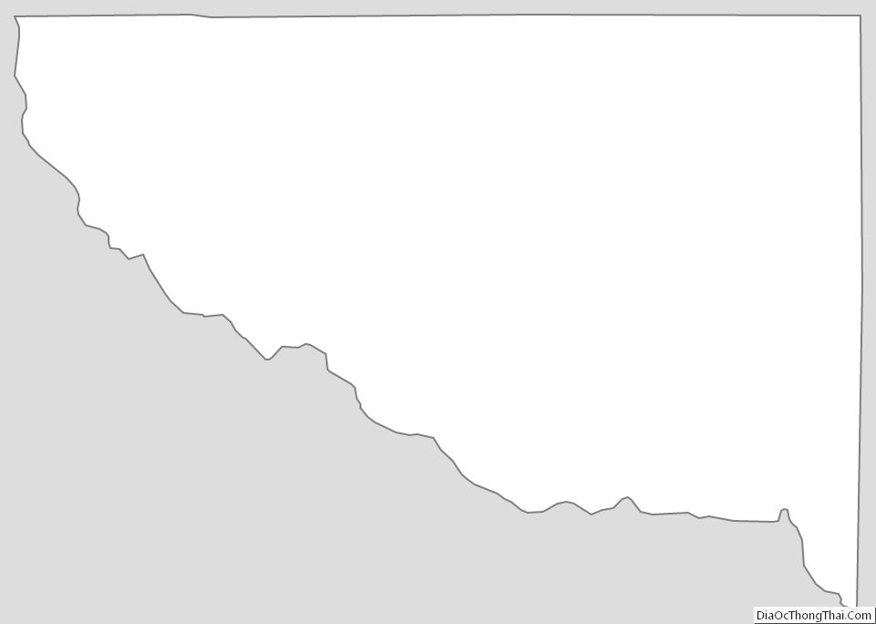
Sherburne County Outline Map
See also
Map of Minnesota State and its subdivision:- Aitkin
- Anoka
- Becker
- Beltrami
- Benton
- Big Stone
- Blue Earth
- Brown
- Carlton
- Carver
- Cass
- Chippewa
- Chisago
- Clay
- Clearwater
- Cook
- Cottonwood
- Crow Wing
- Dakota
- Dodge
- Douglas
- Faribault
- Fillmore
- Freeborn
- Goodhue
- Grant
- Hennepin
- Houston
- Hubbard
- Isanti
- Itasca
- Jackson
- Kanabec
- Kandiyohi
- Kittson
- Koochiching
- Lac qui Parle
- Lake
- Lake of the Woods
- Lake Superior
- Le Sueur
- Lincoln
- Lyon
- Mahnomen
- Marshall
- Martin
- McLeod
- Meeker
- Mille Lacs
- Morrison
- Mower
- Murray
- Nicollet
- Nobles
- Norman
- Olmsted
- Otter Tail
- Pennington
- Pine
- Pipestone
- Polk
- Pope
- Ramsey
- Red Lake
- Redwood
- Renville
- Rice
- Rock
- Roseau
- Saint Louis
- Scott
- Sherburne
- Sibley
- Stearns
- Steele
- Stevens
- Swift
- Todd
- Traverse
- Wabasha
- Wadena
- Waseca
- Washington
- Watonwan
- Wilkin
- Winona
- Wright
- Yellow Medicine
- Alabama
- Alaska
- Arizona
- Arkansas
- California
- Colorado
- Connecticut
- Delaware
- District of Columbia
- Florida
- Georgia
- Hawaii
- Idaho
- Illinois
- Indiana
- Iowa
- Kansas
- Kentucky
- Louisiana
- Maine
- Maryland
- Massachusetts
- Michigan
- Minnesota
- Mississippi
- Missouri
- Montana
- Nebraska
- Nevada
- New Hampshire
- New Jersey
- New Mexico
- New York
- North Carolina
- North Dakota
- Ohio
- Oklahoma
- Oregon
- Pennsylvania
- Rhode Island
- South Carolina
- South Dakota
- Tennessee
- Texas
- Utah
- Vermont
- Virginia
- Washington
- West Virginia
- Wisconsin
- Wyoming