Snohomish County (/snoʊˈhoʊmɪʃ/) is a county located in the U.S. state of Washington. With a population of 827,957 as of the 2020 census, it is the third-most populous county in Washington, after nearby King and Pierce counties, and the 75th-most populous in the United States. The county seat and largest city is Everett. The county forms part of the Seattle metropolitan area, which also includes King and Pierce counties to the south.
The county’s western portion, facing Puget Sound and other inland waters of the Salish Sea, is home to the majority of its population and major cities. The eastern portion is rugged and includes portions of the Cascade Range, with few settlements along major rivers and most of it designated as part of Mount Baker–Snoqualmie National Forest. Snohomish County is bound to the north by Skagit County, to the east by Chelan County, to the south by King County, and to the west by Kitsap and Island counties.
Snohomish County was created out of Island County on January 14, 1861, and is named for the indigenous Snohomish people. It includes the Tulalip Indian Reservation, which was established by the 1855 Point Elliott Treaty, which relocated several indigenous Coast Salish groups to the reservation. The county seat was originally at the city of Snohomish until an 1897 election moved it to Everett. Since the mid-20th century, areas of Snohomish County have developed into an aerospace manufacturing center, largely due to the presence of Boeing in Everett, as well as bedroom communities for workers in Seattle.
Snohomish County now has 18 incorporated cities and 2 towns with their own local governments, in addition to developed unincorporated areas. It is connected to nearby areas by roads (including Interstate 5), railways, and transit systems. The county government is led by a five-member county council and chief executive elected by voters to four-year terms.
| Name: | Snohomish County |
|---|---|
| FIPS code: | 53-061 |
| State: | Washington |
| Founded: | January 14, 1861 |
| Named for: | the Snohomish people |
| Seat: | Everett |
| Largest city: | Everett |
| Total Area: | 2,196 sq mi (5,690 km²) |
| Land Area: | 2,087 sq mi (5,410 km²) |
| Total Population: | 827,957 |
| Population Density: | 384/sq mi (148/km²) |
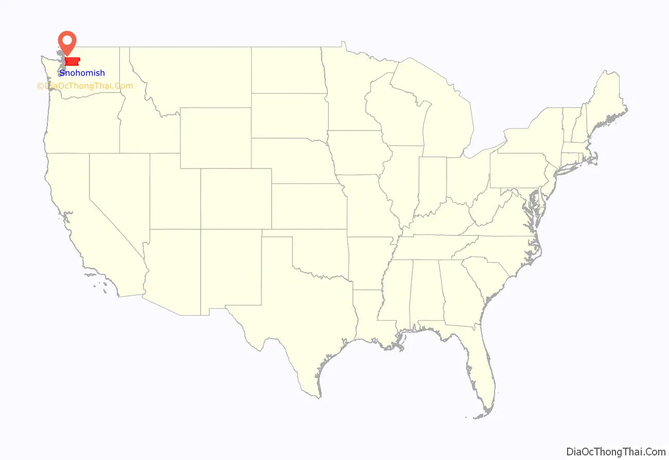
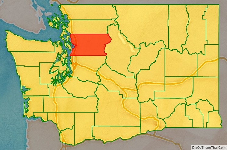
Snohomish County location map. Where is Snohomish County?
History
Snohomish County was originally inhabited by several Coast Salish groups, predominantly settled along the western coastline and near the region’s rivers. The Snohomish were the largest group and occupied an area from present-day Warm Beach to Shoreline, while Stillaguamish lived in the Stillaguamish River basin. The region was first charted and named by European explorers in the late 18th century, beginning with Captain George Vancouver and his British expedition. Vancouver arrived in Puget Sound and Port Gardner Bay on June 4, 1792, landing near present-day Everett.
The Treaty of Point Elliott was signed at present-day Mukilteo on January 22, 1855, marking the cession of Coast Salish territories in the Puget Sound lowlands. The Tulalip Indian Reservation was established to house the remaining tribes, including the Snohomish, Snoqualmie, and Skykomish. Snohomish County was created out of Island County on January 14, 1861.
The territorial legislature designated Mukilteo, the area’s largest settlement, as the temporary county seat in January 1861. The county government was permanently moved to Cadyville, later Snohomish, in July of that year. After the incorporation of the city of Everett in 1893, the city’s leaders attempted to move the county seat from Snohomish. A countywide general election on November 6, 1894, chose to relocate the county seat to Everett, amid controversy and allegations of illegal votes. After two years of litigation between the cities of Snohomish and Everett, the county seat was officially relocated to Everett in December 1896.
One of the first county censuses was taken in 1862 by Sheriff Salem A. Woods.
Early important pioneers in the Snohomish County region included E. F. Cady of Snohomish, E. C. Ferguson of Snohomish and Isaac Cathcart.
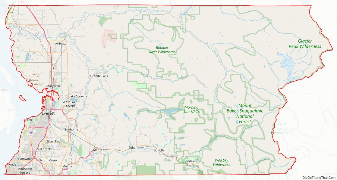
Snohomish County Road Map
Geography
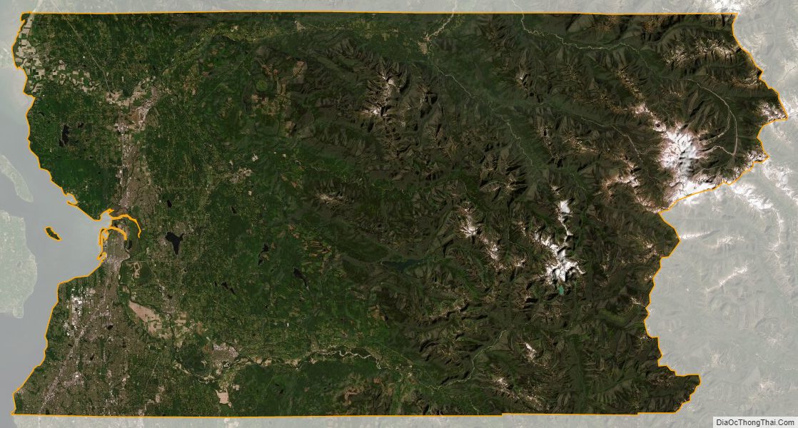
Snohomish County is part of the Puget Sound region of Western Washington, bordered to the south by King County, to the west by Puget Sound and other inland waters, to the north by Skagit County, and to the east by the Chelan County at the crest of the Cascade Range. According to the U.S. Census Bureau, the county has a total square area of approximately 2,196 square miles (5,690 km), of which 2,087 square miles (5,410 km) is land and 109 square miles (280 km), or 5.0%, is water. It is the 13th largest county in Washington by land area and is larger than the states of Delaware and Rhode Island.
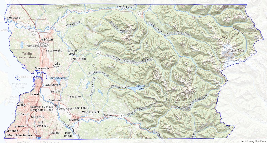
The county’s surface is covered by plains and rolling hills in the west, where the majority of settlements are, and mountainous terrain in the east. The Cascade Range passes through the eastern part of the county and is largely protected from development as part of the Mount Baker–Snoqualmie National Forest. The mountain range includes the highest point in Snohomish County: Glacier Peak, at 10,541 feet (3,212.90 m) above sea level. Several major rivers originate in the Cascades and flow west towards Puget Sound and other parts of the Salish Sea, including the Stillaguamish and Snohomish (fed by the Skykomish and Snoqualmie rivers). These rivers form several valleys used for agriculture that occasionally flood during major weather events, such as atmospheric rivers.
Climate
The lowland areas of western Snohomish County generally has a temperate Mediterranean climate similar to the rest of the central Puget Sound region with dry summers and wet winters. The county’s weather is heavily influenced by maritime systems, pushed by prevailing westerly winds but dampened by the Olympic Mountains. The mean monthly temperatures for the county range from 20 to 40 °F (−7 to 4 °C) during the winter and 55 to 65 °F (13 to 18 °C) in the summer. The record highest temperatures were set during a June 2021 heat wave, with highs of up to 109 °F (43 °C) recorded in several areas. Annual precipitation ranges from 35 inches (89 cm) in the west to 180 inches (460 cm) in the upper elevations of the Cascades; the majority of the region’s precipitation falls between October and March. The county’s lowlands also has an average annual snowfall ranging from 10 to 20 inches (25 to 51 cm). The Puget Sound Convergence Zone, a known meteorological phenomenon, runs through southwestern Snohomish County and causes narrow bands of precipitation.
Flora and fauna
Approximately 68 percent of land in Snohomish County is classified as forestland, which is predominantly located in the eastern portions. These forests are dominated by conifer species such as Douglas firs, hemlocks, and cedars, with pockets of deciduous species in logged areas.
Snohomish County Topographic Map
Snohomish County Satellite Map
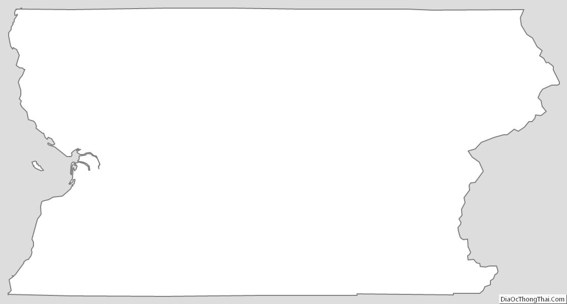
Snohomish County Outline Map
See also
Map of Washington State and its subdivision:- Adams
- Asotin
- Benton
- Chelan
- Clallam
- Clark
- Columbia
- Cowlitz
- Douglas
- Ferry
- Franklin
- Garfield
- Grant
- Grays Harbor
- Island
- Jefferson
- King
- Kitsap
- Kittitas
- Klickitat
- Lewis
- Lincoln
- Mason
- Okanogan
- Pacific
- Pend Oreille
- Pierce
- San Juan
- Skagit
- Skamania
- Snohomish
- Spokane
- Stevens
- Thurston
- Wahkiakum
- Walla Walla
- Whatcom
- Whitman
- Yakima
- Alabama
- Alaska
- Arizona
- Arkansas
- California
- Colorado
- Connecticut
- Delaware
- District of Columbia
- Florida
- Georgia
- Hawaii
- Idaho
- Illinois
- Indiana
- Iowa
- Kansas
- Kentucky
- Louisiana
- Maine
- Maryland
- Massachusetts
- Michigan
- Minnesota
- Mississippi
- Missouri
- Montana
- Nebraska
- Nevada
- New Hampshire
- New Jersey
- New Mexico
- New York
- North Carolina
- North Dakota
- Ohio
- Oklahoma
- Oregon
- Pennsylvania
- Rhode Island
- South Carolina
- South Dakota
- Tennessee
- Texas
- Utah
- Vermont
- Virginia
- Washington
- West Virginia
- Wisconsin
- Wyoming