Stanley County is a county in the U.S. state of South Dakota. As of the 2020 census, the population was 2,980. Its county seat is Fort Pierre. The county was created in 1873, and was organized in 1890. It is named for David S. Stanley, a commander at Fort Sully from 1866 to 1874, which was located nearby.
Stanley County is included in the Pierre, SD Micropolitan Statistical Area.
| Name: | Stanley County |
|---|---|
| FIPS code: | 46-117 |
| State: | South Dakota |
| Founded: | 1873 |
| Named for: | David S. Stanley |
| Seat: | Fort Pierre |
| Largest city: | Fort Pierre |
| Total Area: | 1,517 sq mi (3,930 km²) |
| Land Area: | 1,444 sq mi (3,740 km²) |
| Total Population: | 2,980 |
| Population Density: | 2.0/sq mi (0.76/km²) |
| Website: | www.stanleycounty.org |
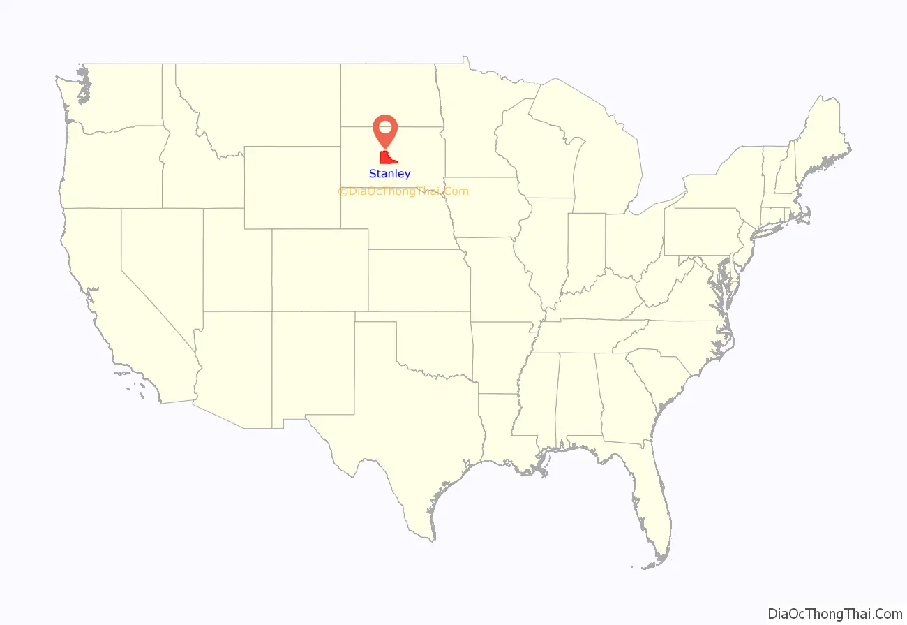
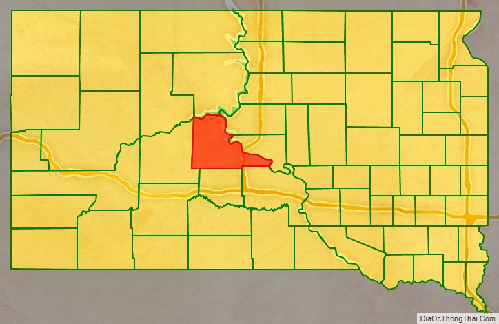
Stanley County location map. Where is Stanley County?
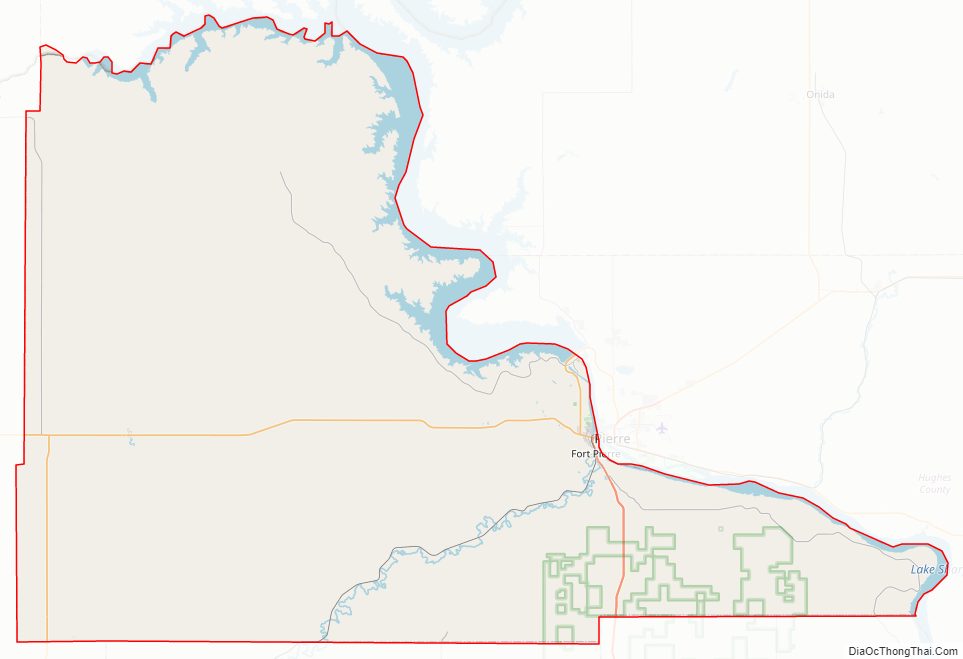
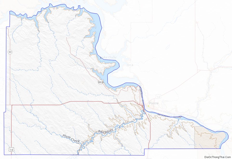
Stanley County Road Map
Geography
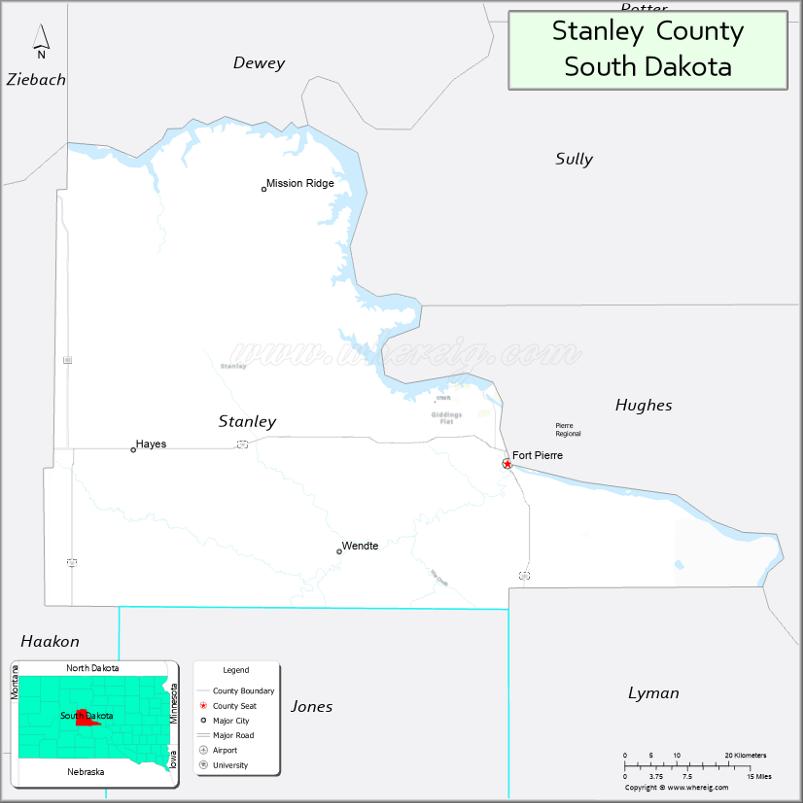
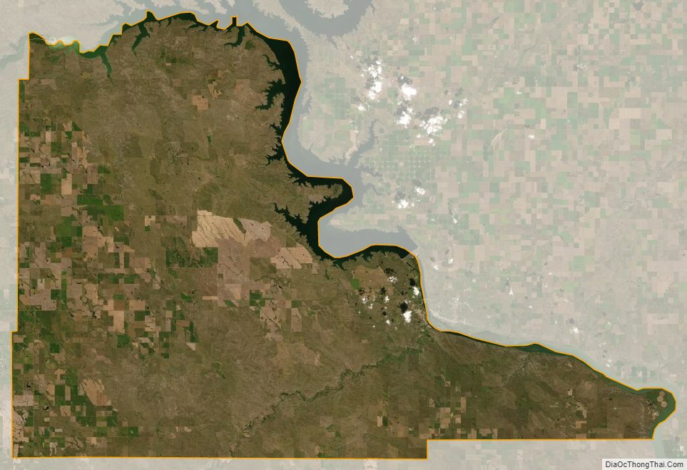
Stanley County’s northwestern boundary is defined by the Cheyenne River which flows eastward, to discharge into the Missouri River at the most northerly point of Stanley County. From there, the county’s northeast boundary is defined by the southeastward-flowing Missouri. The county terrain consists of semi-arid rolling hills, carved by drainages. The area is partially devoted to agriculture. The terrain slopes to the east; its highest point is in the SW county corner, at 2,198′ (670m) ASL. The county has a total area of 1,517 square miles (3,930 km), of which 1,444 square miles (3,740 km) is land and 73 square miles (190 km) (4.8%) is water.
The eastern portion of South Dakota’s counties (48 of 66) observe Central Time; the western counties (18 of 66) observe Mountain Time. Stanley County is on the western end of counties which observe Central Time, and its residents are split east–west in their time observance. Although Fort Pierre, the seat of Stanley County, is located in the Mountain Time Zone, most residents of the city use Central Time because of close social and economic ties with Pierre, which is located in the Central Time Zone.
Major highways
- U.S. Highway 14
- U.S. Highway 83
- South Dakota Highway 34
- South Dakota Highway 63
- South Dakota Highway 1806
Adjacent counties
- Dewey County – north
- Sully County – northeast
- Hughes County – east
- Lyman County – southeast
- Jones County – south
- Haakon County – west
- Ziebach County – northwest
Protected areas
- Antelope Creek State Game Production Area
- Antelope Creek State Lakeside Use Area
- Brush Creek State Game Production Area
- Chantier Creek State Game Production Area
- Chantier Creek State Lakeside Use Area
- Fort George State Game Production Area
- Fort Pierre National Grassland (part)
- Foster Bay State Lakeside Use Area
- Frozen Man Creek State Game Production Area
- Hayes Lake State Game Production Area
- Minneconjou State Game Production Area
- Minneconjou State Lakeside Use Area
- Oahe Downstream State Recreation Area
- Schomer Draw State Game Production Area
- West Shore State Lakeside Use Area
Lakes
- Lake Oahe (part)
- Lake Sharpe (part)
Stanley County Topographic Map
Stanley County Satellite Map
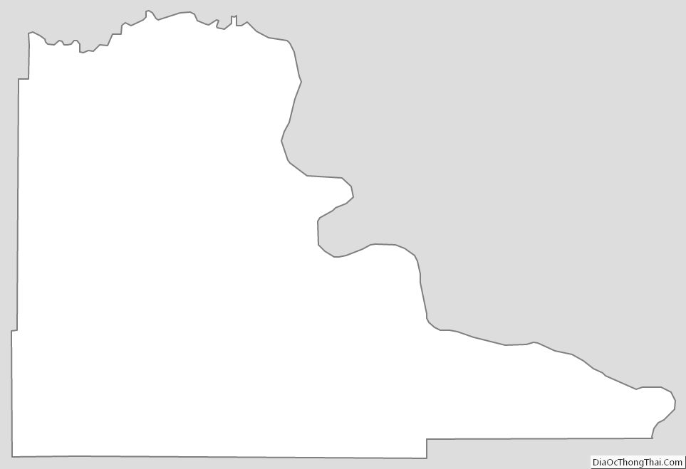
Stanley County Outline Map
See also
Map of South Dakota State and its subdivision:- Aurora
- Beadle
- Bennett
- Bon Homme
- Brookings
- Brown
- Brule
- Buffalo
- Butte
- Campbell
- Charles Mix
- Clark
- Clay
- Codington
- Corson
- Custer
- Davison
- Day
- Deuel
- Dewey
- Douglas
- Edmunds
- Fall River
- Faulk
- Grant
- Gregory
- Haakon
- Hamlin
- Hand
- Hanson
- Harding
- Hughes
- Hutchinson
- Hyde
- Jackson
- Jerauld
- Jones
- Kingsbury
- Lake
- Lawrence
- Lincoln
- Lyman
- Marshall
- McCook
- McPherson
- Meade
- Mellette
- Miner
- Minnehaha
- Moody
- Pennington
- Perkins
- Potter
- Roberts
- Sanborn
- Shannon
- Spink
- Stanley
- Sully
- Todd
- Tripp
- Turner
- Union
- Walworth
- Yankton
- Ziebach
- Alabama
- Alaska
- Arizona
- Arkansas
- California
- Colorado
- Connecticut
- Delaware
- District of Columbia
- Florida
- Georgia
- Hawaii
- Idaho
- Illinois
- Indiana
- Iowa
- Kansas
- Kentucky
- Louisiana
- Maine
- Maryland
- Massachusetts
- Michigan
- Minnesota
- Mississippi
- Missouri
- Montana
- Nebraska
- Nevada
- New Hampshire
- New Jersey
- New Mexico
- New York
- North Carolina
- North Dakota
- Ohio
- Oklahoma
- Oregon
- Pennsylvania
- Rhode Island
- South Carolina
- South Dakota
- Tennessee
- Texas
- Utah
- Vermont
- Virginia
- Washington
- West Virginia
- Wisconsin
- Wyoming