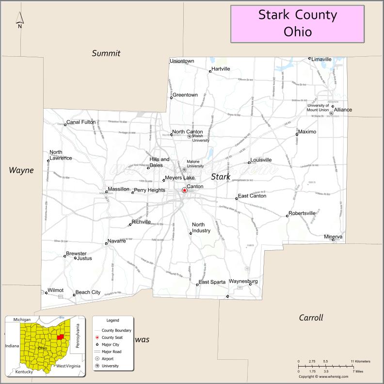
Stark County is a county located in the U.S. state of Ohio. As of the 2020 census, the population was 374,853. Its county seat is Canton. The county was created in 1808 and organized the next year. It is named for John Stark, an officer in the American Revolutionary War.
Stark County is included in the Canton-Massillon, OH Metropolitan Statistical Area, which is also included in the Cleveland-Akron-Canton, OH Combined Statistical Area.
| Name: | Stark County |
|---|---|
| FIPS code: | 39-151 |
| State: | Ohio |
| Founded: | January 1, 1809 |
| Named for: | John Stark |
| Seat: | Canton |
| Largest city: | Canton |
| Total Area: | 581 sq mi (1,500 km²) |
| Land Area: | 575 sq mi (1,490 km²) |
| Total Population: | 374,853 |
| Population Density: | 650/sq mi (250/km²) |
| Time zone: | UTC−5 (Eastern) |
| Summer Time Zone (DST): | UTC−4 (EDT) |
| Website: | www.starkcountyohio.gov |
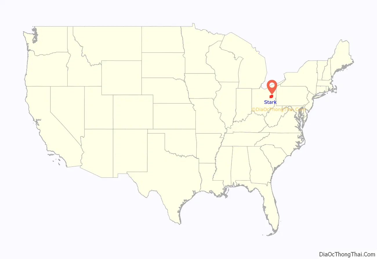
Stark County location map. Where is Stark County?
History
Stark County was named in honor of American Revolutionary War General John Stark. John Stark (August 28, 1728 – May 8, 1822) was a general who served in the American Continental Army during the American Revolutionary War. He became widely known as the “Hero of Bennington” for his exemplary service at the Battle of Bennington in 1777.
In the 1760s and 1770s Moravian missionaries from Pennsylvania came to preach the gospel to the native people, and also to lead and resettle already converted native people migrating away from whites encroaching on their land in Pennsylvania. The earliest of these were Christian Frederick Post and John Heckewelder. See also the history of neighboring Tuscarawas County, Ohio
The first permanent settlements were established in 1805, beginning with Canton. Possibly 80% of the early settlers were German-speakers from Pennsylvania, although others came from Virginia, New York, and New England. Lumbering and sawmills were important early industries, to cater to the enormous demand for lumber from the incoming settlers. Stark County was originally part of Columbiana County, but was split off in 1807.
At the start of the Civil War the men of Stark County were quick to volunteer to preserve the Union. As of 1862 over 1,100 had enlisted.
During the early 20th century, Stark County was an important location in the early development of professional football. The rivalry between the Massillon Tigers and Canton Bulldogs helped bring the Ohio League to prominence in the mid-1900s (decade) and again in the late 1910s. The Bulldogs ended up a charter member of the National Football League, where it played for several years. (The role Stark County had in developing the game is part of the reason the Pro Football Hall of Fame is located in Canton.) Two relatively large football stadiums, Tom Benson Hall of Fame Stadium in Canton and Paul Brown Tiger Stadium in Massillon, are still in use (albeit now mostly for high school football), with Tom Benson Hall of Fame Stadium hosting the NFL’s annual Pro Football Hall of Fame Game each year.
In the later 20th century, Stark County’s voting record swung from one party to another, closely tracking the winner of the U.S. Presidential election. Even within the swing state of Ohio, Stark County is regarded as a quintessential bellwether, and thus presidential candidates have typically made multiple visits to the region. Major media outlets typically pay close attention to the election results in the county. The New York Times in particular has covered the county’s citizens and their voting concerns in a series of features each election cycle for over a decade.
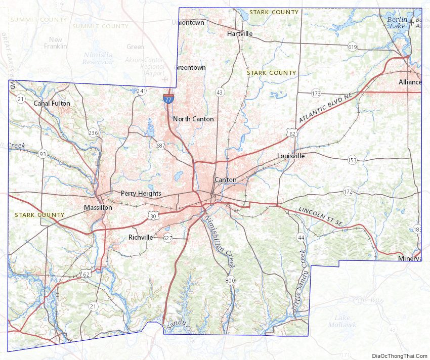
Stark County Road Map
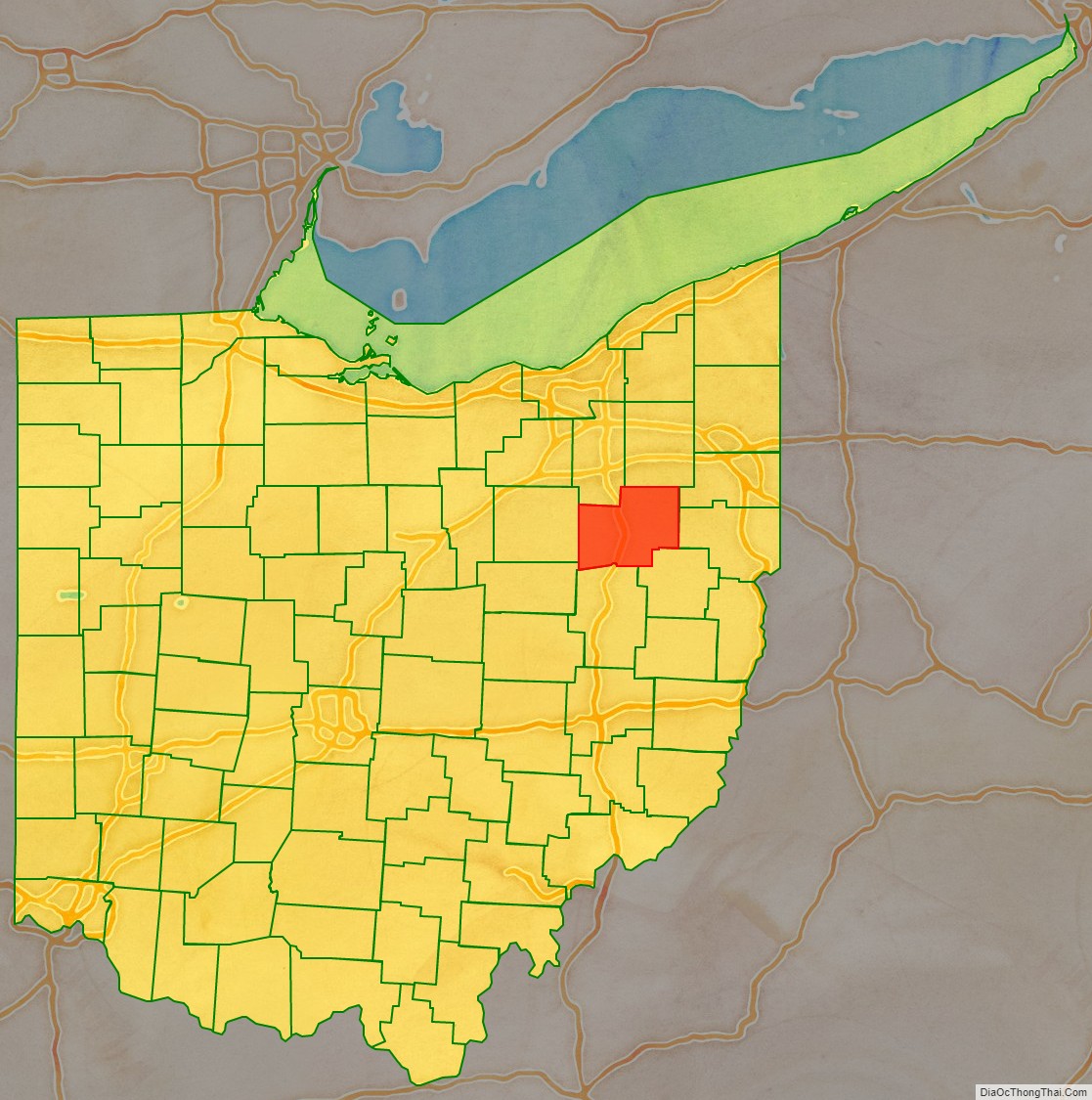
Geography
According to the United States Census Bureau, the county has a total area of 581 square miles (1,500 km), of which 575 square miles (1,490 km) is land and 5.3 square miles (14 km) (0.9%) is water.
Adjacent counties
- Portage County (north)
- Mahoning County (northeast)
- Columbiana County (east)
- Carroll County (southeast)
- Tuscarawas County (south)
- Holmes County (southwest)
- Wayne County (west)
- Summit County (northwest)
Major Highways
- I-77
- US 30
- US 62
- US 250
- SR 21
- SR 43
- SR 44
- SR 93
- SR 153
- SR 172
- SR 173
- SR 183
- SR 212
- SR 236
- SR 241
- SR 297
- SR 619
- SR 627
- SR 687
- SR 800
National protected area
- First Ladies National Historic Site
Stark County Topographic Map
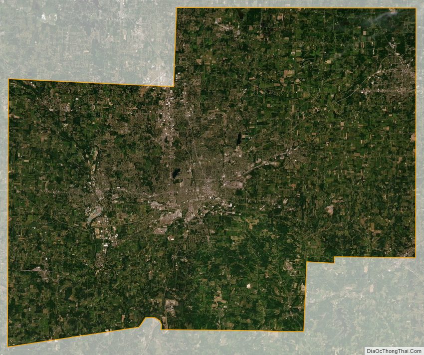
Stark County Satellite Map
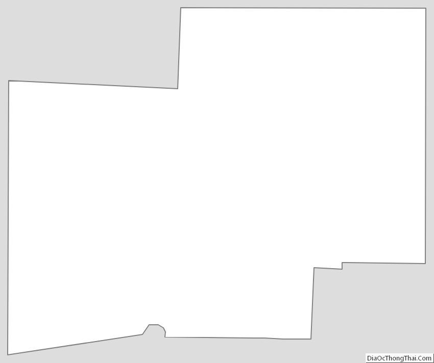
Stark County Outline Map
See also
Map of Ohio State and its subdivision:- Adams
- Allen
- Ashland
- Ashtabula
- Athens
- Auglaize
- Belmont
- Brown
- Butler
- Carroll
- Champaign
- Clark
- Clermont
- Clinton
- Columbiana
- Coshocton
- Crawford
- Cuyahoga
- Darke
- Defiance
- Delaware
- Erie
- Fairfield
- Fayette
- Franklin
- Fulton
- Gallia
- Geauga
- Greene
- Guernsey
- Hamilton
- Hancock
- Hardin
- Harrison
- Henry
- Highland
- Hocking
- Holmes
- Huron
- Jackson
- Jefferson
- Knox
- Lake
- Lake Erie
- Lawrence
- Licking
- Logan
- Lorain
- Lucas
- Madison
- Mahoning
- Marion
- Medina
- Meigs
- Mercer
- Miami
- Monroe
- Montgomery
- Morgan
- Morrow
- Muskingum
- Noble
- Ottawa
- Paulding
- Perry
- Pickaway
- Pike
- Portage
- Preble
- Putnam
- Richland
- Ross
- Sandusky
- Scioto
- Seneca
- Shelby
- Stark
- Summit
- Trumbull
- Tuscarawas
- Union
- Van Wert
- Vinton
- Warren
- Washington
- Wayne
- Williams
- Wood
- Wyandot
- Alabama
- Alaska
- Arizona
- Arkansas
- California
- Colorado
- Connecticut
- Delaware
- District of Columbia
- Florida
- Georgia
- Hawaii
- Idaho
- Illinois
- Indiana
- Iowa
- Kansas
- Kentucky
- Louisiana
- Maine
- Maryland
- Massachusetts
- Michigan
- Minnesota
- Mississippi
- Missouri
- Montana
- Nebraska
- Nevada
- New Hampshire
- New Jersey
- New Mexico
- New York
- North Carolina
- North Dakota
- Ohio
- Oklahoma
- Oregon
- Pennsylvania
- Rhode Island
- South Carolina
- South Dakota
- Tennessee
- Texas
- Utah
- Vermont
- Virginia
- Washington
- West Virginia
- Wisconsin
- Wyoming