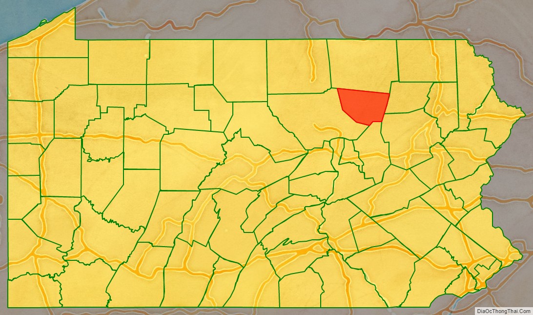
Sullivan County is a county in the Commonwealth of Pennsylvania. It is part of Northeastern Pennsylvania. As of the 2020 census, the population was 5,840, making it the second-least populous county in Pennsylvania. Its county seat is Laporte. The county was created on March 15, 1847, from part of Lycoming County and named for Major General John Sullivan.
| Name: | Sullivan County |
|---|---|
| FIPS code: | 42-113 |
| State: | Pennsylvania |
| Founded: | March 15, 1847 |
| Named for: | Charles C. Sullivan |
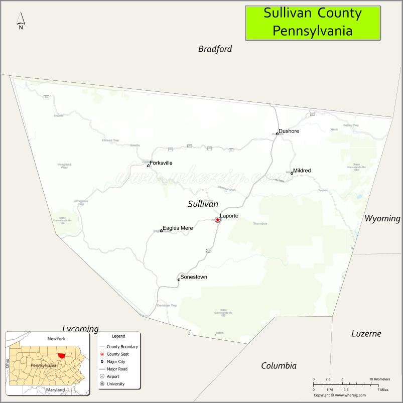
| Seat: | Laporte |
| Total Area: | 452 sq mi (1,170 km²) |
| Land Area: | 450 sq mi (1,200 km²) |
| Total Population: | 5,868 |
| Population Density: | 13/sq mi (5/km²) |
| Time zone: | UTC−5 (Eastern) |
| Summer Time Zone (DST): | UTC−4 (EDT) |
| Website: | www.sullivancounty-pa.us |
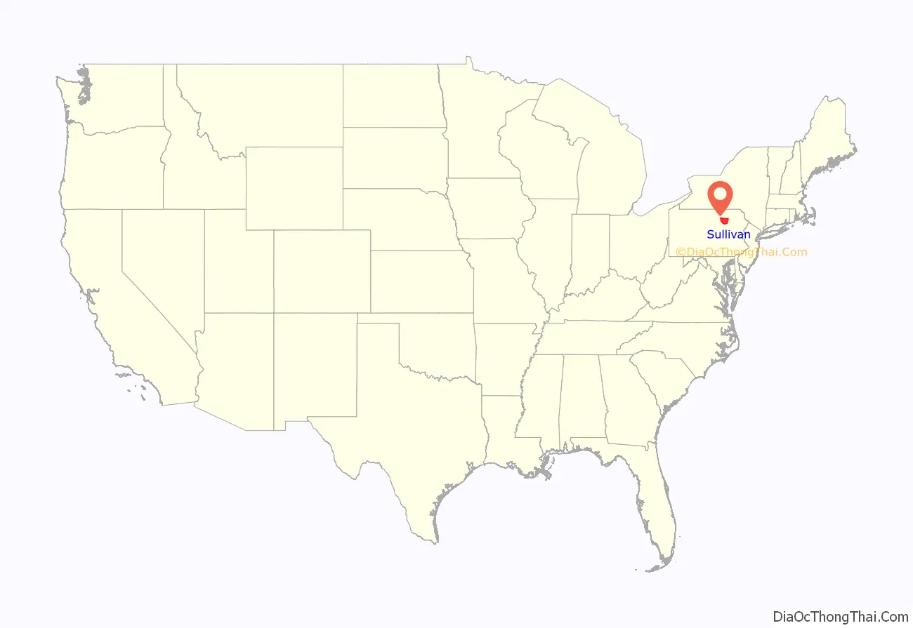
Sullivan County location map. Where is Sullivan County?
History
The land which became Sullivan County was originally purchased from the Iroquois by the Province of Pennsylvania in 1768, as part of the first Treaty of Fort Stanwix. It was then part of Northumberland County, then became part of Lycoming County when it was formed in 1795. Sullivan County itself was formed from the northeastern part of Lycoming County on March 15, 1847. It was the thirteenth and last county formed at least partly from Lycoming County (and the fifth entirely formed from it).
Sullivan County was named for Pennsylvania state senator Charles C. Sullivan, who “took an active part in procuring passage of the bill” establishing the county. However, according to Frederic A. Godcharles (1933), the county is named for General John Sullivan, who led the Sullivan Expedition against the Iroquois in 1779.
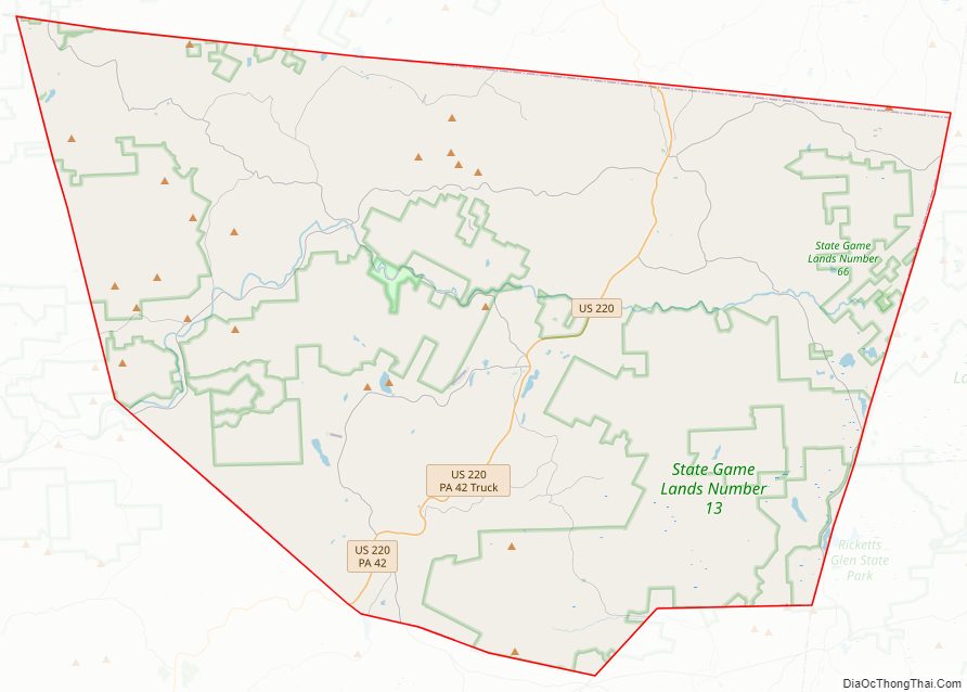
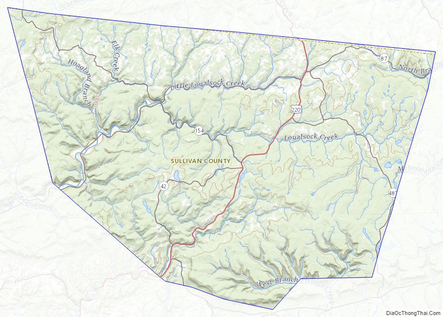
Sullivan County Road Map
Geography
According to the U.S. Census Bureau, the county has a total area of 452 square miles (1,170 km), of which 450 square miles (1,200 km) is land and 2.6 square miles (6.7 km) (0.6%) is water.
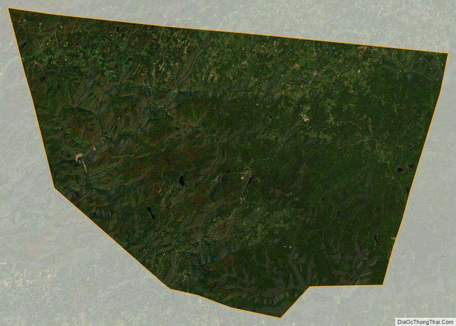
Elevation ranges from 2593 ft at North Mountain in Davidson Township to 779 ft on Loyalsock Creek at the Lycoming County line. The county is served by Pennsylvania Route 42, Pennsylvania Route 87, Pennsylvania Route 154, Pennsylvania Route 487, and U.S. Route 220. The major rivers in the county are Loyalsock Creek, Little Loyalsock Creek, Muncy Creek, and Fishing Creek. The majority of the land in Sullivan County is forest, but there is some farmland, especially in the northern part of the county. There are numerous river valleys in the southern and western parts of Sullivan County.
Sullivan has a warm-summer humid continental climate (Dfb) and average monthly temperatures in Laporte range from 21.8 °F in January to 67.9 °F in July. [1]
Adjacent counties
- Bradford County (north)
- Wyoming County (east)
- Luzerne County (southeast)
- Columbia County (south)
- Lycoming County (west)
Sullivan County Topographic Map
Sullivan County Satellite Map
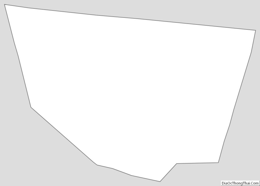
Sullivan County Outline Map
See also
Map of Pennsylvania State and its subdivision:- Adams
- Allegheny
- Armstrong
- Beaver
- Bedford
- Berks
- Blair
- Bradford
- Bucks
- Butler
- Cambria
- Cameron
- Carbon
- Centre
- Chester
- Clarion
- Clearfield
- Clinton
- Columbia
- Crawford
- Cumberland
- Dauphin
- Delaware
- Elk
- Erie
- Fayette
- Forest
- Franklin
- Fulton
- Greene
- Huntingdon
- Indiana
- Jefferson
- Juniata
- Lackawanna
- Lancaster
- Lawrence
- Lebanon
- Lehigh
- Luzerne
- Lycoming
- Mc Kean
- Mercer
- Mifflin
- Monroe
- Montgomery
- Montour
- Northampton
- Northumberland
- Perry
- Philadelphia
- Pike
- Potter
- Schuylkill
- Snyder
- Somerset
- Sullivan
- Susquehanna
- Tioga
- Union
- Venango
- Warren
- Washington
- Wayne
- Westmoreland
- Wyoming
- York
- Alabama
- Alaska
- Arizona
- Arkansas
- California
- Colorado
- Connecticut
- Delaware
- District of Columbia
- Florida
- Georgia
- Hawaii
- Idaho
- Illinois
- Indiana
- Iowa
- Kansas
- Kentucky
- Louisiana
- Maine
- Maryland
- Massachusetts
- Michigan
- Minnesota
- Mississippi
- Missouri
- Montana
- Nebraska
- Nevada
- New Hampshire
- New Jersey
- New Mexico
- New York
- North Carolina
- North Dakota
- Ohio
- Oklahoma
- Oregon
- Pennsylvania
- Rhode Island
- South Carolina
- South Dakota
- Tennessee
- Texas
- Utah
- Vermont
- Virginia
- Washington
- West Virginia
- Wisconsin
- Wyoming