Sully County is a county in the U.S. state of South Dakota. As of the 2020 census, the population was 1,446, making it the fifth-least populous county in South Dakota. Its county seat is Onida. The county was created in 1873 and organized in 1883. It is named after General Alfred Sully, who built Fort Sully.
Sully County is included in the Pierre, SD Micropolitan Statistical Area.
| Name: | Sully County |
|---|---|
| FIPS code: | 46-119 |
| State: | South Dakota |
| Founded: | 1873 |
| Named for: | Alfred Sully |
| Seat: | Onida |
| Largest city: | Onida |
| Total Area: | 1,070 sq mi (2,800 km²) |
| Land Area: | 1,007 sq mi (2,610 km²) |
| Total Population: | 1,446 |
| Population Density: | 1.4/sq mi (0.52/km²) |
| Time zone: | UTC−6 (Central) |
| Summer Time Zone (DST): | UTC−5 (CDT) |
| Website: | www.sullycounty.net |
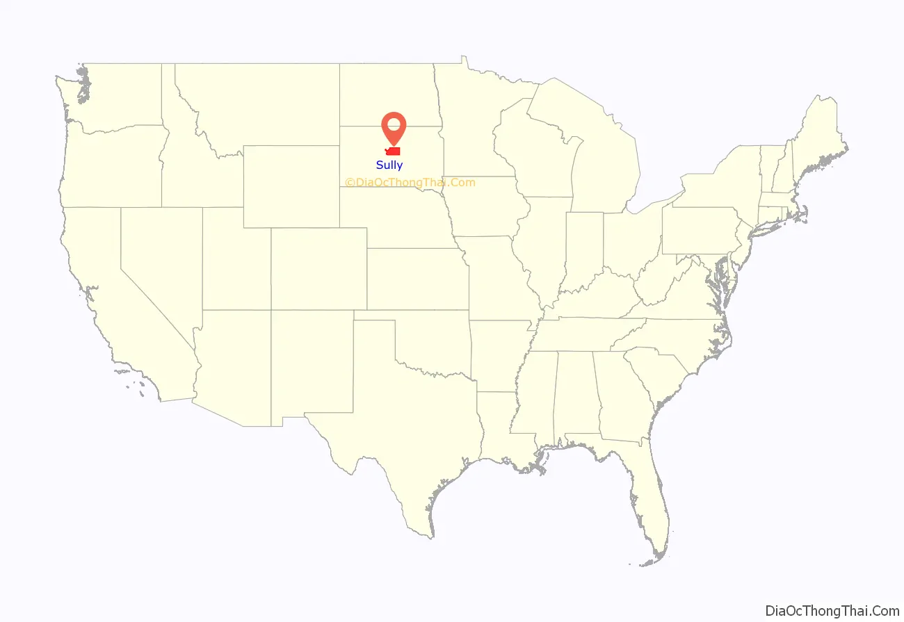
Sully County location map. Where is Sully County?
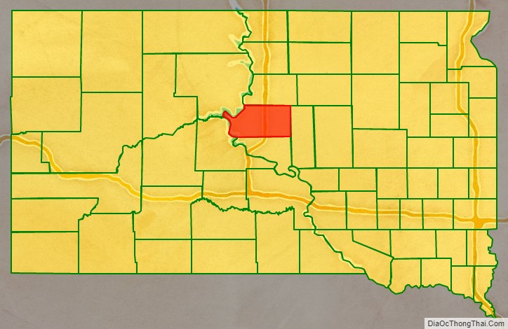
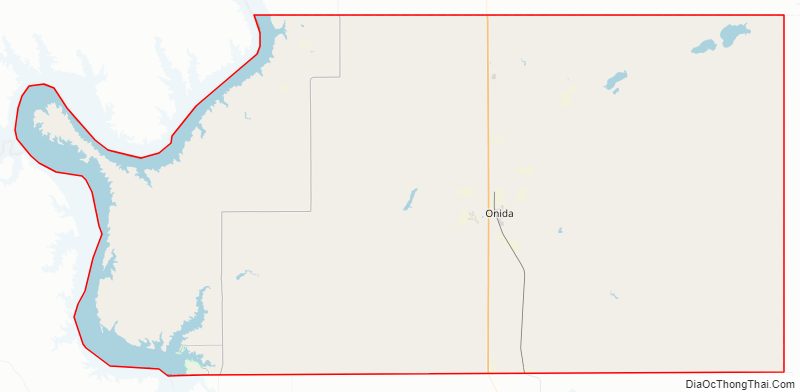
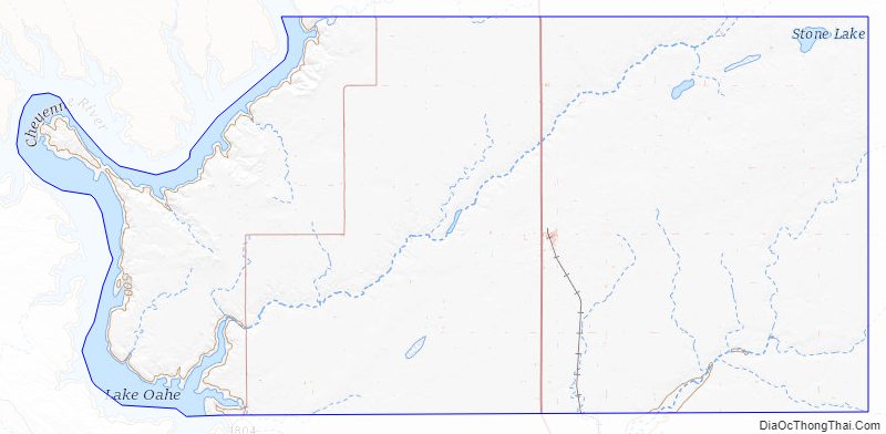
Sully County Road Map
Geography
The west boundary line of Sully County is defined by the meanderings of the Missouri River, which flows southward along its edge. The county’s terrain is composed of semi-arid rolling hills, partially devoted to agriculture. The terrain slopes to the south and east, but the west portion of the county slopes westward into the river valley. The county’s highest point is along the midpoint of its north boundary line, at 1,949′ (594m) ASL. The county has a total area of 1,070 square miles (2,800 km), of which 1,007 square miles (2,610 km) is land and 63 square miles (160 km) (5.9%) is water.
The eastern portion of South Dakota’s counties (48 of 66) observe Central Time; the western counties (18 of 66) observe Mountain Time. Sully County is at the western edge of those counties that observe Central Time.
Major highways
- U.S. Highway 83
- South Dakota Highway 1804
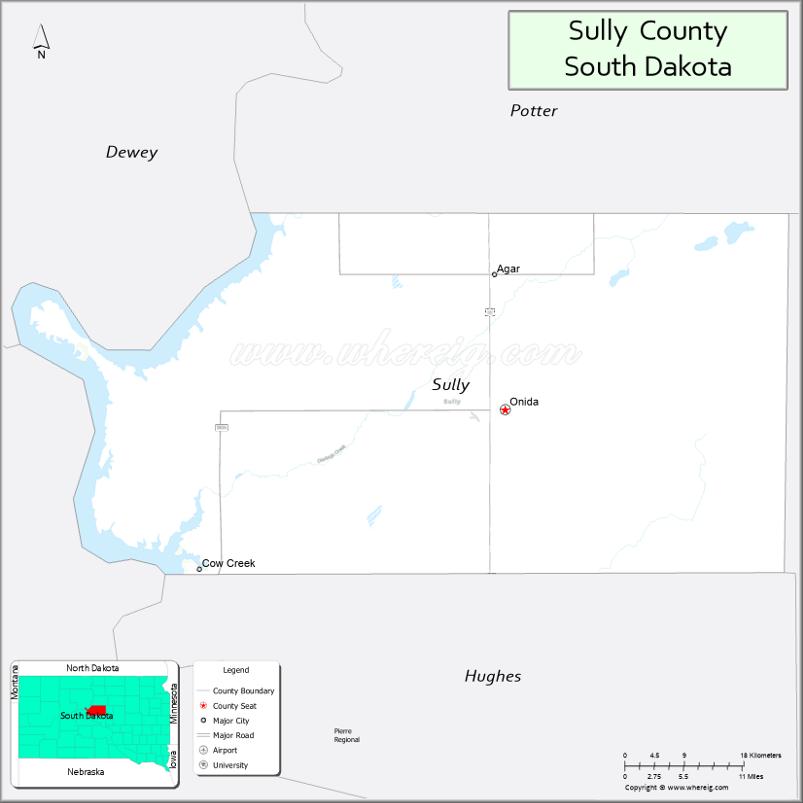
Adjacent counties
- Potter County – north
- Hyde County – east
- Hughes County – south
- Stanley County – southwest (observes mountain time)
- Dewey County – northwest (observes Mountain Time)
Protected areas
- Bush’s Landing State Lakeside Use Area
- Cottonwood Lake State Game Production Area
- Cow Creek State Game Production Area
- Cow Creek State Recreation Area
- Elk State Game Production Area
- Fort Sully State Game Production Area
- Hofer State Game Production Area
- Koenig State Game Production Area Area
- Lambrecht State Game Production Area
- Lake State Game Production Area
- Little Bend State Game Production Area
- Little Bend State Lakeside Use Area Area
- Mail Shack State Game Production Area
- Medicine Knoll Creek State Game Production Area
- Okobojo Creek State Game Production Area
- Okobojo Point State Recreation Area
- Onida State Game Production Area
- Pleasant State Game Production Area
- Spring Creek Recreation Area
- Stone Lake State Game Production Area
- Sutton Bay State Game Production Area
- Sutton Bay State Lakeside Use Area
Lakes
- Cottonwood Lake
- Mundt Lake
- Fuller Lake
- Lake Oahe (part)
- Lake Okobojo
- Stone Lake
- Sully Lake
- Walker Lake
- Warnes Slough
Sully County Topographic Map
Sully County Satellite Map
Sully County Outline Map

See also
Map of South Dakota State and its subdivision:- Aurora
- Beadle
- Bennett
- Bon Homme
- Brookings
- Brown
- Brule
- Buffalo
- Butte
- Campbell
- Charles Mix
- Clark
- Clay
- Codington
- Corson
- Custer
- Davison
- Day
- Deuel
- Dewey
- Douglas
- Edmunds
- Fall River
- Faulk
- Grant
- Gregory
- Haakon
- Hamlin
- Hand
- Hanson
- Harding
- Hughes
- Hutchinson
- Hyde
- Jackson
- Jerauld
- Jones
- Kingsbury
- Lake
- Lawrence
- Lincoln
- Lyman
- Marshall
- McCook
- McPherson
- Meade
- Mellette
- Miner
- Minnehaha
- Moody
- Pennington
- Perkins
- Potter
- Roberts
- Sanborn
- Shannon
- Spink
- Stanley
- Sully
- Todd
- Tripp
- Turner
- Union
- Walworth
- Yankton
- Ziebach
- Alabama
- Alaska
- Arizona
- Arkansas
- California
- Colorado
- Connecticut
- Delaware
- District of Columbia
- Florida
- Georgia
- Hawaii
- Idaho
- Illinois
- Indiana
- Iowa
- Kansas
- Kentucky
- Louisiana
- Maine
- Maryland
- Massachusetts
- Michigan
- Minnesota
- Mississippi
- Missouri
- Montana
- Nebraska
- Nevada
- New Hampshire
- New Jersey
- New Mexico
- New York
- North Carolina
- North Dakota
- Ohio
- Oklahoma
- Oregon
- Pennsylvania
- Rhode Island
- South Carolina
- South Dakota
- Tennessee
- Texas
- Utah
- Vermont
- Virginia
- Washington
- West Virginia
- Wisconsin
- Wyoming