Summers County is a county located in the U.S. state of West Virginia. As of the 2020 census, the population was 11,959. Its county seat is Hinton. The county was created by an act of the West Virginia Legislature on February 27, 1871, from parts of Fayette, Greenbrier, Mercer and Monroe counties and named in honor of George W. Summers (1804–68).
| Name: | Summers County |
|---|---|
| FIPS code: | 54-089 |
| State: | West Virginia |
| Founded: | February 27, 1871 |
| Named for: | George W. Summers |
| Seat: | Hinton |
| Largest city: | Hinton |
| Total Area: | 368 sq mi (950 km²) |
| Land Area: | 360 sq mi (900 km²) |
| Total Population: | 11,959 |
| Population Density: | 32/sq mi (13/km²) |
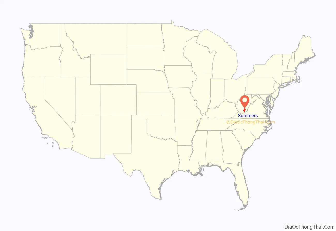
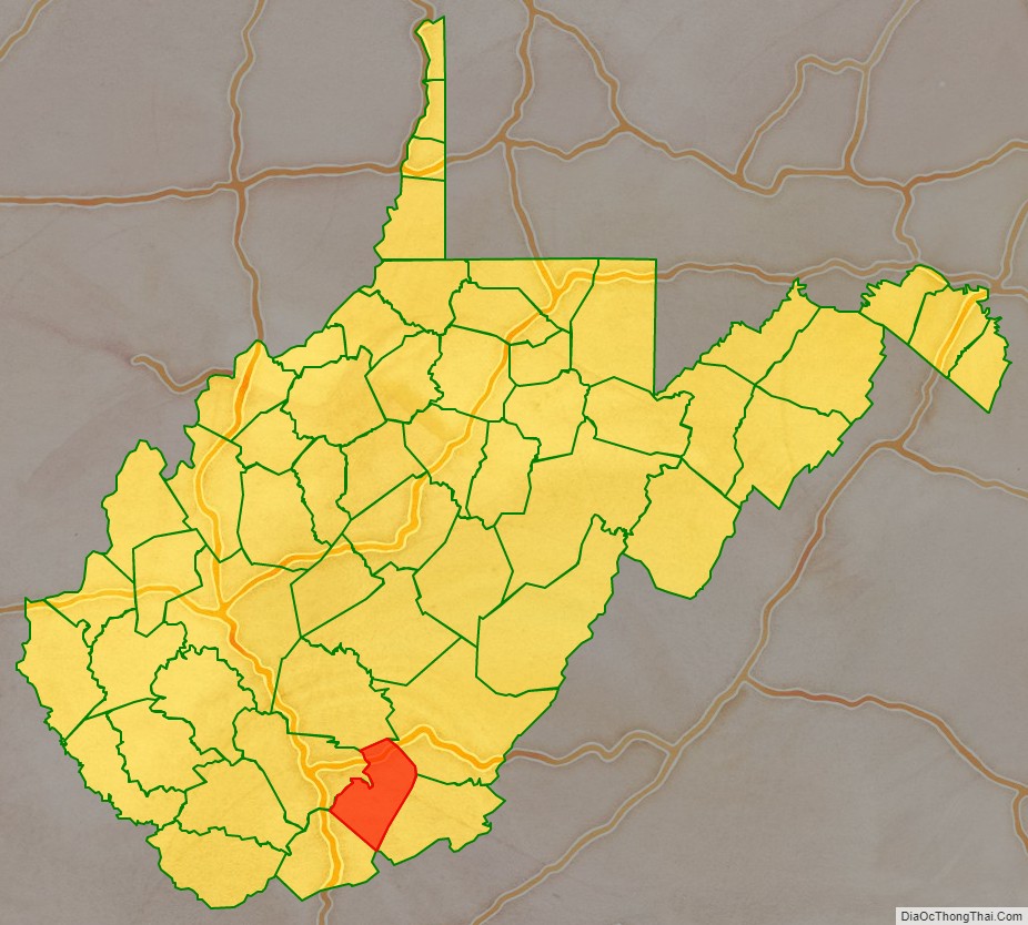
Summers County location map. Where is Summers County?
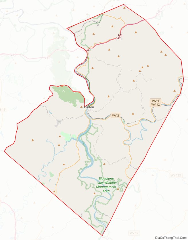
Summers County Road Map
Geography
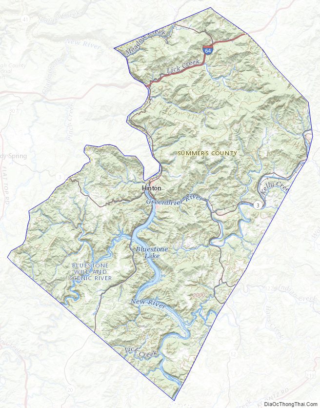
According to the United States Census Bureau, the county has a total area of 368 square miles (950 km), of which 360 square miles (930 km) is land and 7.3 square miles (19 km) (2.0%) is water.
After gaining independence from Virginia in 1863, West Virginia’s counties were divided into civil townships, with the intention of encouraging local government. This proved impractical in the heavily rural state, and in 1872 the townships were converted into magisterial districts. Summers County was initially divided into five townships: Forest Hill, Greenbrier, Green Sulphur, Jumping Branch, and Pipestem. Forest Hill consisted of territory received from Monroe County, where it had been part of a township of the same name. Greenbrier was also formed from territory that had been part of Monroe County. Green Sulphur was formed from territory received from Fayette and Greenbrier Counties, while Jumping Branch and Pipestem consisted of land received from Mercer County.
As the second-last of West Virginia’s counties to be created, Summers County had townships for only a year before they were converted into magisterial districts. In 1879, Talcott District was organized from part of Greenbrier. The six historical districts remained largely unchanged for the next century, until in the 1970s they were consolidated into three new magisterial districts: Bluestone River, Greenbrier River, and New River.
Major highways
- Interstate 64
- West Virginia Route 3
- West Virginia Route 12
- West Virginia Route 20
- West Virginia Route 107
Adjacent counties
- Greenbrier County (northeast)
- Monroe County (east)
- Mercer County (southwest)
- Raleigh County (west)
- Fayette County (northwest)
- Giles County, Virginia (south)
National protected areas
- Bluestone National Scenic River (part)
- New River Gorge National Park and Preserve (part)
Summers County Topographic Map
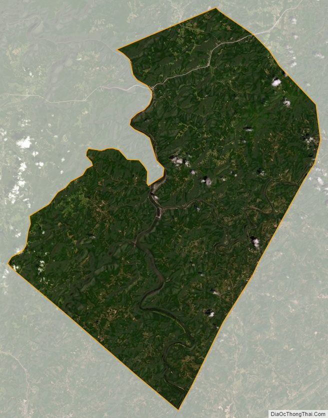
Summers County Satellite Map
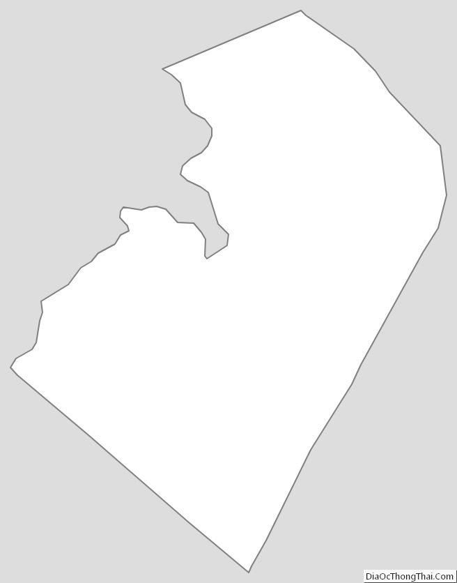
Summers County Outline Map
See also
Map of West Virginia State and its subdivision:- Barbour
- Berkeley
- Boone
- Braxton
- Brooke
- Cabell
- Calhoun
- Clay
- Doddridge
- Fayette
- Gilmer
- Grant
- Greenbrier
- Hampshire
- Hancock
- Hardy
- Harrison
- Jackson
- Jefferson
- Kanawha
- Lewis
- Lincoln
- Logan
- Marion
- Marshall
- Mason
- McDowell
- Mercer
- Mineral
- Mingo
- Monongalia
- Monroe
- Morgan
- Nicholas
- Ohio
- Pendleton
- Pleasants
- Pocahontas
- Preston
- Putnam
- Raleigh
- Randolph
- Ritchie
- Roane
- Summers
- Taylor
- Tucker
- Tyler
- Upshur
- Wayne
- Webster
- Wetzel
- Wirt
- Wood
- Wyoming
- Alabama
- Alaska
- Arizona
- Arkansas
- California
- Colorado
- Connecticut
- Delaware
- District of Columbia
- Florida
- Georgia
- Hawaii
- Idaho
- Illinois
- Indiana
- Iowa
- Kansas
- Kentucky
- Louisiana
- Maine
- Maryland
- Massachusetts
- Michigan
- Minnesota
- Mississippi
- Missouri
- Montana
- Nebraska
- Nevada
- New Hampshire
- New Jersey
- New Mexico
- New York
- North Carolina
- North Dakota
- Ohio
- Oklahoma
- Oregon
- Pennsylvania
- Rhode Island
- South Carolina
- South Dakota
- Tennessee
- Texas
- Utah
- Vermont
- Virginia
- Washington
- West Virginia
- Wisconsin
- Wyoming