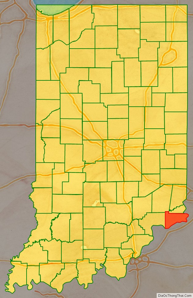
Switzerland County is a county in the southeast corner of the U.S. state of Indiana. As of the 2020 United States Census, the population was 9,737. The county seat is Vevay, one of two incorporated towns in the county.
| Name: | Switzerland County |
|---|---|
| FIPS code: | 18-155 |
| State: | Indiana |
| Founded: | 1814 |
| Named for: | Switzerland |
| Seat: | Vevay |
| Largest town: | Vevay |
| Total Area: | 223.44 sq mi (578.7 km²) |
| Land Area: | 220.63 sq mi (571.4 km²) |
| Total Population: | 9,737 |
| Population Density: | 44/sq mi (17/km²) |
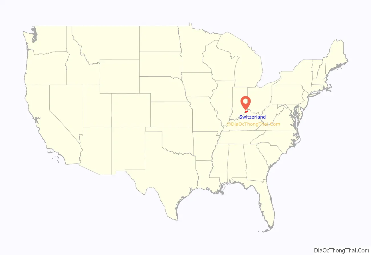
Switzerland County location map. Where is Switzerland County?
History
In 1787, the fledgling United States defined the Northwest Territory, which included the area of present-day Indiana. In 1800, Congress separated Ohio from the Northwest Territory, designating the rest of the land as the Indiana Territory. President Thomas Jefferson chose William Henry Harrison as the territory’s first governor, and Vincennes was established as the territorial capital. After the Michigan Territory was separated and the Illinois Territory was formed, Indiana was reduced to its current size and geography. By December 1816 the Indiana Territory was admitted to the Union as a state.
Starting in 1794, Native American titles to Indiana lands were extinguished by usurpation, purchase, or war and treaty. The United States acquired land from the Native Americans in the 1809 treaty of Fort Wayne, and by the treaty of St. Mary’s in 1818, the SE portion of Indiana Territory was acquired for settlement.
The area included in present-day Switzerland County was first placed in Knox County, formed in 1790. Parts of that extremely large county were partitioned off in 1803 to form Dearborn County and in 1810 to form Jefferson County. Settlers had been pouring into the extreme SE part of the Indiana Territory starting in 1795, and by 1814 there was sufficient population to form a local governing body. Accordingly, the state legislature authorized Switzerland County effective 1 October 1814, partitioning portions of Dearborn and Jefferson counties to make the creation. Four fledgling settlements were considered as the seat of government (Vevay, Little York [present-day Florence], Troy [present-day Patriot], and Center Square). Center Square was nearest the geographic center and was the presumed site, but Vevay carried the day.
Several early settlers were originally from Switzerland. The first was probably Heathcoat Pickett, in 1795. He was followed by John James Dufour (1796), and the Dickason, Cotton, and Rayl families in 1798. Pickett also made the area’s first flatboats; he floated them (loaded with goods for sale) to New Orleans and sold the entire package, then walked back to Switzerland County. He made 20 such trips. Early county residents noted the passage of the first steamboat on the Ohio River in 1811; this form of transport quickly transformed the river into a conduit for commerce and travel. Although Indiana was criss-crossed with railroad tracks during the nineteenth century, none was laid to Switzerland County. This hindered its growth after the decline of steamboat travel.
Industrial wine grape production in Switzerland County earned the area the title “The Rhineland of America”.
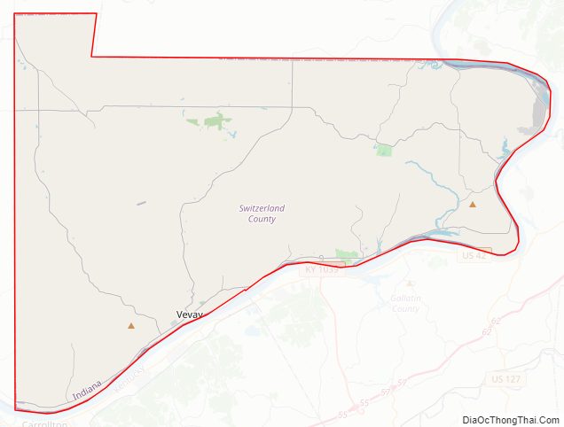
Switzerland County Road Map
Geography
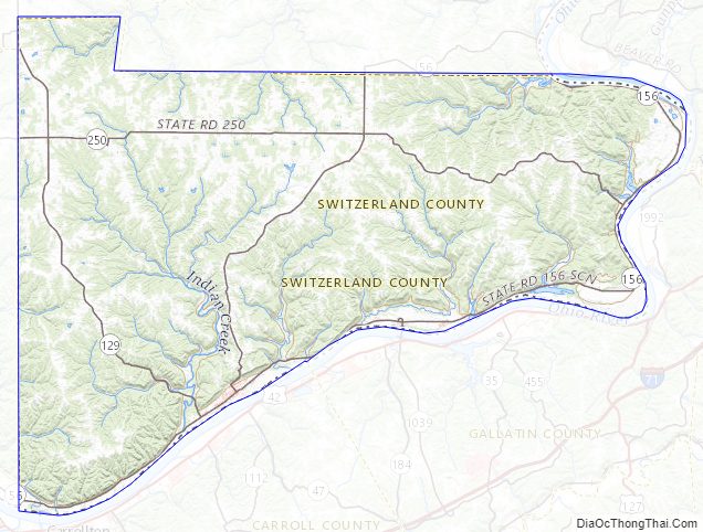
Switzerland County lies at the SE tip of Indiana, with its southeastern border defined by the Ohio River; the state of Kentucky abuts on the opposite shore. Its rolling hills were originally completely wooded. Its more flat areas have been cleared for agricultural or urban use, but its many drainages are still wooded. Its highest elevation (981 feet/299 meters ASL) is a hill in its NW quadrant, 0.7 miles (1.1 km) west of Avonburg.
According to the 2010 census, the county has a total area of 223.44 square miles (578.7 km), of which 220.63 square miles (571.4 km) (or 98.74%) is land and 2.81 square miles (7.3 km) (or 1.26%) is water.
Adjacent counties
- Ohio County – north
- Boone County, Kentucky – northeast
- Gallatin County, Kentucky – east
- Carroll County, Kentucky – south
- Jefferson County – west
- Ripley County – northwest
Incorporated towns
Unincorporated towns
- Aaron
- Allensville
- Antioch
- Avonburg
- Bennington
- Braytown
- Center Square
- East Enterprise (census-designated place)
- Fairview
- Florence (census-designated place)
- Five Points
- Gurley Corner
- Jacksonville
- Lamb
- Long Run
- Markland
- Moorefield
- Mount Sterling
- Pleasant
- Quercus Grove
- Searcy Crossroads
Townships
- Cotton
- Craig
- Jefferson
- Pleasant
- Posey
- York
Highways
- Indiana State Road 56
- Indiana State Road 101
- Indiana State Road 129
- Indiana State Road 156
- Indiana State Road 250
Switzerland County Topographic Map
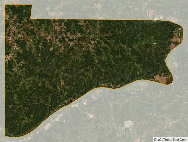
Switzerland County Satellite Map
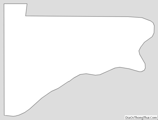
Switzerland County Outline Map
See also
Map of Indiana State and its subdivision:- Adams
- Allen
- Bartholomew
- Benton
- Blackford
- Boone
- Brown
- Carroll
- Cass
- Clark
- Clay
- Clinton
- Crawford
- Daviess
- De Kalb
- Dearborn
- Decatur
- Delaware
- Dubois
- Elkhart
- Fayette
- Floyd
- Fountain
- Franklin
- Fulton
- Gibson
- Grant
- Greene
- Hamilton
- Hancock
- Harrison
- Hendricks
- Henry
- Howard
- Huntington
- Jackson
- Jasper
- Jay
- Jefferson
- Jennings
- Johnson
- Knox
- Kosciusko
- LaGrange
- Lake
- Lake Michigan
- LaPorte
- Lawrence
- Madison
- Marion
- Marshall
- Martin
- Miami
- Monroe
- Montgomery
- Morgan
- Newton
- Noble
- Ohio
- Orange
- Owen
- Parke
- Perry
- Pike
- Porter
- Posey
- Pulaski
- Putnam
- Randolph
- Ripley
- Rush
- Saint Joseph
- Scott
- Shelby
- Spencer
- Starke
- Steuben
- Sullivan
- Switzerland
- Tippecanoe
- Tipton
- Union
- Vanderburgh
- Vermillion
- Vigo
- Wabash
- Warren
- Warrick
- Washington
- Wayne
- Wells
- White
- Whitley
- Alabama
- Alaska
- Arizona
- Arkansas
- California
- Colorado
- Connecticut
- Delaware
- District of Columbia
- Florida
- Georgia
- Hawaii
- Idaho
- Illinois
- Indiana
- Iowa
- Kansas
- Kentucky
- Louisiana
- Maine
- Maryland
- Massachusetts
- Michigan
- Minnesota
- Mississippi
- Missouri
- Montana
- Nebraska
- Nevada
- New Hampshire
- New Jersey
- New Mexico
- New York
- North Carolina
- North Dakota
- Ohio
- Oklahoma
- Oregon
- Pennsylvania
- Rhode Island
- South Carolina
- South Dakota
- Tennessee
- Texas
- Utah
- Vermont
- Virginia
- Washington
- West Virginia
- Wisconsin
- Wyoming