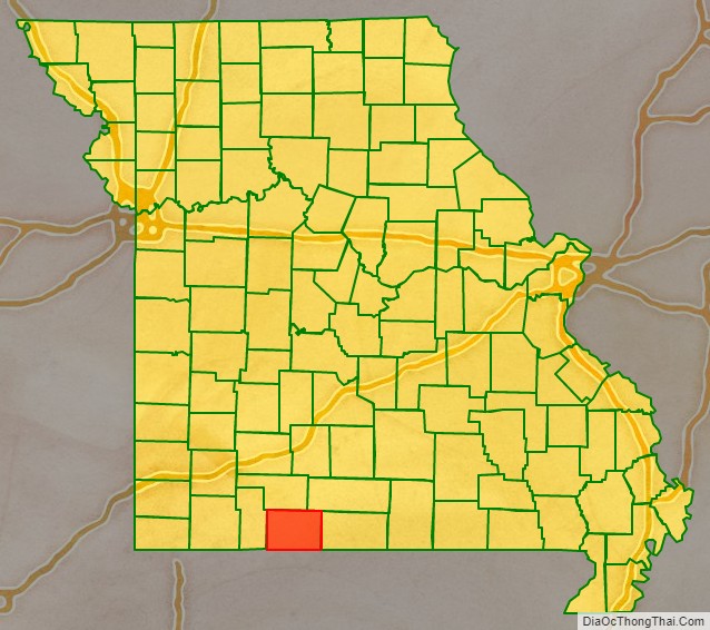
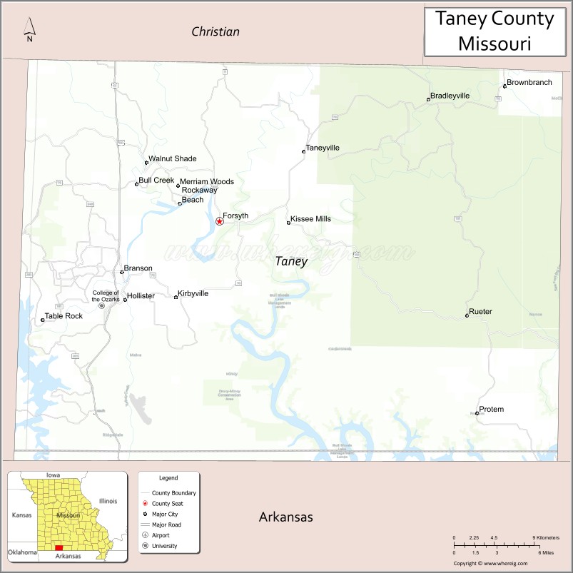
Taney County is a county located in the southwestern portion of the U.S. state of Missouri. As of the 2020 census, the population was 56,066. Its county seat is Forsyth. It is included in the Branson, Missouri, Micropolitan Statistical Area.
Taney County was officially organized on January 4, 1837, and named in honor of Roger Brooke Taney, the fifth Chief Justice of the U.S. Supreme Court, best known for delivering the infamous majority opinion in Dred Scott v. Sandford. However, unlike Roger B. Taney, who pronounced his name /ˈtɔːni/, the “Taney” in Taney County is generally pronounced /ˈteɪni/.
The county includes the popular tourist destinations Branson, Table Rock, Taneycomo and Bull Shoals Lakes.
| Name: | Taney County |
|---|---|
| FIPS code: | 29-213 |
| State: | Missouri |
| Founded: | January 4, 1837 |
| Named for: | Roger B. Taney |
| Seat: | Forsyth |
| Largest city: | Branson |
| Total Area: | 652 sq mi (1,690 km²) |
| Land Area: | 632 sq mi (1,640 km²) |
| Total Population: | 56,066 |
| Population Density: | 86/sq mi (33/km²) |
| Time zone: | UTC−6 (Central) |
| Summer Time Zone (DST): | UTC−5 (CDT) |
| Website: | www.taneycounty.org |
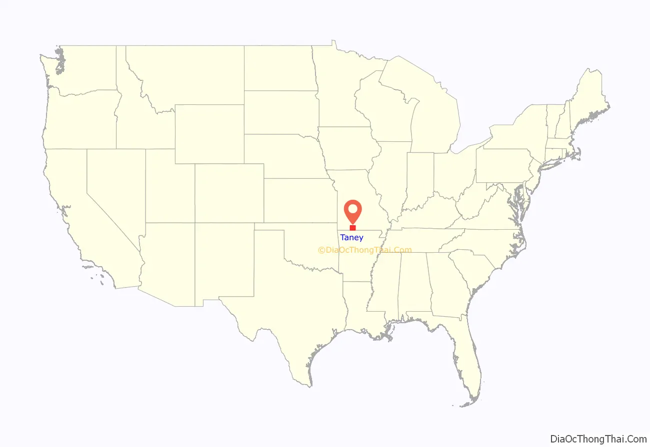
Taney County location map. Where is Taney County?
History
The first Taney County Courthouse was built on the mouth of Bull Creek at the confluence of the White River by early pioneers in 1837. Its use as a courthouse ended after Forsyth became the county seat; it was destroyed in a tornado in 1963.
The county’s second courthouse, in Forsyth, was destroyed in a Civil War battle on July 22, 1861. The rebuilt courthouse was destroyed by fire on December 19, 1885. A third courthouse was removed in 1952 to permit the building of Bull Shoals Lake. The fourth, and present, courthouse was occupied on August 1, 1952. An addition was completed in 1991 after two years of construction.
In 1904, the White River Railway was extended through the rugged terrain of Stone and Taney counties. By then, both counties had for years had a sundown town policy, forbidding African Americans to live there.
In 2008, a New Taney County Judicial Center was built. That Judicial Center houses the courtrooms, the Circuit Clerk, and the County Jail.
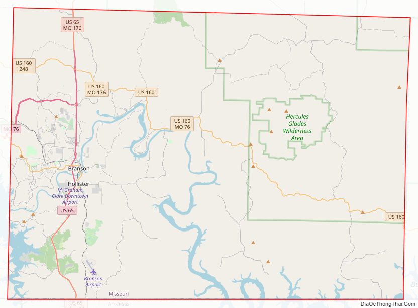
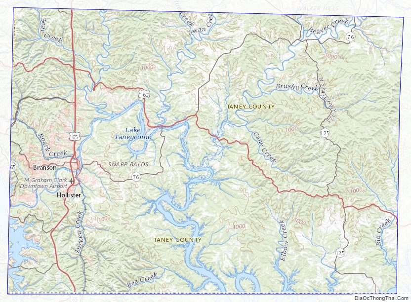
Taney County Road Map
Geography
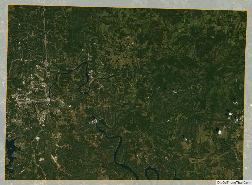
According to the U.S. Census Bureau, the county has a total area of 652 square miles (1,690 km), of which 632 square miles (1,640 km) is land and 19 square miles (49 km) (2.9%) is water.
The county is drained by White River and its affluents.
Adjacent counties
- Christian County (north)
- Douglas County (northeast)
- Ozark County (east)
- Marion County, Arkansas (southeast)
- Boone County, Arkansas (south)
- Carroll County, Arkansas (southwest)
- Stone County (west)
Major highways
- U.S. Route 65
- U.S. Route 160
- Route 76
- Route 86
- Route 125
- Route 165
- Route 176
- Route 248
- Route 265
- Route 376
- Route 465 (decommissioned in early 2020, now part of MO-76)
National protected area
- Mark Twain National Forest (part)
Taney County Topographic Map
Taney County Satellite Map
Taney County Outline Map

See also
Map of Missouri State and its subdivision:- Adair
- Andrew
- Atchison
- Audrain
- Barry
- Barton
- Bates
- Benton
- Bollinger
- Boone
- Buchanan
- Butler
- Caldwell
- Callaway
- Camden
- Cape Girardeau
- Carroll
- Carter
- Cass
- Cedar
- Chariton
- Christian
- Clark
- Clay
- Clinton
- Cole
- Cooper
- Crawford
- Dade
- Dallas
- Daviess
- De Kalb
- Dent
- Douglas
- Dunklin
- Franklin
- Gasconade
- Gentry
- Greene
- Grundy
- Harrison
- Henry
- Hickory
- Holt
- Howard
- Howell
- Iron
- Jackson
- Jasper
- Jefferson
- Johnson
- Knox
- Laclede
- Lafayette
- Lawrence
- Lewis
- Lincoln
- Linn
- Livingston
- Macon
- Madison
- Maries
- Marion
- McDonald
- Mercer
- Miller
- Mississippi
- Moniteau
- Monroe
- Montgomery
- Morgan
- New Madrid
- Newton
- Nodaway
- Oregon
- Osage
- Ozark
- Pemiscot
- Perry
- Pettis
- Phelps
- Pike
- Platte
- Polk
- Pulaski
- Putnam
- Ralls
- Randolph
- Ray
- Reynolds
- Ripley
- Saint Charles
- Saint Clair
- Saint Francois
- Saint Louis
- Sainte Genevieve
- Saline
- Schuyler
- Scotland
- Scott
- Shannon
- Shelby
- Stoddard
- Stone
- Sullivan
- Taney
- Texas
- Vernon
- Warren
- Washington
- Wayne
- Webster
- Worth
- Wright
- Alabama
- Alaska
- Arizona
- Arkansas
- California
- Colorado
- Connecticut
- Delaware
- District of Columbia
- Florida
- Georgia
- Hawaii
- Idaho
- Illinois
- Indiana
- Iowa
- Kansas
- Kentucky
- Louisiana
- Maine
- Maryland
- Massachusetts
- Michigan
- Minnesota
- Mississippi
- Missouri
- Montana
- Nebraska
- Nevada
- New Hampshire
- New Jersey
- New Mexico
- New York
- North Carolina
- North Dakota
- Ohio
- Oklahoma
- Oregon
- Pennsylvania
- Rhode Island
- South Carolina
- South Dakota
- Tennessee
- Texas
- Utah
- Vermont
- Virginia
- Washington
- West Virginia
- Wisconsin
- Wyoming