Teller County is a county located in the U.S. state of Colorado. As of the 2020 census, the population was 24,710. The county seat is Cripple Creek, and the most populous city is Woodland Park.
Teller County is included in the Colorado Springs, CO Metropolitan Statistical Area.
| Name: | Teller County |
|---|---|
| FIPS code: | 08-119 |
| State: | Colorado |
| Founded: | March 23, 1899 |
| Named for: | Henry M. Teller |
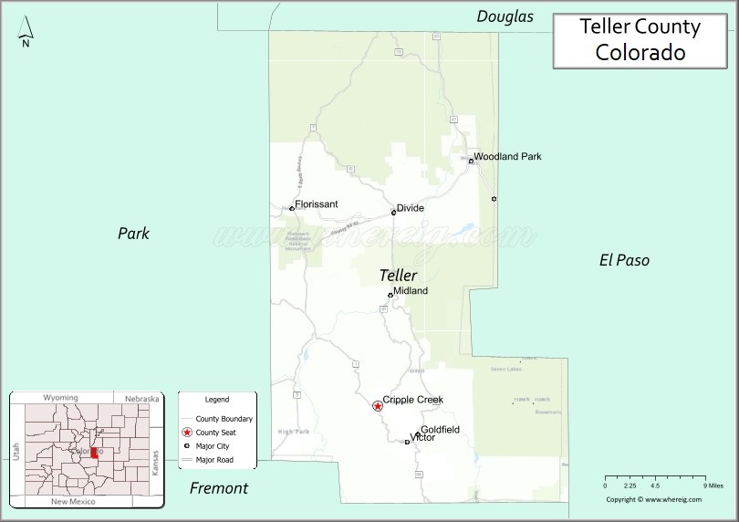
| Seat: | Cripple Creek |
| Largest city: | Woodland Park |
| Total Area: | 559 sq mi (1,450 km²) |
| Land Area: | 557 sq mi (1,440 km²) |
| Total Population: | 24,926 |
| Population Density: | 44/sq mi (17/km²) |
| Time zone: | UTC−7 (Mountain) |
| Summer Time Zone (DST): | UTC−6 (MDT) |
| Website: | www.co.teller.co.us |
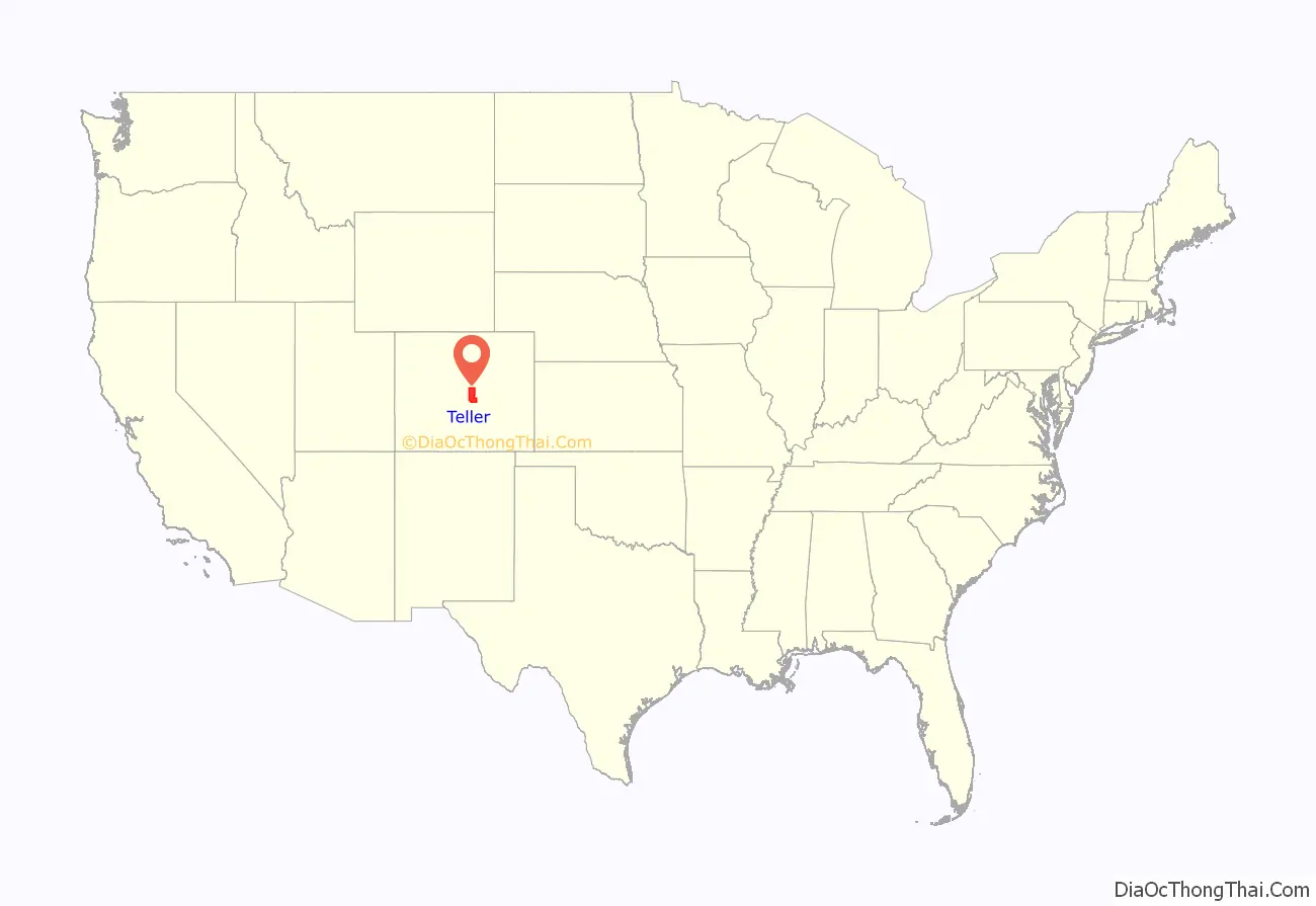
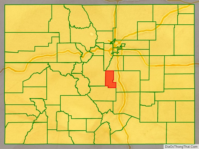
Teller County location map. Where is Teller County?
History
A few years after gold was discovered in Cripple Creek, political differences between area miners and mine owners, many of whom lived in Colorado Springs, resulted in the division of El Paso County. Created in 1899, Teller County was carved from the western slope of Pikes Peak, and was named after United States Senator Henry M. Teller. Within five years of its formation, Teller County became the scene of a dramatic labor struggle called the Colorado Labor Wars.
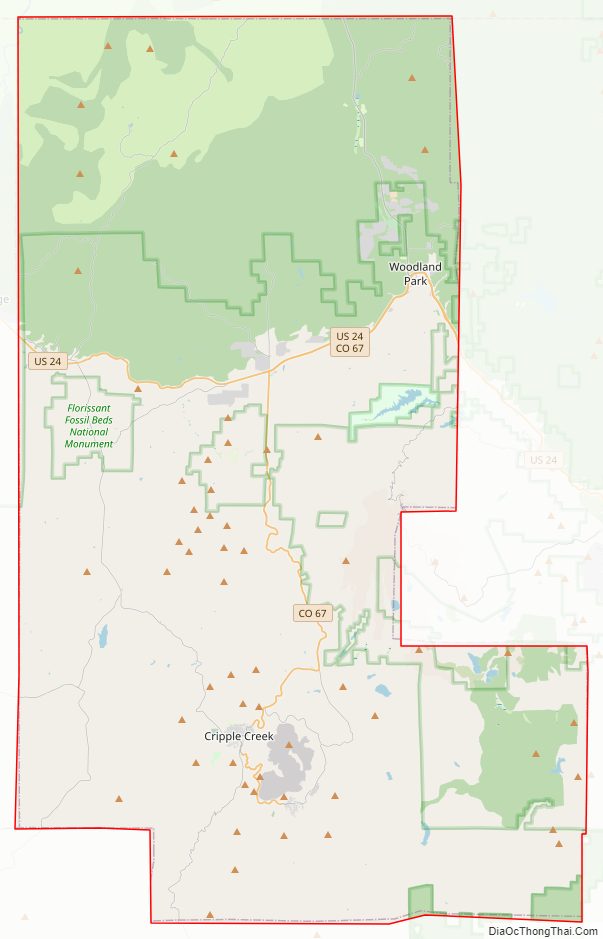
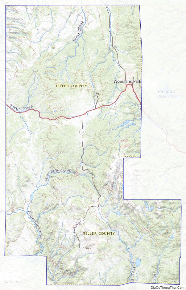
Teller County Road Map
Geography
According to the U.S. Census Bureau, the county has a total area of 559 square miles (1,450 km), of which 557 square miles (1,440 km) is land and 1.9 square miles (4.9 km) (0.3%) is water.
Adjacent counties
- Douglas County – north
- Jefferson County – north
- El Paso County – east
- Fremont County – south
- Park County – west
Major Highways
- U.S. Highway 24
- State Highway 67
National protected areas
- Cripple Creek National Historic District
- Florissant Fossil Beds National Monument
- Pike National Forest
State protected area
- Mueller State Park
Trails and byways
- American Discovery Trail
- Gold Belt Tour National Scenic and Historic Byway
Historic places
- See List of National Register of Historic Places Listings in Teller County
Teller County Topographic Map
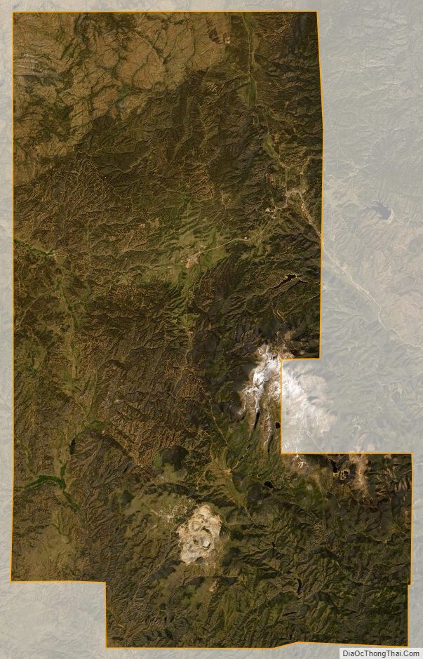
Teller County Satellite Map
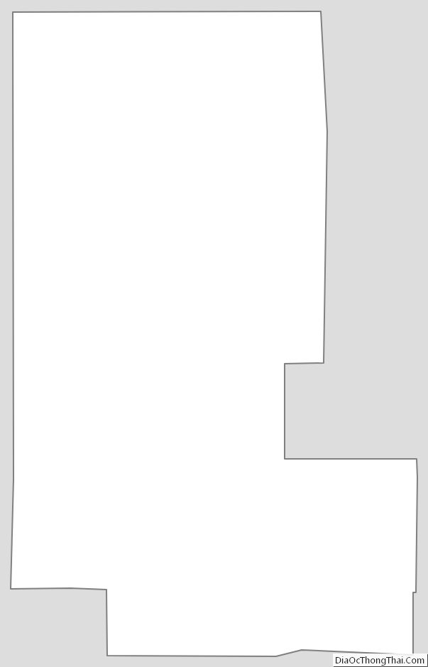
Teller County Outline Map
See also
Map of Colorado State and its subdivision:- Adams
- Alamosa
- Arapahoe
- Archuleta
- Baca
- Bent
- Boulder
- Broomfield
- Chaffee
- Cheyenne
- Clear Creek
- Conejos
- Costilla
- Crowley
- Custer
- Delta
- Denver
- Dolores
- Douglas
- Eagle
- El Paso
- Elbert
- Fremont
- Garfield
- Gilpin
- Grand
- Gunnison
- Hinsdale
- Huerfano
- Jackson
- Jefferson
- Kiowa
- Kit Carson
- La Plata
- Lake
- Larimer
- Las Animas
- Lincoln
- Logan
- Mesa
- Mineral
- Moffat
- Montezuma
- Montrose
- Morgan
- Otero
- Ouray
- Park
- Phillips
- Pitkin
- Prowers
- Pueblo
- Rio Blanco
- Rio Grande
- Routt
- Saguache
- San Juan
- San Miguel
- Sedgwick
- Summit
- Teller
- Washington
- Weld
- Yuma
- Alabama
- Alaska
- Arizona
- Arkansas
- California
- Colorado
- Connecticut
- Delaware
- District of Columbia
- Florida
- Georgia
- Hawaii
- Idaho
- Illinois
- Indiana
- Iowa
- Kansas
- Kentucky
- Louisiana
- Maine
- Maryland
- Massachusetts
- Michigan
- Minnesota
- Mississippi
- Missouri
- Montana
- Nebraska
- Nevada
- New Hampshire
- New Jersey
- New Mexico
- New York
- North Carolina
- North Dakota
- Ohio
- Oklahoma
- Oregon
- Pennsylvania
- Rhode Island
- South Carolina
- South Dakota
- Tennessee
- Texas
- Utah
- Vermont
- Virginia
- Washington
- West Virginia
- Wisconsin
- Wyoming