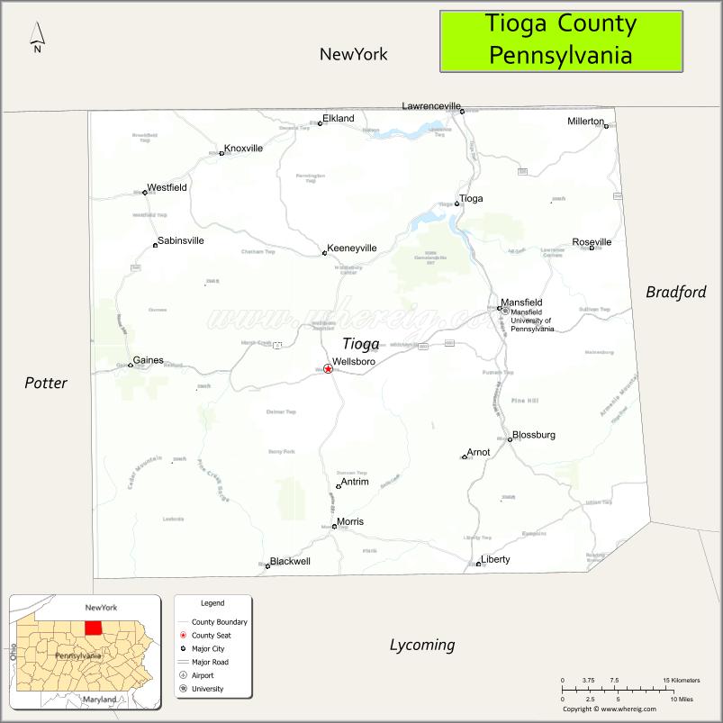
Tioga County is a county in the Commonwealth of Pennsylvania. As of the 2020 census, the population was 41,045. Its county seat is Wellsboro. The county was created on March 26, 1804, from part of Lycoming County and later organized in 1812. It is named for the Tioga River.
| Name: | Tioga County |
|---|---|
| FIPS code: | 42-117 |
| State: | Pennsylvania |
| Founded: | October 13, 1812 |
| Named for: | Tioga River |
| Seat: | Wellsboro |
| Total Area: | 1,137 sq mi (2,940 km²) |
| Land Area: | 1,134 sq mi (2,940 km²) |
| Total Population: | 41,045 |
| Population Density: | 36/sq mi (14/km²) |
| Time zone: | UTC−5 (Eastern) |
| Summer Time Zone (DST): | UTC−4 (EDT) |
| Website: | www.tiogacountypa.us |
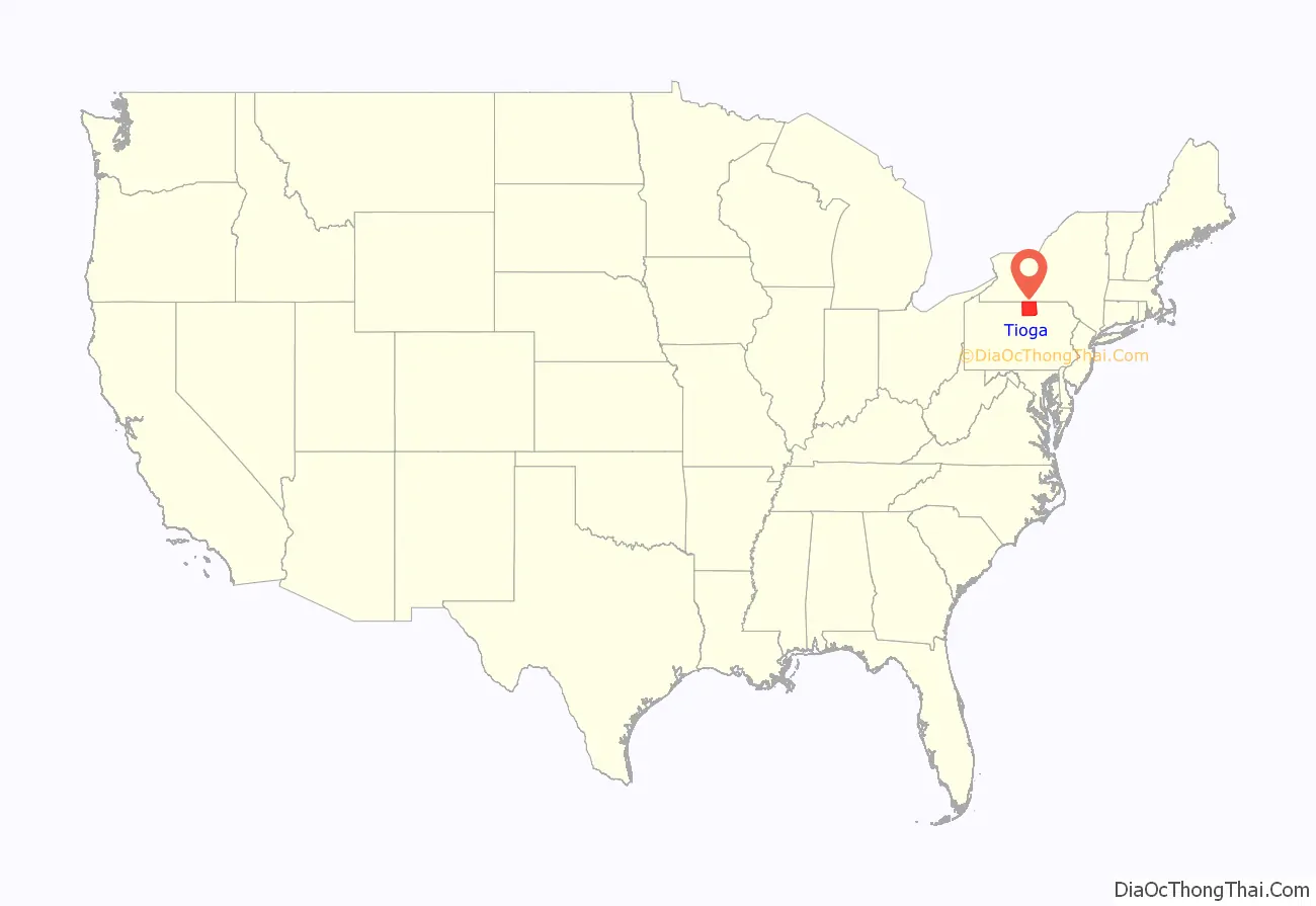
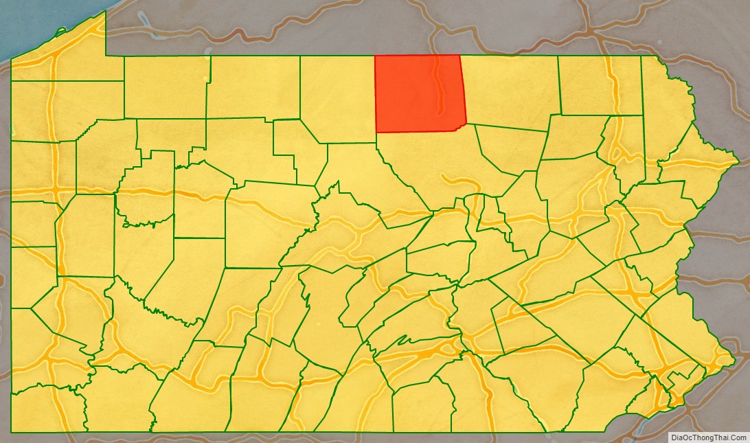
Tioga County location map. Where is Tioga County?
History
The county was colonized by people of Yankee stock (colonists from New England and the western part of New York who were descended from the English Puritans of colonial New England). With the opening of a rough wagon road to the source of the Tioga River, New England colonists poured over the Allegheny Mountains. Tioga County resembled upstate New York more than it did eastern Pennsylvania, as its population primarily consisted of colonists from New England. Developers and land speculators laid out roads, established post routes, erected public buildings, and invited people to move there. The original colonists were entirely of New England origins or were Yankees from upstate New York, whose families had recent ancestors in New England, with colonization taking place in the aftermath of the Revolutionary War. Tioga County was largely culturally contiguous with New England culture, which was influential across the Northern Tier of the United States through its migrants.
In the late 19th and early 20th centuries, the county accepted more immigrants from Ireland, Germany and eastern Europe, who came to work in the coal mines. A number of them were Roman Catholic, introducing more diversity into the mixture of religions here.
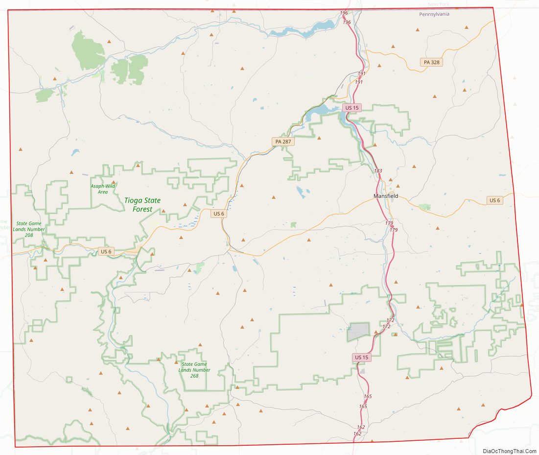
Tioga County Road Map
Geography
According to the U.S. Census Bureau, the county has a total area of 1,137 square miles (2,940 km), of which 1,134 square miles (2,940 km) is land and 3.2 square miles (8.3 km) (0.3%) is water. It is the fourth-largest county in Pennsylvania by land area and fifth-largest by total area. It has a warm-summer humid continental climate (Dfb) and average monthly temperatures in Wellsboro range from 22.8 °F in January to 68.2 °F in July. [1]
Adjacent counties
- Steuben County, New York (north)
- Chemung County, New York (northeast)
- Bradford County (east)
- Lycoming County (south)
- Potter County (west)
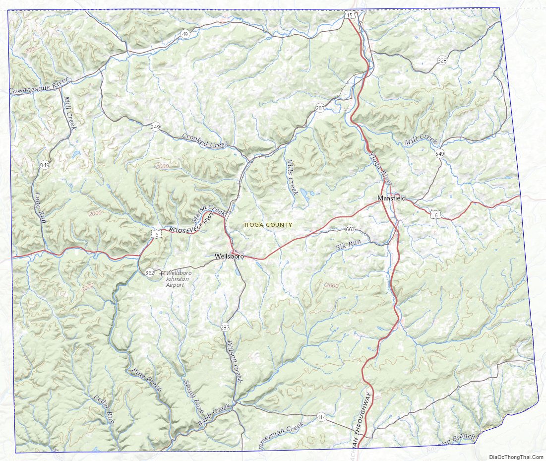
Tioga County Topographic Map
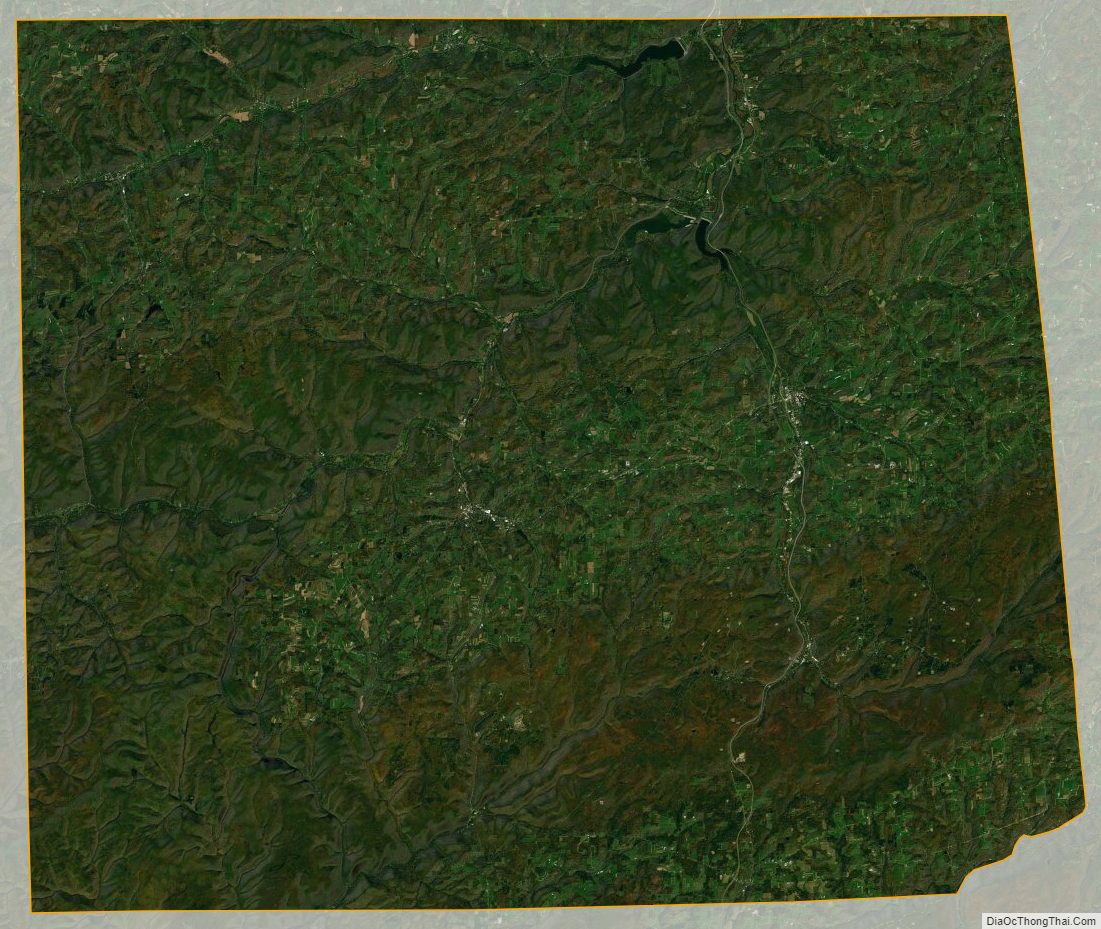
Tioga County Satellite Map
Tioga County Outline Map

See also
Map of Pennsylvania State and its subdivision:- Adams
- Allegheny
- Armstrong
- Beaver
- Bedford
- Berks
- Blair
- Bradford
- Bucks
- Butler
- Cambria
- Cameron
- Carbon
- Centre
- Chester
- Clarion
- Clearfield
- Clinton
- Columbia
- Crawford
- Cumberland
- Dauphin
- Delaware
- Elk
- Erie
- Fayette
- Forest
- Franklin
- Fulton
- Greene
- Huntingdon
- Indiana
- Jefferson
- Juniata
- Lackawanna
- Lancaster
- Lawrence
- Lebanon
- Lehigh
- Luzerne
- Lycoming
- Mc Kean
- Mercer
- Mifflin
- Monroe
- Montgomery
- Montour
- Northampton
- Northumberland
- Perry
- Philadelphia
- Pike
- Potter
- Schuylkill
- Snyder
- Somerset
- Sullivan
- Susquehanna
- Tioga
- Union
- Venango
- Warren
- Washington
- Wayne
- Westmoreland
- Wyoming
- York
- Alabama
- Alaska
- Arizona
- Arkansas
- California
- Colorado
- Connecticut
- Delaware
- District of Columbia
- Florida
- Georgia
- Hawaii
- Idaho
- Illinois
- Indiana
- Iowa
- Kansas
- Kentucky
- Louisiana
- Maine
- Maryland
- Massachusetts
- Michigan
- Minnesota
- Mississippi
- Missouri
- Montana
- Nebraska
- Nevada
- New Hampshire
- New Jersey
- New Mexico
- New York
- North Carolina
- North Dakota
- Ohio
- Oklahoma
- Oregon
- Pennsylvania
- Rhode Island
- South Carolina
- South Dakota
- Tennessee
- Texas
- Utah
- Vermont
- Virginia
- Washington
- West Virginia
- Wisconsin
- Wyoming