Troup County (pronounced /truːp/ TROOP) is a county located in the west central portion of the U.S. state of Georgia. As of the 2020 census, the population was 69,426. The county seat is LaGrange.
Troup County comprises the LaGrange, GA Micropolitan Statistical Area along with Chambers County, AL. It is included in the Atlanta-Athens-Clarke County-Sandy Springs, GA Combined Statistical Area.
| Name: | Troup County |
|---|---|
| FIPS code: | 13-285 |
| State: | Georgia |
| Founded: | 1826 |
| Named for: | George Troup |
| Seat: | LaGrange |
| Largest city: | LaGrange |
| Total Area: | 446 sq mi (1,160 km²) |
| Land Area: | 414 sq mi (1,070 km²) |
| Total Population: | 69,426 |
| Time zone: | UTC−5 (Eastern) |
| Summer Time Zone (DST): | UTC−4 (EDT) |
| Website: | www.troupcountyga.org |
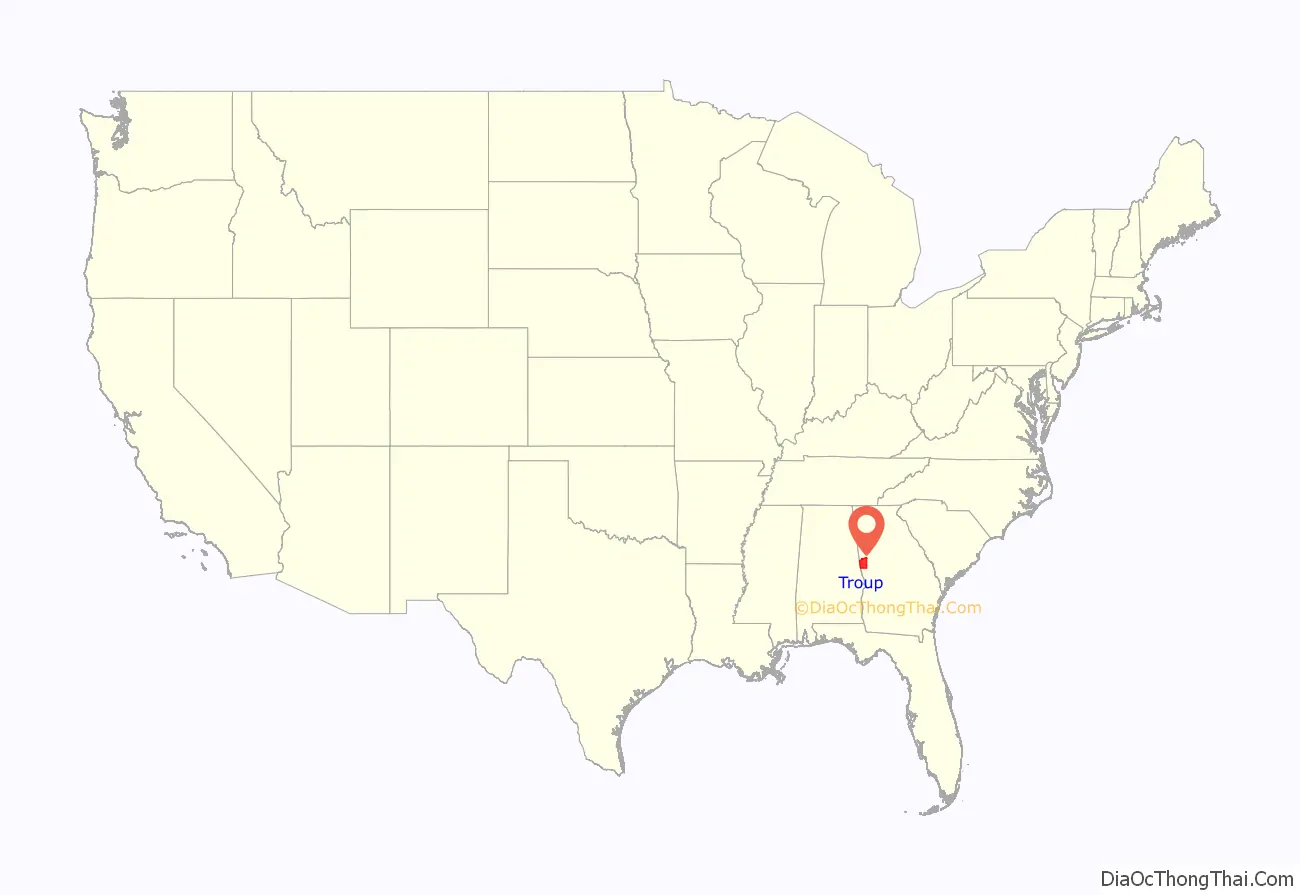
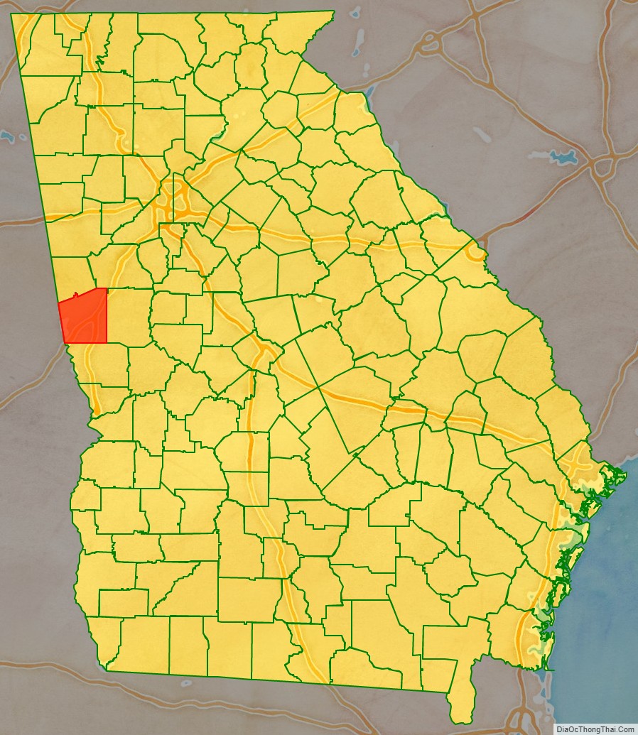
Troup County location map. Where is Troup County?
History
For thousands of years, this area of what is now defined as west central Georgia was occupied by cultures of indigenous peoples. In the historic period, it was part of a large area controlled by the Muscogee, also known as the Creek people.
The land for Lee, Muscogee, Troup, Coweta, and Carroll counties was ceded by the Creek to the United States in the 1825 Treaty of Indian Springs. The counties’ boundaries were created by the Georgia General Assembly on June 9, 1826, but the counties themselves were not named until December 14, 1826.
The county is named for George Troup, thirty-fourth governor of Georgia, U.S. representative, and senator.
As with much of the Piedmont, this area was developed in the antebellum era for cotton cultivation after short-staple cotton was made profitable by invention of the cotton gin. By 1860 Troup County was the fourth-wealthiest in Georgia and fifth-largest slaveholding county in the state.
According to U.S. Census data, the 1860 Troup County population included 6,223 whites, 37 “free colored” and 10,002 slaves. By the 1870 census, the white population had increased about 3% to 6,408, while the “colored” population had increased about 12% to 11,224.
During the post-Reconstruction period, violence and the number of lynchings of blacks increased in the late 19th century, as whites exercised terrorism to re-establish and maintain white supremacy. Whites lynched three African Americans in Troup County in this period, most were killed around the turn of the 20th century. Such deaths occurred through the post-World War II period. A fourth man from Troup County was lynched in neighboring Harris County.
In the late 19th century, entrepreneurs in LaGrange built the first cotton mill, and others were rapidly established in this area. Initially they employed only white workers.
20th century to present
During the first half of the 20th century, thousands of blacks left Georgia and other southern states in what is known as the Great Migration. They were seeking work as mechanization reduced the number of farm jobs, and they were seeking more opportunities than in the Jim Crow South, where they were disenfranchised and socially oppressed.
On September 8, 1940, 16-year-old Austin Callaway, a black youth, was arrested in LaGrange as a suspect in an attack on a white woman. The next night a small, armed group of white men took him from the county jail, driving him out to the nearby countryside, where they lynched him: shooting him several times and leaving him for dead. In 2017 a man who was a child at the time revealed that his white family found and took Callaway to the hospital, where he died the next day. They had kept their role secret out of fear of the KKK. Callaway was noted by the local paper as dying from gunshot wounds; the New York Times at the time described it as a lynching. As was typical in these cases, no one was prosecuted for the murder. In response, that fall African Americans organized the first NAACP chapter in Troup County at Warren Temple Methodist Church in LaGrange. It has worked on a variety of civil rights issues, including voting rights, equal justice, access, and human services.
In 1947, prosperous farmer Henry “Peg” Gilbert, a married African-American father who owned and farmed 100 acres in the county, was arrested and charged with harboring a fugitive by officials from neighboring Harris County, Georgia, in the case of Gus Davidson. Also African American, the latter man was charged in the shooting death of a white farmer. Four days later Gilbert was dead, shot while held in jail by the Harris County Sheriff, in what he said was self-defense. In 2016 the Civil Rights and Restorative Justice Project of Northeastern University reported on this death in custody. They found that Gilbert had been beaten severely before his death, and shot five times. They asserted he had been detained and killed because of his success as a farmer.
By 1960, the county was recorded in the US Census as having 31,418 whites and 15,760 “Negroes” (now classified as black or African Americans). Following passage of the Voting Rights Act of 1965, blacks gradually regained the ability to vote and take part in the political process.
Textile manufacturing was a major part of the economy until the late 20th century, when textile manufacturing moved offshore to areas with cheaper labor. The county has acquired other industry, notably auto parts manufacturers who support the nearby Kia Motors plant. Also in the area are West Point Lake and Callaway Gardens, which attract tourists and visitors as top recreation destinations in the state.
As of 2015, the official historian of Troup County is writer Forrest Clark Johnson, III, who has published several books on the county and region’s history. He is a retired teacher in the county’s school system.
On January 25, 2017, Mayor Jim Thornton and Police Chief Louis M. Dekmar, of the county seat of LaGrange, publicly apologized to more than 200 people gathered for a reconciliation service at Warren Temple United Methodist Church for the police’s failure decades before to protect Callaway, saying:
Residents organized Troup Together, a grassroots group to acknowledge lynchings, commemorate the victims, and work on racial reconciliation. On March 18, 2017, black and white residents of the county gathered to dedicate a historic marker at Warren Temple Church “memorializing Callaway’s lynching and three others documented in the area: Willis Hodnett in 1884; Samuel Owensby in 1913 and Henry Gilbert, a Troup County resident who was lynched in neighboring Harris County in 1947.” Another ceremony was held at Southview Cemetery in LaGrange, where these names were read.
On April 7, 2017, Troup County’s computer systems were the victim of a ransomware attack; it caused all county computer systems to be inaccessible. This included the sheriff’s office and district attorney’s office. After 5 days, the county was still working to get 400 computer systems back online.
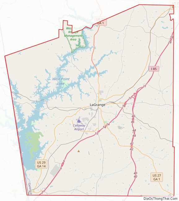
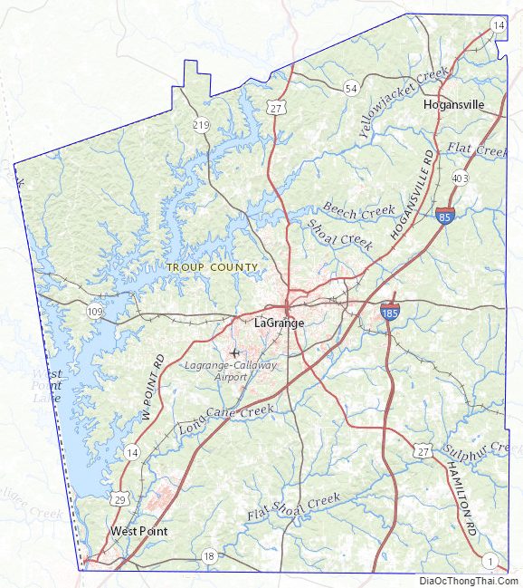
Troup County Road Map
Geography
According to the U.S. Census Bureau, the county has a total area of 446 square miles (1,160 km), of which 414 square miles (1,070 km) is land and 32 square miles (83 km) (7.2%) is water. The county is located in the Piedmont region of the state.
The entirety of Troup County is located in the Middle Chattahoochee River-Lake Harding sub-basin of the ACF River Basin (Apalachicola-Chattahoochee-Flint River Basin).
Major highways
- Interstate 85
- Interstate 185
- U.S. Route 27
- U.S. Route 29
- State Route 1
- State Route 14
- State Route 14 Connector
- State Route 14 Spur
- State Route 18
- State Route 54
- State Route 100
- State Route 103
- State Route 109
- State Route 219
- State Route 403 (unsigned designation for I-85)
- State Route 411 (unsigned designation for I-185)
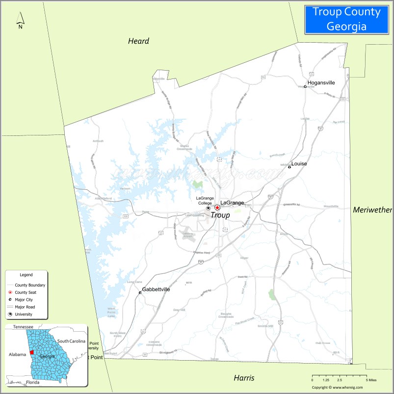
Adjacent counties
- Coweta County (northeast)
- Meriwether County (east)
- Harris County (south)
- Chambers County, Alabama (southwest/CST Border except for Lanett and Valley as they are part of the Columbus Metropolitan Area)
- Randolph County, Alabama (northwest/CST Border)
- Heard County (north)
Troup County Topographic Map
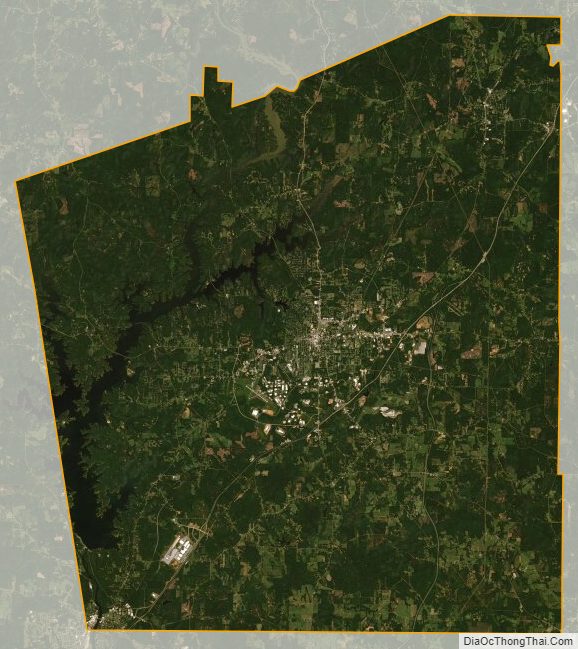
Troup County Satellite Map
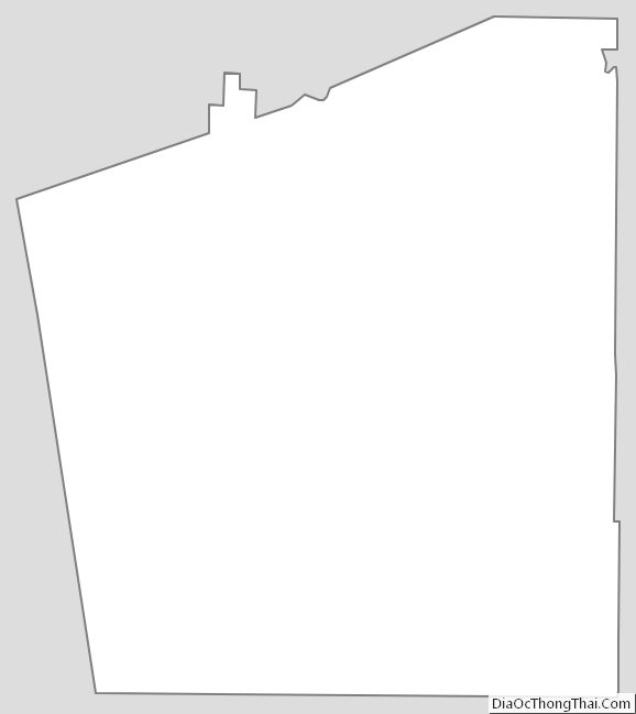
Troup County Outline Map
See also
Map of Georgia State and its subdivision:- Appling
- Atkinson
- Bacon
- Baker
- Baldwin
- Banks
- Barrow
- Bartow
- Ben Hill
- Berrien
- Bibb
- Bleckley
- Brantley
- Brooks
- Bryan
- Bulloch
- Burke
- Butts
- Calhoun
- Camden
- Candler
- Carroll
- Catoosa
- Charlton
- Chatham
- Chattahoochee
- Chattooga
- Cherokee
- Clarke
- Clay
- Clayton
- Clinch
- Cobb
- Coffee
- Colquitt
- Columbia
- Cook
- Coweta
- Crawford
- Crisp
- Dade
- Dawson
- Decatur
- DeKalb
- Dodge
- Dooly
- Dougherty
- Douglas
- Early
- Echols
- Effingham
- Elbert
- Emanuel
- Evans
- Fannin
- Fayette
- Floyd
- Forsyth
- Franklin
- Fulton
- Gilmer
- Glascock
- Glynn
- Gordon
- Grady
- Greene
- Gwinnett
- Habersham
- Hall
- Hancock
- Haralson
- Harris
- Hart
- Heard
- Henry
- Houston
- Irwin
- Jackson
- Jasper
- Jeff Davis
- Jefferson
- Jenkins
- Johnson
- Jones
- Lamar
- Lanier
- Laurens
- Lee
- Liberty
- Lincoln
- Long
- Lowndes
- Lumpkin
- Macon
- Madison
- Marion
- McDuffie
- McIntosh
- Meriwether
- Miller
- Mitchell
- Monroe
- Montgomery
- Morgan
- Murray
- Muscogee
- Newton
- Oconee
- Oglethorpe
- Paulding
- Peach
- Pickens
- Pierce
- Pike
- Polk
- Pulaski
- Putnam
- Quitman
- Rabun
- Randolph
- Richmond
- Rockdale
- Schley
- Screven
- Seminole
- Spalding
- Stephens
- Stewart
- Sumter
- Talbot
- Taliaferro
- Tattnall
- Taylor
- Telfair
- Terrell
- Thomas
- Tift
- Toombs
- Towns
- Treutlen
- Troup
- Turner
- Twiggs
- Union
- Upson
- Walker
- Walton
- Ware
- Warren
- Washington
- Wayne
- Webster
- Wheeler
- White
- Whitfield
- Wilcox
- Wilkes
- Wilkinson
- Worth
- Alabama
- Alaska
- Arizona
- Arkansas
- California
- Colorado
- Connecticut
- Delaware
- District of Columbia
- Florida
- Georgia
- Hawaii
- Idaho
- Illinois
- Indiana
- Iowa
- Kansas
- Kentucky
- Louisiana
- Maine
- Maryland
- Massachusetts
- Michigan
- Minnesota
- Mississippi
- Missouri
- Montana
- Nebraska
- Nevada
- New Hampshire
- New Jersey
- New Mexico
- New York
- North Carolina
- North Dakota
- Ohio
- Oklahoma
- Oregon
- Pennsylvania
- Rhode Island
- South Carolina
- South Dakota
- Tennessee
- Texas
- Utah
- Vermont
- Virginia
- Washington
- West Virginia
- Wisconsin
- Wyoming