Tulare County (/tʊˈlɛəri/ (listen) tuu-LAIR-ee) is a county located in the U.S. state of California. As of the 2020 census, the population was 473,117. The county seat is Visalia. The county is named for Tulare Lake, once the largest freshwater lake west of the Great Lakes. Drained for agricultural development, the site is now in Kings County, which was created in 1893 from the western portion of the formerly larger Tulare County.
Tulare County comprises the Visalia-Porterville, CA Metropolitan Statistical Area. The county is located south of Fresno, spanning from the San Joaquin Valley east to the Sierra Nevada.
Sequoia National Park is located in the county, as is part of Kings Canyon National Park, in its northeast corner (shared with Fresno County), and part of Mount Whitney, on its eastern border (shared with Inyo County). As of the 2020 census, the population was 473,117, up from 442,179 at the 2010 census.
| Name: | Tulare County |
|---|---|
| FIPS code: | 06-107 |
| State: | California |
| Founded: | 1852 |
| Named for: | Tulare Lake, which is named for the tule rush that lined its shores |
| Seat: | Visalia |
| Largest city: | Visalia |
| Total Area: | 4,839 sq mi (12,530 km²) |
| Land Area: | 4,823 sq mi (12,490 km²) |
| Total Population: | 473,117 |
| Population Density: | 98/sq mi (38/km²) |
| Time zone: | UTC−8 (Pacific) |
| Summer Time Zone (DST): | UTC−7 (PDT) |
| Website: | tularecounty.ca.gov |
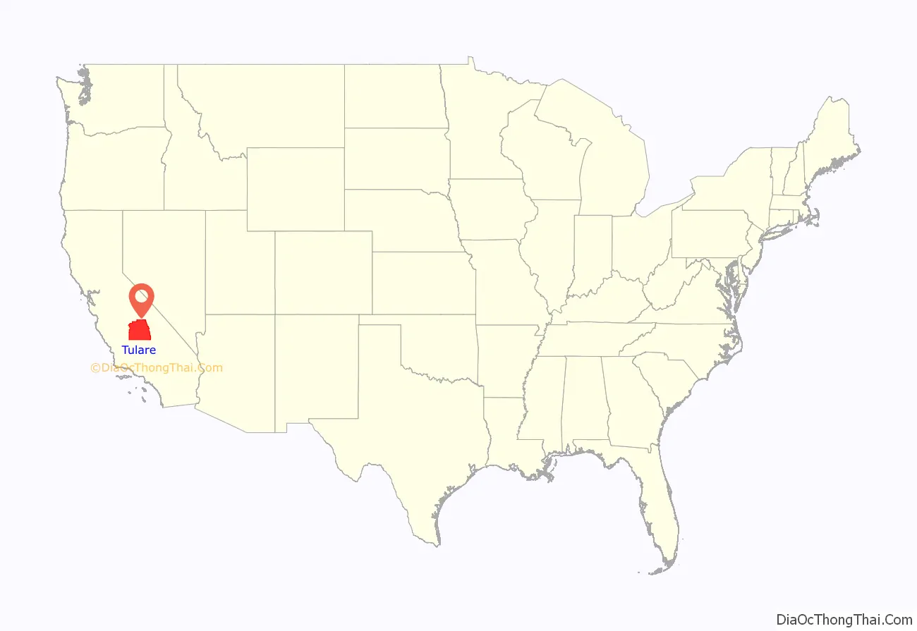
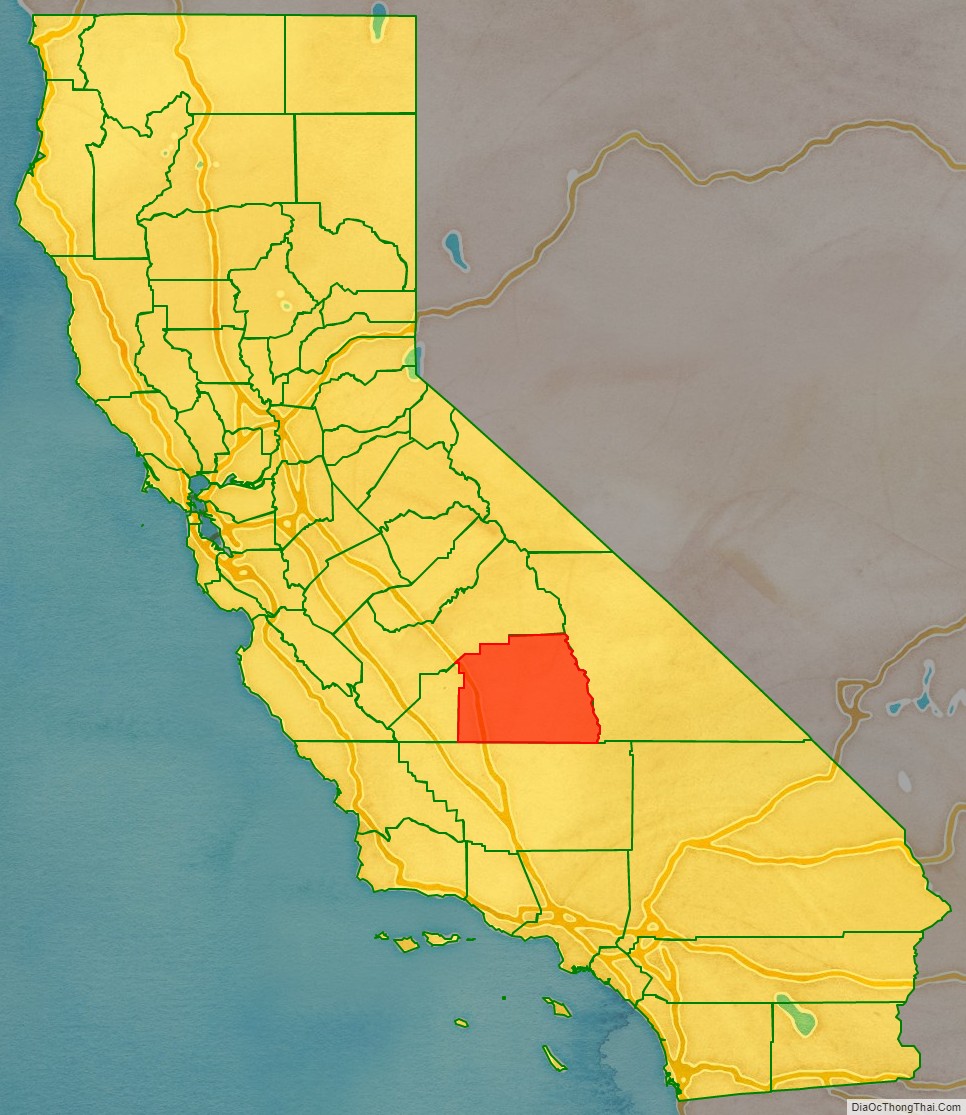
Tulare County location map. Where is Tulare County?
History
The land was occupied for thousands of years by the Yokuts. Beginning in the eighteenth century, Spain established missions to colonize California and convert the American Indians to Christianity. Comandante Pedro Fages, while hunting for deserters in the Central Valley in 1772, discovered a great lake surrounded by marshes and filled with rushes; he named it Los Tules (the tules). It is from this lake that the county derives its name. The root of the name Tulare is found in the Nahuatl word tullin, designating cattail or similar reeds.
In 1805, 1806 and again in 1816, the Spanish out of Mission San Luis Obispo explored Lake Tulare. Bubal was a native village located on the Western side of Lake Tulare. In 1816, Fr. Luis Martinez of Mission San Luis Obispo arrived at Bubal with soldiers and armed Christian Northern Chumash pressuring the people to send their children for baptism at his mission on the coast. Conflict broke out, and Martinez’s party burned Bubal to the ground, destroying the cache of food harvested for the winter. Although Bubal’s relationship with the Christian Salinans under Fr. Cabot at Mission San Miguel was better, between 1816 and 1834, Bubal was a center of native resistance. The marshes around Lake Tulare were impenetrable by Spanish horses, which gave the Yokuts a military advantage. At one point, the Spanish considered building a presidio with 100 soldiers at Bubal to control the resistance, but that never came to pass. The Spanish called the natives of the area Tulareños, and before 1816 and after 1834, they were incorporated into Mission San Miguel and Mission San Luis Obispo.
After Mexico achieved independence, it continued to rule California. After the Mexican Cession and the Treaty of Guadalupe Hidalgo in 1848, the area became part of the United States. Tulare County was soon formed from parts of Mariposa County only four years later in 1852. There were two early attempts to split off a new Buena Vista County in 1855 and Coso County in 1864, but both failed. Parts of the county’s territory were given to Fresno County in 1856, to Kern County and Inyo County in 1866 and to Kings County in 1893.
The infectious disease Tularemia caused by the bacterium Francisella tularensis is named after Tulare County.
In 1908 Colonel Allen Allensworth and associates founded Allensworth as a black farming community. They intended to develop a place where African Americans could thrive free of white discrimination. It was the only community in California founded, financed and governed by African Americans. While its first years were highly successful, the community encountered environmental problems from dropping water tables which eventually caused it to fail. Today the historic area is preserved as the Colonel Allensworth State Historic Park, which is listed on the National Register of Historic Places.
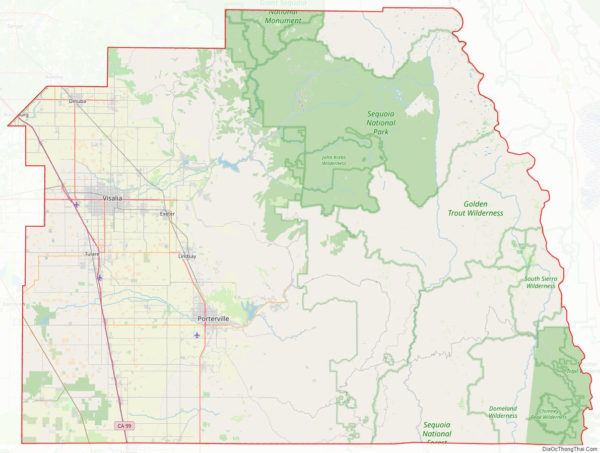
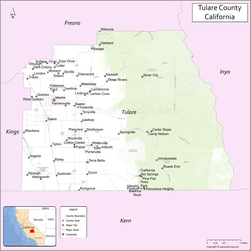
Tulare County Road Map
Geography
According to the U.S. Census Bureau, the county has a total area of 4,839 square miles (12,530 km), of which 4,823 square miles (12,490 km) is land and 14 square miles (36 km), or 0.3%, is water.
Adjacent counties
- Fresno County—north
- Inyo County—east
- Kern County—south
- Kings County—west
Lakes
- Arctic Lake
- Bullfrog Lakes
- Columbine Lake
- Crescent Lake
- Eagle Lake
- Franklin Lakes
- Lake Kaweah
- Lake Success
- Rockslide Lake
- Rocky Basin Lakes
- Weaver Lake
Rivers
- Angora River
- Alpine River
- Kaweah River
- Needlerock River
- Monarch River
- Negro River
- St. John’s River
- Tule River
- Yokohl River
- Yucca River
Parks
- Colonel Allensworth State Historic Park
- Alpaugh Park
- Balch Park
- Bartlett Park
- Cutler Park
- Dry Creek Preserve
- Horse Creek Recreation Area
- Kaweah Oaks Preserve
- Kings River Nature Preserve
- Lackeys Cabin
- Lake Kaweah Recreation Area
- Mineral King Game Refuge
- Mooney Grove Park / Ancient Oak Forest Preserve
- Sequoia National Park
- Woodville Park
- West Main Street Park
National protected areas
- Blue Ridge National Wildlife Refuge
- Giant Sequoia National Monument (part)
- Inyo National Forest (part)
- Kings Canyon National Park (part)
- Pixley National Wildlife Refuge
- Sequoia National Forest (part)
- Sequoia National Park
Sequoia National Park is a national park in the southern Sierra Nevada, east of Visalia. It was established in 1890 as the second U.S. national park, after Yellowstone. The park spans 404,051 acres (1,635.14 km). Encompassing a vertical relief of nearly 13,000 feet (3,962 m), the park contains among its natural resources the highest point in the contiguous 48 United States, Mount Whitney, at 14,505 feet (4,421 m) above sea level. The park is south of and contiguous with Kings Canyon National Park; the two are administered by the National Park Service as one unit, called Sequoia and Kings Canyon National Parks.
Flora
Tulare County is rich in native plant species due in part to a diversity in habitats, including creeks, rivers, hills, and mountains. Native plants include incense cedar (Calocedrus decurrens), valley oak (Quercus lobata), California bay (Umbellularia californica), manzanita (Arctostaphylos manzanita), Salvia spathacea, mountain mahogany (Cercocarpus betuloides), milkweed (Asclepias speciosa), Epilobium cleistogamum, monkeyflower (Mimulus), Penstemon, California melic (Melica californica), and deer grass (Muhlenbergia rigens).
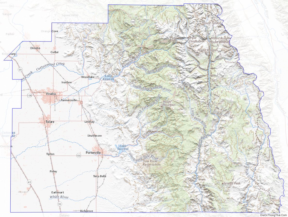
Tulare County Topographic Map
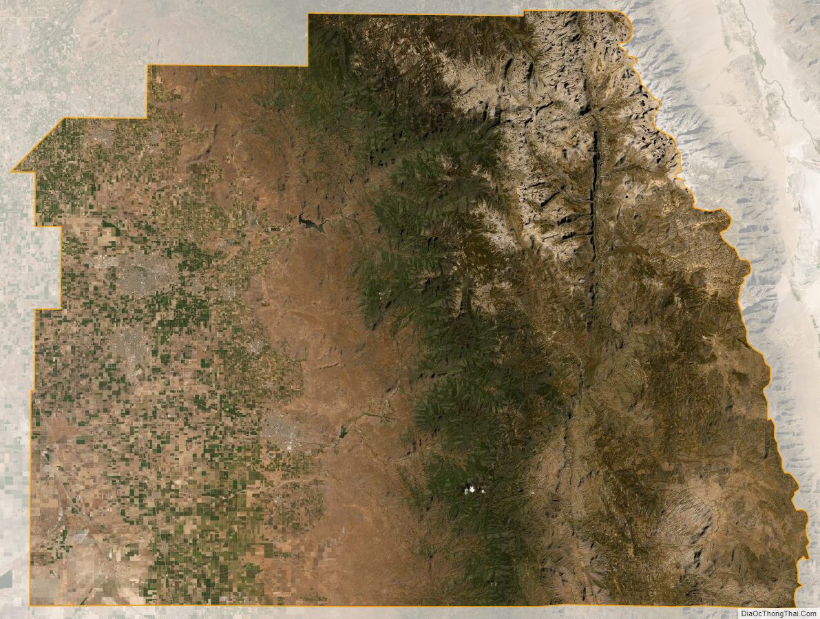
Tulare County Satellite Map
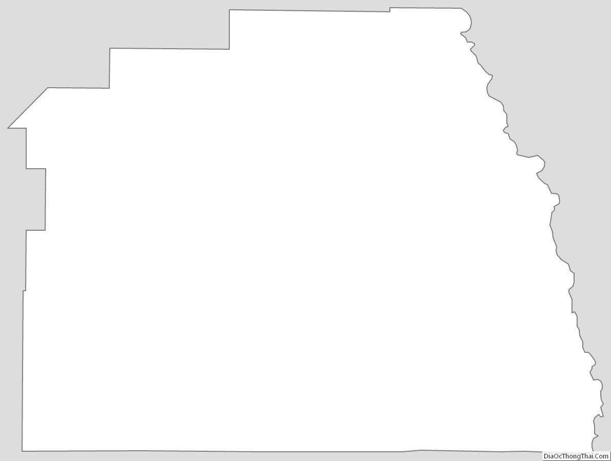
Tulare County Outline Map
See also
Map of California State and its subdivision:- Alameda
- Alpine
- Amador
- Butte
- Calaveras
- Colusa
- Contra Costa
- Del Norte
- El Dorado
- Fresno
- Glenn
- Humboldt
- Imperial
- Inyo
- Kern
- Kings
- Lake
- Lassen
- Los Angeles
- Madera
- Marin
- Mariposa
- Mendocino
- Merced
- Modoc
- Mono
- Monterey
- Napa
- Nevada
- Orange
- Placer
- Plumas
- Riverside
- Sacramento
- San Benito
- San Bernardino
- San Diego
- San Francisco
- San Joaquin
- San Luis Obispo
- San Mateo
- Santa Barbara
- Santa Clara
- Santa Cruz
- Shasta
- Sierra
- Siskiyou
- Solano
- Sonoma
- Stanislaus
- Sutter
- Tehama
- Trinity
- Tulare
- Tuolumne
- Ventura
- Yolo
- Yuba
- Alabama
- Alaska
- Arizona
- Arkansas
- California
- Colorado
- Connecticut
- Delaware
- District of Columbia
- Florida
- Georgia
- Hawaii
- Idaho
- Illinois
- Indiana
- Iowa
- Kansas
- Kentucky
- Louisiana
- Maine
- Maryland
- Massachusetts
- Michigan
- Minnesota
- Mississippi
- Missouri
- Montana
- Nebraska
- Nevada
- New Hampshire
- New Jersey
- New Mexico
- New York
- North Carolina
- North Dakota
- Ohio
- Oklahoma
- Oregon
- Pennsylvania
- Rhode Island
- South Carolina
- South Dakota
- Tennessee
- Texas
- Utah
- Vermont
- Virginia
- Washington
- West Virginia
- Wisconsin
- Wyoming