| Name: | Tuolumne County |
|---|---|
| FIPS code: | 06-109 |
| State: | California |
| Founded: | 1850 |
| Seat: | Sonora |
| Largest city: | Sonora |
| Total Area: | 2,274 sq mi (5,890 km²) |
| Land Area: | 2,221 sq mi (5,750 km²) |
| Total Population: | 55,620 |
| Population Density: | 24/sq mi (9.4/km²) |
| Time zone: | UTC−8 (Pacific Time Zone) |
| Summer Time Zone (DST): | UTC−7 (Pacific Daylight Time) |
| Website: | www.co.tuolumne.ca.us |
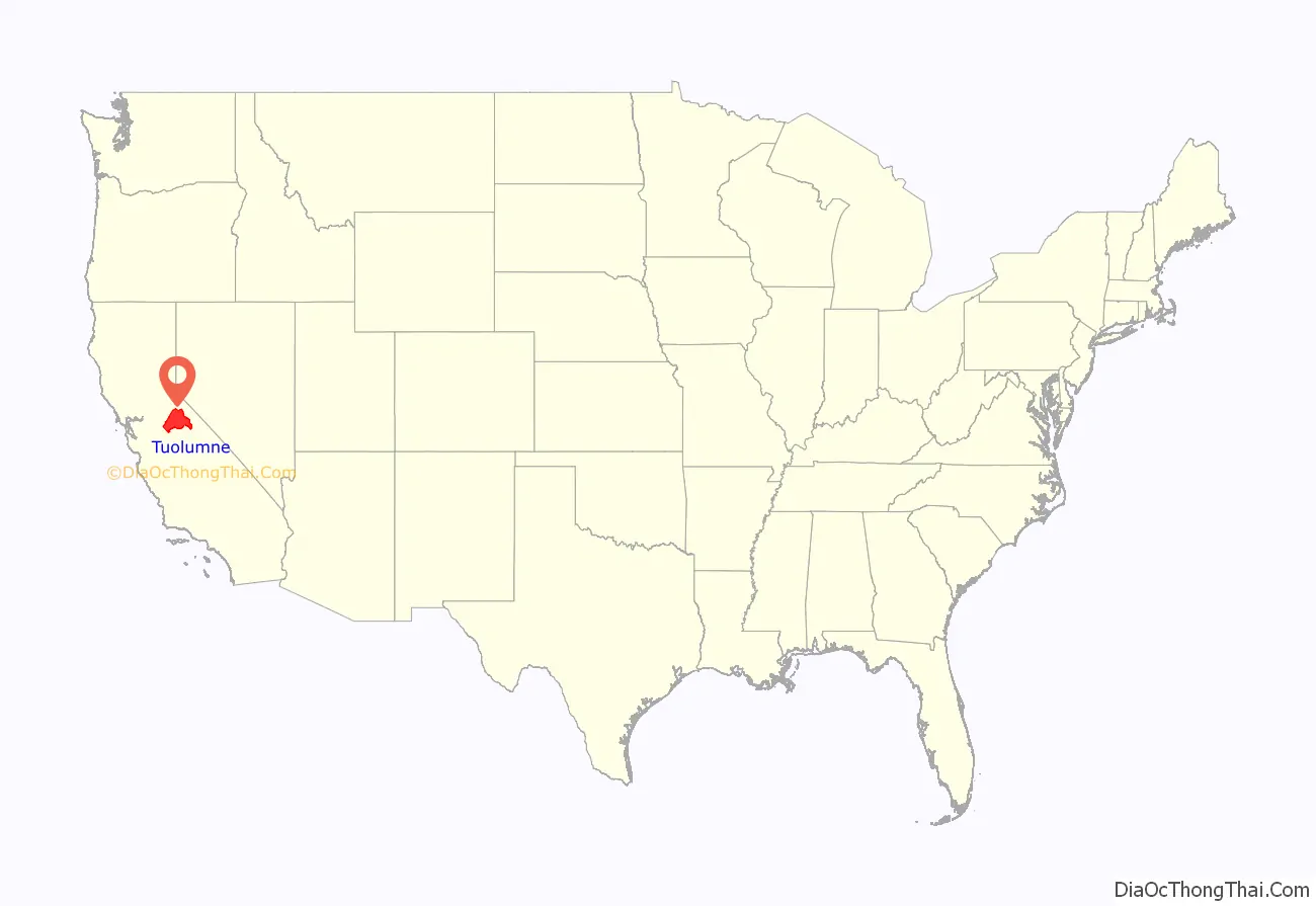
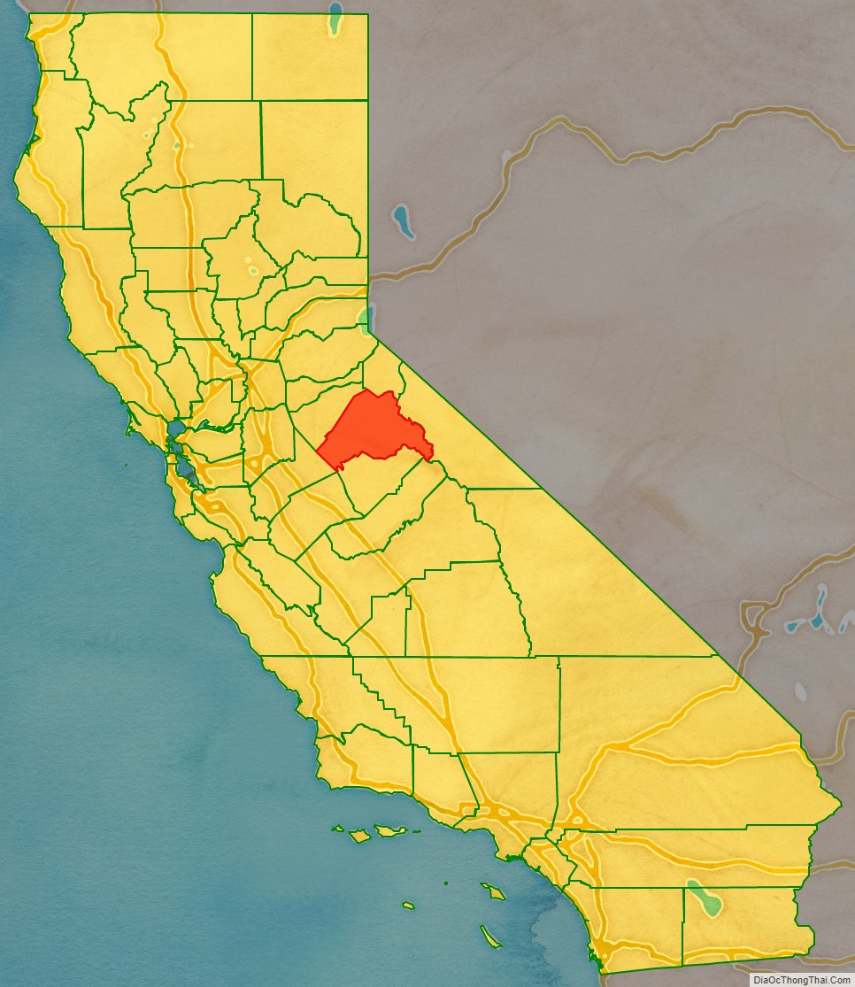
Tuolumne County location map. Where is Tuolumne County?
History
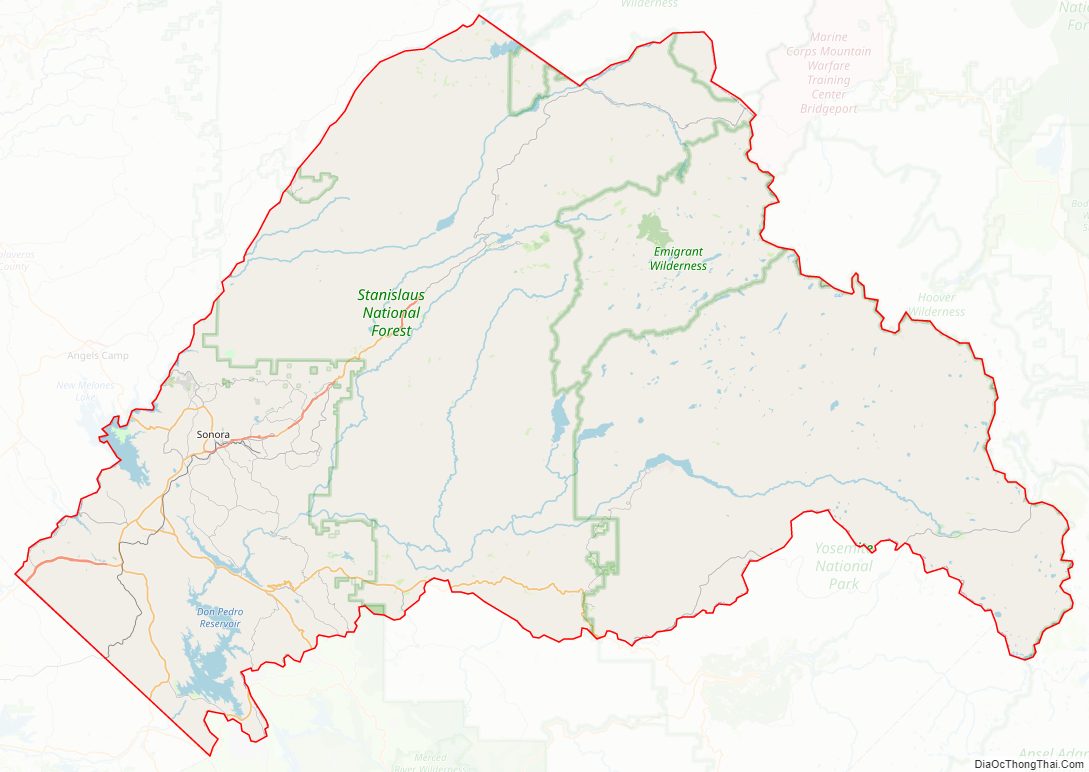
Tuolumne County Boundaries
One of California’s original 27 counties, Tuolumne was organized in 1850.
Prior to the official naming of counties by the state, Tuolumne was sometimes referred to as Oro County.
The original lines of Tuolumne County were not long established. In 1854 and 1855 the portion of Tuolumne County that extended west into the San Joaquin Valley was reorganized as Stanislaus County. In 1864 a number of the original counties including Tuolumne contributed lands that would lead to the establishment of Alpine County to the northeast. With the State’s Adoption of the Political Code in 1872 the current boundaries of Tuolumne County were largely established as shown in the maps below.
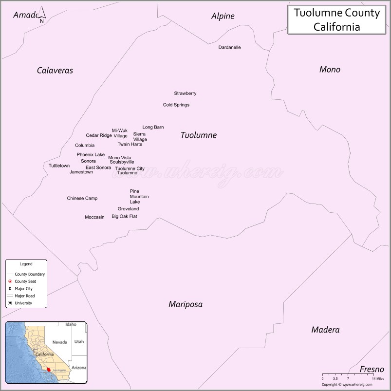
Tuolumne County Road Map
Geography
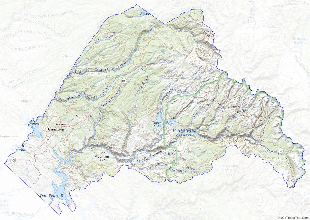
According to the U.S. Census Bureau, the county has a total area of 2,274 square miles (5,890 km), of which 2,221 square miles (5,750 km) is land and 54 square miles (140 km) (2.4%) is water. A California Department of Forestry document reports Tuolumne County’s 1,030,812 acres (4,171.55 km) include federal lands such as Yosemite National Park, Stanislaus National Forest, Bureau of Land Management lands, and Indian reservations. Notable landforms in the county include Table Mountain.
Special Districts
Special districts in Tuolumne County include:
- Belleview Elementary School District
- Big Oak Flat-Groveland Unified School District
- Chinese Camp Elementary School District
- Columbia Fire District
- Columbia Union Elementary School District
- Curtis Creek Elementary School District
- Groveland Community Services District
- Jamestown Elementary School District
- Jamestown Fire District
- Mi-Wuk Sugar Pine Fire Protection District
- Sonora Elementary School District
- Sonora Union High School District
- Soulsbyville Elementary School District
- Strawberry Fire District
- Summerville Elementary School District
- Summerville Union High School District
- Tuolumne County Air Pollution Control District
- Tuolumne County Water District No. 1
- Tuolumne Fire District
- Tuolumne Regional Water District
- Tuolumne Utilities District
- Twain Harte Fire District
- Twain Harte-Long Barn Union Elementary School District
- Yosemite Community College District
Adjacent counties
- Alpine County, California – north
- Calaveras County, California – northwest
- Stanislaus County, California – southwest
- Mariposa County, California – south
- Madera County, California – southeast
- Mono County, California – east
- Merced County, California – southwest
Geographical features
- Red Hills (Tuolumne County) (Area of Critical Environmental Concern)
- Stanislaus National Forest (National protected area, part)
- Yosemite National Park (NPA, part)
- Grand Canyon of the Tuolumne
- Lone Gulch
- Tiltill Valley
Tuolumne County Topographic Map
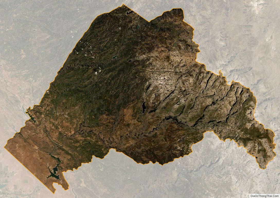
Tuolumne County Satellite Map
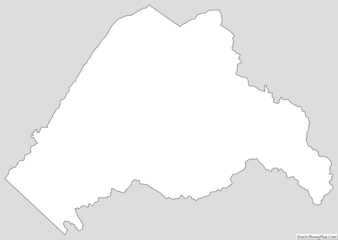
Tuolumne County Outline Map
See also
Map of California State and its subdivision:- Alameda
- Alpine
- Amador
- Butte
- Calaveras
- Colusa
- Contra Costa
- Del Norte
- El Dorado
- Fresno
- Glenn
- Humboldt
- Imperial
- Inyo
- Kern
- Kings
- Lake
- Lassen
- Los Angeles
- Madera
- Marin
- Mariposa
- Mendocino
- Merced
- Modoc
- Mono
- Monterey
- Napa
- Nevada
- Orange
- Placer
- Plumas
- Riverside
- Sacramento
- San Benito
- San Bernardino
- San Diego
- San Francisco
- San Joaquin
- San Luis Obispo
- San Mateo
- Santa Barbara
- Santa Clara
- Santa Cruz
- Shasta
- Sierra
- Siskiyou
- Solano
- Sonoma
- Stanislaus
- Sutter
- Tehama
- Trinity
- Tulare
- Tuolumne
- Ventura
- Yolo
- Yuba
- Alabama
- Alaska
- Arizona
- Arkansas
- California
- Colorado
- Connecticut
- Delaware
- District of Columbia
- Florida
- Georgia
- Hawaii
- Idaho
- Illinois
- Indiana
- Iowa
- Kansas
- Kentucky
- Louisiana
- Maine
- Maryland
- Massachusetts
- Michigan
- Minnesota
- Mississippi
- Missouri
- Montana
- Nebraska
- Nevada
- New Hampshire
- New Jersey
- New Mexico
- New York
- North Carolina
- North Dakota
- Ohio
- Oklahoma
- Oregon
- Pennsylvania
- Rhode Island
- South Carolina
- South Dakota
- Tennessee
- Texas
- Utah
- Vermont
- Virginia
- Washington
- West Virginia
- Wisconsin
- Wyoming