Tuscaloosa County is a county in the northwest-central portion of the U.S. state of Alabama and is the center of commerce, education, industry, health care, and entertainment for the region.
The county’s population was 227,036 as of the 2020 census. The county seat and largest city is Tuscaloosa. Tuscaloosa County is part of the Tuscaloosa, AL Metropolitan Statistical Area, which also includes Hale and Pickens counties. The community gained international attention in 1993 when it landed Mercedes-Benz’s first North American assembly plant, and as of 2021, the company employs over 4,000 people at the facility. Even so, Tier-1 research university The University of Alabama remains the county’s largest employer and dominant economic and cultural engine.
| Name: | Tuscaloosa County |
|---|---|
| FIPS code: | 01-125 |
| State: | Alabama |
| Founded: | February 6, 1818 |
| Named for: | Tuskaloosa |
| Seat: | Tuscaloosa |
| Largest city: | Tuscaloosa |
| Total Area: | 1,351 sq mi (3,500 km²) |
| Land Area: | 1,322 sq mi (3,420 km²) |
| Total Population: | 227,036 |
| Population Density: | 170/sq mi (65/km²) |
| Time zone: | UTC−6 (Central) |
| Summer Time Zone (DST): | UTC−5 (CDT) |
| Website: | www.tuscco.com |
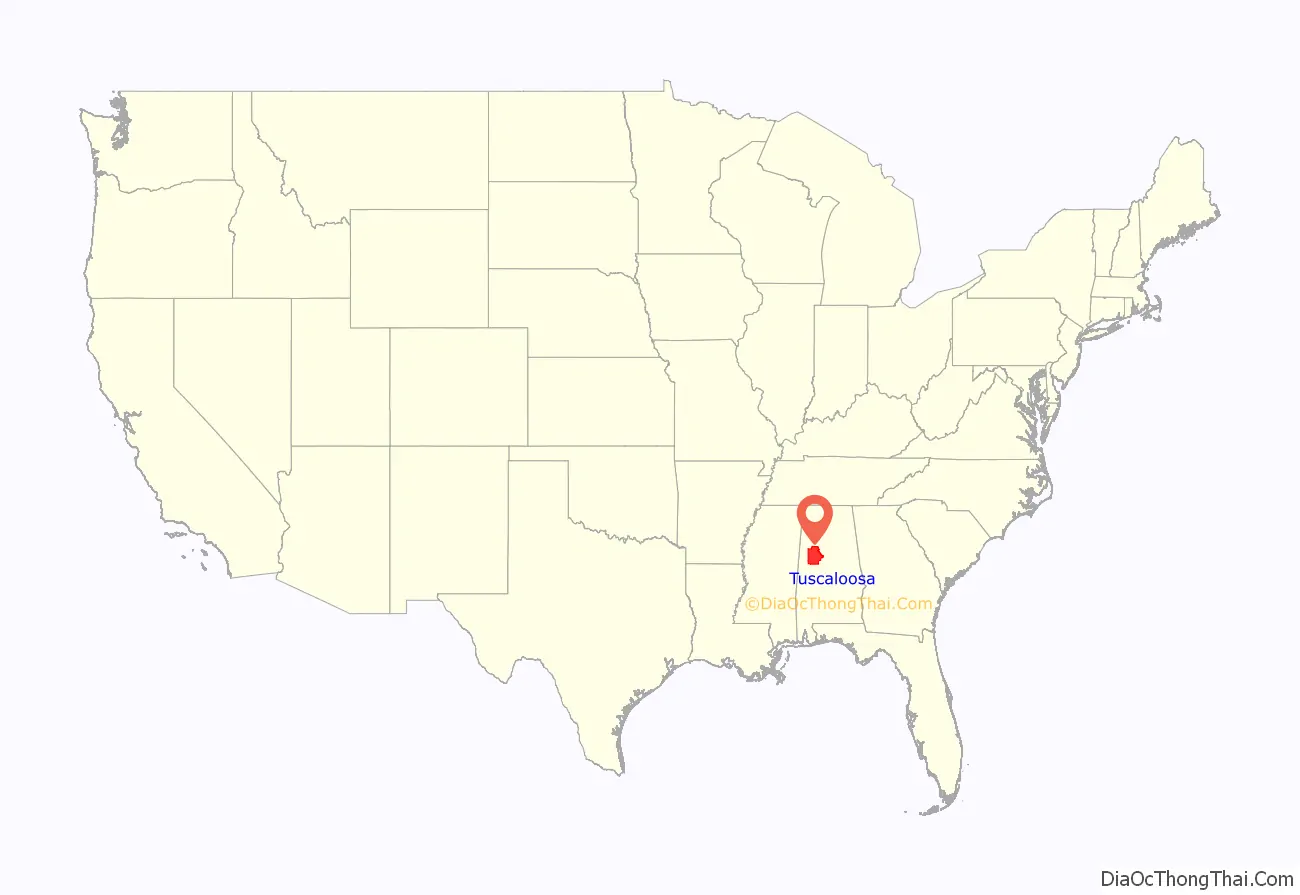
Tuscaloosa County location map. Where is Tuscaloosa County?
History
See also the history of Tuscaloosa, Alabama
Early settlement
The pace of white settlement in the Southeast increased greatly after the War of 1812 and the Treaty of Fort Jackson and the subsequent availability of land previously settled by Native Americans. A small assortment of log cabins soon arose near the large Creek village at the fall line of the river, which the new settlers named in honor of the sixteenth-century Chief Tuskaloosa. of a Muskogean-speaking tribe and paramount chief of the Mississippian culture. To form the word, they combined the Choctaw words “tushka” or “tashka” (“warrior”) and “lusa” (“black”).
In 1817, Alabama became a territory. Tuscaloosa County was established on February 6, 1818. On December 13, 1819, the territorial legislature incorporated the town of Tuskaloosa- now Tuscaloosa – one day before Congress admitted Alabama the Union as a state.
From 1826 to 1846, Tuskaloosa was the capital of Alabama. The State House was built at the corner of 6th Street and 28th Avenue (now the site of Capitol Park). In 1831, the University of Alabama was established.
Civil War and Reconstruction
During the antebellum years, the principal crop was cotton, cultivated and processed by African-American slaves. By 1860, shortly before Alabama’s secession from the Union, the county had a total of 12,971 whites, 84 “free” African Americans, and 10,145 African-American slaves; the latter comprised 43.7 percent of the total population. The Civil War brought significant changes, including migration out of the county by some African Americans. Some freedmen moved to nearby counties and larger cities for more opportunities and to join with other freedmen in communities less subject to white supervision and intimidation.
Several thousand men from Tuscaloosa County fought in the Confederate armies. During the last weeks of the War, a brigade of Union troops raiding the city burned the campus of the university. The town of Tuscaloosa was also damaged in the battle and shared fully in the South’s economic sufferings which followed the defeat. Following Reconstruction, there was violence as whites struggled to regain control of the state legislature. It reached a height in the late 19th and early 20th centuries. Tuscaloosa County had a total of 10 documented lynchings of African Americans, according to a 2015 study by the Equal Justice Initiative.
In the 1890s the construction of a system of locks and dams on the Black Warrior River by the U.S. Army Corps of Engineers improved navigation to such an extent that Tuscaloosa was effectively connected to the Gulf Coast seaport of Mobile. This stimulated the economy and trade, and mining and metallurgical industries were developed in the region. By the advent of the 20th century, the growth of the University of Alabama and the mental health-care facilities in the city, along with a strong national economy, fueled a steady growth in Tuscaloosa which continued unabated for 100 years.
In 1901, the state legislature passed a constitution that disenfranchised most African Americans and tens of thousands of poor whites and followed with Jim Crow laws enforcing racial segregation. Due to this oppression and problems of continued violence by lynchings, many African Americans left Alabama in two waves of the Great Migration in the first half of the 20th century. They went to Northern and Midwestern industrial cities. Their mass departure from Tuscaloosa County is reflected in the lower rates of county population growth from 1910 to 1930, and from 1950 to 1970. (see Census Table).
Civil Rights era
Blacks by 1960 represented 28.7% of the county population, and they were still disenfranchised throughout the state. African Americans in Tuscaloosa were active in demonstrations and other civil rights activities throughout the 1960s, seeking desegregation of public facilities, including the county courthouse. The university was at the center of significant moments in the civil rights movement, including the admission of Autherine Lucy and the pro-segregation demonstration that followed as well as the Stand in the Schoolhouse Door incident in which then-governor George Wallace attempted to stop desegregation of the institution by denying entrance to two African-American students.
The late 21st century brought positive economic news when Mercedes-Benz announced it would build its first U.S. assembly plant near Vance. The facility opened in 1995 It opened in and began assembling the R-Class Grand Sport Tourer in 2005. From 2006–2015 it produced the GL-Class vehicles; and since 1998 and 2015 respectively, has produced the GLS-Class and GLE-CLASS. The plant brought thousands of jobs to the area through its own direct hires as well as those of the many component suppliers it attracted.
2000 to Present
On April 27, 2011, the city of Tuscaloosa was hit by a half-mile (800 m) wide EF4 tornado, which was part of the 2011 Super Outbreak. It resulted in at least 44 deaths in the city, over 1000 injuries, and massive devastation. Officials at DCH Hospital (alone) in Tuscaloosa reported treating more than 1000 injured people in the first several days of the tornado aftermath. Mayor Maddox was quoted saying that “We have neighborhoods that have been basically removed from the map.” On April 29, President Barack Obama, upon touring the tornado damage in Tuscaloosa, said “I have never seen devastation like this”.
In the decade since, more than $1 billion in public and private funding has assisted the community in recovery. Former Tuscaloosa City Council President told NPR in 2021, “Black, white, young and old come together and we worked through this thing and made Tuscaloosa what it is today.”
According to a police violence tracking website, police have killed directly or indirectly 18 people over the last 21 years in the county, half of them African American.
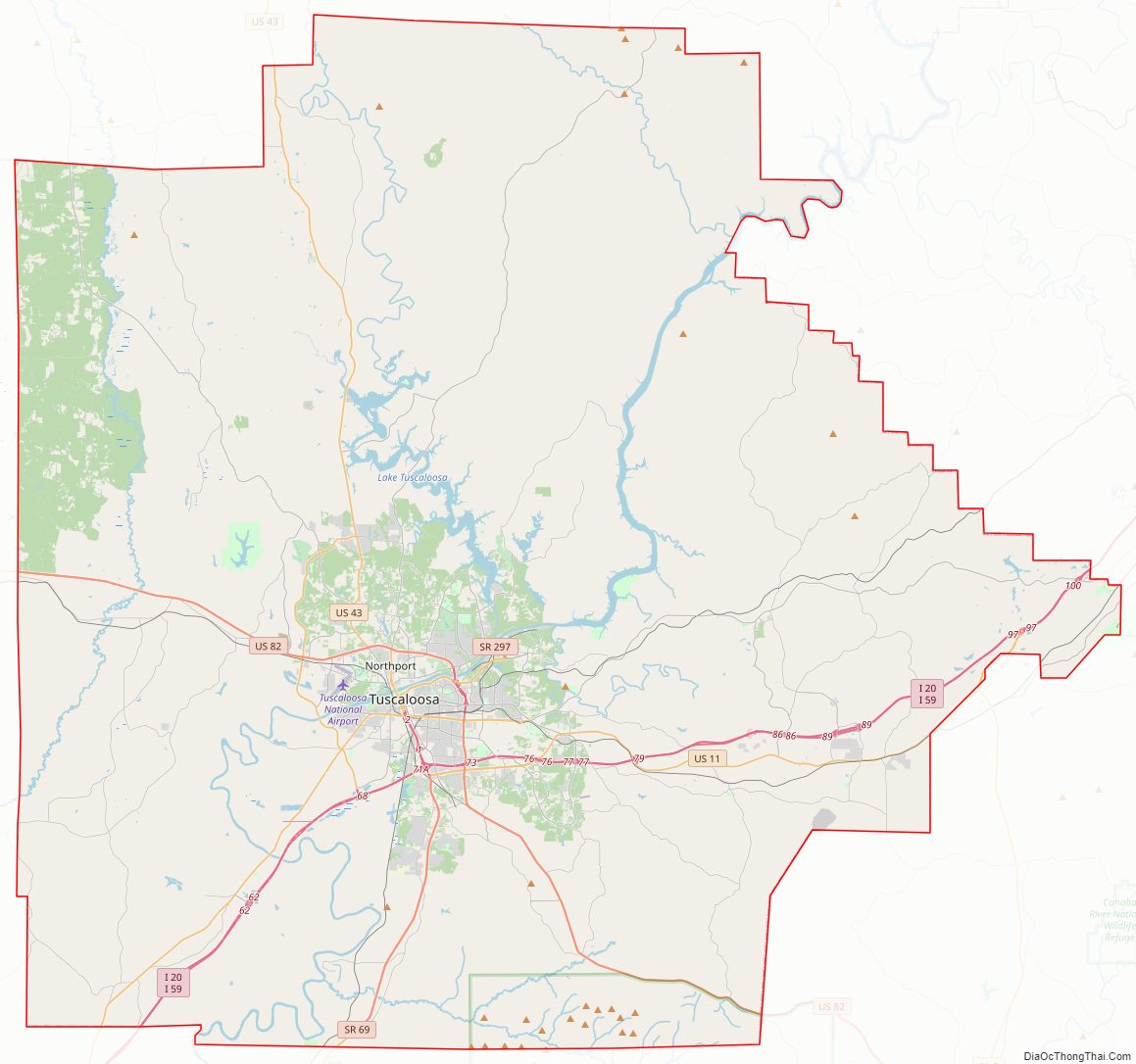
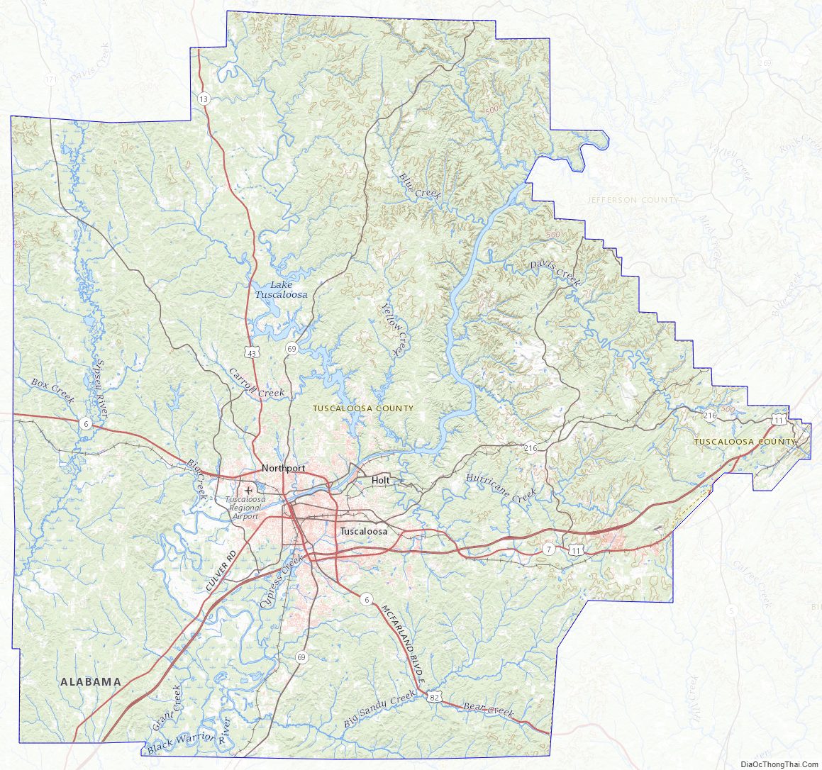
Tuscaloosa County Road Map
Geography
According to the United States Census Bureau, the county has a total area of 1,351 square miles (3,500 km), of which 1,322 square miles (3,420 km) is land and 30 square miles (78 km) (2.2%) is water. It is the second-largest county in Alabama by land area and third-largest by total area. It is located in the west central part of the state, in the region commonly known as West Alabama. The county straddles the boundary between the Appalachian Highlands and the Gulf Coastal Plain and consequently boasts a diverse geography. Tuscaloosa County contains part of the Talladega National Forest, a national protected area.
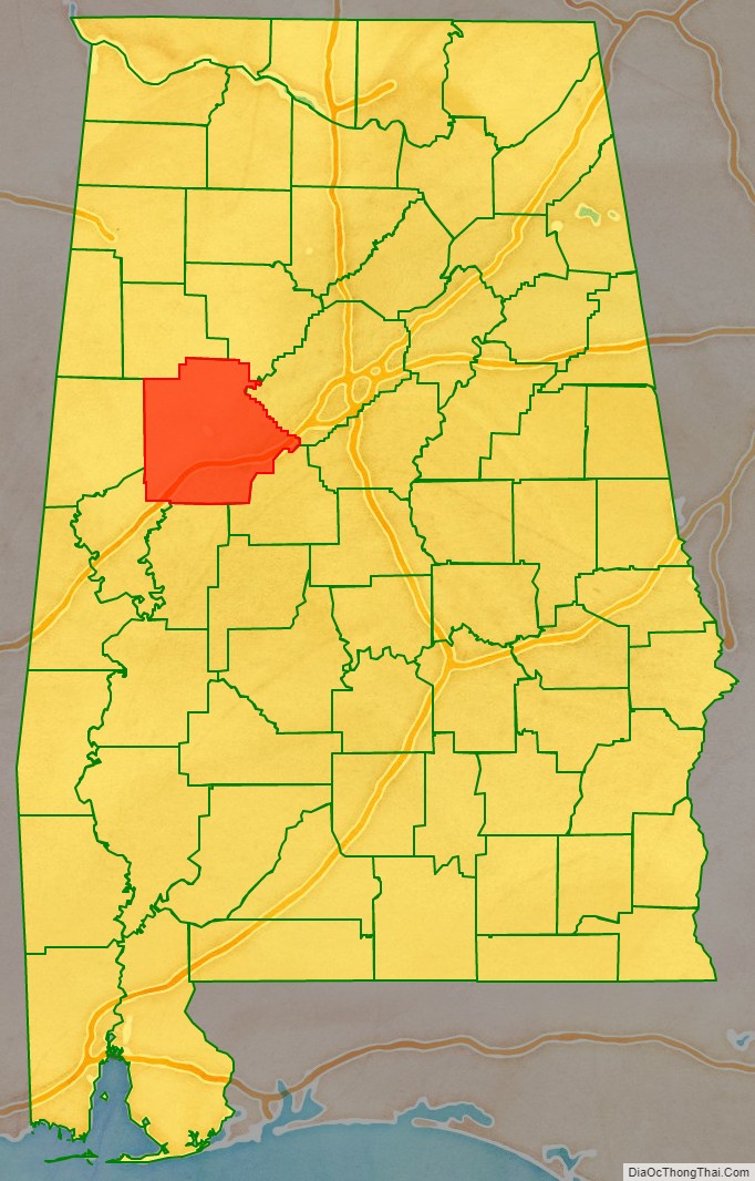
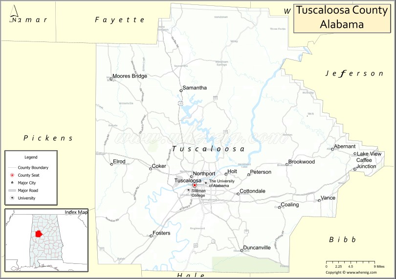
Adjacent counties are: Walker County (northeast), Jefferson County (east), Bibb County (southeast), Hale County (south), Greene County (southwest), Pickens County (west), and Fayette County (northwest)
Tuscaloosa County Topographic Map
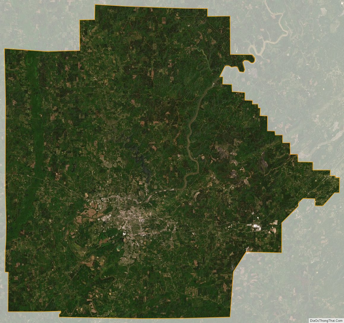
Tuscaloosa County Satellite Map
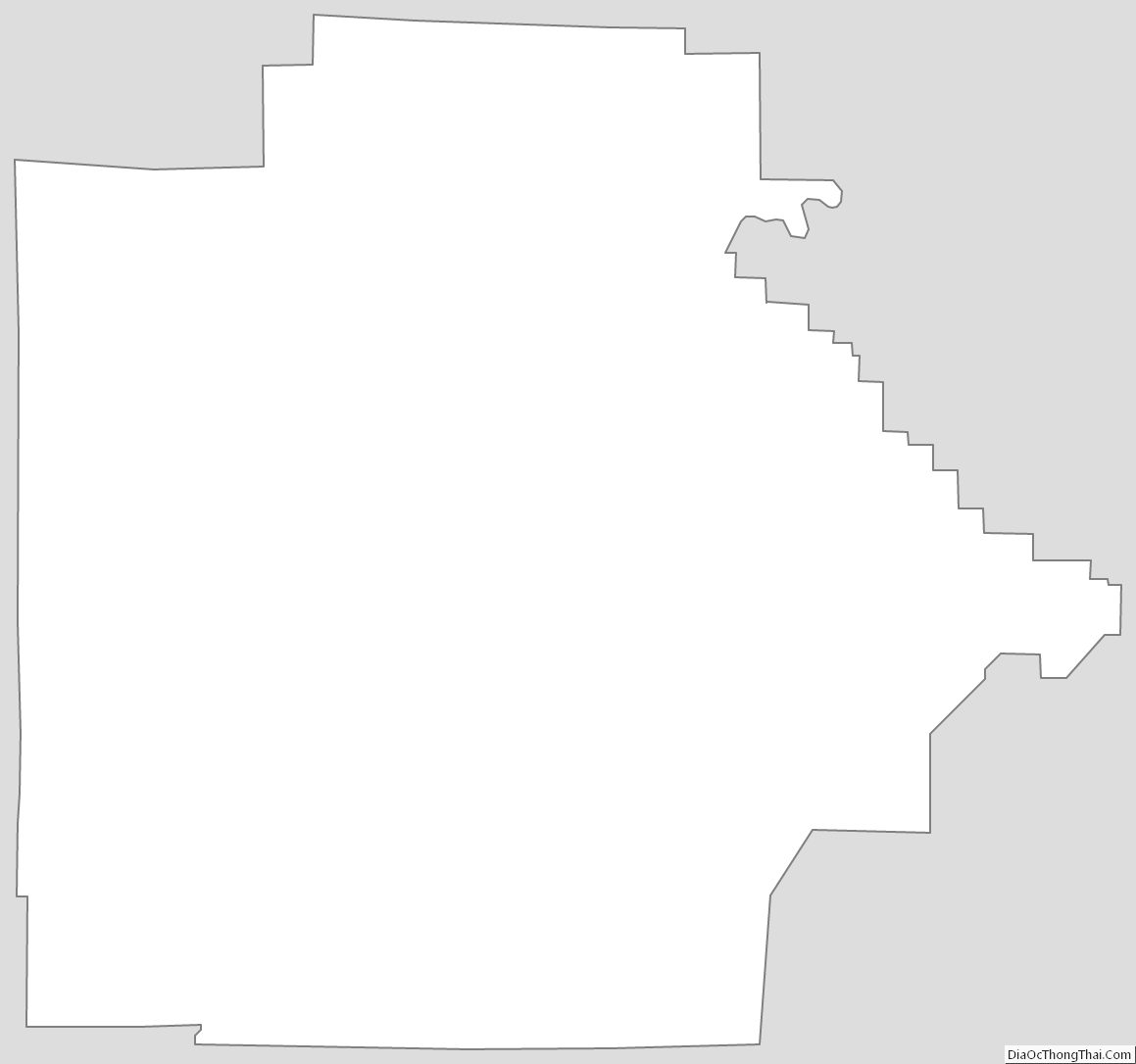
Tuscaloosa County Outline Map
See also
Map of Alabama State and its subdivision:- Autauga
- Baldwin
- Barbour
- Bibb
- Blount
- Bullock
- Butler
- Calhoun
- Chambers
- Cherokee
- Chilton
- Choctaw
- Clarke
- Clay
- Cleburne
- Coffee
- Colbert
- Conecuh
- Coosa
- Covington
- Crenshaw
- Cullman
- Dale
- Dallas
- De Kalb
- Elmore
- Escambia
- Etowah
- Fayette
- Franklin
- Geneva
- Greene
- Hale
- Henry
- Houston
- Jackson
- Jefferson
- Lamar
- Lauderdale
- Lawrence
- Lee
- Limestone
- Lowndes
- Macon
- Madison
- Marengo
- Marion
- Marshall
- Mobile
- Monroe
- Montgomery
- Morgan
- Perry
- Pickens
- Pike
- Randolph
- Russell
- Saint Clair
- Shelby
- Sumter
- Talladega
- Tallapoosa
- Tuscaloosa
- Walker
- Washington
- Wilcox
- Winston
- Alabama
- Alaska
- Arizona
- Arkansas
- California
- Colorado
- Connecticut
- Delaware
- District of Columbia
- Florida
- Georgia
- Hawaii
- Idaho
- Illinois
- Indiana
- Iowa
- Kansas
- Kentucky
- Louisiana
- Maine
- Maryland
- Massachusetts
- Michigan
- Minnesota
- Mississippi
- Missouri
- Montana
- Nebraska
- Nevada
- New Hampshire
- New Jersey
- New Mexico
- New York
- North Carolina
- North Dakota
- Ohio
- Oklahoma
- Oregon
- Pennsylvania
- Rhode Island
- South Carolina
- South Dakota
- Tennessee
- Texas
- Utah
- Vermont
- Virginia
- Washington
- West Virginia
- Wisconsin
- Wyoming