Tyler County is a county in the U.S. state of West Virginia. As of the 2020 census, the population was 8,313. Its county seat is Middlebourne. The county was founded in 1814 and is named after John Tyler, Sr., father of President John Tyler.
| Name: | Tyler County |
|---|---|
| FIPS code: | 54-095 |
| State: | West Virginia |
| Founded: | December 6, 1814 |
| Named for: | John Tyler Sr. |
| Seat: | Middlebourne |
| Largest city: | Paden City |
| Total Area: | 261 sq mi (680 km²) |
| Land Area: | 256 sq mi (660 km²) |
| Total Population: | 8,313 |
| Population Density: | 32/sq mi (12/km²) |
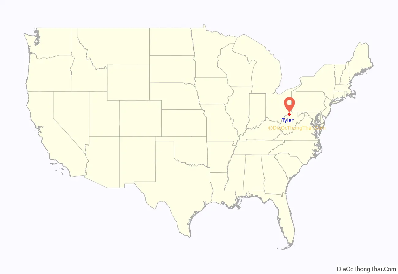
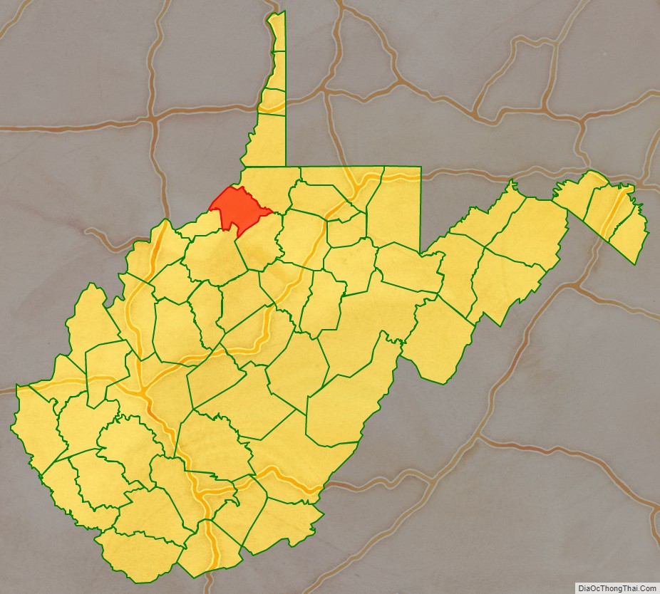
Tyler County location map. Where is Tyler County?
History
The earliest white hunters (mainly of Scotch-Irish, English, and German descent) settled in what later became Tyler County in 1792 near the present town of Friendly. This area on the banks of the Ohio River was former Indian hunting grounds.
Tyler County was officially formed from a portion of what was then Ohio County, Virginia, on December 6, 1814. The following year, Middlebourne (founded 1798) became the county seat. This vast area was diminished over the years: in 1845 a small portion went the newly established Doddridge County; in 1846 the northern half went to make up the new Wetzel County; and in 1851 the southern third went to Pleasants County.
On June 20, 1863, at the height of the Civil War, Tyler was one of fifty Virginia counties that entered the Union as the state of West Virginia. Later that year, the counties were divided into civil townships, with the intention of encouraging local government. This proved impractical in the heavily rural state, and in 1872 the townships were converted into magisterial districts. Tyler County was divided into six districts: Centreville, Ellsworth, Lincoln, McElroy, Meade, and Union. Except for minor adjustments, these districts were largely unchanged until the 1980s, when they were consolidated into four new magisterial districts: Central, North, South, and West. The names and boundaries of the historic magisterial districts continued to exist in the form of tax and assessment districts.
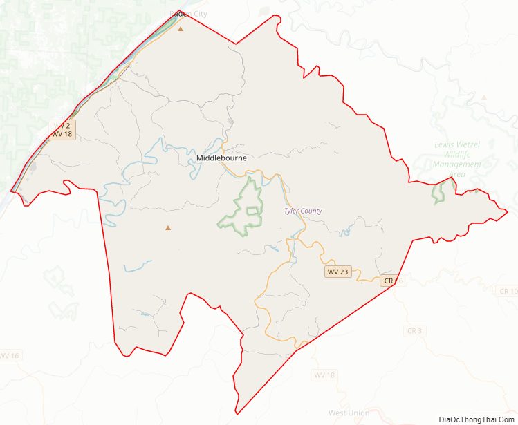
Tyler County Road Map
Geography
According to the United States Census Bureau, the county has a total area of 261 square miles (680 km), of which 256 square miles (660 km) is land and 4.4 square miles (11 km) (1.7%) is water.
Major highways
- WV 2
- WV 18
- WV 23
- WV 74
- WV 180
Adjacent counties
- Wetzel County (northeast)
- Doddridge County (southeast)
- Ritchie County (southwest)
- Pleasants County (west)
- Washington County, Ohio (west)
- Monroe County, Ohio (northwest)
National protected area
- Ohio River Islands National Wildlife Refuge (part)
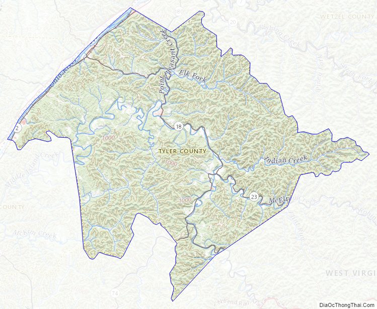
Tyler County Topographic Map
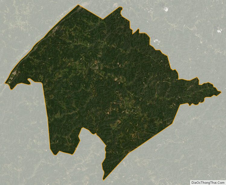
Tyler County Satellite Map
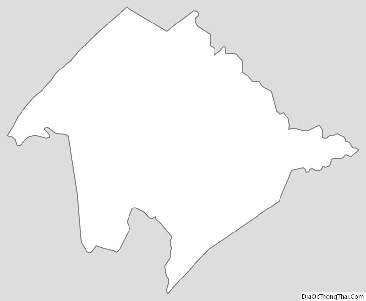
Tyler County Outline Map
See also
Map of West Virginia State and its subdivision:- Barbour
- Berkeley
- Boone
- Braxton
- Brooke
- Cabell
- Calhoun
- Clay
- Doddridge
- Fayette
- Gilmer
- Grant
- Greenbrier
- Hampshire
- Hancock
- Hardy
- Harrison
- Jackson
- Jefferson
- Kanawha
- Lewis
- Lincoln
- Logan
- Marion
- Marshall
- Mason
- McDowell
- Mercer
- Mineral
- Mingo
- Monongalia
- Monroe
- Morgan
- Nicholas
- Ohio
- Pendleton
- Pleasants
- Pocahontas
- Preston
- Putnam
- Raleigh
- Randolph
- Ritchie
- Roane
- Summers
- Taylor
- Tucker
- Tyler
- Upshur
- Wayne
- Webster
- Wetzel
- Wirt
- Wood
- Wyoming
- Alabama
- Alaska
- Arizona
- Arkansas
- California
- Colorado
- Connecticut
- Delaware
- District of Columbia
- Florida
- Georgia
- Hawaii
- Idaho
- Illinois
- Indiana
- Iowa
- Kansas
- Kentucky
- Louisiana
- Maine
- Maryland
- Massachusetts
- Michigan
- Minnesota
- Mississippi
- Missouri
- Montana
- Nebraska
- Nevada
- New Hampshire
- New Jersey
- New Mexico
- New York
- North Carolina
- North Dakota
- Ohio
- Oklahoma
- Oregon
- Pennsylvania
- Rhode Island
- South Carolina
- South Dakota
- Tennessee
- Texas
- Utah
- Vermont
- Virginia
- Washington
- West Virginia
- Wisconsin
- Wyoming