Unicoi County (/ˈjuːnɪˌkɔɪ/) is a county located in the U.S. state of Tennessee. As of the 2020 census, the population was 17,928. Its county seat is Erwin. Unicoi is a Cherokee word meaning “white,” “hazy,” “fog-like,” or “fog draped,” and refers to the mist often seen in the foothills and mountains of this far northeast county. Unicoi County is part of the Johnson City Metropolitan Statistical Area, which is a component of the Johnson City–Kingsport–Bristol, TN-VA Combined Statistical Area, commonly known as the “Tri-Cities” region.
| Name: | Unicoi County |
|---|---|
| FIPS code: | 47-171 |
| State: | Tennessee |
| Founded: | March 23, 1875 |
| Named for: | Cherokee word for “fog-draped” or “hazy” |
| Seat: | Erwin |
| Largest town: | Erwin |
| Total Area: | 186 sq mi (480 km²) |
| Land Area: | 186 sq mi (480 km²) |
| Total Population: | 17,928 |
| Population Density: | 98/sq mi (38/km²) |
| Time zone: | UTC−5 (Eastern) |
| Summer Time Zone (DST): | UTC−4 (EDT) |
| Website: | www.unicoicountytn.gov |
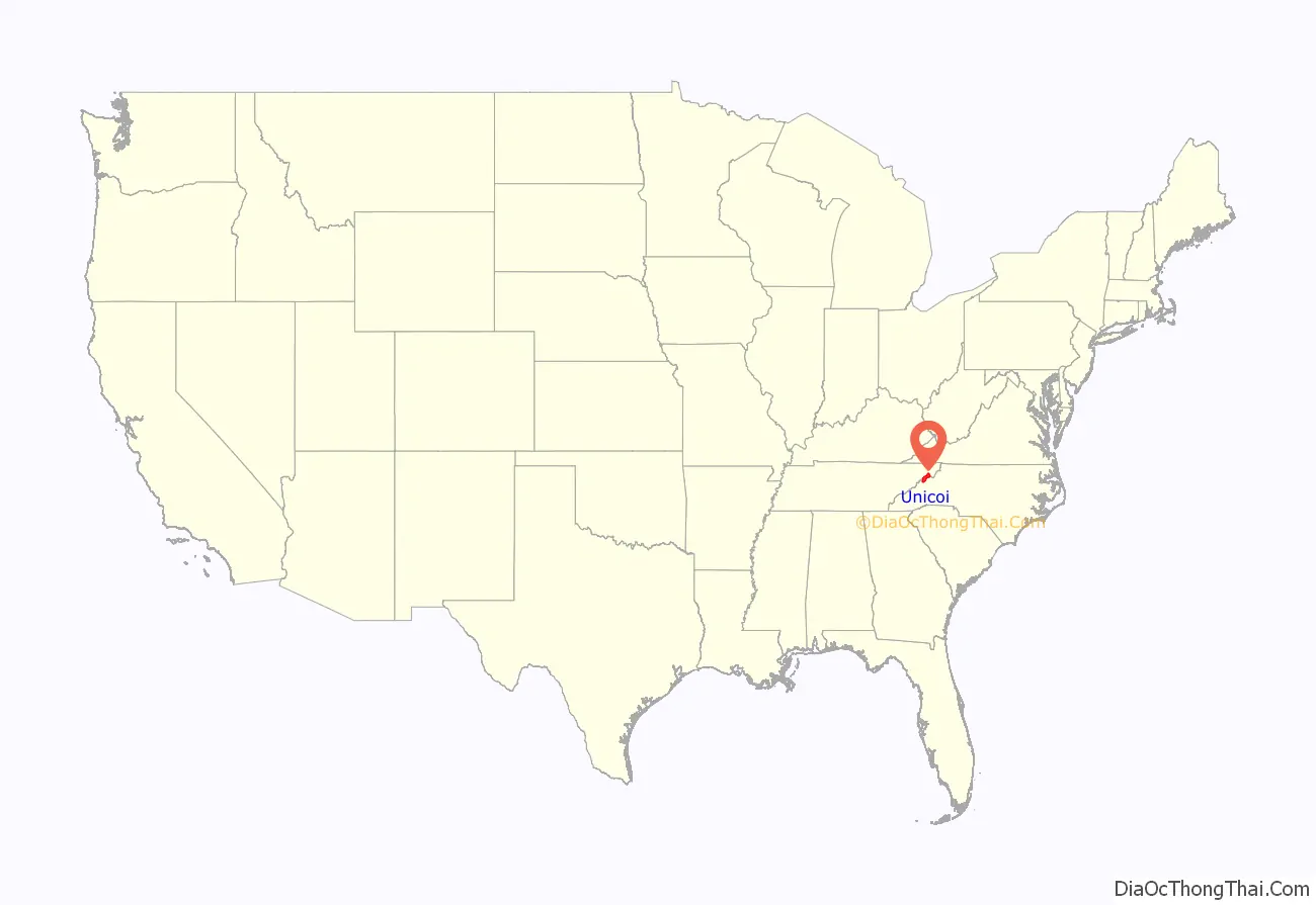
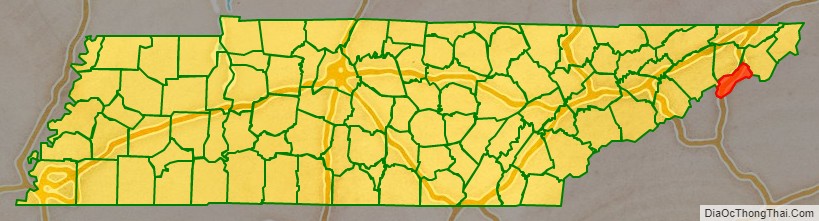
Unicoi County location map. Where is Unicoi County?
History
This area was long inhabited by indigenous peoples, including the historic Cherokee who encountered European and English traders and settlers. The mountainous terrain made it less attractive to subsistence farmers.
Unicoi County was created in 1875 from portions of Washington and Carter counties. Its first European-American settlers had arrived more than a century earlier but the population had been small. The county remained predominantly agrarian until the railroads were constructed in the area in the 1880s.
During the 1910s, the Clinchfield Railroad established a pottery in Erwin, which eventually incorporated under the name, “Southern Potteries.” This company produced a popular brand of dishware, commonly called Blue Ridge China, which featured hand-painted underglaze designs. While the company folded in the 1950s, Blue Ridge dishes remain popular with antique collectors.
In 1916, a circus elephant, Mary, was hanged in Erwin for killing her trainer. Hanging was chosen as the method of execution because the animal survived being shot. She was hanged by a railroad car crane. The hanging was the subject of a book, The Day They Hung the Elephant (1992), by Charles Edwin Price.
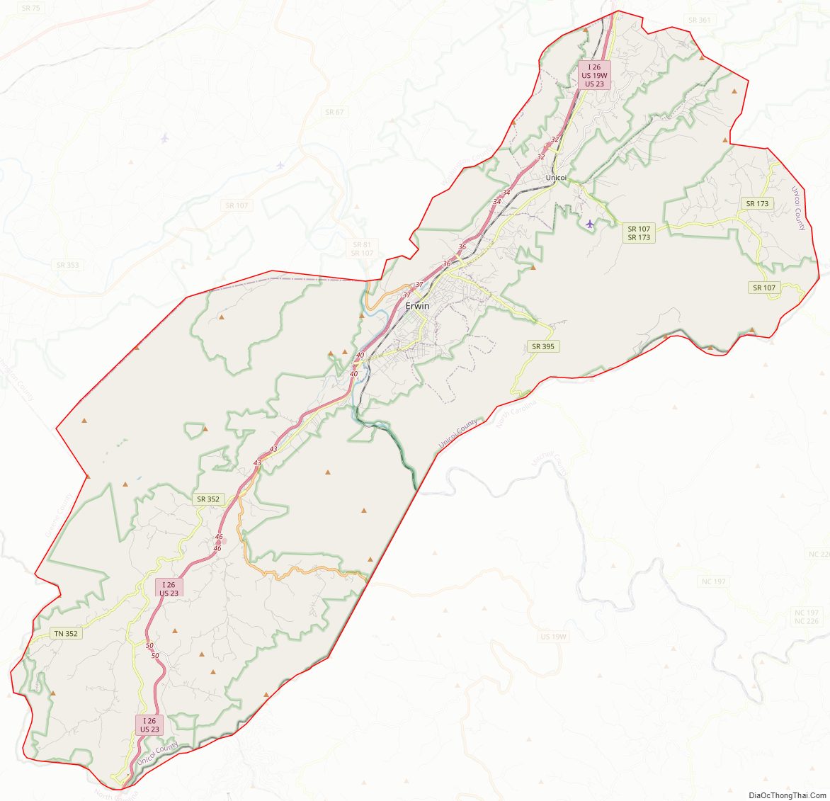
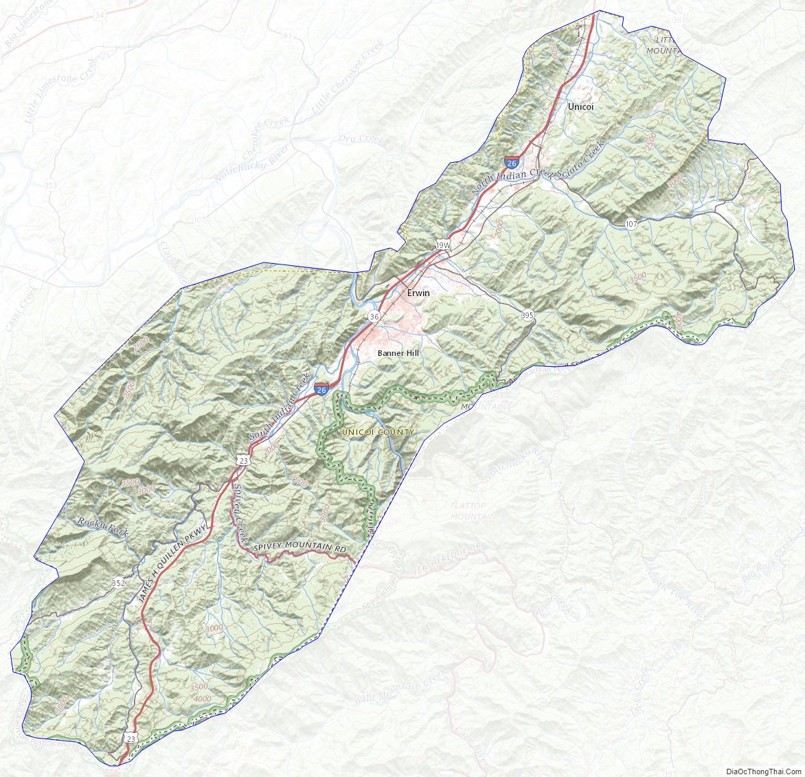
Unicoi County Road Map
Geography
According to the U.S. Census Bureau, the county has a total area of 186 square miles (480 km), of which 186 square miles (480 km) is land and 0.3 square miles (0.78 km) (0.2%) is water. It is the fifth-smallest county in Tennessee by total area. The Nolichucky River, which enters Unicoi County from North Carolina, is the county’s primary drainage.
Unicoi County is situated entirely within the Blue Ridge Mountains, specifically the Bald Mountains (south of the Nolichucky) and the Unaka Range (north of the Nolichucky). Big Bald, which at 5,516 feet (1,681 m) is the highest mountain in the Balds, is also Unicoi County’s high point. Traversed by the Appalachian Trail, the mountain is topped by a grassy bald, allowing a 360-degree view of the surrounding mountains.
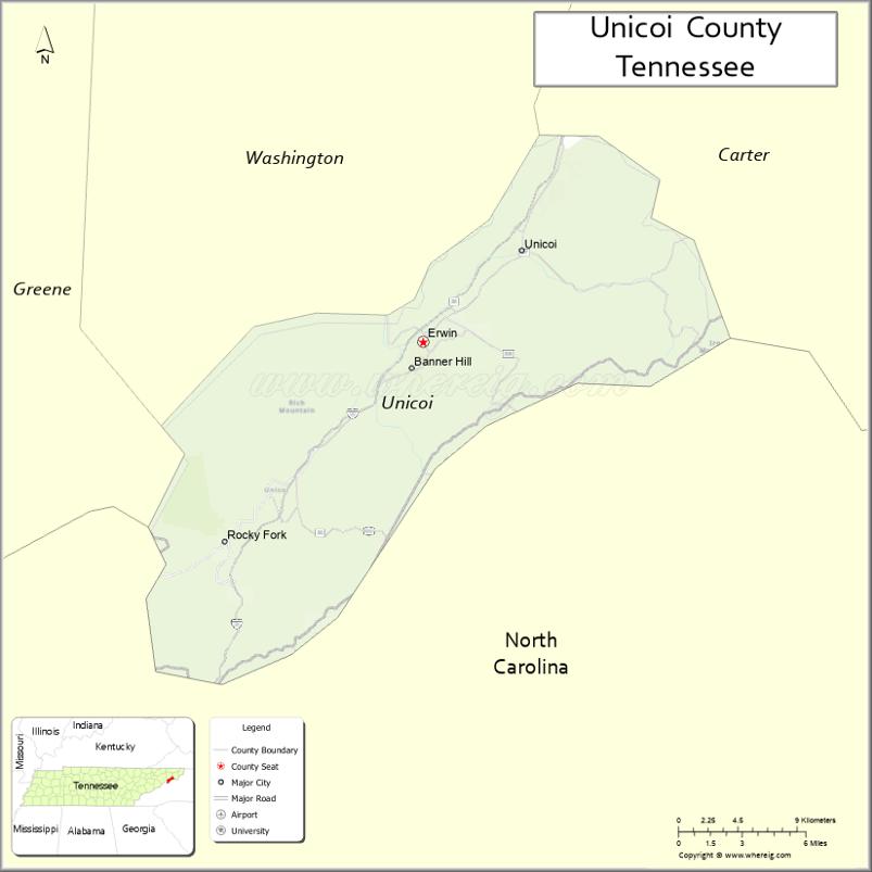
Adjacent counties
- Washington County (north)
- Carter County (northeast)
- Mitchell County, North Carolina (east)
- Yancey County, North Carolina (south)
- Madison County, North Carolina (southwest)
- Greene County (west)
National protected areas
- Appalachian Trail (part)
- Cherokee National Forest (part)
State protected areas
- Rocky Fork State Park
Major Highways
- I-26
- US 19W
- SR 36
- SR 107
- SR 173
- SR 352
- SR 395
Unicoi County Topographic Map
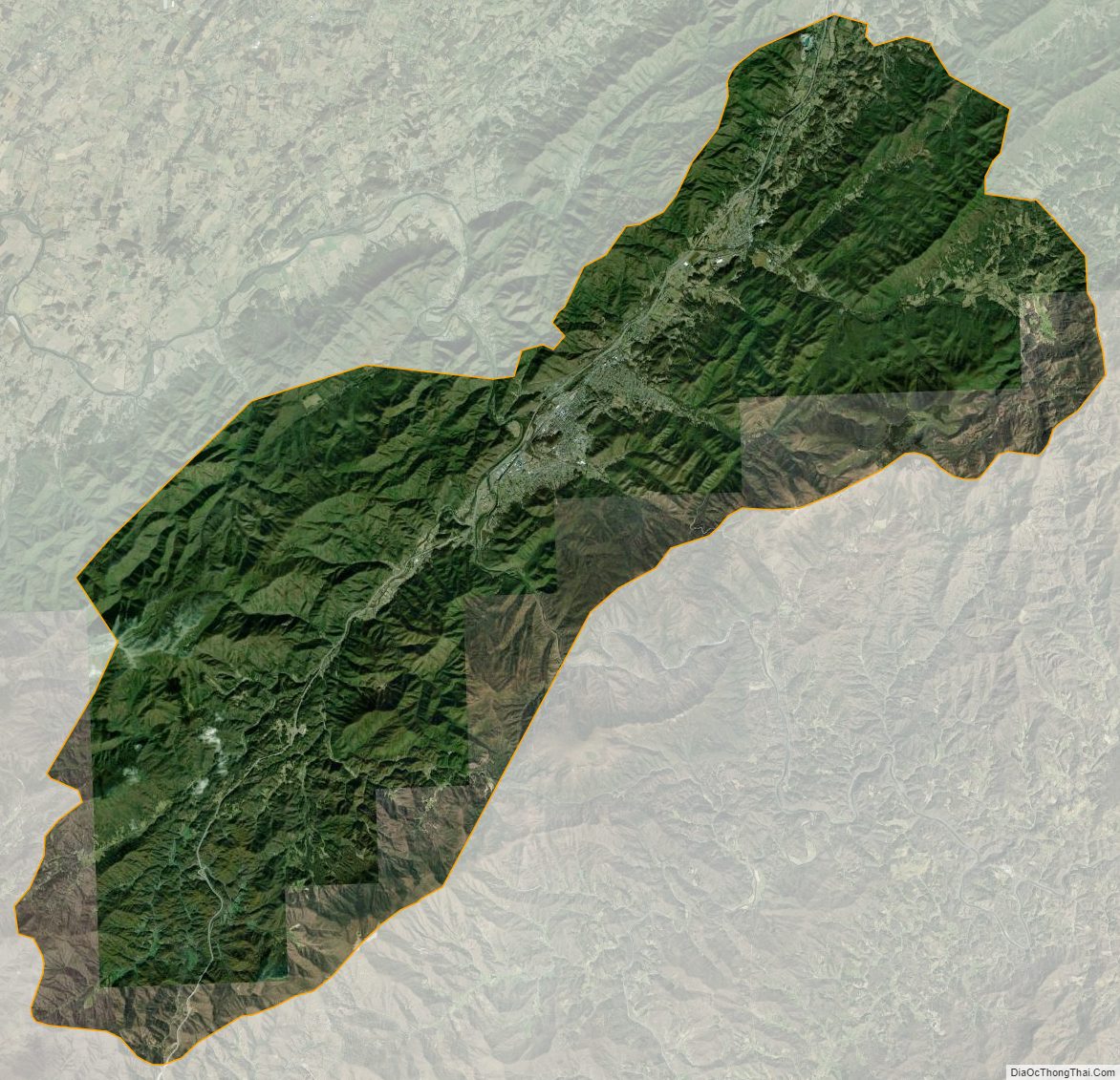
Unicoi County Satellite Map
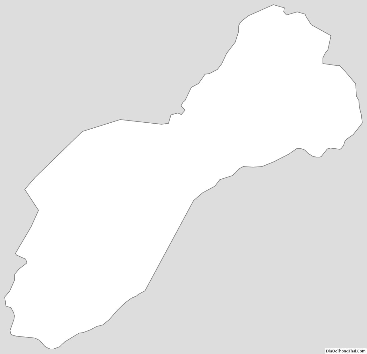
Unicoi County Outline Map
See also
Map of Tennessee State and its subdivision:- Anderson
- Bedford
- Benton
- Bledsoe
- Blount
- Bradley
- Campbell
- Cannon
- Carroll
- Carter
- Cheatham
- Chester
- Claiborne
- Clay
- Cocke
- Coffee
- Crockett
- Cumberland
- Davidson
- Decatur
- DeKalb
- Dickson
- Dyer
- Fayette
- Fentress
- Franklin
- Gibson
- Giles
- Grainger
- Greene
- Grundy
- Hamblen
- Hamilton
- Hancock
- Hardeman
- Hardin
- Hawkins
- Haywood
- Henderson
- Henry
- Hickman
- Houston
- Humphreys
- Jackson
- Jefferson
- Johnson
- Knox
- Lake
- Lauderdale
- Lawrence
- Lewis
- Lincoln
- Loudon
- Macon
- Madison
- Marion
- Marshall
- Maury
- McMinn
- McNairy
- Meigs
- Monroe
- Montgomery
- Moore
- Morgan
- Obion
- Overton
- Perry
- Pickett
- Polk
- Putnam
- Rhea
- Roane
- Robertson
- Rutherford
- Scott
- Sequatchie
- Sevier
- Shelby
- Smith
- Stewart
- Sullivan
- Sumner
- Tipton
- Trousdale
- Unicoi
- Union
- Van Buren
- Warren
- Washington
- Wayne
- Weakley
- White
- Williamson
- Wilson
- Alabama
- Alaska
- Arizona
- Arkansas
- California
- Colorado
- Connecticut
- Delaware
- District of Columbia
- Florida
- Georgia
- Hawaii
- Idaho
- Illinois
- Indiana
- Iowa
- Kansas
- Kentucky
- Louisiana
- Maine
- Maryland
- Massachusetts
- Michigan
- Minnesota
- Mississippi
- Missouri
- Montana
- Nebraska
- Nevada
- New Hampshire
- New Jersey
- New Mexico
- New York
- North Carolina
- North Dakota
- Ohio
- Oklahoma
- Oregon
- Pennsylvania
- Rhode Island
- South Carolina
- South Dakota
- Tennessee
- Texas
- Utah
- Vermont
- Virginia
- Washington
- West Virginia
- Wisconsin
- Wyoming