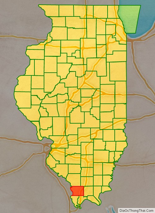
Union County is a county located in the U.S. state of Illinois. According to the 2020 United States Census, it had a population of 17,244. Its county seat is Jonesboro. It is located in the southern portion of Illinois known locally as “Little Egypt”.
| Name: | Union County |
|---|---|
| FIPS code: | 17-181 |
| State: | Illinois |
| Founded: | 2 January 1818 |
| Seat: | Jonesboro |
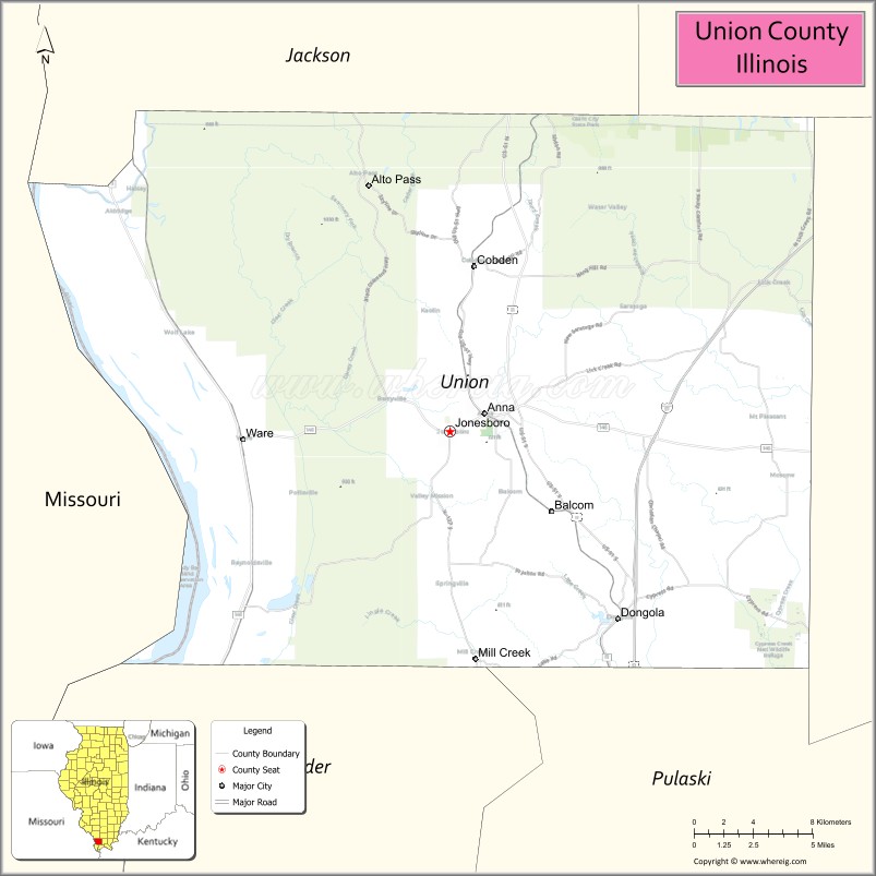
| Largest city: | Anna |
| Total Area: | 422 sq mi (1,090 km²) |
| Land Area: | 413 sq mi (1,070 km²) |
| Total Population: | 17,244 |
| Population Density: | 41/sq mi (16/km²) |
| Time zone: | UTC−6 (Central) |
| Summer Time Zone (DST): | UTC−5 (CDT) |
| Website: | www.unioncountyil.gov |
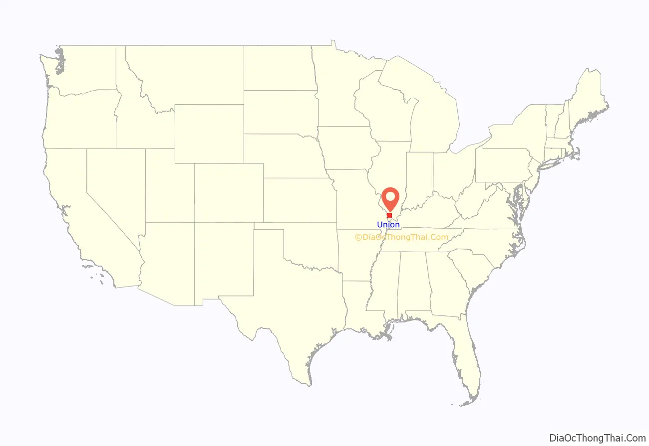
Union County location map. Where is Union County?
History
Union County was formed out of Johnson County, nearly a year before the Illinois Territory gained statehood. It was named for a joint revival meeting of the Baptists and Dunkards, called a “union meeting”. The county seal depicts the leaders of these two groups shaking hands.
For its first year of existence, Union County included an area of unorganized territory temporarily attached to it.
In 1819, the additional territory became Alexander County, reducing Union to its current borders.
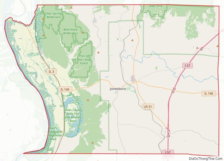
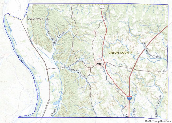
Union County Road Map
Geography
According to the US Census Bureau, the county has a total area of 422 square miles (1,090 km), of which 413 square miles (1,070 km) is land and 8.7 square miles (23 km) (2.1%) is water.
Climate and weather
In recent years, average temperatures in the county seat of Jonesboro have ranged from a low of 22 °F (−6 °C) in January to a high of 90 °F (32 °C) in July, although a record low of −20 °F (−29 °C) was recorded in January 1918 and a record high of 112 °F (44 °C) was recorded in July 1901. Average monthly precipitation ranged from 3.13 inches (80 mm) in September to 5.22 inches (133 mm) in May.
Major highways
- Interstate 57
- U.S. Highway 51
- Illinois Route 3
- Illinois Route 127
- Illinois Route 146
Adjacent counties
- Jackson County – north
- Williamson County – northeast
- Johnson County – east
- Pulaski County – southeast
- Alexander County – south
- Cape Girardeau County, Missouri – west
- Perry County, Missouri – northwest
Protected areas
- Brown Barrens Nature Preserve
- Crab Orchard National Wildlife Refuge (partial)
- Cypress Creek National Wildlife Refuge (partial)
- Lincoln Memorial Picnic Grounds
- Giant City State Park (partial)
- McClure Shale Glade Nature Preserve
- Trail of Tears State Forest
- Shawnee National Forest (partial)
- Union County State Fish and Wildlife Area
Union County Topographic Map
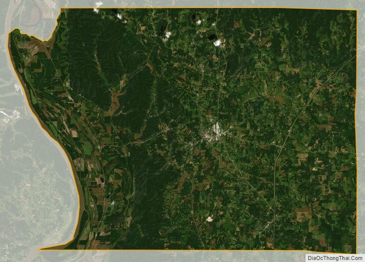
Union County Satellite Map
Union County Outline Map

See also
Map of Illinois State and its subdivision:- Adams
- Alexander
- Bond
- Boone
- Brown
- Bureau
- Calhoun
- Carroll
- Cass
- Champaign
- Christian
- Clark
- Clay
- Clinton
- Coles
- Cook
- Crawford
- Cumberland
- De Kalb
- De Witt
- Douglas
- Dupage
- Edgar
- Edwards
- Effingham
- Fayette
- Ford
- Franklin
- Fulton
- Gallatin
- Greene
- Grundy
- Hamilton
- Hancock
- Hardin
- Henderson
- Henry
- Iroquois
- Jackson
- Jasper
- Jefferson
- Jersey
- Jo Daviess
- Johnson
- Kane
- Kankakee
- Kendall
- Knox
- La Salle
- Lake
- Lake Michigan
- Lawrence
- Lee
- Livingston
- Logan
- Macon
- Macoupin
- Madison
- Marion
- Marshall
- Mason
- Massac
- McDonough
- McHenry
- McLean
- Menard
- Mercer
- Monroe
- Montgomery
- Morgan
- Moultrie
- Ogle
- Peoria
- Perry
- Piatt
- Pike
- Pope
- Pulaski
- Putnam
- Randolph
- Richland
- Rock Island
- Saint Clair
- Saline
- Sangamon
- Schuyler
- Scott
- Shelby
- Stark
- Stephenson
- Tazewell
- Union
- Vermilion
- Wabash
- Warren
- Washington
- Wayne
- White
- Whiteside
- Will
- Williamson
- Winnebago
- Woodford
- Alabama
- Alaska
- Arizona
- Arkansas
- California
- Colorado
- Connecticut
- Delaware
- District of Columbia
- Florida
- Georgia
- Hawaii
- Idaho
- Illinois
- Indiana
- Iowa
- Kansas
- Kentucky
- Louisiana
- Maine
- Maryland
- Massachusetts
- Michigan
- Minnesota
- Mississippi
- Missouri
- Montana
- Nebraska
- Nevada
- New Hampshire
- New Jersey
- New Mexico
- New York
- North Carolina
- North Dakota
- Ohio
- Oklahoma
- Oregon
- Pennsylvania
- Rhode Island
- South Carolina
- South Dakota
- Tennessee
- Texas
- Utah
- Vermont
- Virginia
- Washington
- West Virginia
- Wisconsin
- Wyoming