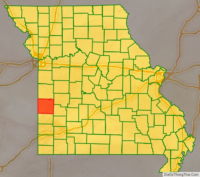
Vernon County is located in the western region of the U.S. state of Missouri, on the border with Kansas. As of the 2010 census, the population was 21,159. Its county seat is Nevada. The county was organized on February 27, 1855, considerably later than counties in the eastern part of the state. It was named for Colonel Miles Vernon (1786–1867), a state senator and veteran of the Battle of New Orleans. This was part of the large historic territory of the Osage Nation of Native Americans.
| Name: | Vernon County |
|---|---|
| FIPS code: | 29-217 |
| State: | Missouri |
| Founded: | February 27, 1855 |
| Named for: | Colonel Miles Vernon, state senator, and veteran of the Battle of New Orleans |
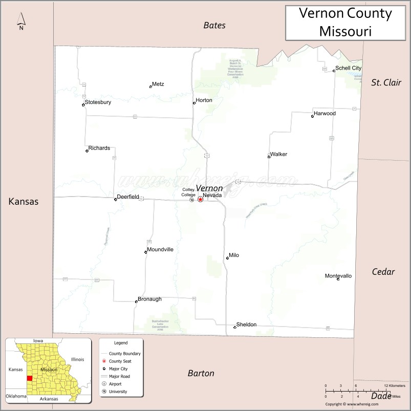
| Seat: | Nevada |
| Largest city: | Nevada |
| Total Area: | 837 sq mi (2,170 km²) |
| Land Area: | 826 sq mi (2,140 km²) |
| Total Population: | 21,159 |
| Population Density: | 25/sq mi (9.8/km²) |
| Time zone: | UTC−6 (Central) |
| Summer Time Zone (DST): | UTC−5 (CDT) |
| Website: | www.vernoncountymo.org |
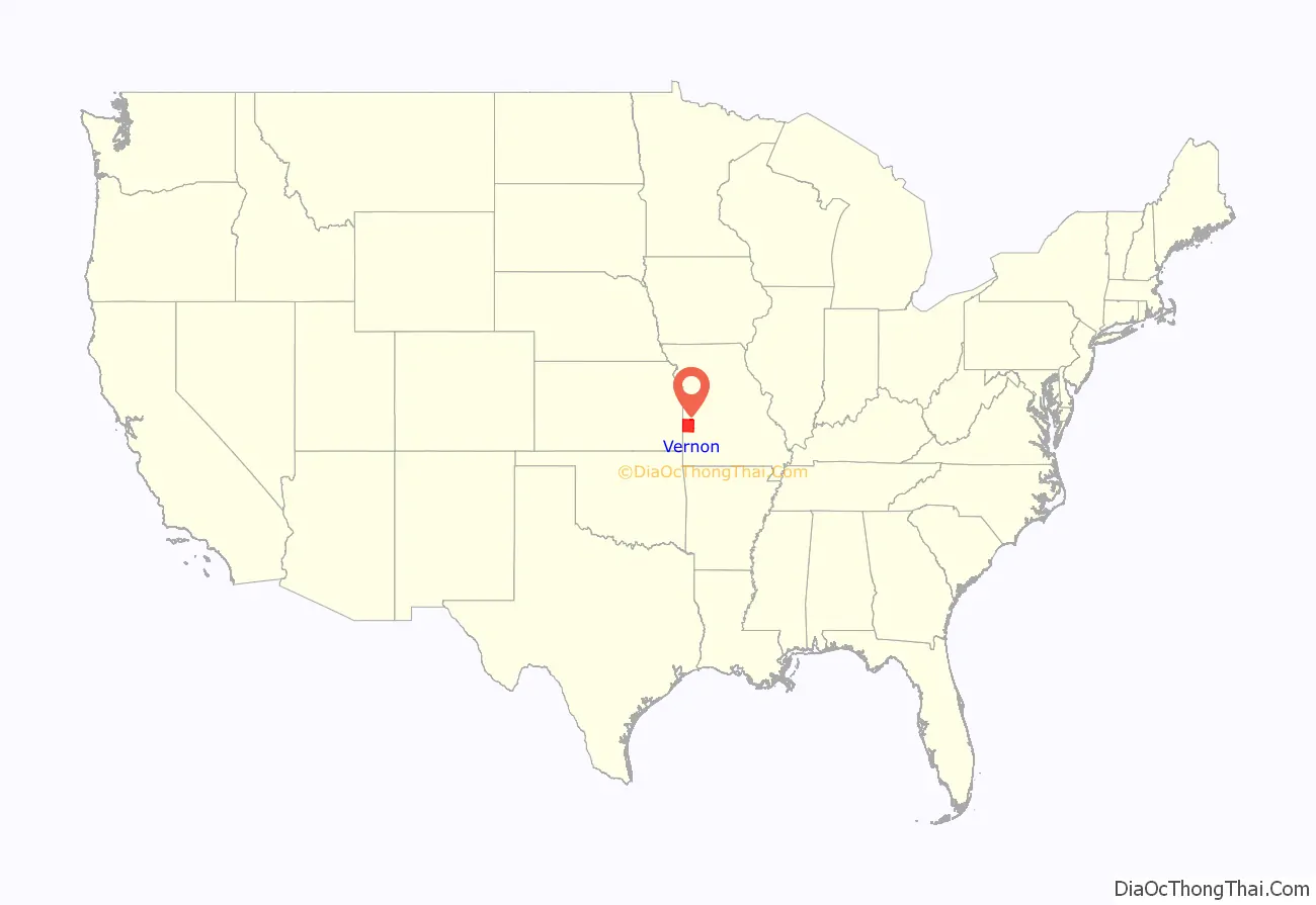
Vernon County location map. Where is Vernon County?
History
The county was developed for agriculture and is still mostly rural.
Vernon County suffered considerable damage during the American Civil War. Guerrillas and insurgents had waged raids against Union troops and carried out personal vendettas in the county. On May 23, 1863, Union Army soldiers burned the county seat of Nevada, along with the courthouse, in retaliation. The present courthouse was completed in 1907.
Vernon County was one of four Missouri counties that were wholly depopulated by Union General Thomas Ewing’s General Order No. 11 (1863), which ordered the people evacuated to end support for Confederate guerrillas operating in the area. Most of the residents would not be allowed to return to their homes until after the Civil War ended in May 1865.
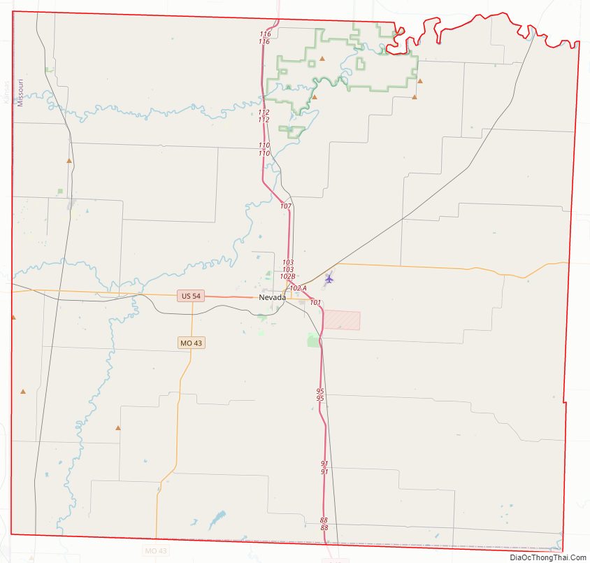
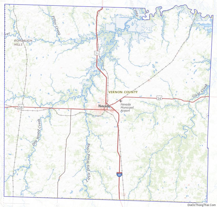
Vernon County Road Map
Geography
According to the U.S. Census Bureau, the county has a total area of 837 square miles (2,170 km), of which 826 square miles (2,140 km) is land and 10 square miles (26 km) (1.2%) is water.
Adjacent counties
- Bates County (north)
- St. Clair County (northeast)
- Cedar County (east)
- Barton County (south)
- Crawford County, Kansas (southwest)
- Bourbon County, Kansas (west)
- Linn County, Kansas (northwest)
Major highways
- Interstate 49
- U.S. Route 54
- U.S. Route 71
- Route 43
Vernon County Topographic Map
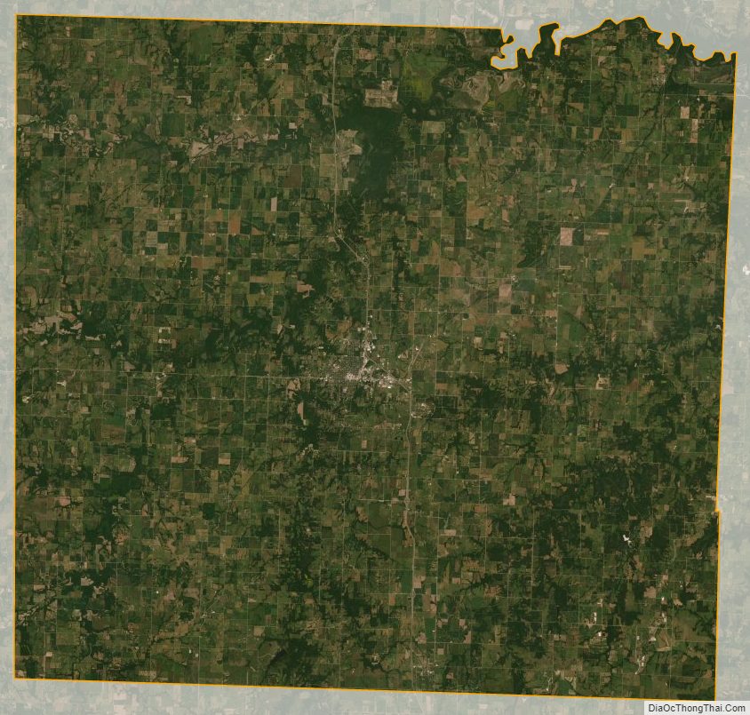
Vernon County Satellite Map
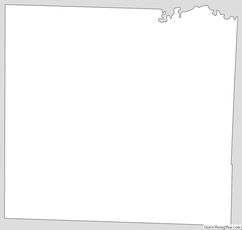
Vernon County Outline Map
See also
Map of Missouri State and its subdivision:- Adair
- Andrew
- Atchison
- Audrain
- Barry
- Barton
- Bates
- Benton
- Bollinger
- Boone
- Buchanan
- Butler
- Caldwell
- Callaway
- Camden
- Cape Girardeau
- Carroll
- Carter
- Cass
- Cedar
- Chariton
- Christian
- Clark
- Clay
- Clinton
- Cole
- Cooper
- Crawford
- Dade
- Dallas
- Daviess
- De Kalb
- Dent
- Douglas
- Dunklin
- Franklin
- Gasconade
- Gentry
- Greene
- Grundy
- Harrison
- Henry
- Hickory
- Holt
- Howard
- Howell
- Iron
- Jackson
- Jasper
- Jefferson
- Johnson
- Knox
- Laclede
- Lafayette
- Lawrence
- Lewis
- Lincoln
- Linn
- Livingston
- Macon
- Madison
- Maries
- Marion
- McDonald
- Mercer
- Miller
- Mississippi
- Moniteau
- Monroe
- Montgomery
- Morgan
- New Madrid
- Newton
- Nodaway
- Oregon
- Osage
- Ozark
- Pemiscot
- Perry
- Pettis
- Phelps
- Pike
- Platte
- Polk
- Pulaski
- Putnam
- Ralls
- Randolph
- Ray
- Reynolds
- Ripley
- Saint Charles
- Saint Clair
- Saint Francois
- Saint Louis
- Sainte Genevieve
- Saline
- Schuyler
- Scotland
- Scott
- Shannon
- Shelby
- Stoddard
- Stone
- Sullivan
- Taney
- Texas
- Vernon
- Warren
- Washington
- Wayne
- Webster
- Worth
- Wright
- Alabama
- Alaska
- Arizona
- Arkansas
- California
- Colorado
- Connecticut
- Delaware
- District of Columbia
- Florida
- Georgia
- Hawaii
- Idaho
- Illinois
- Indiana
- Iowa
- Kansas
- Kentucky
- Louisiana
- Maine
- Maryland
- Massachusetts
- Michigan
- Minnesota
- Mississippi
- Missouri
- Montana
- Nebraska
- Nevada
- New Hampshire
- New Jersey
- New Mexico
- New York
- North Carolina
- North Dakota
- Ohio
- Oklahoma
- Oregon
- Pennsylvania
- Rhode Island
- South Carolina
- South Dakota
- Tennessee
- Texas
- Utah
- Vermont
- Virginia
- Washington
- West Virginia
- Wisconsin
- Wyoming