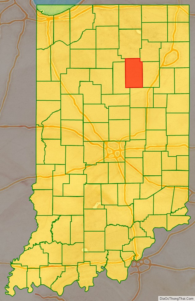
Wabash County is a county located in the northern central part of the U.S. state of Indiana. As of 2020, the population was 30,976. The county seat is Wabash.
| Name: | Wabash County |
|---|---|
| FIPS code: | 18-169 |
| State: | Indiana |
| Founded: | Jan., 1820; organized 1835 |
| Named for: | Wabash River |
| Seat: | Wabash |
| Largest city: | Wabash |
| Total Area: | 420.98 sq mi (1,090.3 km²) |
| Land Area: | 412.43 sq mi (1,068.2 km²) |
| Total Population: | 30,976 |
| Population Density: | 85/sq mi (33/km²) |
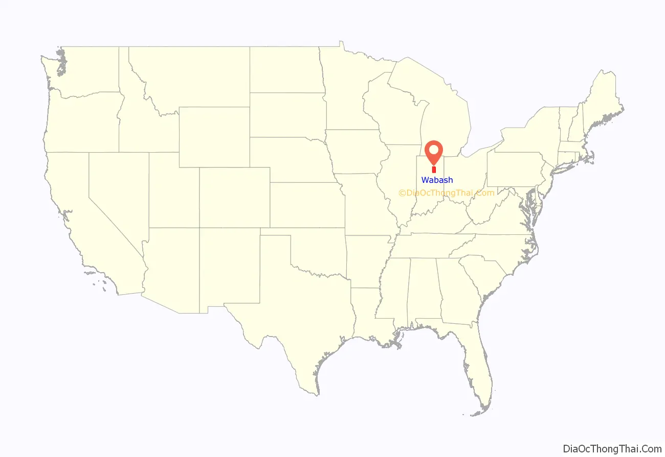
Wabash County location map. Where is Wabash County?
History
The area was inhabited for thousands of years by cultures of indigenous peoples. French explorers and traders encountered the historical Miami Native Americans beginning in the 17th century.
Wabash County, along with Delaware County, was originally formed Jan. 1820 out of the 1818 New Purchase resulting from the Treaty of St. Mary’s. Wabash County was the Wabash River drainage area, and Delaware County, the White River drainage area. Numerous counties were carved out of the Wabash New Purchase. Wabash County as it exists today was organized out of a remnant portion of the original county in 1835.
The name “Wabash” is an English spelling of the earlier French name for the river, Ouabache. French traders derived the French version from the Indian name for the river, Wabashike (pronounced “Wah-bah-she-keh”) (meaning “pure white”.) Much of the river bottom is white limestone, now obscured by mud.
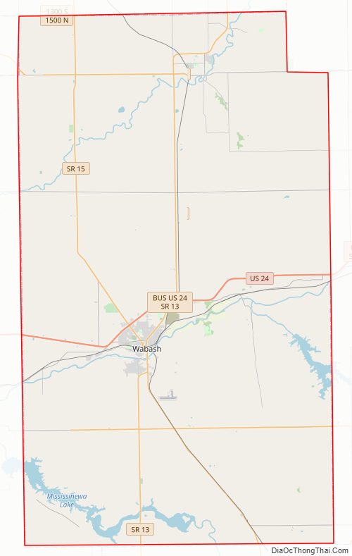
Wabash County Road Map
Geography
According to the 2010 census, the county has a total area of 420.98 square miles (1,090.3 km), of which 412.43 square miles (1,068.2 km) (or 97.97%) is land and 8.54 square miles (22.1 km) (or 2.03%) is water.
Adjacent counties
- Kosciusko County (north)
- Whitley County (northeast)
- Huntington County (east)
- Grant County (south)
- Miami County (west)
- Fulton County (northwest)
Cities
Towns
Census-designated places
Other unincorporated places
- America
- Bolivar
- College Corner
- Disko
- Ijamsville
- Liberty Mills
- Lincolnville
- Mount Vernon
- Newton
- Pioneer
- Richvalley
- Servia
- South Haven
- Speicherville
- Stockdale
- Sunnymede
- Treaty
- Urbana
- Valley Brook
Extinct
- Dora
- Rose Hill
Townships
- Chester
- Lagro
- Liberty
- Noble
- Paw Paw
- Pleasant
- Waltz
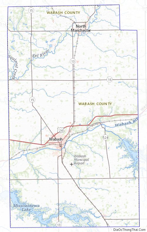
Major highways
- U.S. Route 24
- Indiana State Road 13
- Indiana State Road 15
- Indiana State Road 16
- Indiana State Road 114
- Indiana State Road 115
- Indiana State Road 124
- Indiana State Road 218
- Indiana State Road 524
Wabash County Topographic Map
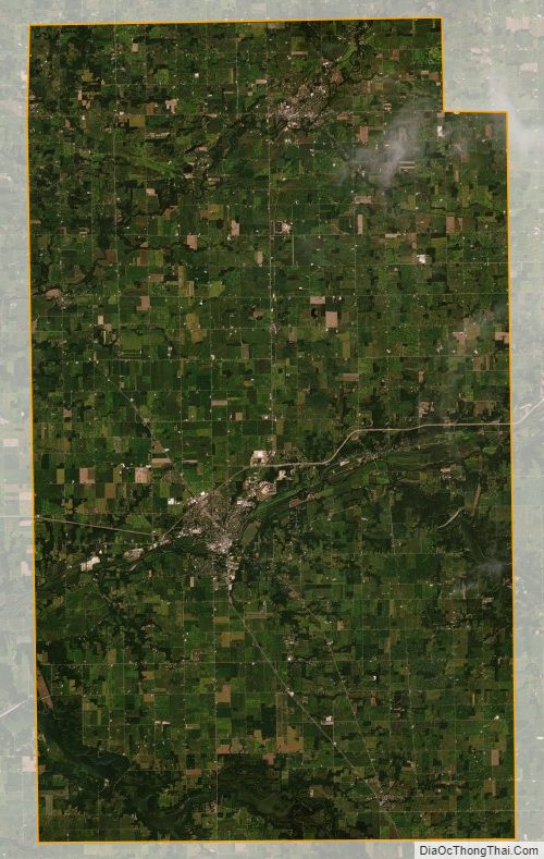
Wabash County Satellite Map
Wabash County Outline Map

See also
Map of Indiana State and its subdivision:- Adams
- Allen
- Bartholomew
- Benton
- Blackford
- Boone
- Brown
- Carroll
- Cass
- Clark
- Clay
- Clinton
- Crawford
- Daviess
- De Kalb
- Dearborn
- Decatur
- Delaware
- Dubois
- Elkhart
- Fayette
- Floyd
- Fountain
- Franklin
- Fulton
- Gibson
- Grant
- Greene
- Hamilton
- Hancock
- Harrison
- Hendricks
- Henry
- Howard
- Huntington
- Jackson
- Jasper
- Jay
- Jefferson
- Jennings
- Johnson
- Knox
- Kosciusko
- LaGrange
- Lake
- Lake Michigan
- LaPorte
- Lawrence
- Madison
- Marion
- Marshall
- Martin
- Miami
- Monroe
- Montgomery
- Morgan
- Newton
- Noble
- Ohio
- Orange
- Owen
- Parke
- Perry
- Pike
- Porter
- Posey
- Pulaski
- Putnam
- Randolph
- Ripley
- Rush
- Saint Joseph
- Scott
- Shelby
- Spencer
- Starke
- Steuben
- Sullivan
- Switzerland
- Tippecanoe
- Tipton
- Union
- Vanderburgh
- Vermillion
- Vigo
- Wabash
- Warren
- Warrick
- Washington
- Wayne
- Wells
- White
- Whitley
- Alabama
- Alaska
- Arizona
- Arkansas
- California
- Colorado
- Connecticut
- Delaware
- District of Columbia
- Florida
- Georgia
- Hawaii
- Idaho
- Illinois
- Indiana
- Iowa
- Kansas
- Kentucky
- Louisiana
- Maine
- Maryland
- Massachusetts
- Michigan
- Minnesota
- Mississippi
- Missouri
- Montana
- Nebraska
- Nevada
- New Hampshire
- New Jersey
- New Mexico
- New York
- North Carolina
- North Dakota
- Ohio
- Oklahoma
- Oregon
- Pennsylvania
- Rhode Island
- South Carolina
- South Dakota
- Tennessee
- Texas
- Utah
- Vermont
- Virginia
- Washington
- West Virginia
- Wisconsin
- Wyoming