Wagoner County is a county located in the U.S. state of Oklahoma. As of the 2020 census, the population was 80,981. Its county seat is Wagoner.
Wagoner County is included in the Tulsa metropolitan statistical area.
| Name: | Wagoner County |
|---|---|
| FIPS code: | 40-145 |
| State: | Oklahoma |
| Founded: | 1907 |
| Named for: | Henry “Bigfoot” Wagoner |
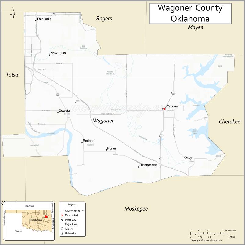
| Seat: | Wagoner |
| Largest city: | Coweta |
| Total Area: | 591 sq mi (1,530 km²) |
| Land Area: | 562 sq mi (1,460 km²) |
| Total Population: | 73,085 |
| Population Density: | 144/sq mi (56/km²) |
| Time zone: | UTC−6 (Central) |
| Summer Time Zone (DST): | UTC−5 (CDT) |
| Website: | www.ok.gov/wagonercounty |
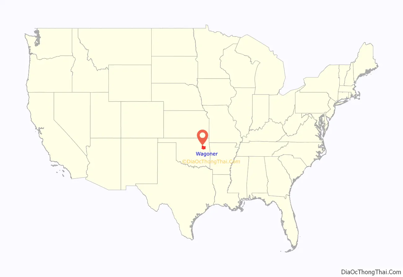
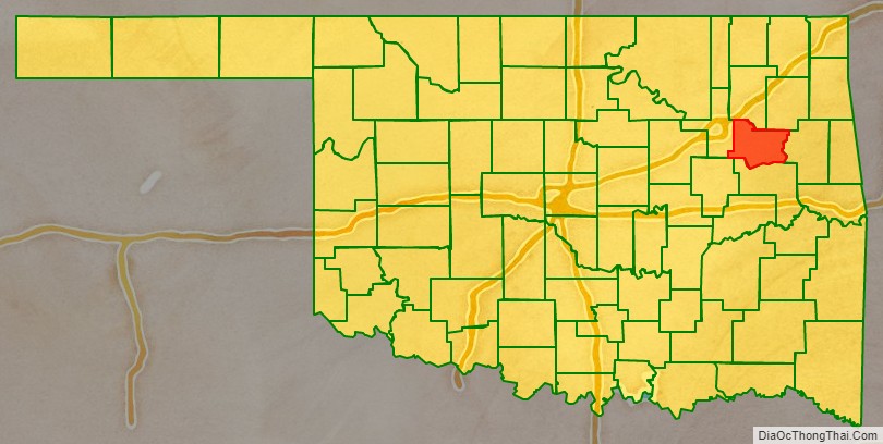
Wagoner County location map. Where is Wagoner County?
History
According to archaeological studies, this area was inhabited by Caddoan Mound Builders during 300 to 1200 AD.
The western area of Wagoner County was settled by the Creek after their forced removal in Alabama in the 1820s. The eastern portion of the county was settled by the Cherokee.
During the Civil War in 1865, the present county was the scene of the Battle of Flat Rock (also known as the Hay Camp Action). Confederate troops led by Brig. General Stand Watie and Brig. General Richard Gano captured 85 Union troops and killed even more who were harvesting hay.
In 1905, the Sequoyah Convention proposed creating two counties from this area. The western half would be named Coweta and the eastern half would have been named Tumechichee. However, failure of the attempt to create the state of Sequoyah negated the proposal. In 1907 at Oklahoma statehood, Wagoner County was organized. The towns of Porter and Coweta vied with Wagoner as the county seat. The county was named after the town of Wagoner, which won the election. The town was named after Henry “Bigfoot” Wagoner, a Katy Railroad dispatcher from Parsons, Kansas.
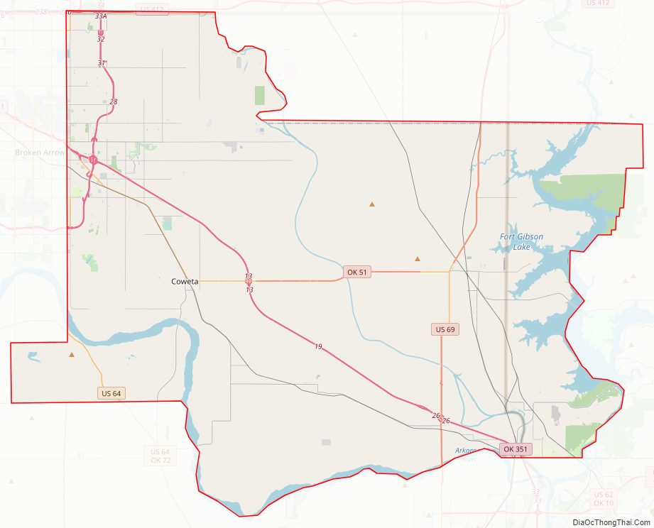
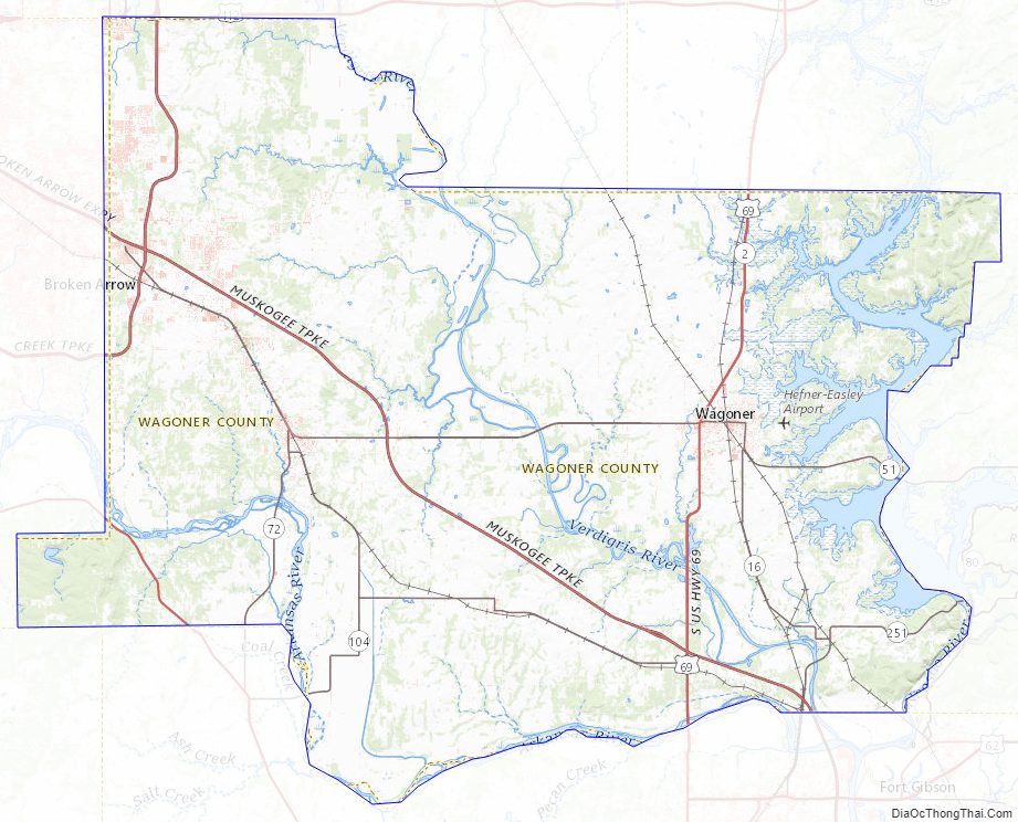
Wagoner County Road Map
Geography
According to the U.S. Census Bureau, the county has a total area of 591 sq mi (1,530 km), of which 29 sq mi (75 km) (4.9%) are covered by water. It is part of the Ozark Highlands. The Verdigris River divides the east and west parts of the county. The Arkansas River forms part of the western and southern boundaries. Grand River also flows south through the county. It was dammed in 1942 to create Fort Gibson Lake.
Adjacent counties
- Rogers County (northwest)
- Mayes County (northeast)
- Cherokee County (east)
- Muskogee County (south)
- Tulsa County (west)
Wagoner County Topographic Map
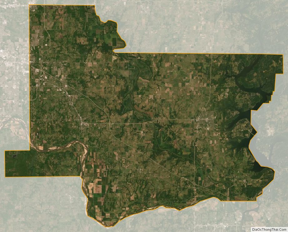
Wagoner County Satellite Map
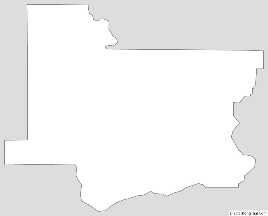
Wagoner County Outline Map
See also
Map of Oklahoma State and its subdivision:- Adair
- Alfalfa
- Atoka
- Beaver
- Beckham
- Blaine
- Bryan
- Caddo
- Canadian
- Carter
- Cherokee
- Choctaw
- Cimarron
- Cleveland
- Coal
- Comanche
- Cotton
- Craig
- Creek
- Custer
- Delaware
- Dewey
- Ellis
- Garfield
- Garvin
- Grady
- Grant
- Greer
- Harmon
- Harper
- Haskell
- Hughes
- Jackson
- Jefferson
- Johnston
- Kay
- Kingfisher
- Kiowa
- Latimer
- Le Flore
- Lincoln
- Logan
- Love
- Major
- Marshall
- Mayes
- McClain
- McCurtain
- McIntosh
- Murray
- Muskogee
- Noble
- Nowata
- Okfuskee
- Oklahoma
- Okmulgee
- Osage
- Ottawa
- Pawnee
- Payne
- Pittsburg
- Pontotoc
- Pottawatomie
- Pushmataha
- Roger Mills
- Rogers
- Seminole
- Sequoyah
- Stephens
- Texas
- Tillman
- Tulsa
- Wagoner
- Washington
- Washita
- Woods
- Woodward
- Alabama
- Alaska
- Arizona
- Arkansas
- California
- Colorado
- Connecticut
- Delaware
- District of Columbia
- Florida
- Georgia
- Hawaii
- Idaho
- Illinois
- Indiana
- Iowa
- Kansas
- Kentucky
- Louisiana
- Maine
- Maryland
- Massachusetts
- Michigan
- Minnesota
- Mississippi
- Missouri
- Montana
- Nebraska
- Nevada
- New Hampshire
- New Jersey
- New Mexico
- New York
- North Carolina
- North Dakota
- Ohio
- Oklahoma
- Oregon
- Pennsylvania
- Rhode Island
- South Carolina
- South Dakota
- Tennessee
- Texas
- Utah
- Vermont
- Virginia
- Washington
- West Virginia
- Wisconsin
- Wyoming