Wahkiakum County (/wəˈkaɪ.əkʌm/) is a county located in the U.S. state of Washington. As of the 2020 census, the population was 4,422, making it the third-least populous county in Washington. The county seat and only incorporated town is Cathlamet. The county was formed out of Cowlitz County in April 1854 and is named for Chief Wahkiakum (“Tall Timber”) of the Chinook, who is buried in the Pioneer Cemetery in Cathlamet.
The county operates the Wahkiakum County Ferry, which connects Cathlamet to Westport, Oregon, across the Columbia River.
| Name: | Wahkiakum County |
|---|---|
| FIPS code: | 53-069 |
| State: | Washington |
| Founded: | April 24, 1854 |
| Named for: | Chief Wahkiakum |
| Seat: | Cathlamet |
| Largest town: | Puget Island |
| Total Area: | 287 sq mi (740 km²) |
| Land Area: | 263 sq mi (680 km²) |
| Total Population: | 4,422 |
| Population Density: | 15/sq mi (6/km²) |
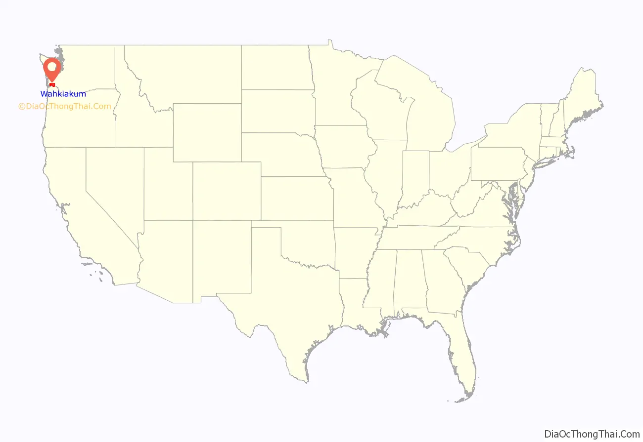
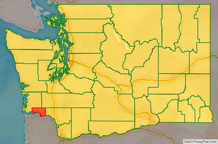
Wahkiakum County location map. Where is Wahkiakum County?
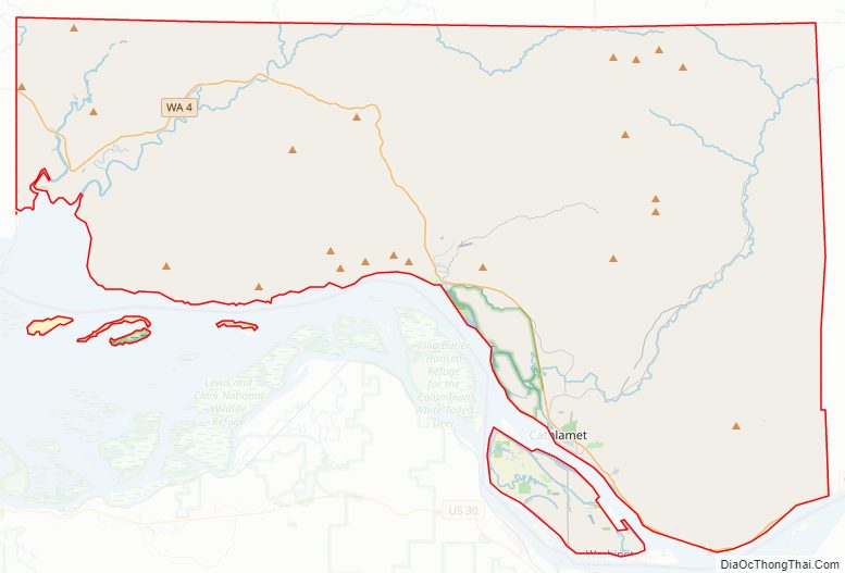
Wahkiakum County Road Map
Geography
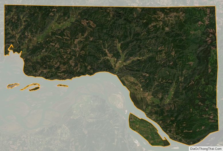
According to the United States Census Bureau, the county has a total area of 287 square miles (740 km), of which 263 square miles (680 km) is land and 24 square miles (62 km) (8.3%) is water. It is the smallest county of Washington by total area and the third-smallest by land area, after San Juan County and Island County, which are mostly water by area.
Geographic features
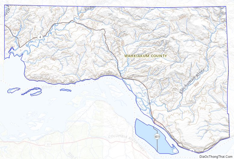
- Columbia River
- Elochoman River
- Grays River
- Puget Island
State highways
- State Route 4
- State Route 409
Adjacent counties
- Pacific County – northwest
- Lewis County – north/northeast
- Cowlitz County – east/southeast
- Columbia County, Oregon – south/southeast
- Clatsop County, Oregon – south/southwest
National protected area
- Julia Butler Hansen National Wildlife Refuge (part)
Wahkiakum County Topographic Map
Wahkiakum County Satellite Map
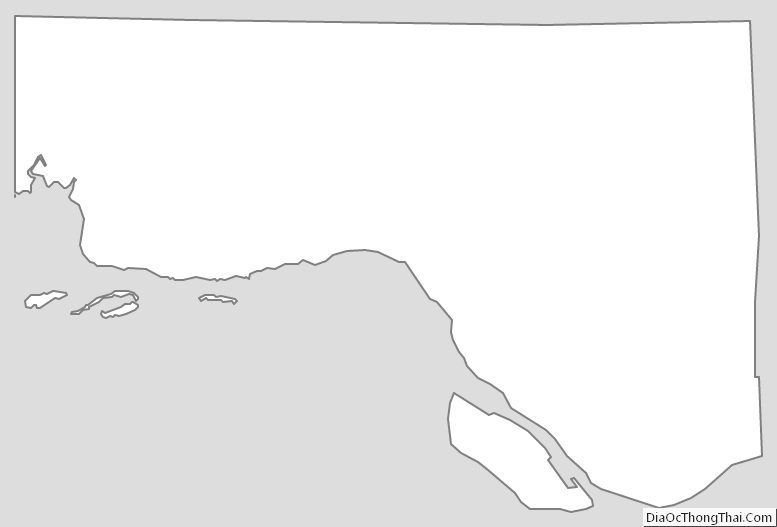
Wahkiakum County Outline Map
See also
Map of Washington State and its subdivision:- Adams
- Asotin
- Benton
- Chelan
- Clallam
- Clark
- Columbia
- Cowlitz
- Douglas
- Ferry
- Franklin
- Garfield
- Grant
- Grays Harbor
- Island
- Jefferson
- King
- Kitsap
- Kittitas
- Klickitat
- Lewis
- Lincoln
- Mason
- Okanogan
- Pacific
- Pend Oreille
- Pierce
- San Juan
- Skagit
- Skamania
- Snohomish
- Spokane
- Stevens
- Thurston
- Wahkiakum
- Walla Walla
- Whatcom
- Whitman
- Yakima
- Alabama
- Alaska
- Arizona
- Arkansas
- California
- Colorado
- Connecticut
- Delaware
- District of Columbia
- Florida
- Georgia
- Hawaii
- Idaho
- Illinois
- Indiana
- Iowa
- Kansas
- Kentucky
- Louisiana
- Maine
- Maryland
- Massachusetts
- Michigan
- Minnesota
- Mississippi
- Missouri
- Montana
- Nebraska
- Nevada
- New Hampshire
- New Jersey
- New Mexico
- New York
- North Carolina
- North Dakota
- Ohio
- Oklahoma
- Oregon
- Pennsylvania
- Rhode Island
- South Carolina
- South Dakota
- Tennessee
- Texas
- Utah
- Vermont
- Virginia
- Washington
- West Virginia
- Wisconsin
- Wyoming