Wallowa County (/wəˈlaʊwə/) is the northeastern most county in the U.S. state of Oregon. As of the 2020 census, the population was 7,391, making it Oregon’s fifth-least populous county. Its county seat is Enterprise. According to Oregon Geographic Names, the origins of the county’s name are uncertain, with the most likely explanation being it is derived from the Nez Perce term for a structure of stakes (a weir) used in fishing. An alternative explanation is that Wallowa is derived from a Nez Perce word for “winding water”. The journals of Lewis and Clark Expedition record the name of the Wallowa River as Wil-le-wah.
Wallowa County is part of the eight-county definition of Eastern Oregon.
| Name: | Wallowa County |
|---|---|
| FIPS code: | 41-063 |
| State: | Oregon |
| Founded: | October 14, 1887 |
| Named for: | Wallowa River |
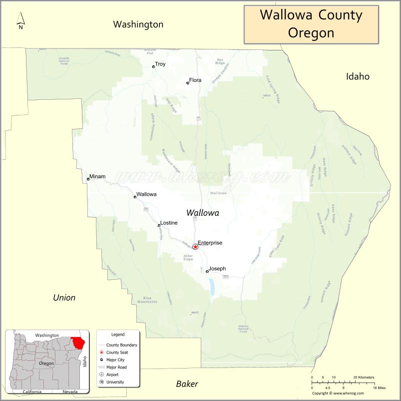
| Seat: | Enterprise |
| Largest city: | Enterprise |
| Total Area: | 3,152 sq mi (8,160 km²) |
| Land Area: | 3,146 sq mi (8,150 km²) |
| Total Population: | 7,391 |
| Population Density: | 2.2/sq mi (0.8/km²) |
| Time zone: | UTC−8 (Pacific) |
| Summer Time Zone (DST): | UTC−7 (PDT) |
| Website: | co.wallowa.or.us |
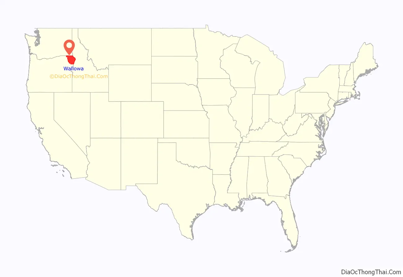
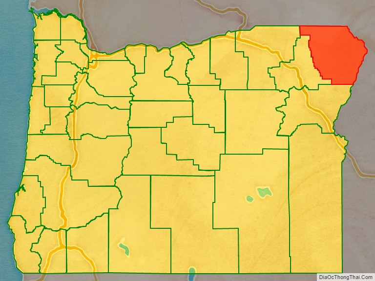
Wallowa County location map. Where is Wallowa County?
History
In 1871, the first white settlers came to the area, crossing the mountains in search of livestock feed in the Wallowa Valley. The county was established on February 11, 1887, from the eastern portion of Union County. Boundary changes occurred with Union County in 1890, 1900, and 1915.
In 1877, the younger Chief Joseph of the Nez Perce, incensed at the government’s attempt to remove his people from the Wallowa Valley, refused to relocate to the reservation in north central Idaho. Several regiments of U.S. Army cavalry troops were dispatched to force them onto the reservation. After numerous battles and a journey of almost two thousand miles (3,200 km), the Nez Perce fought their last battle at Bear Paw, just shy of the Canadian border, when Joseph and the other chiefs decided to stop fighting. He and some of the surviving Nez Perce were held in prison camps in Kansas and Oklahoma, and those who survived that were relocated to Colville Reservation in northeast Washington. Approximately half of the survivors moved to the Nez Perce Reservation in Idaho. Chief Joseph last visited Wallowa County in 1902, and died two years later.
Wallowa County was the scene of perhaps the worst incident of violence against Chinese in Oregon, when in May 1887 a gang of rustlers massacred 10-34 Chinese gold miners in Hells Canyon. Of the seven rustlers and schoolboys believed to have been responsible, only three were brought to trial in Enterprise, where a jury found them not guilty on September 1, 1888. A proposal to commemorate this event on official maps as Chinese Massacre Cove was approved in 2005 and encompasses a five-acre site.
In 1896, the Joseph town bank was robbed and there was a shootout in the streets. The town has occasionally had re-enactments of that event.
Wallowa County Courthouse was built in 1909–1910, using locally quarried Bowlby stone, a type of volcanic tuff. It is a Romanesque Revival-style building with Queen Anne architectural elements in some exterior features. The courthouse was listed on National Register of Historic Places in 2000. Today, it still houses Wallowa County government offices and faces west toward South River Street and is surrounded by Courthouse Square which encompasses one city block, approximately 1.3 acres (1 ha). The square is landscaped with oak, pine, maple, linden, juniper, and flowering crab apple trees. There are roses planted on the north, west, and south sides of the courthouse. The square also has several veteran memorials along with a 20-by-24-foot (6.1 by 7.3 m) wood-framed gazebo in the northeast corner of the square.
United States Supreme Court Associate Justice William O. Douglas was one famous summer visitor to Wallowa County, building a vacation cabin on Lostine River Road in 1939.
In December 2003, a developer announced a proposal to buy a 62-acre (0.25 km) property near Wallowa Lake, and build 11 homes on it. This property is adjacent to the property that is home to the grave of Old Chief Joseph, father of the younger Chief Joseph. This proposal drew opposition from a local group, as well as from the Nez Perce, Colville, and Umatilla tribes. Prior offers by the National Park Service and the Trust for Public Land to buy the land were rejected. The County commissioners gave conditional approval for the developers to complete a final plat of the land on February 13, 2004, but the attorney for the Nez Perce said the tribe would appeal the decision to the Oregon Land Use Board of Appeals. As of 2016, the controversy was still active.
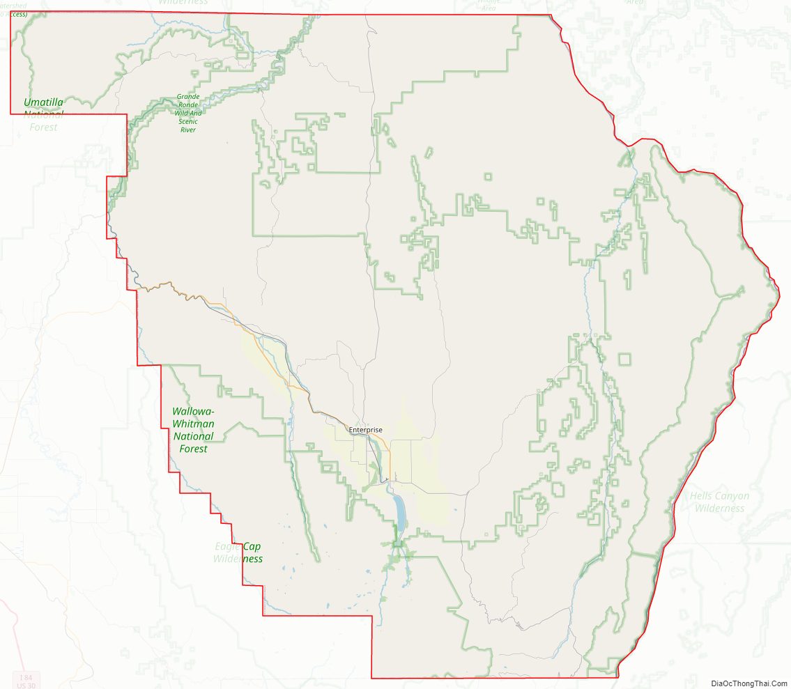
Wallowa County Road Map
Geography
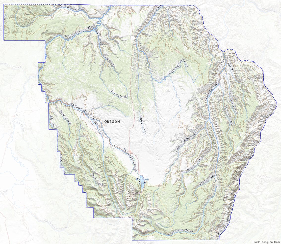
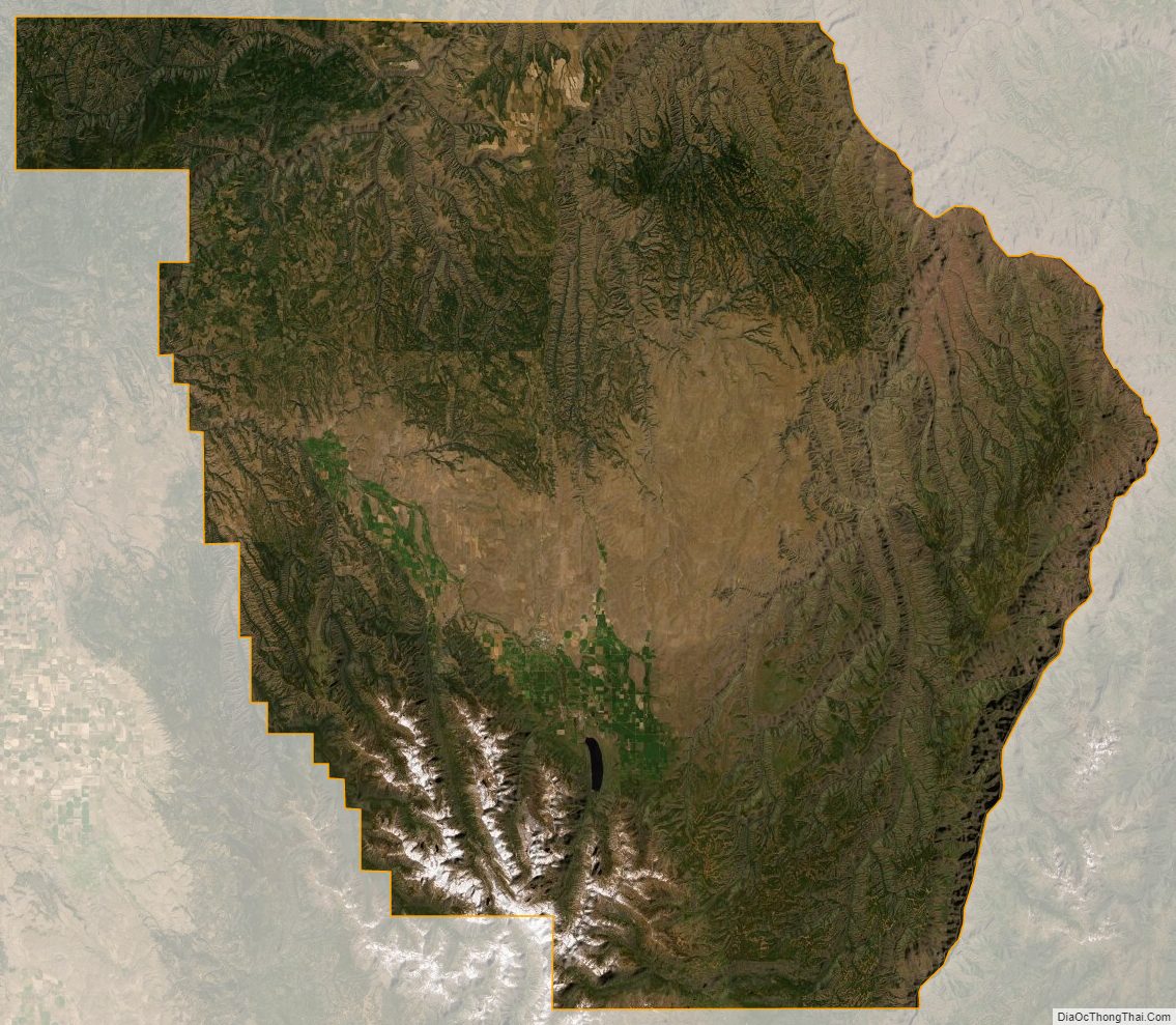
Wallowa is the northeasternmost county of Oregon. According to the United States Census Bureau, the county has a total area of 3,152 square miles (8,160 km), of which 3,146 square miles (8,150 km) is land and 5.5 square miles (14 km) (0.2%) is water.
Geographic features
Wallowa Lake and the Wallowa Mountains attract tourists to this region. The lake is a natural glacial formation, held in on three sides by prominent moraines. The microclimate is somewhat different from the surrounding areas and provides a cool retreat during the summer. Other geographic features include:
- Grande Ronde River
- Joseph Canyon
- Hells Canyon
- Wallowa River
Adjacent counties
- Columbia County, Washington – northwest
- Garfield County, Washington – north
- Asotin County, Washington – northeast
- Nez Perce County, Idaho – northeast
- Idaho County, Idaho – east/Mountain Time Border
- Adams County, Idaho – southeast/Mountain Time Border
- Baker County (south)
- Union County (southwest)
- Umatilla County (west)
National protected areas
- Nez Perce National Historical Park (part)
- Umatilla National Forest (part)
- Wallowa–Whitman National Forest (part)
- Hells Canyon National Recreation Area (part)
Wallowa County Topographic Map
Wallowa County Satellite Map
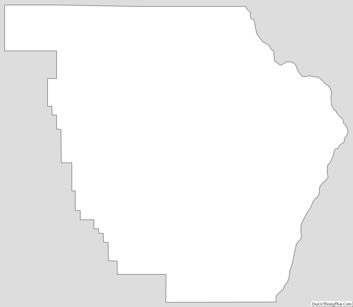
Wallowa County Outline Map
See also
Map of Oregon State and its subdivision: Map of other states:- Alabama
- Alaska
- Arizona
- Arkansas
- California
- Colorado
- Connecticut
- Delaware
- District of Columbia
- Florida
- Georgia
- Hawaii
- Idaho
- Illinois
- Indiana
- Iowa
- Kansas
- Kentucky
- Louisiana
- Maine
- Maryland
- Massachusetts
- Michigan
- Minnesota
- Mississippi
- Missouri
- Montana
- Nebraska
- Nevada
- New Hampshire
- New Jersey
- New Mexico
- New York
- North Carolina
- North Dakota
- Ohio
- Oklahoma
- Oregon
- Pennsylvania
- Rhode Island
- South Carolina
- South Dakota
- Tennessee
- Texas
- Utah
- Vermont
- Virginia
- Washington
- West Virginia
- Wisconsin
- Wyoming