Walworth County is a county in the U.S. state of South Dakota. As of the 2020 census, the population was 5,315. Its county seat is Selby. The county was created in 1873 and organized in 1883. It is named for Walworth County, Wisconsin.
| Name: | Walworth County |
|---|---|
| FIPS code: | 46-129 |
| State: | South Dakota |
| Founded: | 1873 |
| Named for: | Walworth County, Wisconsin |
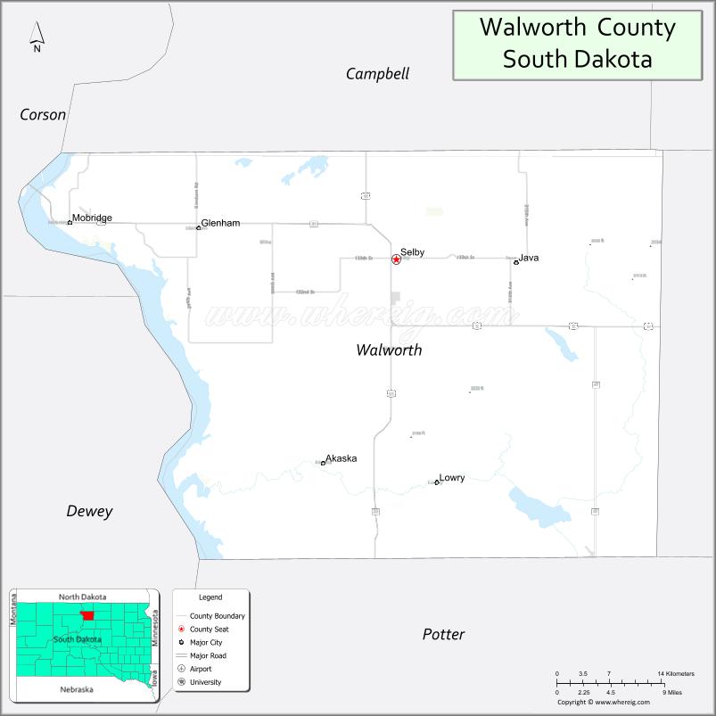
| Seat: | Selby |
| Largest city: | Mobridge |
| Total Area: | 745 sq mi (1,930 km²) |
| Land Area: | 709 sq mi (1,840 km²) |
| Total Population: | 5,315 |
| Population Density: | 7.1/sq mi (2.8/km²) |
| Time zone: | UTC−6 (Central) |
| Summer Time Zone (DST): | UTC−5 (CDT) |
| Website: | walworthco.org |
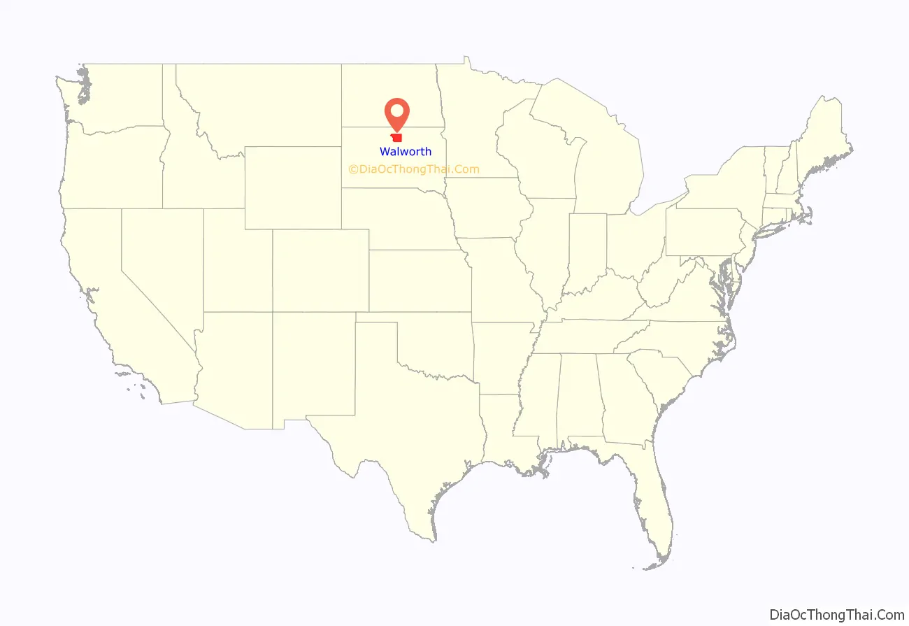
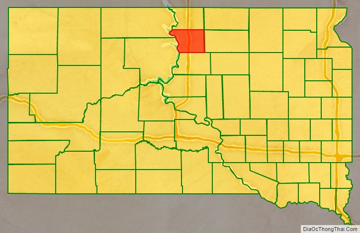
Walworth County location map. Where is Walworth County?
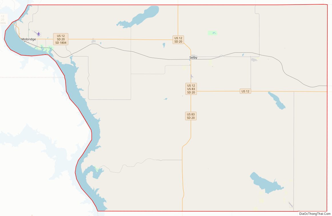
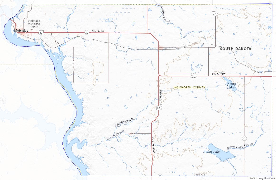
Walworth County Road Map
Geography
The Missouri River flows southward along the county’s west boundary line. Swan Creek flows west-northwest through the county’s SW corner, discharging into the Missouri. The county’s terrain consists of semi-arid rolling hills, carved by drainages and gullies. Most of the area is devoted to agriculture. The terrain slopes to the south and east, although the western portion of the county drops westward into the Missouri River valley. The county’s highest point is on the eastern portion of its north boundary line, at 1,982′ (604m) ASL. The county has a total area of 745 square miles (1,930 km), of which 709 square miles (1,840 km) is land and 36 square miles (93 km) (4.8%) is water.
The eastern portion of South Dakota’s counties (48 of 66) observe Central Time; the western counties (18 of 66) observe Mountain Time. Walworth County is the westernmost of the SD counties to observe Central Time.
Major highways
- U.S. Highway 12
- U.S. Highway 83
- South Dakota Highway 20
- South Dakota Highway 47
- South Dakota Highway 130
- South Dakota Highway 144
- South Dakota Highway 271
- South Dakota Highway 1804
Adjacent counties
- Campbell County – north
- McPherson County – northeast
- Edmunds County – east
- Potter County – south
- Dewey County – southwest (observes Mountain Time)
- Corson County – northwest (observes Mountain Time)
Protected areas
- Blue Blanket Lake State Game Production Area
- Bowdle Beach State Lakeside Use Area
- Indian Creek State Recreation Area
- Lake Hiddenwood State Recreation Area
- LeBeau State Lakeside Use Area
- Oahe Blue Blanket State Game Production Area
- Revheim Bay Recreation Area
- Spring Lake State Game Production Area
- Swan Creek State Game Production Area
- Swan Creek State Recreation Area
- Swan Lake State Game Production Area
- Thomas Bay State Lakeside Use Area
- Walth Bay State Game Production Area
- Walth Bay State Lakeside Use Area
Lakes
- Horseshoe Lake
- Lake Hiddenwood
- Lake Oahe (part)
- Molsted Lake
- Spring Lake
- Swan Lake
Walworth County Topographic Map
Walworth County Satellite Map
Walworth County Outline Map

See also
Map of South Dakota State and its subdivision:- Aurora
- Beadle
- Bennett
- Bon Homme
- Brookings
- Brown
- Brule
- Buffalo
- Butte
- Campbell
- Charles Mix
- Clark
- Clay
- Codington
- Corson
- Custer
- Davison
- Day
- Deuel
- Dewey
- Douglas
- Edmunds
- Fall River
- Faulk
- Grant
- Gregory
- Haakon
- Hamlin
- Hand
- Hanson
- Harding
- Hughes
- Hutchinson
- Hyde
- Jackson
- Jerauld
- Jones
- Kingsbury
- Lake
- Lawrence
- Lincoln
- Lyman
- Marshall
- McCook
- McPherson
- Meade
- Mellette
- Miner
- Minnehaha
- Moody
- Pennington
- Perkins
- Potter
- Roberts
- Sanborn
- Shannon
- Spink
- Stanley
- Sully
- Todd
- Tripp
- Turner
- Union
- Walworth
- Yankton
- Ziebach
- Alabama
- Alaska
- Arizona
- Arkansas
- California
- Colorado
- Connecticut
- Delaware
- District of Columbia
- Florida
- Georgia
- Hawaii
- Idaho
- Illinois
- Indiana
- Iowa
- Kansas
- Kentucky
- Louisiana
- Maine
- Maryland
- Massachusetts
- Michigan
- Minnesota
- Mississippi
- Missouri
- Montana
- Nebraska
- Nevada
- New Hampshire
- New Jersey
- New Mexico
- New York
- North Carolina
- North Dakota
- Ohio
- Oklahoma
- Oregon
- Pennsylvania
- Rhode Island
- South Carolina
- South Dakota
- Tennessee
- Texas
- Utah
- Vermont
- Virginia
- Washington
- West Virginia
- Wisconsin
- Wyoming