Warren County is a county located in the U.S. state of Mississippi. As of the 2020 census, the population was 44,722. Its county seat is Vicksburg. Established by legislative act of December 22, 1809, Warren County is named for American Revolutionary War officer Joseph Warren.
Part of the Mississippi Delta and the historic cotton culture, Warren County is included in the Vicksburg, MS Micropolitan Statistical Area, which is also included in the Jackson-Vicksburg-Brookhaven, MS Combined Statistical Area.
| Name: | Warren County |
|---|---|
| FIPS code: | 28-149 |
| State: | Mississippi |
| Founded: | December 22, 1809 |
| Named for: | Joseph Warren |
| Seat: | Vicksburg |
| Largest city: | Vicksburg |
| Total Area: | 619 sq mi (1,600 km²) |
| Land Area: | 589 sq mi (1,530 km²) |
| Total Population: | 44,722 |
| Population Density: | 72/sq mi (28/km²) |
| Time zone: | UTC−6 (Central) |
| Summer Time Zone (DST): | UTC−5 (CDT) |
| Website: | www.co.warren.ms.us |
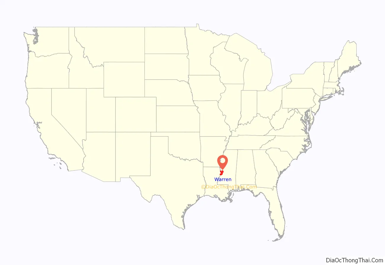
Warren County location map. Where is Warren County?
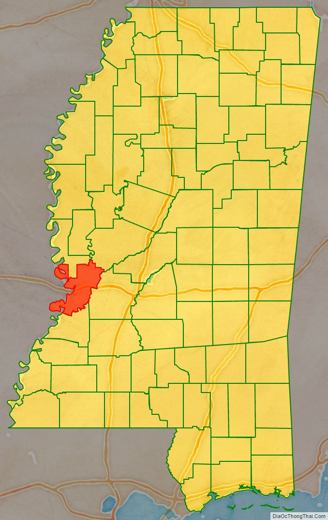
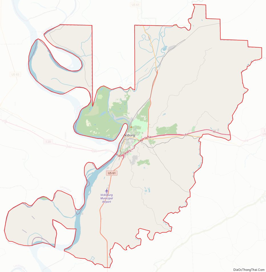
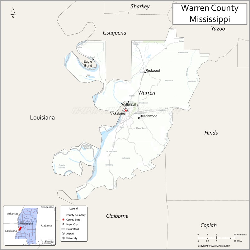
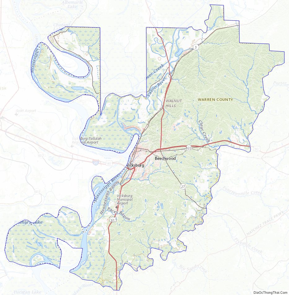
Warren County Road Map
Geography
According to the U.S. Census Bureau, the county has a total area of 619 square miles (1,600 km), of which 589 square miles (1,530 km) is land and 30 square miles (78 km) (4.9%) is water.
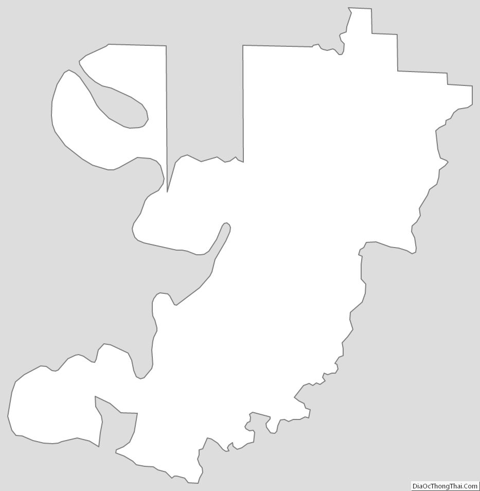
The county exists in two sections, connected only by a narrow 500 foot wide section between Madison Parish, Louisiana and Issaquena County, Mississippi along the delta of the Yazoo River. This area was once along the Mississippi River, but has since become an oxbow lake and marsh and no roads traverse this strip of land. The community of Eagle Bend is in this area.
Major highways
- Interstate 20
- U.S. Route 61
- U.S. Route 80
- Mississippi Highway 3
- Mississippi Highway 27
Adjacent counties
- Issaquena County (north)
- Yazoo County (northeast)
- Hinds County (east)
- Claiborne County (south)
- Tensas Parish, Louisiana (southwest)
- Madison Parish, Louisiana (west)
National protected areas
- Theodore Roosevelt National Wildlife Refuge (part)
- Vicksburg National Military Park (part)
Warren County Topographic Map
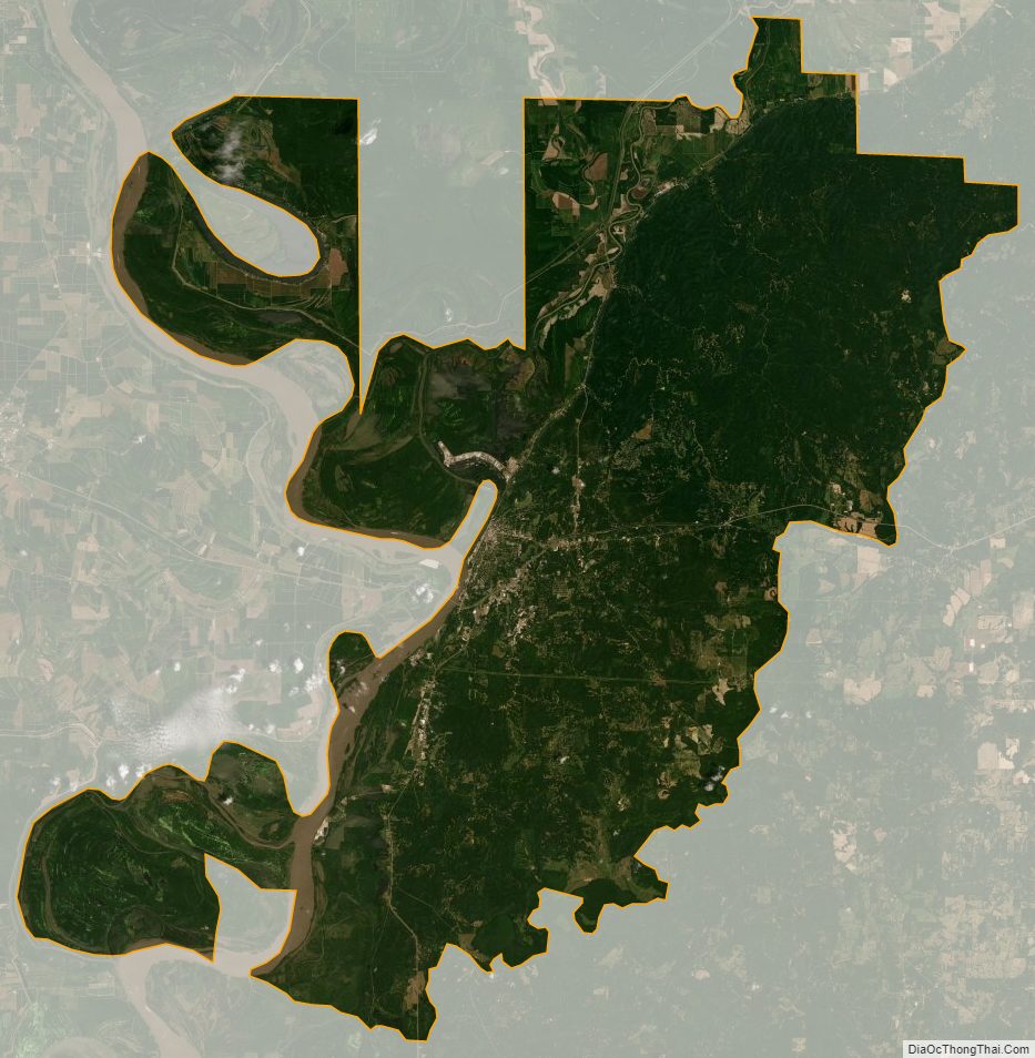
Warren County Satellite Map
Warren County Outline Map
See also
Map of Mississippi State and its subdivision:- Adams
- Alcorn
- Amite
- Attala
- Benton
- Bolivar
- Calhoun
- Carroll
- Chickasaw
- Choctaw
- Claiborne
- Clarke
- Clay
- Coahoma
- Copiah
- Covington
- Desoto
- Forrest
- Franklin
- George
- Greene
- Grenada
- Hancock
- Harrison
- Hinds
- Holmes
- Humphreys
- Issaquena
- Itawamba
- Jackson
- Jasper
- Jefferson
- Jefferson Davis
- Jones
- Kemper
- Lafayette
- Lamar
- Lauderdale
- Lawrence
- Leake
- Lee
- Leflore
- Lincoln
- Lowndes
- Madison
- Marion
- Marshall
- Monroe
- Montgomery
- Neshoba
- Newton
- Noxubee
- Oktibbeha
- Panola
- Pearl River
- Perry
- Pike
- Pontotoc
- Prentiss
- Quitman
- Rankin
- Scott
- Sharkey
- Simpson
- Smith
- Stone
- Sunflower
- Tallahatchie
- Tate
- Tippah
- Tishomingo
- Tunica
- Union
- Walthall
- Warren
- Washington
- Wayne
- Webster
- Wilkinson
- Winston
- Yalobusha
- Yazoo
- Alabama
- Alaska
- Arizona
- Arkansas
- California
- Colorado
- Connecticut
- Delaware
- District of Columbia
- Florida
- Georgia
- Hawaii
- Idaho
- Illinois
- Indiana
- Iowa
- Kansas
- Kentucky
- Louisiana
- Maine
- Maryland
- Massachusetts
- Michigan
- Minnesota
- Mississippi
- Missouri
- Montana
- Nebraska
- Nevada
- New Hampshire
- New Jersey
- New Mexico
- New York
- North Carolina
- North Dakota
- Ohio
- Oklahoma
- Oregon
- Pennsylvania
- Rhode Island
- South Carolina
- South Dakota
- Tennessee
- Texas
- Utah
- Vermont
- Virginia
- Washington
- West Virginia
- Wisconsin
- Wyoming